Migdal Tsedek National Park – Photographed Visitors Guide
You can find a fortress, trails, and many other things at Migdal Tsedek (Migdal Afek) National Park by Rosh Haayin.
Note: in 2021, after restoration, Migdal Tsedek was reopened.
Table of Contents
Map
Migdal Tsedek National Park is located to the south of Rosh Haayin. You can see it from road #444, and the entrance is from Ben Gurion Boulevard, Rosh Haayin. The easiest way to get there is by entering “Migdal Tsedek National Park” on Waze.
Directions for drivers: Link to Waze and Link to Google Maps
Directions for public transport: Link to Moovit
Interactive map of the area:
We have visited Migdal Tsedek several since it reopened. Each time we visit another area (track) or an event (there are tours and some music events). And here are the relevant maps:
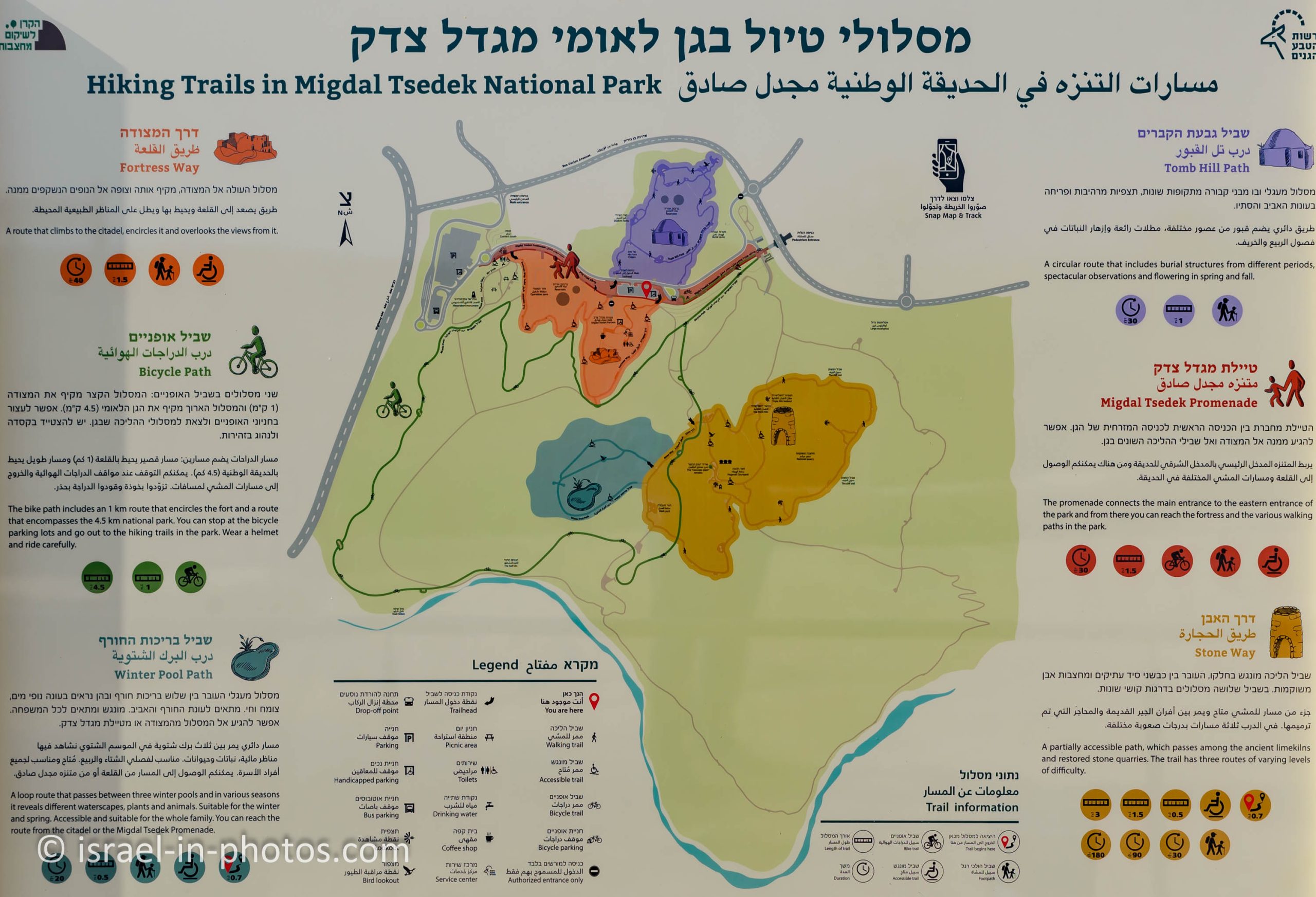
On the map above, you can see the whole national park. And near the beginning point of each track, you can find the path map. Here are several examples:


Note: you can click on the maps to enlarge them.
Tracks
As you can see from the map, there are various trails. Most trails, except bicycle paths, are not long (1 – 2 km).
| Name | Color on the Map | Description | Length |
|---|---|---|---|
| Fortress Way | Orange | It is an accessible trail that begins at the lower parking (on the left of the map) and goes to the fortress and around it. | 1.5 km and about 40 minutes |
| Migdal Tsedek Promenade | Red | If you do not mind the stairs, you can take the promenade from the lower parking to the fortress. | 1.5 km and 30 minutes |
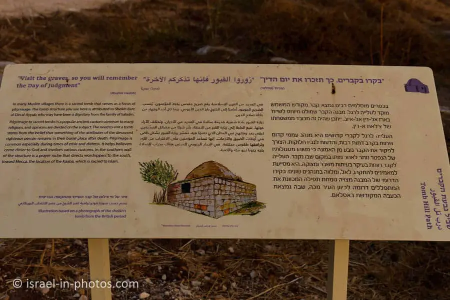
| Tomb Hill Path | Purple | The tomb hill is located north of the fortress, and you can use an easy one km loop trail to explore it. In the spring, you can find many flowers along this trail. | 1 km and 30 minutes |
| Bicycle Path | Green | The short bicycle path around the fort is about one km long, and the way through the entire park is four km long. | 4.5 km and one hour |
| Stone Way | Brown | Stone Way leads through lime kilns and stone quarries. There are three options to make this hike. | 0.5 – 3 km and 30 – 180 minutes |
| Winter Pool Path | Dark Green | It is an accessible path near winter pools (for animal lovers). | 0.5 km and 20 minutes |
As you can see from the map, you can combine several trails for an extended trip.
Opening Hours
Sunday – Thursday and Saturday: 6:00 – 17:00 (08:00 – 16:00 during winter).
Friday: 6:00 – 16:00 (08:00 – 15:00 during winter).
On holidays, usually 8:00 – 13:00.
Note: during the early morning hours (06:00 – 08:00), you can enter for free only by foot through Psagot Afek. Also, at those hours, you can only either hike or cycle. And if you visit after 8:00, it is similar to a regular visit to national parks. In both cases, you must book your visit through the official site.
Entrance Fee
If you are visiting after 8:00, then the entry fee will be:
Adult 28 NIS, child 14 NIS, and student 24 NIS. And free for annual Matmon members.
If you visit several National Parks, then consider purchasing a combo ticket. You can find additional info at National Parks And Nature Reserves.
Note: opening hours and entrance fees were updated in December 2022. In any case, recheck the official site before visiting.

Two common questions are answered by the sign above:
- Dogs are allowed in the park only when leashed and muzzled.
- Do not light fires in the park, including barbeques.

And now, we will visit the different parts of the park.
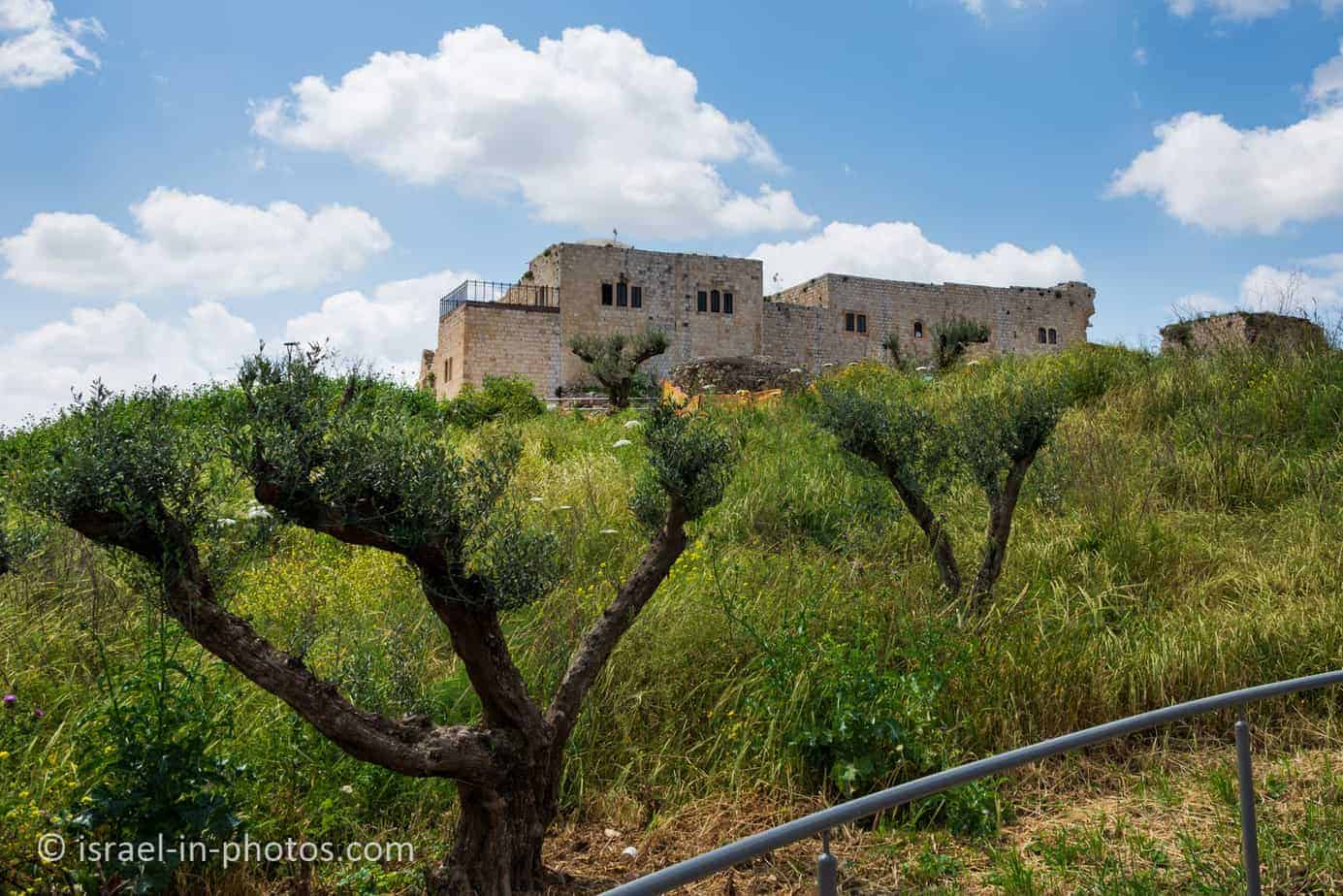
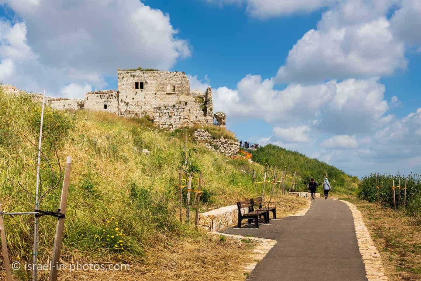
The Fortress Way
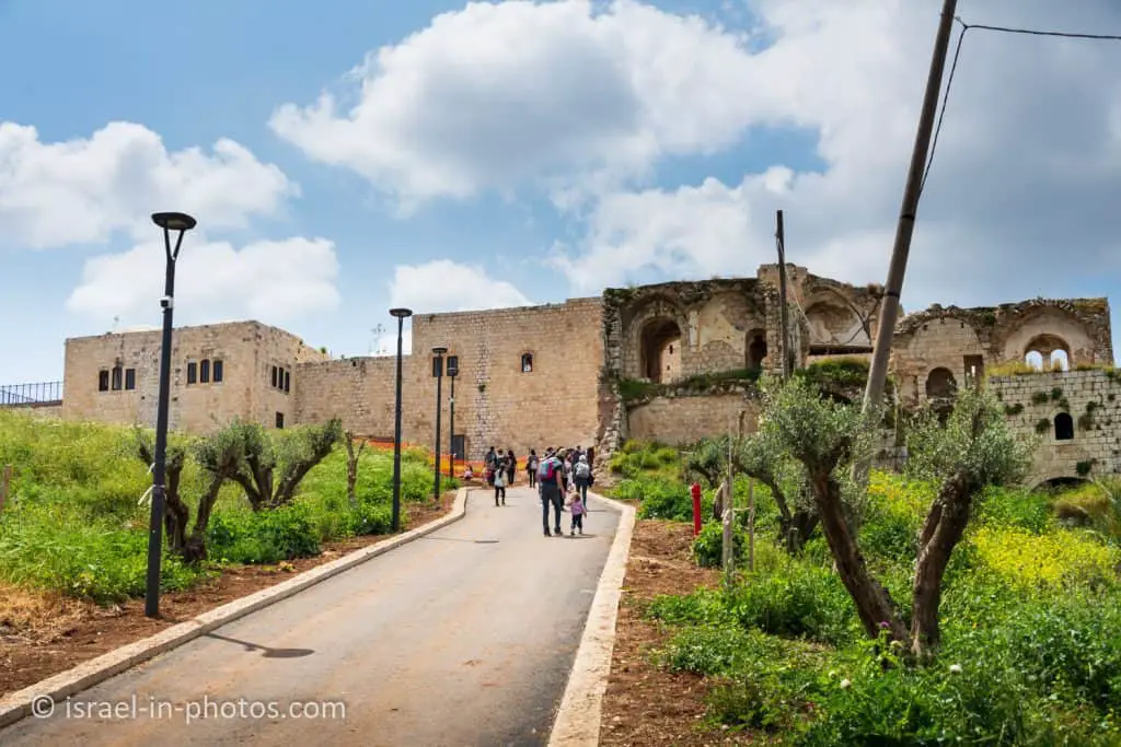
We parked at the main parking during our visit to Migdal Tsedek National Park (located on the left part of the map). And we started making our way to the fortress.

“The Fortress Way” is an accessible path leading uphill toward the Migdal Tsedek fortress. As you walk on this path, you will see the fort and the cityscape beneath.


It took us about 15 minutes to reach the Migdal Tsedek fortress.
On another visit, we parked at the upper parking. You can see it in the following photo:

Via Maris
To understand why there is a fortress at this spot and its strategic importance, we need to mention Via Maris.
Via Maris was an ancient trade route dating from the early Bronze Age, linking Egypt with Syria, Anatolia, and Mesopotamia. Via Maris means “way of the sea” in Latin, and this historic road also passed through Israel. It runs along the Israeli Mediterranean coast in southern Israel, then passes into Jezreel’s plain and the Jordan valley.

And if you have read my blog for a while, you are already familiar with Via Maris. Each time we visited a place near Via Maris, I mentioned it. Here is a partial list of sites along this route: Ashkelon National Park, Ramla, Yarkon National Park – Tel Afek (Antipatris), Tel Megiddo National Park, and Tel Hazor National Park.
And the reason this trading route passed here is the marsh.
In the past, it was not possible to pass from the southern coastal plain towards the Sharon and northwards due to the marshes that had developed around the river. The ancient Via Maris that traversed the country lengthwise had to circumvent the marshes from the east, which is why the region was called the “Afek Passage.” The route went along a pass between the mountain and the sources of the Yarkon. From ancient times, this passage was a focus for human settlement, which is evidenced by the remains of a settlement at Tel Afek.
Over time, two fortresses were built on both sides of the “Afek Passage.” On one side, there was Yarkon National Park – Tel Afek (Antipatris), and on the other, Mirabel (also known as Migdal Afek and Migdal Tsedek).

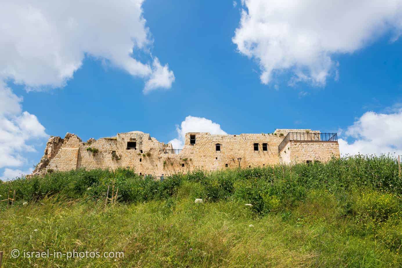
Migdal Tsedek Fortress
Many remains of settlement from various periods were found in the national park area, including ancient agricultural farms from the 8th century BCE. In the days of the Second Temple, there was a Jewish settlement here called “Migdal Afek.”
During the Crusader period, a magnificent fortress was built at the top of the hill, called “Mirabel,” which means “wonder of beauty.” In the 12th century, the fortress was conquered and destroyed by the Ayyubid army under the command of Saladin.
The village of Majdal Yabaya is one of the largest villages between Samaria and the coastal plain. The village is mentioned in the 13th century as Majdal Yafa. And with the weakening of the Ottoman rule in the 18th century, the power of local Sheikh began to rise. Sheikh Zadek al-Jama’ini from Majdal Yaba renovated the remains of the Crusader fortress and turned it into a mansion.
The village continued to develop due to its geographical advantages: proximity to Jaffa and its markets, employment opportunities in nearby quarries and British army camps, proximity to the railway, and ownership of the fertile lands where orchards were planted.
With the development of Jewish settlements on the coastal plain in the early 20th century, the quarries in the area multiplied. The stone industry flourished, and during the peak period, about 35 lime kilns and stone quarries operated in the area.
During the years of Hebrew work at the site, several attempts were made to establish a “Kfar Hatzvim” where the quarry workers and their families would live and live a pioneering life.
Between 1937 and 1947, there was a labor and guard camp in Migdal Tzedek with the character of a military outpost. Yitzhak Sadeh, who became later the first commander of the Palmach, established the field companies and organized the guards’ activities in Migdal Tzedek. The guards were Jewish policemen who acted on behalf of the British police during the Arab uprising and defended settlements, factories, and roads. But in practice, they were subordinate to the Haganah organization. The guards’ activities enabled the stone industry to operate in Migdal Tsedek and helped protect Petah Tikva and the nearby Yarkon springs.
At the outbreak of the War of Independence, the security situation in the area deteriorated. It was decided to stop Jewish work at the Migdal Tzedek factories and withdraw the guard force of the defense fighters. Iraqi forces took over the quarry areas and the nearby Rosh HaAyin, the train station, and the Yarkon springs from which water was pumped to Jerusalem.
On the night of July 12, 1948, the 32nd Battalion of the Alexandroni Brigade captured the Migdal Tsedek and Rosh HaAyin in Operation Batak.
In the 1970s, the quarries were abandoned and turned into waste sites.
In 1994 the fortress was declared a “national park.” In 2005, the garden complex was expanded, and since then, extensive restoration work has been carried out there.
Source: official site

Restoration of Migdal Afek
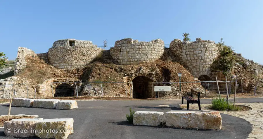
As you can see from the following photo, the fortress is still under restoration.

In 2013, vandalism took place in Migdal Tsedek (reference). As a result, Migdal Tsedek National Park was closed for restoration.
I visited Migdal Tsedek National Park in 2011. In this section, I want to bring several photos for comparison.


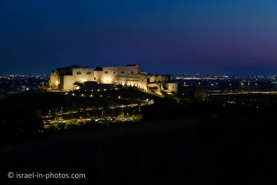
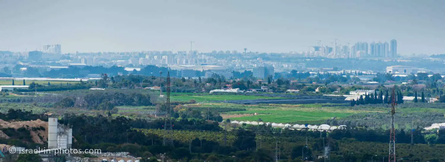
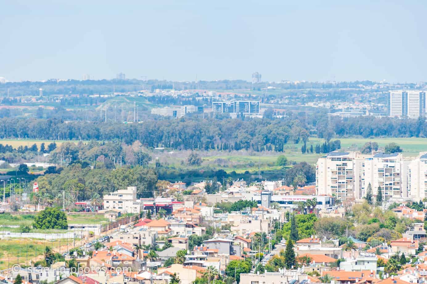
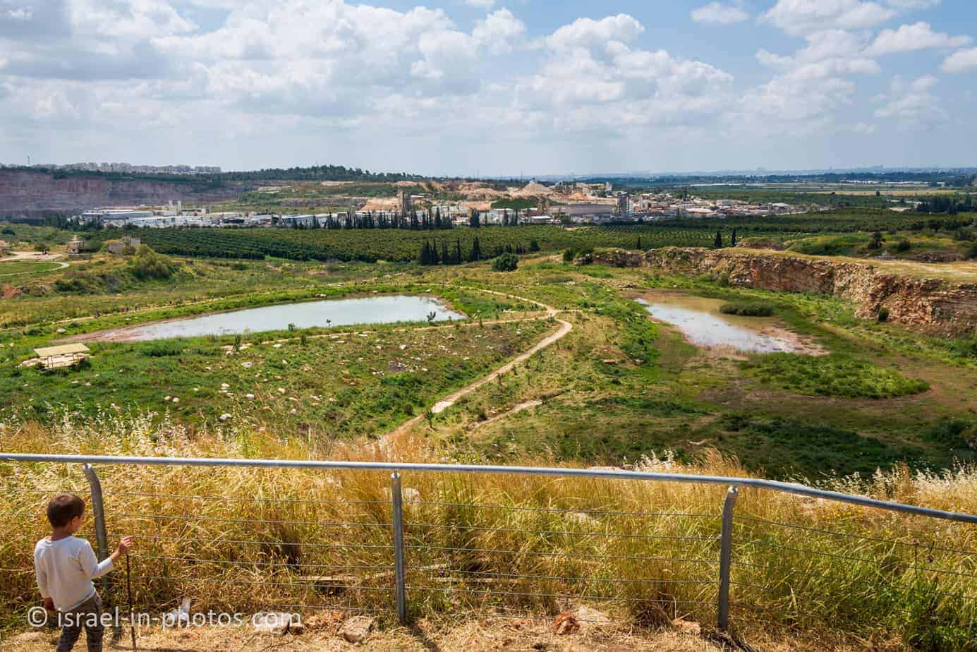
Migdal Tsedek as a Viewpoint
Migdal Tsedek serves as an excellent viewpoint. And on a clear day, you can see from Hod Hasharon to Ashdod. But I was looking for something else. While visiting Antipatris (at Yarkon National Park), you can see Migdal Afek. Thus, I tried to see Antipatris from here but did not see it for some reason.
Here are several photos from Migdal Tsedek:

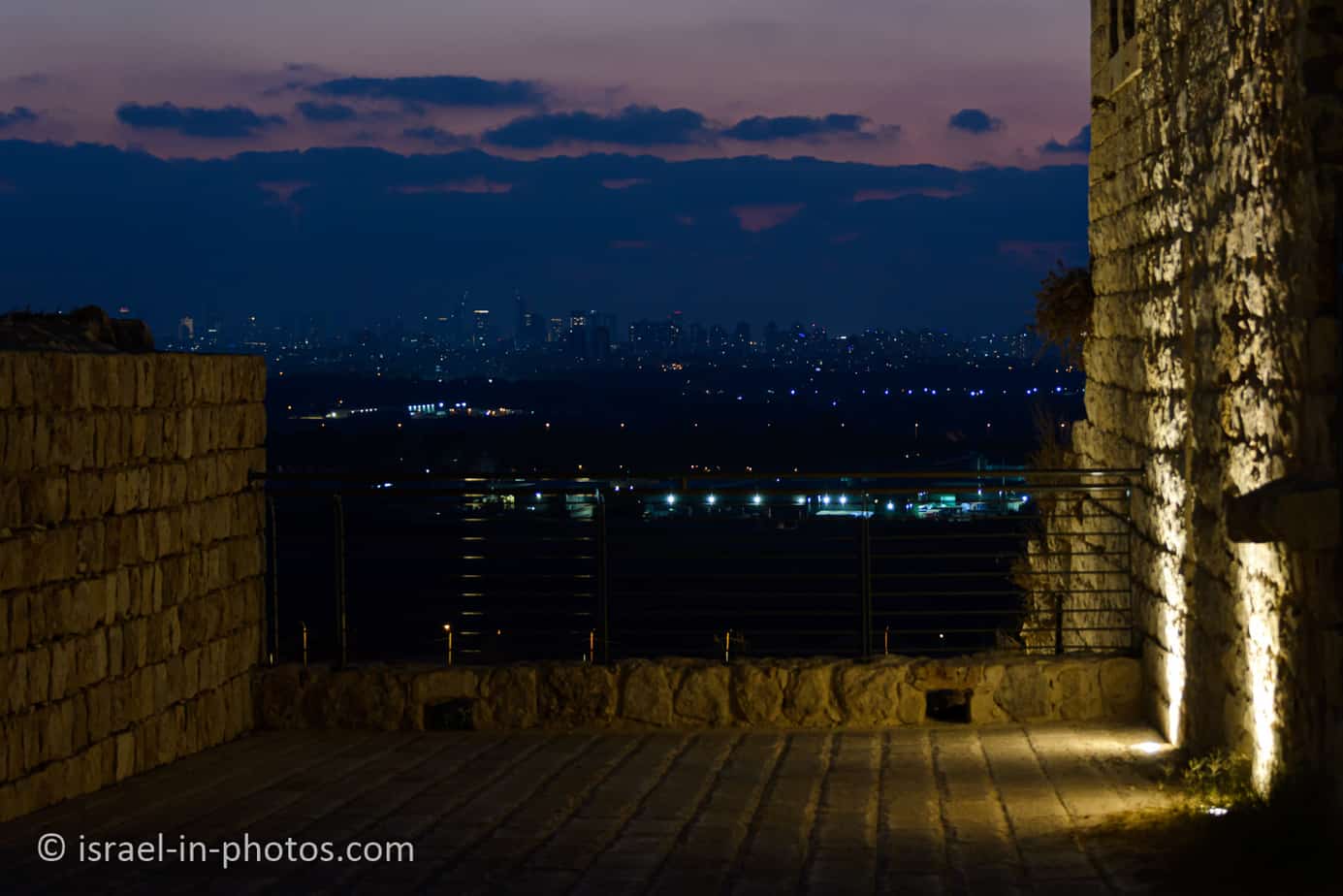


And here are several photos from our evening visit:


Inside Migdal Tsedek
As you enter the fort, you will see a small shop and several explanation signs in the inner court. But as you can see, large parts are still under reconstruction.
Note: during our August visit, we could enter the rooms in the fortress, but they were empty, and there were no exhibits.

As the Ottoman government weakened in the eighteenth century, the power of local sheiks grew stronger. Sheikh Sadiq al-Jamma’ini, from Majdal Yaba, renovated the remains of the Crusader fortress and turned it into a manor house. He controlled the main road, imposing taxes on 22 villages between Lod and Tul Karm.
His rule was brief, but his architectural influence can be seen to this day. The manor house contained some 60 rooms and courtyards. The ground floor was fronted by a large courtyard with space for animals and storage, and the top floor had four apartments in which the sheik and his family lived.
Source: sign


The Lintel Robbery
Conservation and restoration work began in the fortress in 1993. Original materials and ancient construction technologies were utilized as much as possible in keeping with international standards. Among other aspects of the work, the gatehouse and parts of the upper story were restored, and facades were completed. The entrances to the courtyards and the rooms once featured decorated lintels, and most were robbed during the 1970s and 1980s. In 2014, the lintels were restored and reworked according to old photographs.
Source: sign


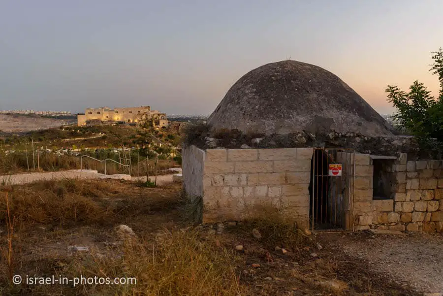
Lime Kilns and Stone Quarries
We exited the fortress using the doorways in the photo above, and the first thing we saw was a stone quarry.


“The Stone Way” leads through lime kilns and stone quarries.


The local guide gave a short overview of this park every fifteen minutes. And after listening to him, we continued along The Fortress Way.

The Fortress Way leads around the fort. On the way, you can see the fortress and winter pools. And then it returns to the parking lot. Here are several photos from the path.
Stone Way
And here are several photos from Stone Way:


Tomb Hill Path
And here are several photos from the Tomb Hill Path:


Summary
On average, our visits take 2 – 3 hours. But you can make your stay longer by combining several tracks. Alternatively, you can visit several times and each time choose another path.
Overall, it is a lovely park, and we enjoyed our visits.
Have you ever been to Migdal Tsedek National Park? Tell us about your experience in the comments below.
That’s all for today, and I’ll see you in future travels!
Stay Tuned!
Additional Resources
Here are several resources that I created to help travelers:- Trip Planner with Attractions and Itineraries is the page that will help you create your perfect travel route.
- What is the Best Time to visit Israel? To answer this question, we will consider the weather, prices, holidays, festivals, and more.
- Information and Tips for Tourists to Israel will answer the most common questions tourists have about Israel (including safety, passports, weather, currency, tipping, electricity, and much more).
- Israel National Parks and Nature Reserves include a complete list, top ten, map, tickets (Israel Pass, Matmon, combo), and campsites.
- If you are looking for things to do, here are the pages for Jerusalem, Tel Aviv, Haifa, Sea Of Galilee, Akko (Acre), Eilat, Nazareth, Safed (Tzfat), and Makhtesh Ramon.


I’ve been visiting here since 1986. It’s very exciting to see how much has been accomplished
We have been many times since 2006 years. And we saw how this place changed. A lot of work has been done. Previously, it was just a fortress with trodden paths, but now everything has been landscaped. True, you just can’t get into the park now. It is paid.
If you arrive early, you can enter for free.