

Tel Megiddo National Park – Visitors Guide with Photos

Tel Megiddo National Park in northern Israel allows seeing the remains of the ancient city Megiddo (Armageddon).
Megiddo and Tel Megiddo National Park
Megiddo was an ancient city known for its historical, geographical, and theological importance, especially under its Greek name Armageddon. This World Heritage Site became Tel Megiddo National Park. So for tourist and travel purposes, Megiddo and Tel Megiddo National Park are the same.
And here is a short YouTube video about this site:
Map and Directions
Tel Megiddo National Park is located near Kibbutz Megiddo in Northern Israel in the Jezreel Valley.
Directions for drivers: Link to Waze and Link to Google Maps
Directions for public transport: Link to Moovit
Interactive map of the area:
And here is the map of the national park:

Note: you can click on the image to enlarge it.
If you reach this National Park by public transport, you should take a bus to the Megiddo junction. Among the biggest Israeli cities, Haifa is the closest one. You can reach Megiddo junction from Haifa using bus #248. If you arrive from Tel Aviv, you can take bus #825 (Tel Aviv – Afula line). In any case, for directions, use the following link to Moovit. Update the starting point, and you will get the updated directions.
You can use a navigation application to get directions if you have a car. In Waze, type Tel Megiddo National Park, and you will get there. There is free parking on site.
Opening Hours
Sunday – Thursday and Saturday: 8:00 – 17:00 (16:00 in winter).
Friday: 8:00 – 16:00 (15:00 in winter).
On holiday eves, usually 8:00 – 13:00.
Note: Since the pandemic, the Israel Nature and Parks Authority has started limiting the number of people in each park. Thus, reservations are recommended through the official site (you can find the link below).
Entrance Fee
Adult – 28 NIS, child – 14 NIS, and student – 24 NIS. Free for National Parks annual subscribers.
If you visit several National Parks, consider purchasing a combo ticket. For additional information, see National Parks and Nature Reserves.
Note: opening hours and ticket prices were updated in October 2022. In any case, recheck the official site before visiting.
What Does Tel Mean?
The ancient city of Megiddo is located on a higher plane, which gives it a strategic advantage. But it is not a mountain. It is a Tel. Tel is a hill created by many generations living and rebuilding in the same spot.
In archaeology, tel is an artificial mound formed from the accumulated refuse of people living on the same site for hundreds or thousands of years. A classic tell looks like a low, truncated cone with sloping sides and can be up to 30 meters high.
Tells are most commonly associated with the archaeology of the ancient Near East. They are still found elsewhere, such as Central Asia, Eastern Europe, West Africa, and Greece. Within the Near East, they are concentrated in less arid regions, including Upper Mesopotamia, the Southern Levant, Anatolia, and Iran.
Source: Wikipedia
Armageddon
The word Armageddon appears only once in the Greek New Testament, in Revelation 16:16.
And they assembled them at the place that in Hebrew is called Harmagedon.
Armageddon is the predicted location of armies gathering for a battle during the end times. It is either a literal or symbolic location. Why did ancient people say the End of Days war would be at Megiddo? Due to its importance, Megiddo was conquered 25 times! Thus, if there will be an end of the world war, it will probably be in Megiddo.
How do we know that the city was conquered so many times? Besides written sources, excavations revealed 26 layers of ruins. Therefore, I would strongly recommend using a guided tour when visiting this site. Otherwise, understanding what ruins belongs to what period is pretty impossible. During one of our visits, we joined a 10:00 Saturday free tour. Moreover, see above the offer by Bein Harim.
What does Megiddo mean?
All sources I found (including Wikipedia, Britannica, and others) suggest the same. Armageddon is a combination of two words: Har Megiddo. Har in Hebrew means mountain or, in our case Tel. Thus Armageddon is Tel Megiddo. But when I was trying to understand the meaning of the word Megiddo, there was no consensus. Wikipedia suggests that Tel Megiddo means “The Tell of the Governor,” but there are no resources, and I have not found any other sources that support this theory.
Megiddo in The Bible
The name Megiddo appears 12 times in the Bible. The city of Megiddo was under the tribe Menashe and is mentioned in the context of the tribe’s failure to inherit the city. In the days of King Solomon, the city became the governor’s center. Additionally, it is mentioned in the construction activities that Solomon carried out in the town. Assyrian and Aramaic sources also mention Megiddo.
Here are several of the mentions:
The king of Taanach, one; the king of Megiddo, one;
Joshua 12:21
And Manasseh had in Issachar and Asher Bethshean and her towns, and Ibleam and her towns, and the inhabitants of Dor and her towns, and the inhabitants of Endor and her towns, and the inhabitants of Taanach and her towns, and the inhabitants of Megiddo and her towns, even three countries.
Joshua 17:11
Neither did Manasseh drive out the inhabitants of Bethshean and her towns, nor Taanach and her towns, nor the inhabitants of Dor and her towns, nor the inhabitants of Ibleam and her towns, nor the inhabitants of Megiddo and her towns: but the Canaanites would dwell in that land.
Judges 1:27
The kings came and fought, then fought the kings of Canaan in Taanach by the waters of Megiddo; they took no gain of money.
Judges 5:19
And this is the reason of the levy which king Solomon raised; for to build the house of the Lord, and his own house, and Millo, and the wall of Jerusalem, and Hazor, and Megiddo, and Gezer.
1 Kings 9:15
You can find the complete list here.
Tel Megiddo

Tours
For some reason, I do not see any tour information on the official site. But maybe that is because the guides are volunteers. I have seen tours in Hebrew, English, and Russian, but there are tours in other languages. I would recommend contacting them before your visit and query regarding guided tours. You can contact the park by phone at 04-6590316 or by mail at gl.megido@npa.org.il. Moreover, see above the offer by Bein Harim.
Location, Location, and Location
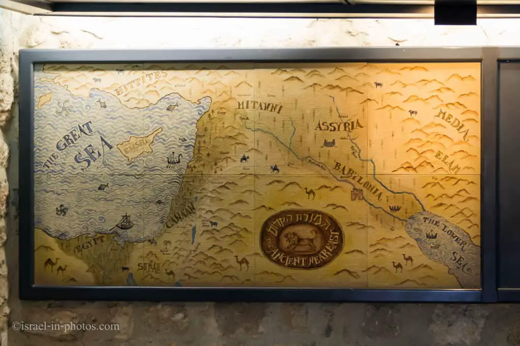
Tel Megiddo was an important city because of its strategic location. The head of a pass through the Carmel Ridge overlooks the Jezreel Valley from the west. And whoever controlled Megiddo controlled caravans passing on Via Maris (an ancient trade route dating from the early Bronze Age, linking Egypt with the northern empires of Syria, Anatolia, and Mesopotamia).
Map from the museum showcasing the great empires of that age and their trading routes:
Museum and Movie
When entering the site, there is a small complex of buildings near the parking. The house you enter serves as a small store to buy souvenirs, ice cream, and entrance tickets. Then you can explore the nearby rooms. Several rooms serve as a small museum. One room shows movies about this site in different languages, and there is also a small museum and restrooms.
The cashier told us that a historical movie about Meggido in Hebrew would start in fifteen minutes as we entered the site. Thus, I would recommend asking about the film in your preferred language (if the guides will not mention it).
Since we had some time to kill, we visited the museum.
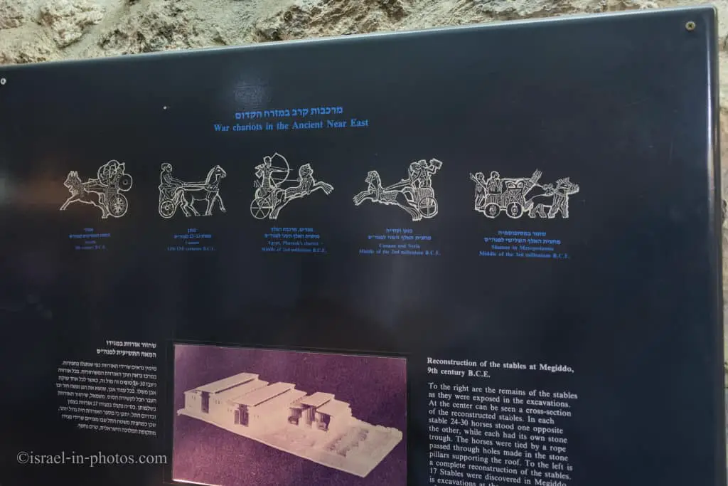
At that time, horses were widely used and integrated into the military. You can find the remains of two stables in Tel Megiddo National Park, but we will reach them later.
We watched a ten-minute movie about the site’s history and then played a little with the city’s model.

You can find buttons that lift different model parts and reveal lower layers near the model.
Ruins of Tel Megiddo
Visiting the museum and the movie took about half an hour, and then we headed outside to the ruins. The map above has a number for each point of interest and a suggested route. If it is your first visit, I advise sticking to the route. And that is mainly because the whole site is not big, and you can easily hike it within two hours.
After a five-minute hike from the museum, we reached point #1.
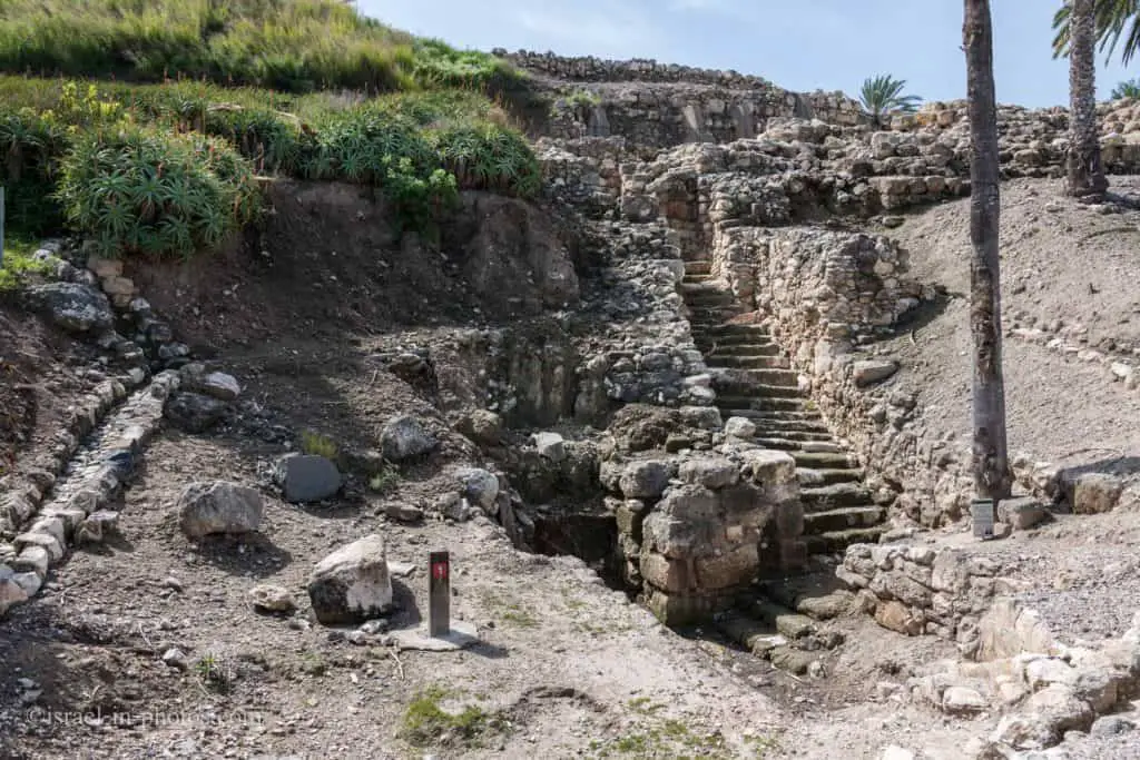
Number 1 is a water reservoir. You can see the stairs leading to a pool. But, it is still not clear what the water source was.
Not sure what’s this bug’s name, but on one of our visits, we saw thousands of them:

The Canaanite period

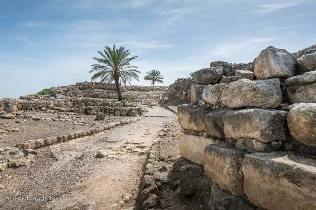
The city gate and Canaanite palace: The main find from the Canaanite period is the city gate (15th century BCE) and the original stone paving from the period that leads to it. Alongside it is the Canaanite palace – the remains of a large structure of rooms built around a central courtyard. In one of the rooms, spectacular items were found, including gold objects, hundreds of pieces of decorated ivory jewelry, and a washroom paved with shells.
Source: unless stated otherwise, all historical quotes were taken from the official site.
One interesting fact is that Tel Hazor National Park and Tel Gezer have the same gate type. That leads historians to conclude that the same government built these gates, the Israelite administration.
The gate from inside:
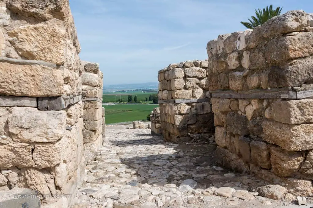
As you can see, there are rooms on both sides of the entrance. During its construction, the city did not have walls. Thus the purpose of this gate was not a defense. And instead, it was a ritual one.

According to the base level, the castle’s size was 30×50 meters, and a collection of decorating ivory that was found here depicts the high status of the ruler.
Northern Stables
And we reached #6 – the Northern Stables.

Researchers found the remains of two stables in the city. That means that Megiddo of that era was a city whose primary purpose was horse-trading or supporting the horsemen army.
At Megiddo, two stable complexes were excavated from Stratum IVA, one in the north and one in the south. The southern complex contained five structures built around a lime paved courtyard. The buildings themselves were divided into three sections. Two large stone-paved aisles were built adjacent to the main corridor paved with lime. The buildings were about twenty-one meters long by eleven meters wide.
Separating the main corridor from outside aisles was a series of stone pillars. Holes were bored into many of these pillars so that horses could be tied to them. Also, the remains of stone mangers were found in the buildings. These feeders were placed between the pillars to feed the horses. It is suggested that each side could hold fifteen horses, giving each building an overall thirty horse capacity. The buildings on the northern side of the city were similar in their construction. However, there was no central courtyard. The capacity of the northern buildings was about three hundred horses altogether. Both complexes could hold from 450–480 horses combined.
Source: Wikipedia
Temple Area

Researchers excavated this area until the lowest layer. They found 20 layers of different cities. And in the Temple Area, they saw various Temples from different periods.
The temple area: An interesting site in the “large section” excavated by the