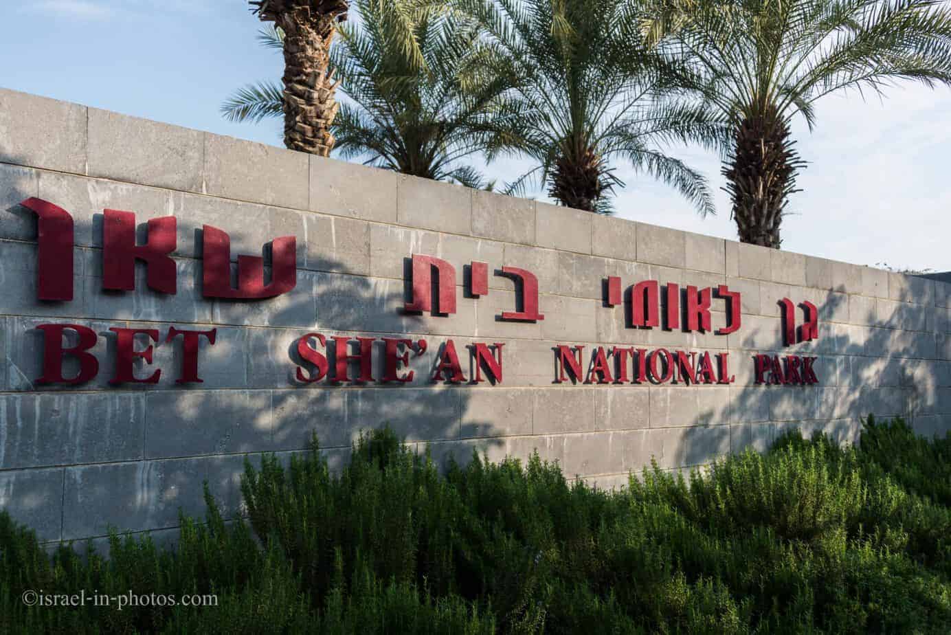
Yarkon National Park – Tel Afek (Antipatris) Compound – Visitors Guide
Tel Afek compound at Yarkon National Park has the Antipatris fort, an artificial lake, paddling pools, and a large picnic area.
Note: This article contains information about Afek. If you are interested in the other Yarkon National Park compound, check out Yarkon Springs.
Table of Contents
- 1 Map
- 2 Trails at Yarkon National Park
- 3 Directions
- 4 Opening Hours
- 5 Entrance Fee
- 6 Why was Afek important? And what does Afek mean?
- 7 The Squill Trail at Tel Afek
- 8 The Roman Cardo
- 9 The Roman Theater
- 10 Alexandroni Brigade Memorial
- 11 Antipatris
- 12 The British Water Pumping Station
- 13 The Artificial Lake
- 14 Recreation Area and Amusement Facility
- 15 Paddling Pools
- 16 Events and Concerts
- 17 Work Area
- 18 Summary
Map
Yarkon National Park is in central Israel between Petah Tikva and Rosh Haayin.
Directions for drivers: Link to Waze and Link to Google Maps
Directions for public transport: Link to Moovit
Interactive map of the area:
Yarkon National Park has two compounds with two separate entrances. I marked both regions on the map above, and you can also see them on the following map.

Note: you can click on the map to enlarge it.
On the right side of the map, you can find Tel Afek. You will see Antipatris Fort, the British water pumping station, the artificial lake, paddling pools, and other points of interest.
And on the left side of the map, you can find the Yarkon Springs area. You can walk along the Yarkon River in this region and see the Yarkon bream pool, Al-Mir flour mill, and several other places. Also, the camping area is situated in the Yarkon Springs area.
No road inside the park connects Tel Afek and the Yarkon Springs area. There is only a hiking trail between the two parts of the park. That means that you have to choose in advance where to park your car and hike from there. If you want to drive from one part of the park to another, you must exit and drive around the national park.
Trails at Yarkon National Park
There are several options for hikes. The first two options would be a short hike in each area (about half an hour to an hour). You can also extend these hikes by visiting the Water-Lilly Ponds in the middle of the map (marked as #6 on the map above). Then, a typical hike will take about one and a half to two hours. And the longest walk includes visiting both areas. If you have a car parked in each region, it will take about two hours. Otherwise, you must return to the initial point, a four-hour walk.
Note: sometimes, the gates that allow hiking from one park’s compound to another are closed. Thus, if you plan to walk from one area to another, contact the Israel Nature and Parks Authority in advance.
Directions
As mentioned above, you must choose in advance whether to park at Tel Afek or the Yarkon Springs area. There are two separate entrances, and they are not close to each other.
You can reach the entry to Tel Afek from road #483 or use the links above the interactive map.
Note: there are many parking spaces inside each section of the park.
Opening Hours
Sunday – Thursday and Saturday: 8:00 – 17:00 (16:00 in winter).
Friday: 8:00 – 16:00 (15:00 in winter).
On holiday eves, usually 8:00 – 13:00.
Note: Since the pandemic, the Israel Nature and Parks Authority has started limiting the number of people in each park. Thus, reservations are recommended through the official site (you can find the link below).
Entrance Fee
Adult – 28 NIS, child – 14 NIS, and student – 24 NIS. Free for National Parks annual subscribers.
If you visit several National Parks, consider purchasing a combo ticket. For additional information, see National Parks and Nature Reserves.
Note: the entry ticket is valid for both areas on the same day.
Note: opening hours and entrance fees were updated in April 2024. In any case, recheck the official site before visiting.
Why was Afek important? And what does Afek mean?
In the past, it was not possible to pass from the southern coastal plain towards the Sharon and northwards due to the marshes that had developed around the river. The ancient Via Maris that traversed the country lengthwise had to circumvent the marshes from the east, which is why the region was called the “Afek Passage.” The route went along a pass between the mountain and the sources of the Yarkon. Already from ancient times, this passage was a focus for human settlement, which is evidenced by the remains of a settlement at Tel Afek.
The area was settled continuously for 5,000 years, from the beginning of the Bronze Age until the Ottoman period. In the later Roman period (2nd-4th centuries CE), Antipatris was the major city in the region and an important junction in the system of roads built by the Roman rulers in Palestine. Antipatris (and Mirabel at Rosh Ha’Ayin) commanded the Afek Passage, the Yarkon basin, and the Southern Sharon. The name “Afek” derives from the Akkadian word “Aphek”/Aphekum,” meaning springs, which also appears to be connected to the Hebrew word “Afek” – riverbed, stream.
Note: unless stated otherwise, all quotes were taken from the official site.
The Squill Trail at Tel Afek
We will visit Tel Afek using the Squill trail. It is an easy loop walking path about two km long and takes around an hour.
The Squill trail – a walking route along which squills (Drimia Maritima) were planted in 2011. The inspiration for selecting squill to mark the trail came from the ancient practice of using the plant as boundaries between fields. The Squill Trail is a circular route passing through sites from the Roman, Ottoman, and British periods.
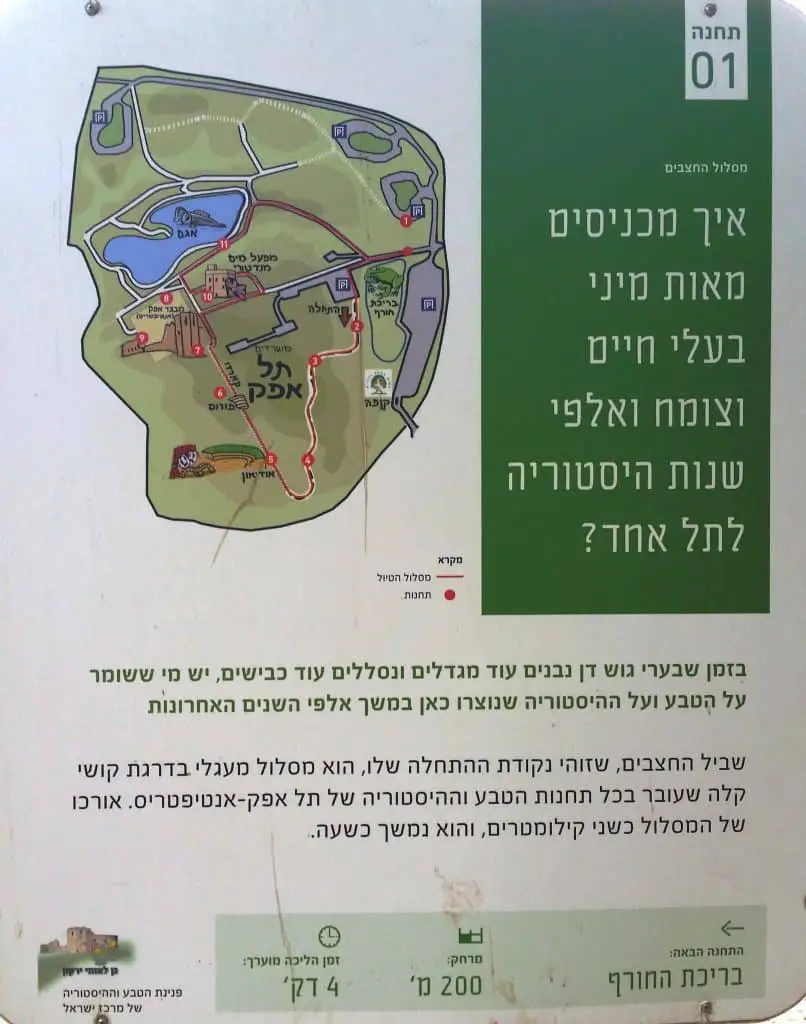
The Squill trail starts at the parking near the winter pool (marked as #1 on the map).


Along the Squill trail, you can find different informational signs in Hebrew.

And after about ten minutes, you will reach Cardo.
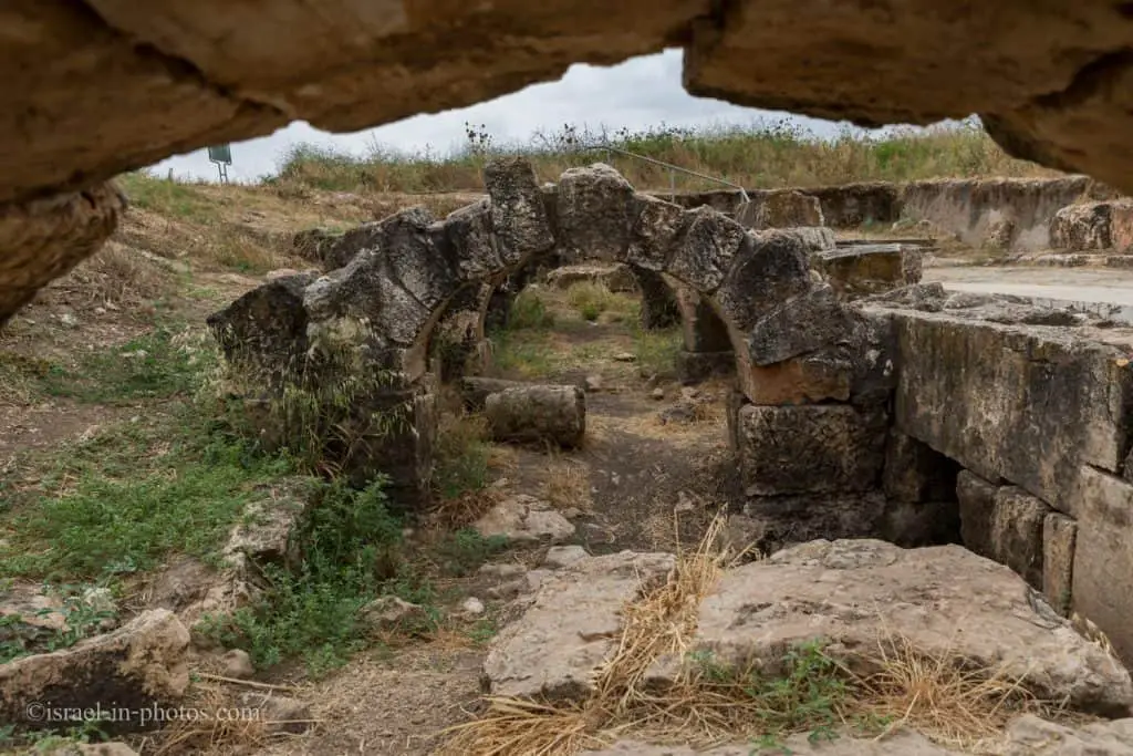
The Roman Cardo
It was the main street of the Roman city of Antipatris. You can see grooves on the paving stones carved by carriages.

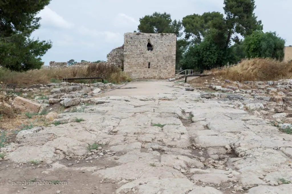
At the far end of the Cardo, you can see a lookout tower. That is Antipatris Fort, and we will reach it shortly. But meanwhile, let’s visit the theater.

The Roman Theater
The Roman city Antipatris used the Cardo and the Roman Theater at the beginning of the first century.

Alexandroni Brigade Memorial
Shortly after the theater, you will see a sign for the Alexandroni Brigade memorial.
Forty-one soldiers from the Alexandroni brigade died in this region during the independence war.

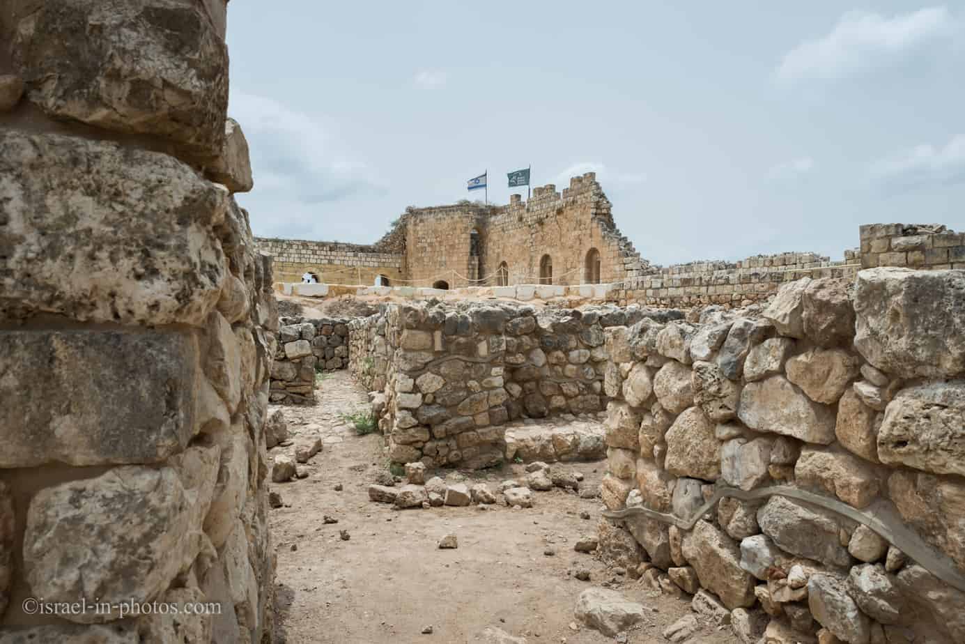
Antipatris
We will continue along the Cardo until we reach the Antipatris Fort (marked as #3 on the map at the beginning of this post).
You will see the word “Tel” many times in this post. Tel is an artificial mound that was created by building one city on top of another over and over again. You can find more information about Tel at Tel Megiddo National Park.
Archeological excavations at Tel Afeq exposed many layers from the fourth millennium BCE until the 20th century. In the Second Temple period, Herod built the city of Antipatris. And the remains of the fortress you can see today are the Ottoman fort called “Head of the Spring.”
The City of Antipatris
Short overview of Antipatris:
Antipatris was one of the most important cities in Israel; it was settled almost continuously for 5,000 years, from the early Bronze Age to the Ottoman period, and achieved a size of over 120 dunams. Its importance derives from its location at the “Afek Passage” – the narrow passage that connects the hills of Samaria and the sources of the Yarkon River. This passage served to circumvent the marshy area and was part of the Via Maris, which traversed the length of the country.
At the top of the Tel the ruins of a Turkish fortress can be seen, and within the Tel palaces from a Canaanite city were found. Part of the Roman-Byzantine city Antipatris was excavated south of the fortress, and in it were found the cardo with stores alongside it, a villa with mosaic floors and the city square. West of the Tel was found the remains of the Odeon – a Roman structure similar to a small theater, designed for musical performances. East of the top of the Tel are buildings and concrete pools belonging to the Mandate-period water facility that pumped water from the Yarkon and transported it to Jerusalem.
Who was Antipatris?
Antipatris was a city built by Herod the Great and named in honor of his father, Antipater II of Judea. It lay between Caesarea Maritima and Lydda, on the great Roman road from Caesarea to Jerusalem, and figures prominently in Roman-era history.
According to Josephus, Antipatris was built on the site of an older town that was formerly called Chabarzaba, a place so-named in classical Jewish literature and the Mosaic of Rehob. During the outbreak of the Jewish war with Rome in 64 CE, the Roman army under Cestius was routed as far as Antipatris.
Paul the Apostle was brought by night from Jerusalem to Antipatris and next day from there to Caesarea Maritima, to stand trial before the governor Antonius Felix.
Only one of the early bishops of the Christian bishopric of Antipatris, a suffragan of Caesarea, is mentioned by name in extant documentation: Polychronius, who was present both at the Robber Council of Ephesus in 449 and the Council of Chalcedon in 451. No longer a residential bishopric, Antipatris is today listed by the Catholic Church as a titular see.
In 363, the city was badly damaged by an earthquake.
Source: Wikipedia
Antipatris Fort

The fortress at the top of the Tel was built between 1572 -1574 in the Ottoman period and is called “Binar Bashi,” an Arabic corruption of the Turkish name Pinar Basha, literally – “fountainhead” or “head of the springs” (in Hebrew – Rosh Ha’Ayin). The fortress is known mistakenly as Antipatris Fort, after the Roman city that existed here. The function of the fortress was to guard the Afek Passage – the narrow pass that connected the hills of Shomron with the sources of the Yarkon River.
This pass circumvented the marshy region and was part of the ancient Via Maris that traversed the length of the country.
And now, let’s enter the fortress.

You can see a tower with flags on top of the fortress at the far end of the fort. If you climb the stairs to the tower’s second level, you will see something similar to a spyglass.

If you look through that spyglass, you can see another fort on top of a mountain. That is Migdal Afek, which is part of Migdal Tsedek National Park. And the “Afek Passage,” part of Via Maris, lies between the two fortresses. Moreover, the same passage is used today for roads #6, #444, and the train.
Note: Migdal Tsedek National Park was reopened in 2021. You can find additional details at Migdal Tsedek National Park.

Inside the fortress, there is an excavated area. The lower level is an Egyptian governor’s house.

And as you take the stairs down, look at the stairway. Each stair lists another period and the name used to denote this city at that period.


We will leave the stronghold and continue towards point #2.
The British Water Pumping Station
Between 1936 and 1939, water was supplied from this point to Jerusalem. The supply was made using more than sixty km long pipes. As you guessed, we are in the British Water Pumping Station (marked as #2 on the Map of Yarkon National Park).
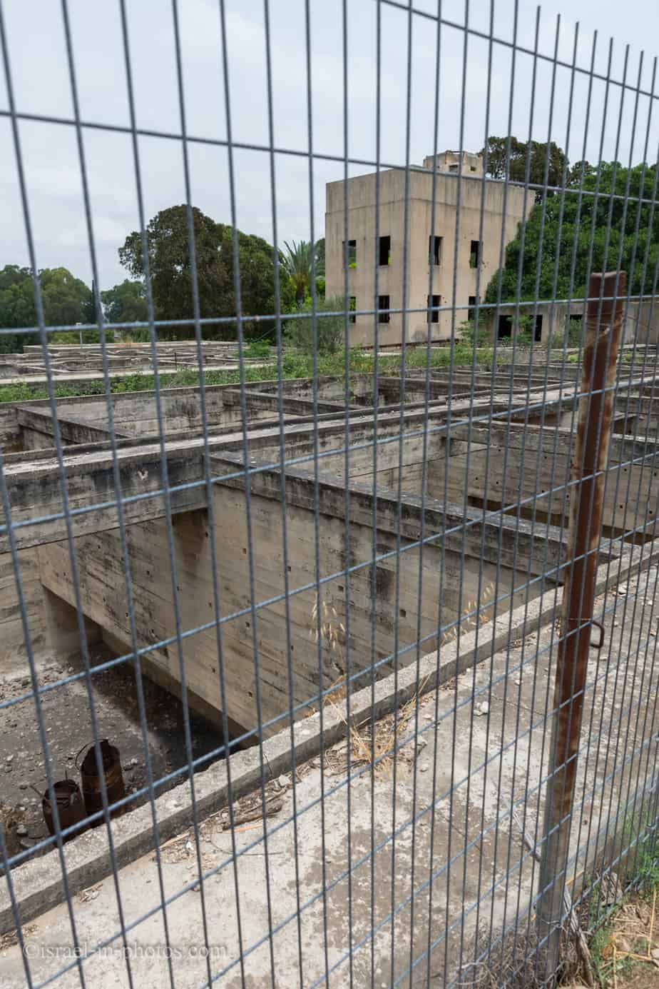
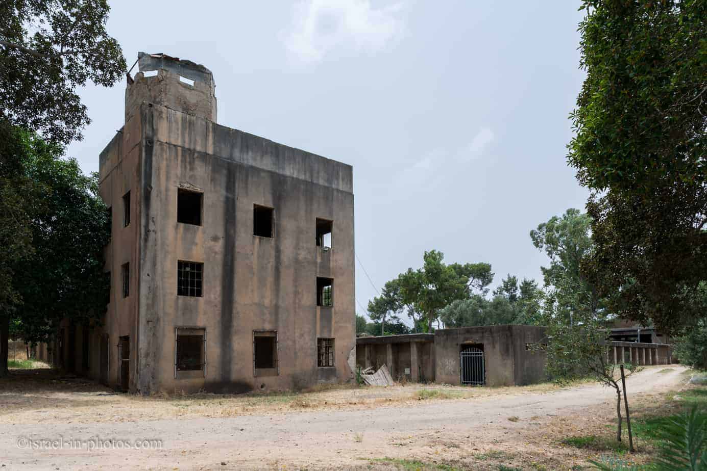
The British Water Pumping Station – a facility erected by the British in Palestine during the Mandate, which was part of the facility that conveyed water to Jerusalem. The water was collected in pipes at the Rosh Ha’Ayin springs and transferred to filtering pools for cleaning and then to a chlorination structure. After that, the water was conveyed to an underground reservoir and pumping stations, and from there, it was delivered to Jerusalem. The old structures seen in the Afek area are the pumping station, the sinking and filtering pools, and the chlorination structure. Opposite there are buildings that served as offices and residence for the British soldiers who guarded the pumping station, which Nature and Parks Authority use today.
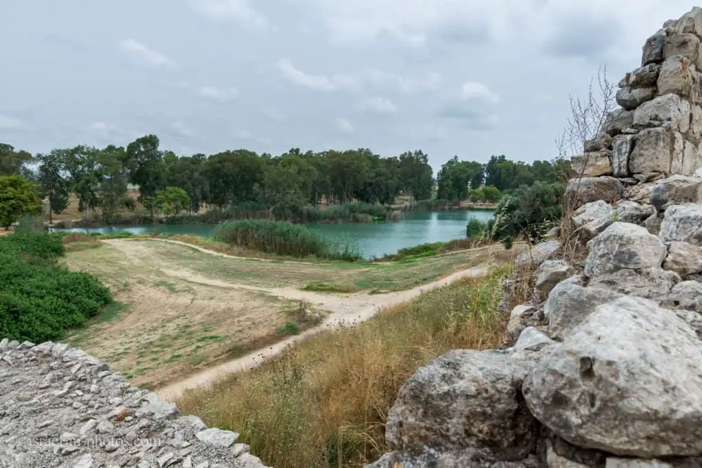
The Artificial Lake
We will descend to the artificial lake (marked #4 on the map of Yarkon National Park).
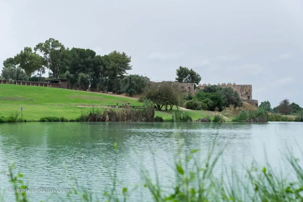
The Artificial Lake – a narrow peaceful waterway flows into the lake originating from the National Water Carrier pipeline. The lake was built in a natural basin located there, in order to create a suitable habitat for water fauna and for leisure and recreation purposes.
If you stand on the shore of the lake, you can see many catfish.

Besides catfish, you can also see Yarkon Bleak. The Yarkon Bleak is an endemic species that was almost extinct.
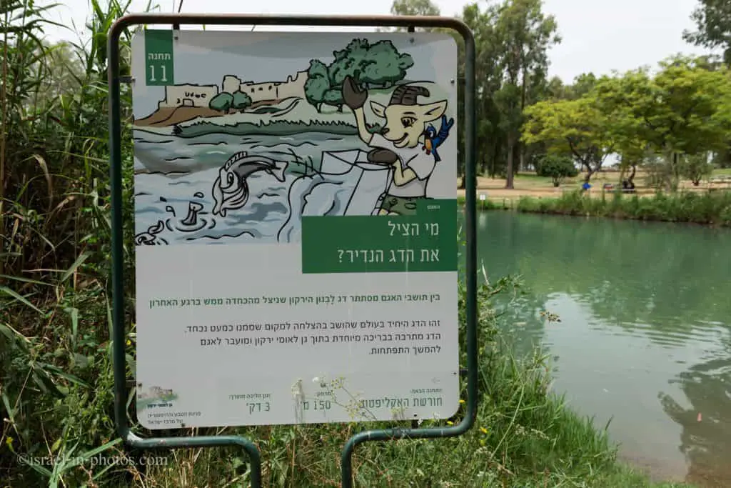
I will not elaborate here since I have already written about the Yarkon Bleak. You can find additional information in my guide to Ein Afek Nature Reserve.

The lake also nurtures plants that grew in Yarkon and became almost extinct.

Recreation Area and Amusement Facility
There is plenty of space if you want to have a picnic or a barbeque. Many park areas have all the required amenities, and you can light the fire. We have had barbeques several times in Tel Afek, and my kids love this place because they can go to the paddling pools.

Paddling Pools
Several paddling pools for kids are located near the winter pool (marked as #1 on the map). The depth of the wading pools is about 40 cm.
The Paddling Pools – above the artificial lake a few paddling pools were built at the end of 2012, and visitors are invited to paddle in them (bathing is prohibited in the lake itself).
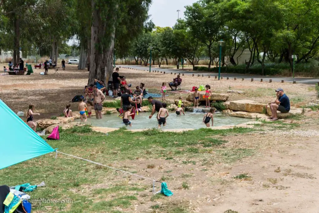
Since the pools are shallow, they are more suited for younger kids. Toddlers and preschoolers will enjoy the paddling pools the most.
And this is how the pools look on a weekday in August (during the summer vacation):

And despite the number of people, we could find a quiet corner.
Events and Concerts
Since the Afek area is quite extensive, they hold different events. Thus, you can combine a visit to an event with a hike in the park. Here, for example, is a link to an exhibition we visited at the Classic Car Club in Israel.


If you are going to a concert at Tel Afek, I have two tips. First, as you can see from the photo above, bring something to sit on. You can also bring plastic chairs, but chairs are permitted only in the back. The second tip is to take something against mosquitoes.
Also, most people bring food. And I will mention that a nearby kiosk is open during concerts, and besides the standard selection, they also offer small pizzas and pretzels.
Work Area
Tel Afek is one of the national parks that offer a working area. There are tables with electricity sockets and Wifi, enabling you to visit with a laptop and work from there.
The tables are located near the British water pumping station, and on one occasion, when an electricity break was planned in my area, I went there. There were about eight picnic tables with electricity, and two big groups took over the area. Thus, I had to return home. If you are planning to work from there, you better come early.
Summary
Yarkon National Park is liked not only because of its location. But also because it has many things to offer. There is archeology, history, and wildlife. Moreover, if you are looking for a hike, a place for a picnic, or some activity for the kids, you can find it all in this park.
And if you are interested in the other Yarkon National Park compound, check out Yarkon Springs.
Have you ever been to Yarkon National Park? Tell us about your experience in the comments below.
That’s all for today, and I’ll see you in future travels!
Stay Tuned!
Additional Resources
Here are several resources that I created to help travelers:- Trip Planner with Attractions and Itineraries is the page that will help you create your perfect travel route.
- What is the Best Time to visit Israel? To answer this question, we will consider the weather, prices, holidays, festivals, and more.
- Information and Tips for Tourists to Israel will answer the most common questions tourists have about Israel (including safety, passports, weather, currency, tipping, electricity, and much more).
- Israel National Parks and Nature Reserves include a complete list, top ten, map, tickets (Israel Pass, Matmon, combo), and campsites.
- If you are looking for things to do, here are the pages for Jerusalem, Tel Aviv, Haifa, Sea Of Galilee, Akko (Acre), Eilat, Nazareth, Safed (Tzfat), and Makhtesh Ramon.