Yehiam Fortress National Park – Visitors Guide
Yehiam Fortress from the Crusader and Ottoman periods, near Nahariya, is a lovely attraction for a short family visit.
Table of Contents
- 1 Map
- 2 Opening Hours
- 3 Entrance Fee
- 4 Contact Information
- 5 Yehiam Fortress Campsite
- 6 Barefoot Trail
- 7 Sound and Light Show
- 8 Main Gate
- 9 Crusader Wall
- 10 Crusader Tower
- 11 Defense Positions
- 12 Western Observation Terrace and Bathhouse
- 13 Pillared Hall
- 14 History
- 15 What Does Yehiam Mean?
- 16 How Old Is Yehiam?
- 17 Related Attractions
- 18 Summary
Map
Kibbutz and Fortress Yehiam are located in northern Israel, about 8km from Nahariya.
Kibbutz Yehiam is known for its meat products and Malka Beer. And in front of Malka Beer, on the ground of this kibbutz, you can find the Yehiam Fortress.
Free parking is available near the entrance to the national park.
Directions for drivers: Link to Waze and Link to Google Maps
Directions for public transport: Link to Moovit
Interactive map of the area:
We received the following brochure with the site plan and basic info when we entered it.

Here is a map from 2021:

Note: you can click on the map to enlarge it.
Opening Hours
Sunday – Thursday and Saturday: 8:00 – 17:00 (16:00 in winter).
Friday: 8:00 – 16:00 (15:00 in winter).
On holiday eves, usually 8:00 – 13:00.
Note: Since the pandemic, the Israel Nature and Parks Authority has started limiting the number of people in each park. Thus, reservations are recommended through the official site (you can find the link below).
Entrance Fee
Adult 14 NIS, child 7 NIS, and student 12 NIS. And free for National Parks’ annual subscribers.
If you visit several National Parks, consider purchasing a combo ticket. You can find additional info at National Parks And Nature Reserves.
Note: opening hours and ticket prices were updated in May 2022. In any case, recheck the official site before visiting.

Contact Information
Phone: 04-8276600
Yehiam Fortress Campsite
Yehiam Campground was recently upgraded, and in 2022, showers were added.

The campsite has lightning, a faucet, electric outlets, restrooms, and picnic tables. You can find additional info here.

Barefoot Trail
When you visit this National Park, you start from the bottom, near the parking, and go up. To the right of the entrance, you can find the barefoot trail.


The barefoot trail is not that long, but it is an excellent addition that kids enjoy.
You can find a castle drawing on the ground at the end of the barefoot trail.

Children can put on costumes (from a nearby box) and lie on the painting. Then, parents can connect to a camera on a pole above the drawing and photograph children. It is a lovely addition to the park.
The barefoot trail ends near the entrance to Yehiam Fortress and the Byzantine burial caves (#1 on the map).
Note: in the bottom part of the photo above, you can see the sign by the entrance to the Byzantine burial cave.
Sound and Light Show
We will go over Yehiam Fortress National Park according to the numbers on the map from 2021. Thus, after the Byzantine burial caves (#1 on the new map), we continue to the sound and light show (#2 on the new map).
As you enter this national park, you can ask when the next screening will be. But from our experience, you can start the movie yourself (there are several buttons by the entrance door).
After pressing one of the buttons (depending on the wanted language), you will see a short movie (about 10 minutes) telling the history of this place.
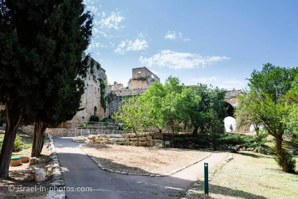
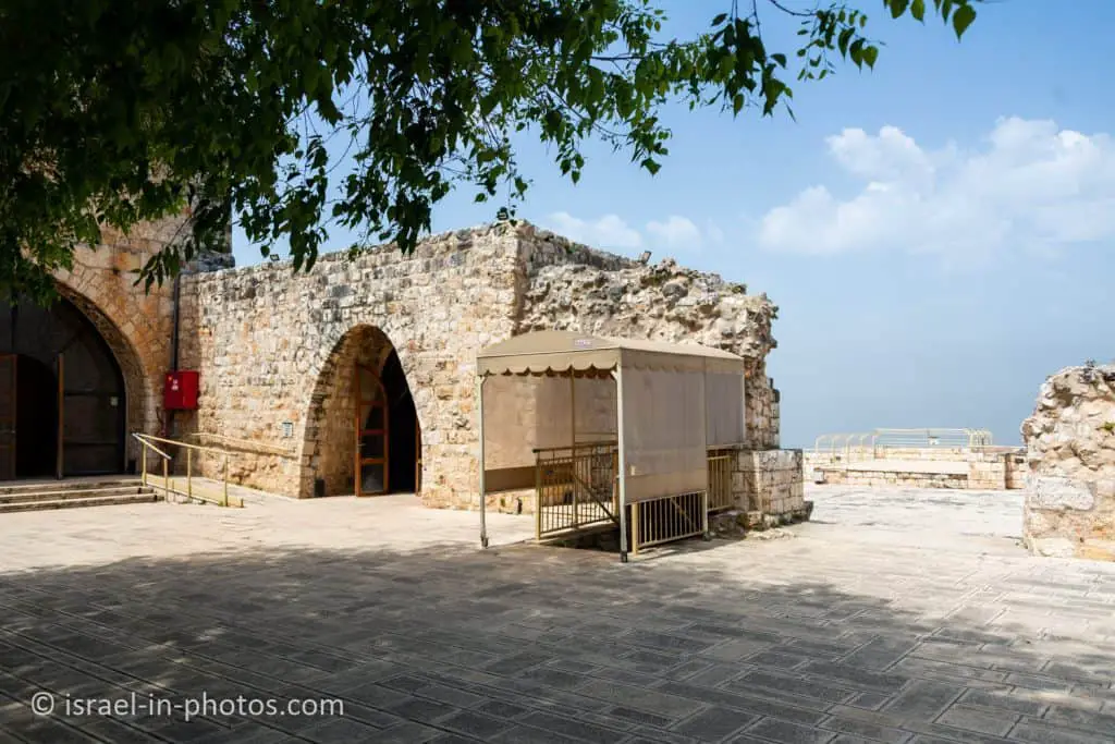
Main Gate
After visiting the sound and light show, you continue walking along the outer wall till you reach the main gate (#3 on the new map).
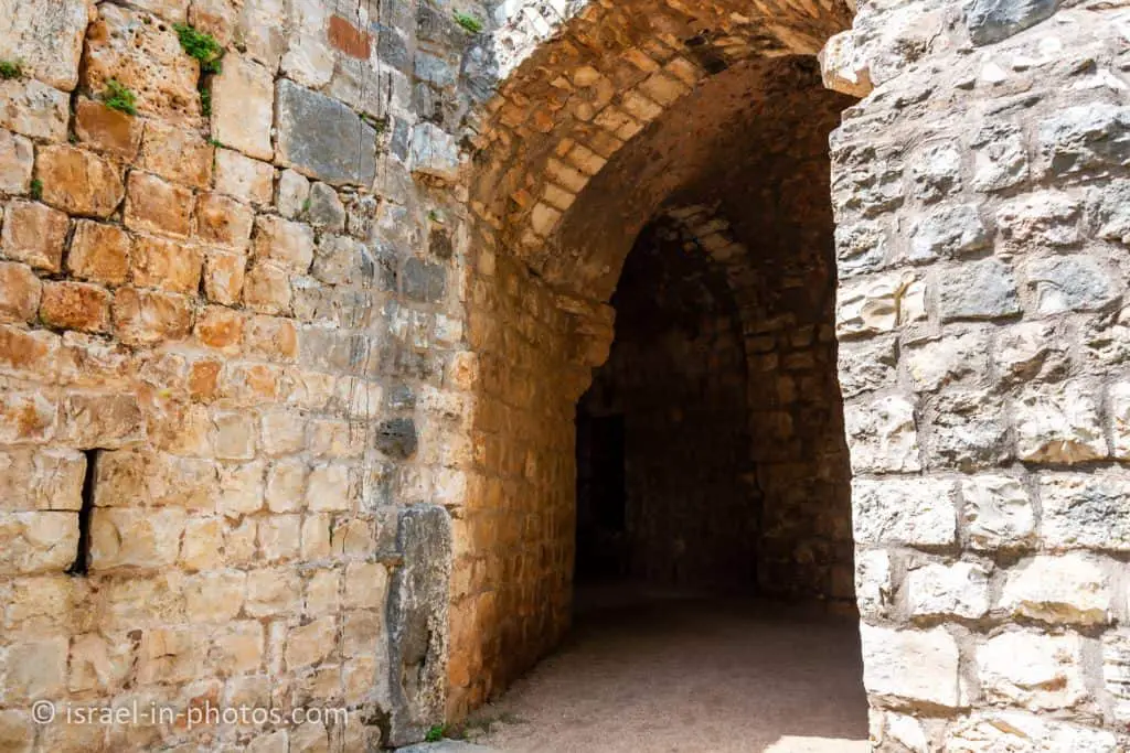
The Fortress Gate – the fortress is entered through a gate from the time of Zahir al-Umar (most of the ruins that can be seen today at the fortress are from this period). A strong, semicircular tower protects the gate. The stones of the threshold were taken from Byzantine period buildings at the site. The gate was closed by two wooden doors plated with strips of metal.
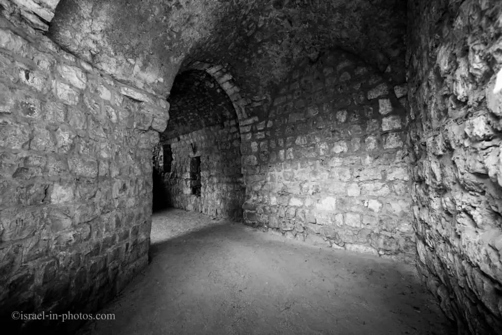
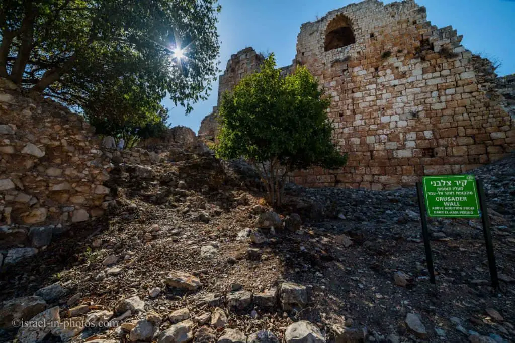
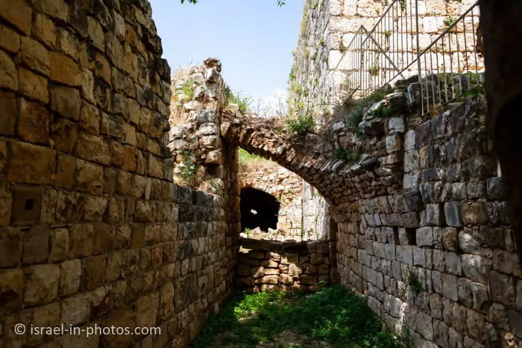
Crusader Wall
After entering the main gate, you will see the Crusader wall (#4 on the new map) and the tower on top.
You can see the following stairs that lead to the tower by the wall.
Most of the remains date from the time of the Bedouin Sheikh Daher al-Omar, who ruled the Galilee in the 1760s. He built new walls and towers and surrounded the fortress with a moat.
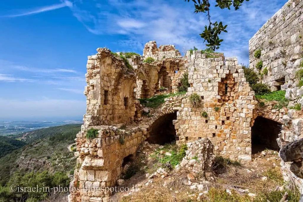
Crusader Tower
Let’s climb to the Crusader tower (#5 on the new map). You get a 360-degree view of the fortress and Western Galilee region from the top.
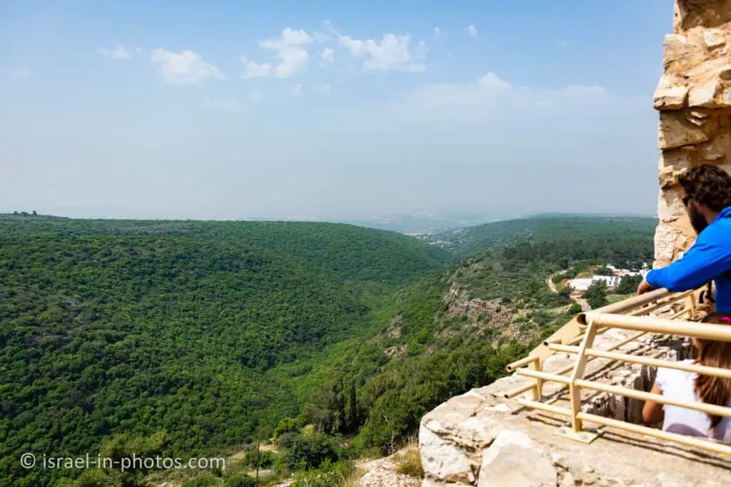
The Crusader Tower – steps lead up to the top of the tower, one of two that existed in the Crusader fortress. This tower has very thick walls, whose strength made it possible to build a three-story tower, today rising to a height of 15 m. A staircase leads up to a lookout balcony on the roof.


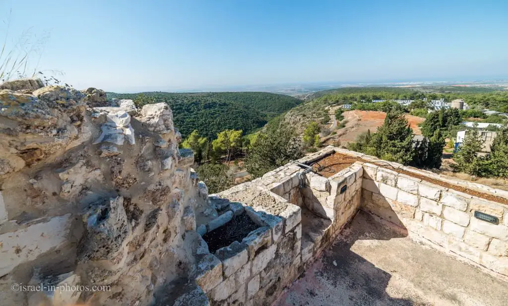
Defense Positions
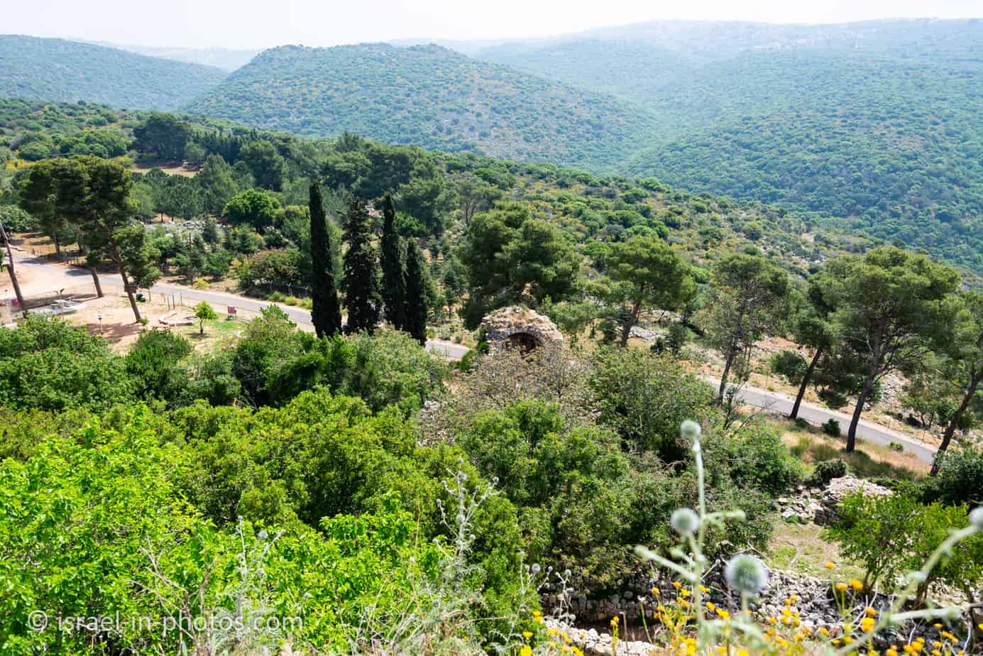
And now, let’s get down from the balcony on the top of the Crusader tower and explore the nearby area.
As you get down, continue to the south and then turn east towards the defense positions (#6 on the new map).
It is pretty hard to see, but this is the view of Nahariya and the sea.
The path at the bottom of the following photo leads to the defense positions.

The Crusader Tower from another side:

Yehiam Fortress has different areas constructed and modified at various times. Here is the most recent part. Israeli soldiers took a stand during the Israeli Independence War in this area.
Defense positions – around Tower A, the path continues to the eastern part of the fortress, passing between the communication trenches and defense positions of Kibbutz Yehi’am from the War of Independence.


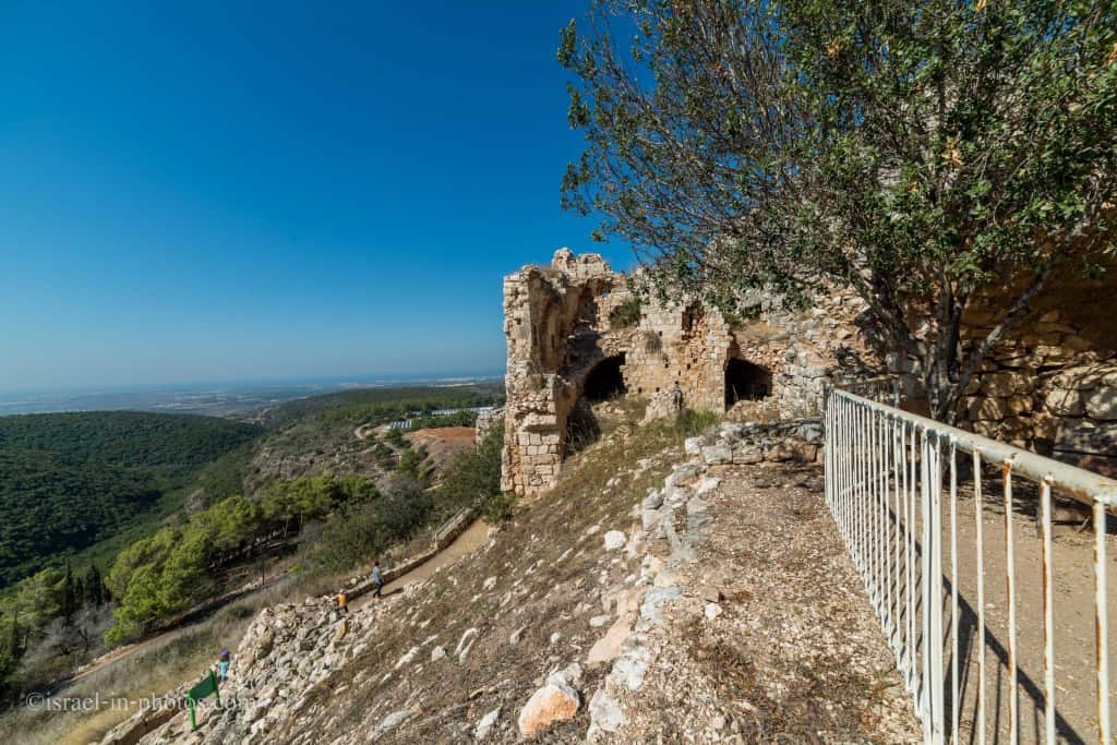
Western Observation Terrace and Bathhouse
We head west towards Western Observation Terrace and Bathhouse (#9 on the new map).
Note: the map gives a top-down view, which can be confusing since the fortress is a multi-level structure. Thus, numbers 9 and 10 are on different floors next to each other on the map. Beneath the Western Observation Terrace and Bathhouse, you can find the Pillared Hall. And in the center of the photo above, you can see the stairs to the lower level.

In the photo above, the door on the right leads to the “Mushroom Hall.”
this hall was used by the members of Kibbutz Yehi’am for growing mushrooms in the 1950s
Currently, this space is empty.
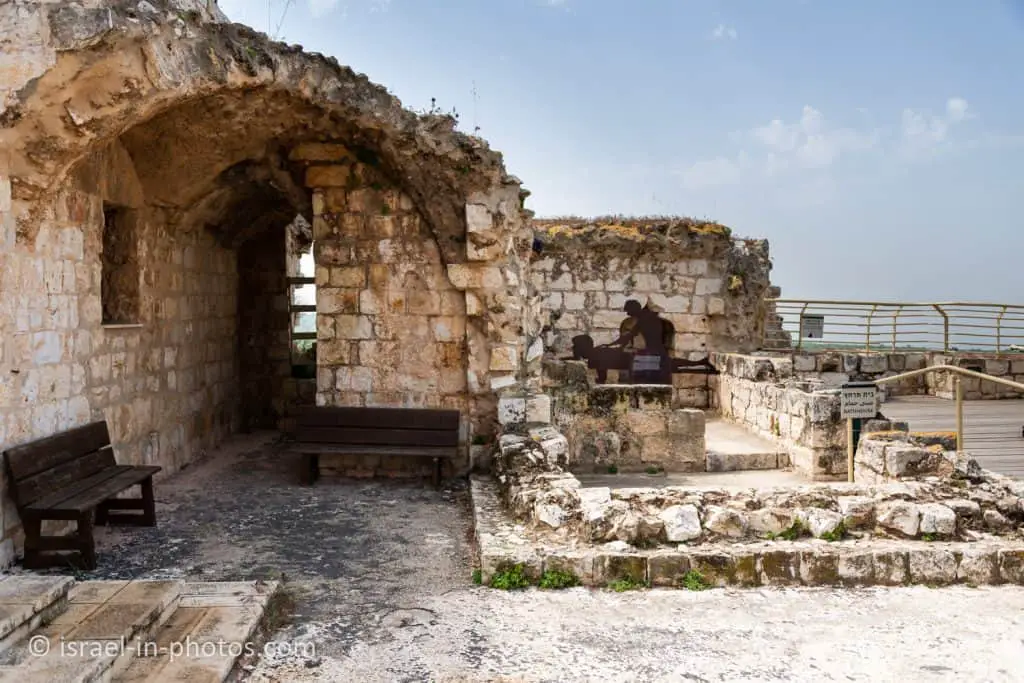
Western observation terrace and bathhouse – a spacious, open roof that served in the past as the floor of many rooms that no longer exist. From this terrace, there is a breathtaking view. On the southern side are the remains of a small bathhouse, apparently used by the fortress commander. Water was brought up in jars from the cistern in the fortress and poured into a channel that carried it to the bathhouse.
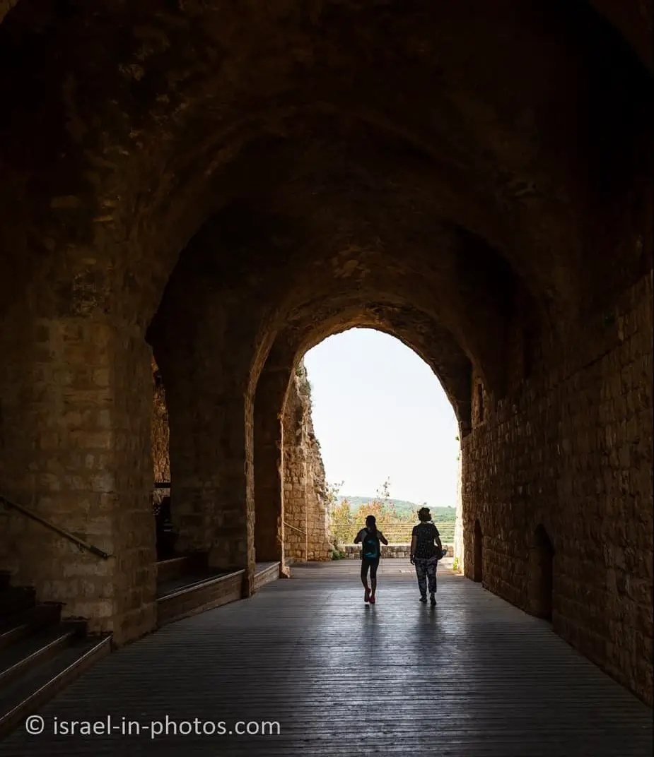
Pillared Hall
Let’s take the stairs to the pillared hall (#10 on the new map).
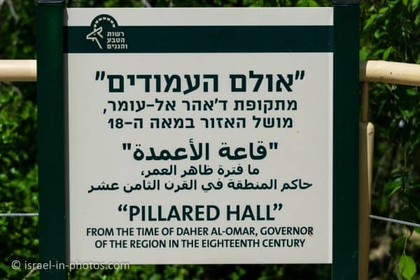
It is an impressive hall, and it could easily host several hundred people.
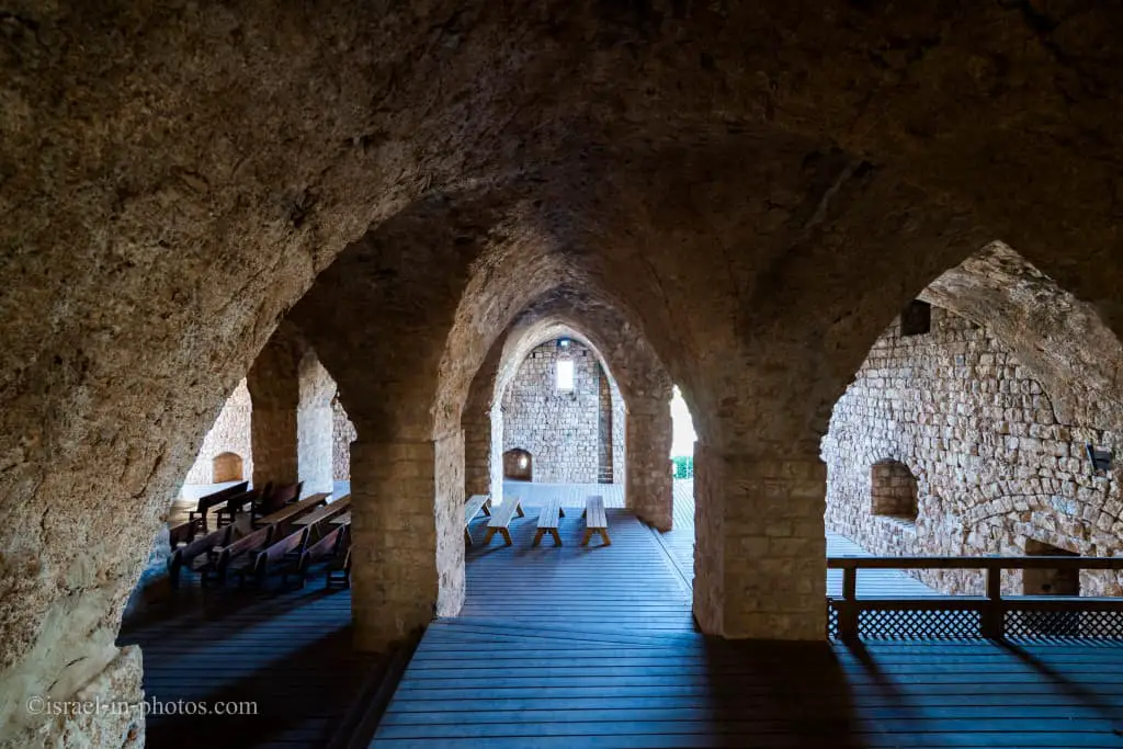
Reception hall – a large, pillared hall with 15 piers, intended as the base for the fortress complex above it. It can be assumed that during the Ottoman period, it was used as a storeroom. The first members of Kibbutz Yehi’am lived in this hall before moving to the permanent settlement.


This hall looks similar to Hospitaller Fortress in Old Acre.
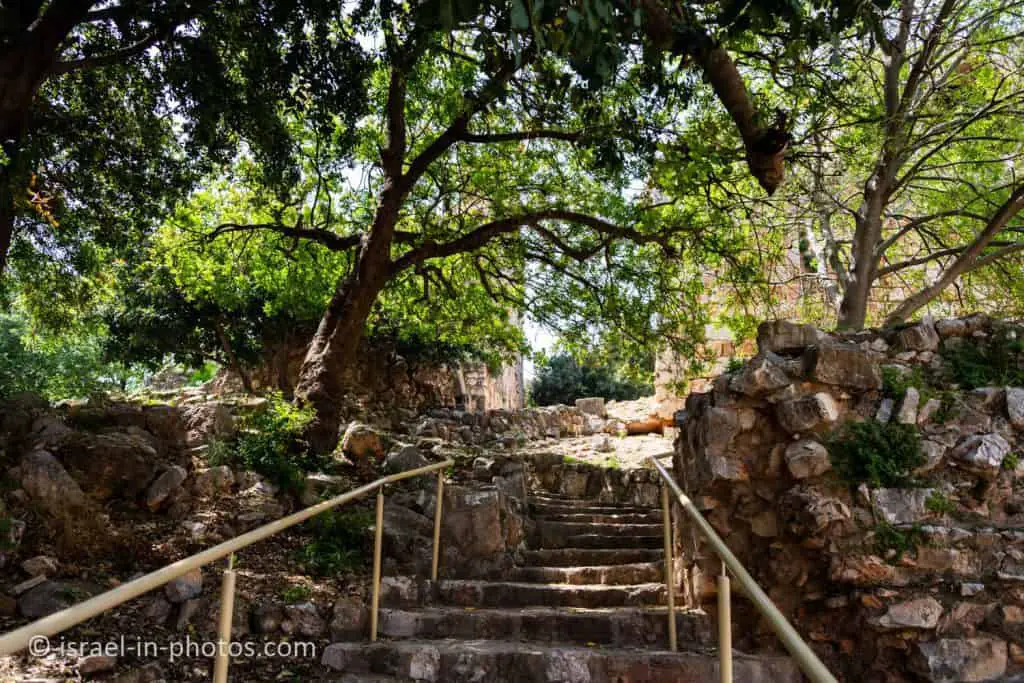
The visit to the Pillared Hall ends our hike at Yehiam Fortress National Park. But I also want to mention a lovely picnic area near the fort.
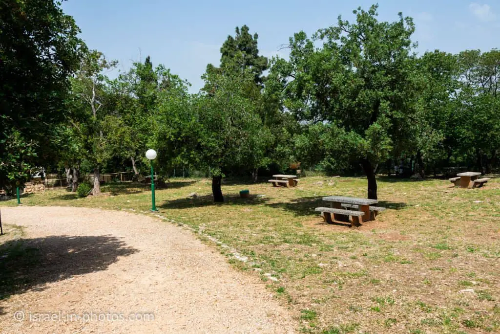
Lighting fires in the picnic area is forbidden.

History
On the south-western slopes of the national park, a burial cave and the ruins of a 6th century CE church and mosaic were found. Archaeological excavations were not carried out at the site.
Note: unless stated otherwise, all quotes were taken from the official site.

Crusader Period
The main interest in the site begins with the Crusader period. Yehi’am Fortress, Iudyn by its Crusader name, apparently started as a fortified agricultural farm, built in the mid-12th century as one of the Crusader settlements in Western Galilee. The site at the time was part of the feudal estate of Mergelcolon, which was in the area of Bet Hakerem Valley, today part of the lands of the village of Majd al-Krum.
At the beginning of the 13th century, as they established themselves in Galilee, the Knights of the Teutonic Order purchased the place from Lady Stephanie de Milly. Her family owned land in Western Galilee. The Teutonic Knights built the fortress in the 1240s, but in 1265 the Mameluke Sultan Baibars attacked the fort and destroyed it. Domes, walls, and crenellations have survived in the fortress from those times.
There is no historical evidence regarding the construction of the fortress at Jiddin, nor any legal document in the archives of the Teutonic Order relating to the fortress. In 1283, two decades after the Mamelukes captured the fortress, the German monk Burchard of Mount Sion mentioned visiting the ruins of the fortress, which he attributed to the Teutonic Knights.
Ottomans Period
The Mamelukes and the Ottomans who came after them did not see fit to maintain the place, and it was abandoned for some 500 years. In the 18th century, the local leader Mahd al-Hussein took courage, took over the place, and made it his estate. In 1738 Zahir al-Umar, the Bedouin leader of Galilee, captured the fortress from al-Hussein. The main remains of the fortress that can be seen today are from this period.
During the “Peasants Revolt” against Muhammad Ali (1834), the rebels barricaded themselves in Jiddin Fortress, which took mortar fire from the cannons of his son, Ibrahim Pasha. The revolt was put down.
War of Independence
Yehi’am Fortress witnessed a new chapter in history in the 20th century. On November 27, 1946, Hashomer Hatsair groups went up to the ancient fortress and settled in its gloomy halls. They called this new post Yehi’am, after the son of Yosef Weitz, who fell in operation to blow up the bridges over the nearby Kziv Stream. According to the United Nations partition plan, the area north of Neeman Stream, including Kibbutz Yehi’am, was not part of the Jewish state.
After the declaration of the state (May 14, 1948), the kibbutz was attacked by the Second Yarmukh Battalion, under the command of Adib Shishakli, who recruited Arab fighters in Lebanon and came down to Galilee. The battalion’s first task was to capture Yehi’am. The kibbutzniks barricaded themselves between the walls of the fortress and, together with soldiers from the Haganna Field Corps who came to their assistance, overcame a two-month siege and waged a battle of life and death, which became one of the greatest dramas of the War of Independence.
What Does Yehiam Mean?
Kibbutz Yehiam was named after Yehiam Weitz.
Kibbutz Yehi’am was founded on November 27, 1946, by 50 members of the Zionist-socialist Hashomer Hatzair youth movement, who transformed the ruins of an Ottoman castle built on top of Crusader remains at Khirbat Jiddin into a military training camp. It was named after Yehiam Weitz, son of Zionist leader Yosef Weitz, who was killed on the “Night of the Bridges,” a Palmach operation on June 16-17, 1946.
And Yehiam is a composite of two Hebrew words: long live the people.
How Old Is Yehiam?
Archeologists found a Roman fort, Byzantine monastery, burial caves, and other remains.
The construction-date of the Yehi’am Fortress is unknown, but it was originally part of the Ma’iliyah estate and was later sold to the Crusader Teutonic knights, who also purchased nearby Montfort Fortress.
Related Attractions
During this post, we mentioned several places. First of all is the Montfort fortress.
Montfort is a ruined Crusader castle in the Upper Galilee region in northern Israel, about 22 miles (35 km) northeast of the city of Haifa and 10 miles (16 km) south of the border with Lebanon. The site is now a national park inside the Nahal Kziv nature reserve and is an important tourist destination attracting many visitors from inside and outside Israel.
Source: Wikipedia
Moreover, we mentioned the Sultan and General Baibars in the history section. Though he did not stay here, he renovated Nimrod Fortress, the biggest Middle Ages castle In Israel.
Rosh HaNikra Grottoes, Achziv National Park, Keshet Cave, and Old Acre are among the nearby attractions.
Summary
Yehiam Fortress National Park is an excellent place for a several-hour visit. It is in good condition and offers fantastic views of the surrounding area. There are also picnic tables in this national park. Moreover, you can combine this visit with other nearby attractions.
My tip for parents with young children would be to take flashlights. There are some darker areas where kids can play with flashlights and have fun.
Also, if you are looking for a place to eat, within a short walking distance of this national park, you can find Chateau Yehiam (mostly cheeses and wine) and Malka (beer and snacks).
Have you ever been to Yehiam Fortress National Park? Tell us about your experience in the comments below.
That’s all for today, and I’ll see you in future travels!
Stay Tuned!
Additional Resources
Here are several resources that I created to help travelers:- Trip Planner with Attractions and Itineraries is the page that will help you create your perfect travel route.
- What is the Best Time to visit Israel? To answer this question, we will consider the weather, prices, holidays, festivals, and more.
- Information and Tips for Tourists to Israel will answer the most common questions tourists have about Israel (including safety, passports, weather, currency, tipping, electricity, and much more).
- Israel National Parks and Nature Reserves include a complete list, top ten, map, tickets (Israel Pass, Matmon, combo), and campsites.
- If you are looking for things to do, here are the pages for Jerusalem, Tel Aviv, Haifa, Sea Of Galilee, Akko (Acre), Eilat, Nazareth, Safed (Tzfat), and Makhtesh Ramon.


Simply desire to say your article is as astonishing. The clarity in your post is simply great and i can assume you
are an expert on this subject. Well with your permission let me to grab your RSS feed to keep up to date with forthcoming post.
Thanks a million and please carry on the rewarding work.