Ashkelon National Park – Visitors Guide
At Ashkelon National Park, you can see remains of the Canaanite city, go to the beach, have a picnic, or stay at the campsite.
Note: sometimes, Ashkelon National Park is called Tel Ashkelon.
Table of Contents
Map
Ashkelon National Park is located in the city with the same name.
Directions for drivers: Link to Waze and Link to Google Maps
Directions for public transport: Link to Moovit
Interactive map of the area:
And here is a photo of the map from the official brochure:
Note: you can click on the map to enlarge it.
Opening Hours
Summer hours: 08:00-20:00
Winter hours: 08:00-16:00
In summer, you need to exit the park before 22:00, and in winter, before 18:00.
Beach Opening Hours
April – August: 08:00–19:00
September: 08:00–18:00
October until October 18: 08:00–17:00
Entrance Fee
Adult 28 NIS, child 14 NIS, and student 24 NIS. And free for National Park’s annual subscribers.
If you visit several National Parks, consider purchasing a combo ticket. You can find additional info at National Parks And Nature Reserves.
Note: opening hours and ticket prices were updated in July 2022. In any case, recheck the official site before visiting.
Contact Information
Phone: 08-6736444
Email: gl.ashkelon@npa.org.il
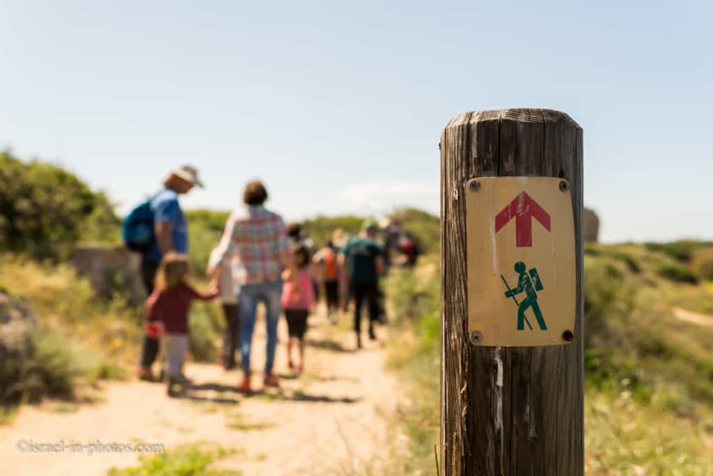
Tracks
Here is an interactive map from israelhiking.osm.org.il where the circular trail that covers the whole park is marked:
As you can see on the map, there are several trails (marked by the red dashed line). And are they:
| # | Name | Description | Distance (km) | Total climb and descent (meters) | Notes |
| 1 | Wall Path | It starts at the Roman basilica (in the center of the map) and goes along the wall till you reach the sea. | 1 | 44 | This trail takes about an hour. |
| 2 | Cliff Path | The path goes along the sea, on the cliffs above the beach. | 1.5 | 55 | It covers the park’s western side and ends at the Canaanite city. This trail will also take around an hour. |
| 3 | Inner Route | Leads between several points of interest in the middle of the park. You will see the Roman basilica, Antilia wells, and others. | 1 | 32 | |
| 4 | Long Cyclic Trail | It covers the whole park and is similar to what we did. It is a combination of the first three routes. | 4 | 151 | The long trail takes around two hours. |
Tours
On our latest visit, we participated in a free tour. If you are interested in joining, you need to find available tours. To do so, check the official site or call 08-6220835.
Camping
There is a campsite in Ashkelon National Park. It is located close to the sea and has all the basic facilities. Thus, if you have a tent or rent a tent, you can stay for the night. But there are some rules. For example, you can not leave the camp at night (between 22:00 and 8:00), and it is forbidden to bring animals. Also, campfires are permitted only in designated areas. You can find additional information here.
History
Finds from the Neolithic period provide evidence of human settlement in Ashkelon as far back as 10,000 years ago.
The origin of the name Ashkelon appears to come from the root of the word “shekel,” denoting a measure of weight – a fitting name for a commercial port city. The specific name Ashkelon is mentioned in the Egyptian execration texts of the 19th century BCE, and it appears again in other, later Egyptian inscriptions.
Biblical Times
In biblical times, Ashkelon was one of the cities of the Philistine Pentapolis. The city is mentioned in David’s lament over the deaths of Saul and Jonathan. “Tell it not in Gat, publish it not in the streets of Ashkelon, lest the daughters of the Philistines rejoice, lest the daughters of the uncircumcised exult” (2 Samuel 1:20). Ashkelon is also related to the heroic deeds of Samson. It was here that Samson struck down 30 Philistines and took their garments to pay his companions after they solved his famous riddle (Judges 14).
Ashkelon also played a part in the battle against the Assyrians. Zedaka, the ruler of Ashkelon, joined the rebellion of Hezekiah king of Judah (701 BCE). In response, Sennacherib king of Assyria took over the city and replaced the treacherous ruler with one of his subjects. The Babylonian king Nebuchadnezzar, who came to the city later, was less merciful. In 604 BCE he deported Aga, the last Philistine king of Ashkelon, and razed the city to the ground.
Persians, Alexander the Great, and Romans
During the Persian period, Ashkelon was a prosperous commercial city under the auspices of the port cities of Tyre and Sidon. A cemetery was found in the excavations of Tel Ashkelon containing the bones of more than 1,500 dogs. In the 6th and 5th centuries BCE, it was customary to bury dogs in their cemeteries, and they may even have been worshipped.
After Alexander the Great conquered the land of Israel in 332 BCE, Ashkelon became an independent Hellenistic city, and its residents adopted the Greek language and culture. The town remained independent at the time the Hasmoneans controlled the country and even minted its coins – a clear sign of sovereign rule.
The high point of Ashkelon’s prosperity came in the Roman period. The city covered an area that was 1100 m from north to south and 600 m in width. This area was too small to contain its growing population, and gradually a dense cluster of small villages and farms sprang up around the city. Thirty-five settlement sites from the Byzantine period (4th – 7th centuries CE) have been found around Ashkelon, which was the city’s agricultural hinterland. The city became a regional wheat trading center, and also had date orchards, vegetable gardens, and vineyards. To this day, a particular variety of onion called scallion bears a reminder of the name of Ashkelon. During the Byzantine period (5th – 6th centuries CE) Ashkelon was a center for fine wines, which were sent from its port to the countries of Europe.
Arabs and Crusaders
The Arabs conquered Ashkelon in the 7th century. They gave it a special status because of a shrine (Mashhad) in which tradition said that the head of Husayn ibn Ali, grandson of Muhammad, was preserved, while the rest of his body was buried in Karbala, in Iraq. In 1154 the skull was moved to Cairo, for fear that it would fall into the hands of the Crusaders. Ashkelon continued to flourish at that time, and in the 11th century, it was fortified by the Fatimid rulers with the walls whose remains are still visible today.
In 1153 the Crusaders took the city, but they were forced to abandon it in 1187, for fear of the renowned Muslim general Salah ad-Din (Saladin). After his forces were roundly defeated in the battle of Arsuf (Apollonia) in 1191, his emirs claimed that they were not able to defend Ashkelon against the approaching army of Richard the Lionheart. To his chagrin, Salah ad-Din was forced to destroy the city wall: “It is easier for me to lose all my sons than to move a single stone from these walls,” he said. The Crusaders took control of Ashkelon that same year, but in 1270 the Mameluke Sultan Beybars captured the city and destroyed it, and it did not rise again until modern times.
Note: unless stated otherwise, all quotes were taken from the official site.
I also want to mention that Via Maris passed through Ashkelon. It gave the city an additional economic boost.
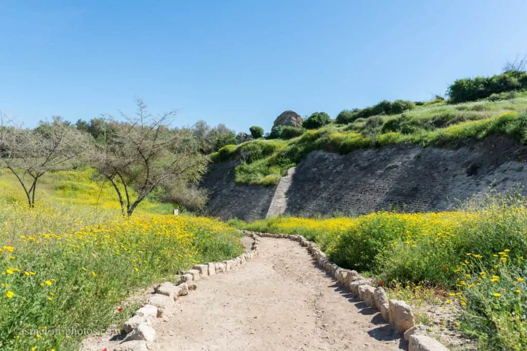
Wall Path
Many Israeli know Ashkelon National Park for its beach and picnic area. And I am one of them. I have visited Ashkelon National Park four times before, and it was always some combination of a picnic and beach. Thus, when I saw a free tour (included with entry tickets) by the Israeli National Parks Authority, we decided to join.

We parked near the basilica since our guided tour started at a small coffee shop in front of it. And from there, our guide took us to the Wall Path.
This route goes along the ancient Ashkelon wall, hence the name.
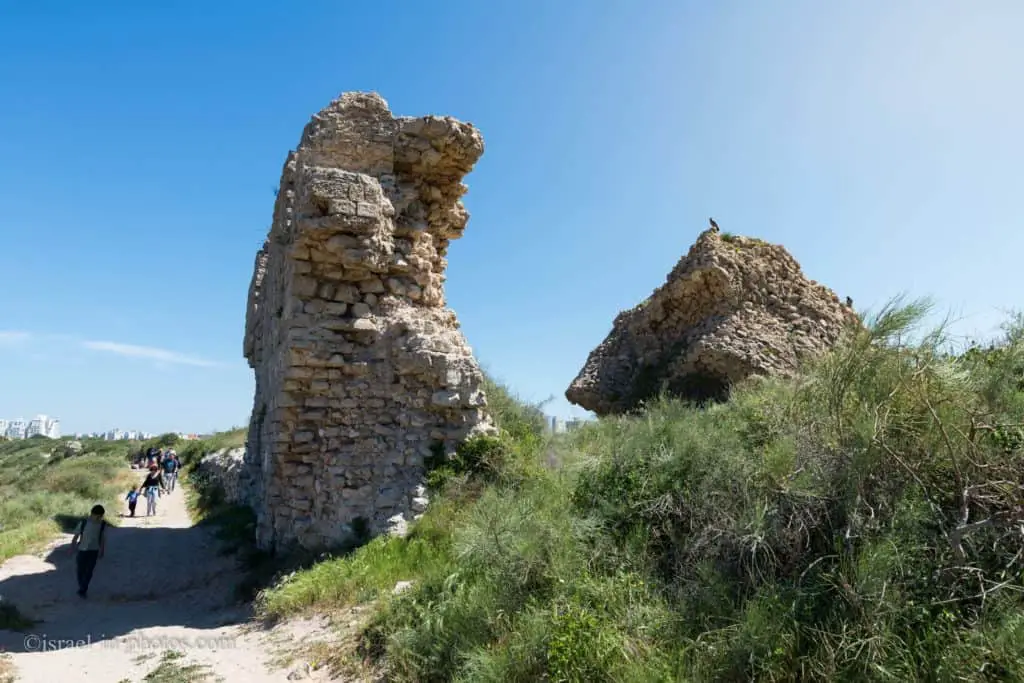
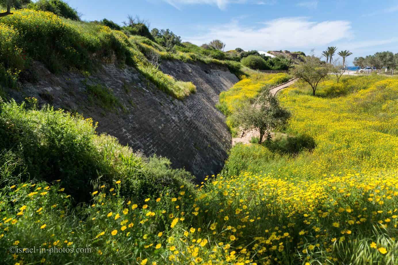
Medieval walls: The walls of Ashkelon, whose impressive remains still stand, were built by the Fatimid Muslims in the 12th century to fortify the city against the Crusaders. The wall had four gates: Jerusalem Gate, Gaza Gate, Jaffa Gate, and Sea Gate, named for the directions in which they left the city. To the east of the Canaanite gate is an impressive section of the wall rising above a deep moat. The waves have destroyed part of the seawall, affording impressive views of sections of the wall in which columns and other architectural elements from earlier buildings have been incorporated.
Remains of the wall:

The Origin of the Name Ashkelon
We made several stops during this path. In the first period, we looked at the word Ashkelon and what words are hiding within it. Shekel, the name of Israeli currency, is one of those words.
The origin of the name Ashkelon appears to come from the root of the word “shekel,” denoting a measure of weight – a fitting name for a commercial port city. The specific name Ashkelon is mentioned in the Egyptian execration texts of the 19th century BCE, and it appears again in other, later Egyptian inscriptions.
Since the wall path is on high ground, you can see the Roman basilica at the bottom and the sea farther away.

Most of this trail is on the sand. Thus, in another stop, we discussed the plants and how they adapt to dry areas. For example, some plants have deep routes. And others have no leaves. That is because plants lose a lot of water due to evaporation. Therefore, some plants turned their leaves into needles.
I do not know the wall’s original height, but the remains reach at least 4 – 5 meters high.
Towards the end of the wall path, we reached the Southern part of the National park. And it is the closest point to the Ashkelon power station.
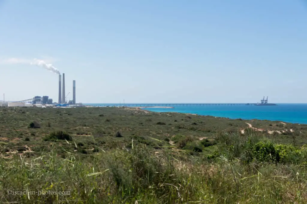
Animals
As it turns out, there is a small pack of mountain gazelles in this area (between Ashkelon National Park and the power station). And people from Nature and Parks Authority are continually monitoring the mountain gazelles.
In initial surveys, they found 16 species of reptiles in the area. But we focused on turtles. They lay eggs on the beaches in this area. And it is interesting that turtles always return and bury their eggs at the same place where they were born. It is both fascinating and sad. It is exciting because scientists do not know how the turtles find the exact spot of their birth. And sad since if something is built near the beach, all turtles born in this area will likely have no offspring. Therefore, people from the Israeli Parks Authority dig out the eggs along Israeli shores and move them to the protected areas.

Moreover, we talked about how to help turtles to survive. And there are several simple rules. First, waste, especially plastic, is one of their worst enemies. Secondly, driving jeeps on beaches can hurt the eggs. And thirdly, loud music at night can confuse turtles from returning to the sea (since it is dark at night, they listen to the sea’s sound to know which way to head).
Note: did you know that there are Nile softshell turtles in Israel? See Turtle Bridge at Alexander River for additional details.
At this point, our guided trip ended about an hour since we started the wall path. But since we were not tired and wanted to explore more, we continued to the cliff path.
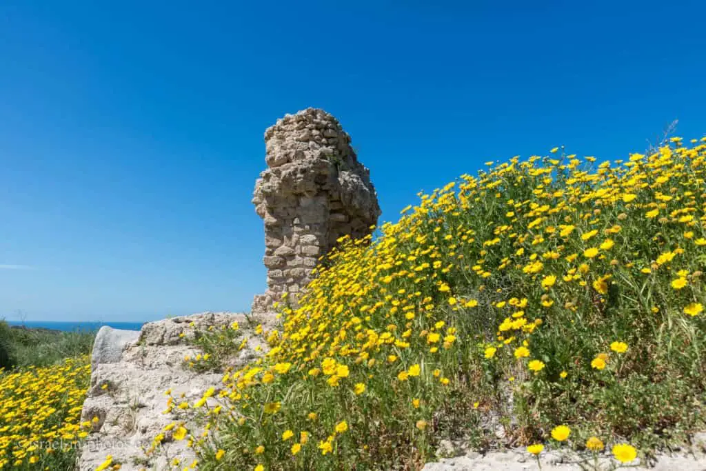
Cliff Path
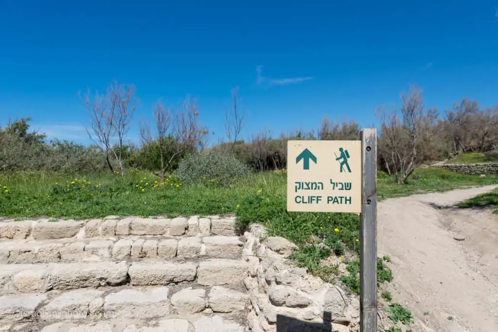
The cliff path goes along the sea on top of the cliffs.

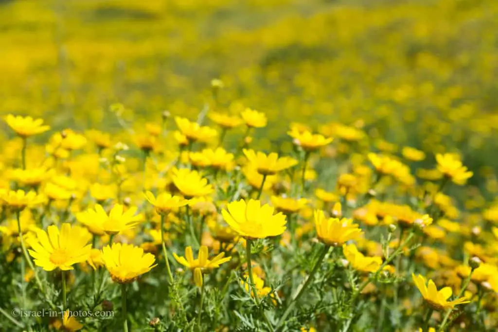
Recently I wrote a post about traveling in Israel by season. As I mentioned there, Spring is the best time for a trip. It will still be moderately hot, and you will find plenty of flowers.
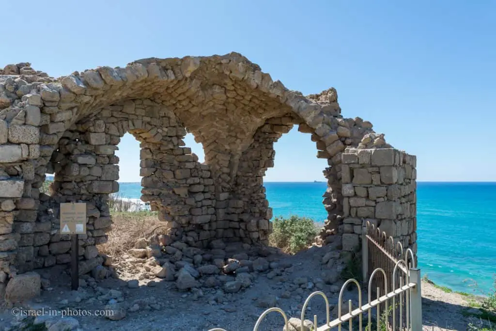
Old remains on top of the cliff (#20 on the map).
Ashkelon Beach

Between April to October, the beach is fully operational with lifeguard services, showers, and toilets (the building in the center of the photo). Lifeguard services are usually from 8:00 to 17:00 or later (see the opening hours section at the top), and swimming is allowed only at the official beach when there is a lifeguard on duty.
As we continue further to the North, we can see the same beach and the power station from another angle.

The Port
At strategic points, several benches offer excellent viewpoints along the cliff route. And with this view, I should mention the port.
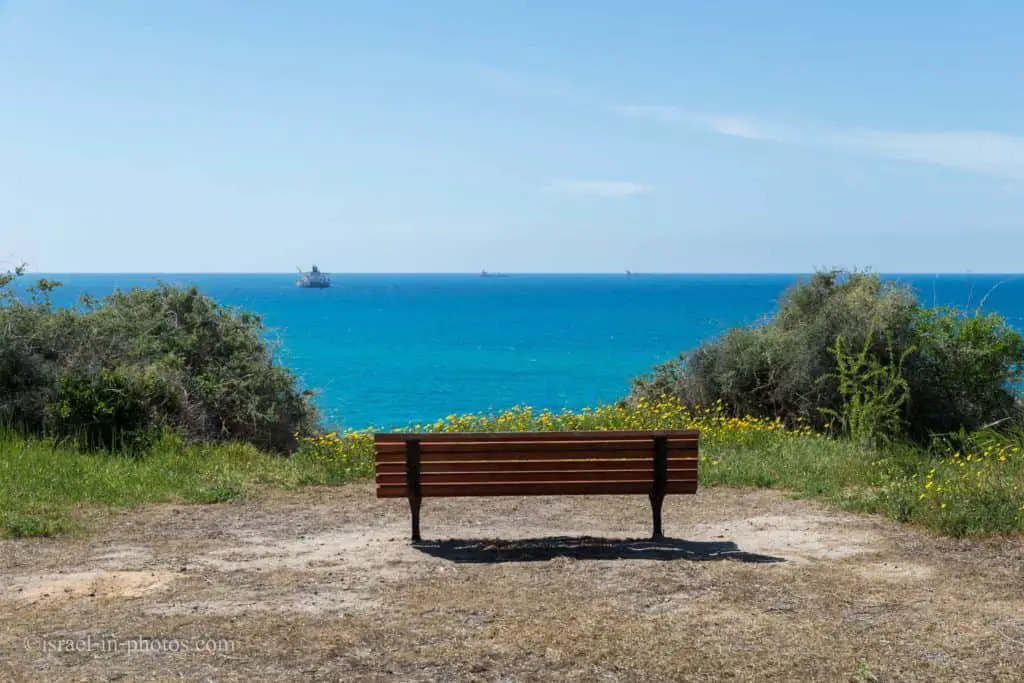
Ancient Ashkelon lay on the southern coastal shore, between Evtah Stream and Shikma Stream. This location had many advantages: Ashkelon was an important trading station, thanks to its location on the ancient international route from Egypt and Syria, and it had a convenient cross-country route towards Jerusalem. The city was also blessed with an abundance of productive wells, a comfortable climate, and fertile soil, which gave it a large and stable agricultural hinterland.
In ancient times, Ashkelon’s strategic value was priceless because whoever controlled the city could block access from Egypt and the Sinai desert to the populated areas. Although Ashkelon had no natural bay, it appears that its residents were able to create a flourishing port already in the Canaanite period, making the city a popular station on the maritime trade routes. Ashkelon’s ancient port has not yet been found and appears to have been silted up over the years.
Besides international and domestic trade, the port was used for fishing. And maybe one of the reasons it was not found is that it was not a standard port. There were no docks, meaning vessels anchored in the open sea, a few hundred meters from the beach. And merchandise was passed using smaller boats.
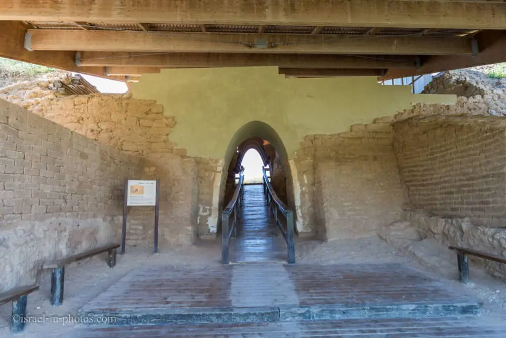
The Canaanite Gate
The Cliff path ends near the Canaanite city, but the trail continues, as so we will.


The Canaanite gate in Ashkelon was built of mud and kurkar bricks. It is dated to 1850 BCE and is considered to be the oldest vaulted gate in the world. The gate is built in the form of a 15 m long corridor, almost 4 m in height and more than 2 m wide. It appears that carts, laden with goods and drawn by oxen and donkeys, passed through it on their way to and from the port. The gate was in use for some 250 years and was then buried under a new earth rampart. A city gate was built elsewhere, in a location that is as yet unknown.

It is the most ancient arched gate in the world. It consists of an arched corridor with arched openings on both sides. The gate was constructed in approximately 1850 BCE as part of the city’s fortifications.
View from the other side:
The gate and the wall:

The Canaanite Fortifications
The Canaanite city was established around 2000 BCE, and about 15,000 people lived in the 600-dunam city. One hundred years after the town was built, a moat and a wall were added to protect it from Egyptians.
An enormous earthen rampart surrounds the ruins of Ashkelon. The rampart marked the borders of the settlement in the form of a semicircle that is around 2200 m in length. That is a huge earth wall, rising to a height of 15 m and over 30 m wide at its base. The earthen rampart was the basis for a system of fortifications and a glacis. The glacis was built of a mixture of mud bricks and kurkar, and its exterior wall was built of chiseled kurkar.
To the west, there is no existing rampart, either because the waves destroyed it or because it never existed at all in its land-side form. The rampart was built in the Middle Bronze Age (2000 – 1550 BCE) and served the residents of Ashkelon for over 500 years.
In 1175 BCE, the Philistines conquered Ashqelon. The Philistines used the fortifications. The city was built on massive glacis during the Roman, Byzantine, and Muslim periods. And the wall that we see on the eastern and southern sides dates back to the Muslim period.

Roman Basilica
At this point, after completing the cyclic trail, we headed towards the parking. And since we parked near the Roman basilica, here is its photograph.

Currently, the basilica is being restored. And within several years, they will probably open it to the public. At present, there is a fence that prevents you from going closer.
Note: in July 2022, the basilica was opened to the public.
Near the Roman basilica is a small open-air stock of various remains. And this is where I took the following photo.
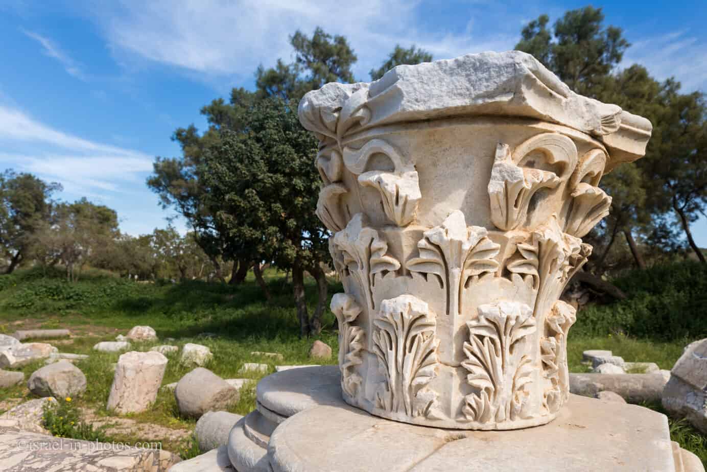
That was our last stop, and after a three-hour visit, we finished our tour in Ashkelon National Park and headed home.
In the following photograph, you can see my leg. I inserted my 47 shoe size to give a perspective of the column’s size.

Shallot
Before I finish this post, I want to mention one interesting fact. You are probably familiar with shallot (a botanical variety of the onion). Greek gave the name shallot after the origin of this onion variety.
The name “shallot” comes from Ashkelon, an ancient Canaanite city, where people in classical Greek times believed shallots originated.
Frequent Questions
The Bible mentions Ashkelon twelve times (you can find the list here). Thus many things happened, but the most known story is probably about Samson. More precisely, the story of Samson’s death. When he breaks the pillars, causing the temple to collapse, killing him and everybody else inside.
Ashkelon was an ancient commercial port city. The origin of name Ashkelon appears to come from the root of the word “shekel,” denoting a measure of weight (also the modern currency in Israel).
Summary
Ashkelon National Park offers various excellent activities. You can go to the beach, picnic, and visit the archeological parts. Or even build a tent and stay for a night. It is one of Israel’s most popular national parks for all these reasons.
Have you ever been to Ashkelon National Park? Tell us about your experience in the comments below.
That’s all for today, and I’ll see you in future travels!
Stay Tuned!
Additional Resources
Here are several resources that I created to help travelers:- Trip Planner with Attractions and Itineraries is the page that will help you create your perfect travel route.
- What is the Best Time to visit Israel? To answer this question, we will consider the weather, prices, holidays, festivals, and more.
- Information and Tips for Tourists to Israel will answer the most common questions tourists have about Israel (including safety, passports, weather, currency, tipping, electricity, and much more).
- Israel National Parks and Nature Reserves include a complete list, top ten, map, tickets (Israel Pass, Matmon, combo), and campsites.
- If you are looking for things to do, here are the pages for Jerusalem, Tel Aviv, Haifa, Sea Of Galilee, Akko (Acre), Eilat, Nazareth, Safed (Tzfat), and Makhtesh Ramon.


One Comment