Susita National Park (Hippos) – Visitors Guide
Susita National Park (Hippos) was a Hellenistic city on a hill of the Golan Heights overlooking the Sea of Galilee.
Table of Contents
- 1 Map
- 2 Opening Hours
- 3 Entrance Fee
- 4 Parking
- 5 National Park
- 6 What does Sussita / Hippos mean?
- 7 The Hike to Susita
- 8 Decapolis
- 9 About Hippos
- 10 Sussita Today
- 11 Decumanus Maximus
- 12 The Early Research
- 13 Roman Basilica
- 14 Churches
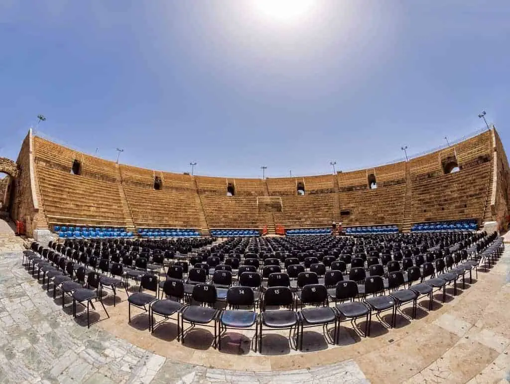
- 15 Odeon
- 16 The Bastion
- 17 Excavation
- 18 Susita Cable Car
- 19 The Black Track
- 20 Summary
Map
Susita National Park is located on Golan Heights, on the eastern shore of the Sea of Galilee. About two km east of Ein Gev.
Note: the road to Susita National Park is considered dangerous. And despite that, many people visit this place daily. Regardless, according to this press release from May 2022, a new road will be built soon.
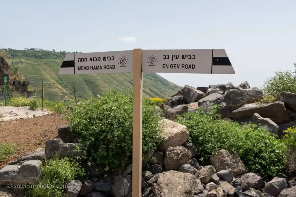
Road #7891 passes near this national park and the easiest way to reach it is by entering “Horvat Susita” into Waze or clicking this link.
Directions for drivers: Link to Waze and Link to Google Maps
Directions for public transport: Link to Moovit
Interactive map of the area:
And on the following Sea Of Galilee map, you can see this national park on the right shore. It is marked with a red star near Ein Gev. You can also see other important places.

And here is an areal map of this national park:

Note: you can click on the maps to enlarge them.
Opening Hours
Always open, but visit only during daytime.
Note: according to the following sign, it is prohibited to remain in the national park after dark.
Entrance Fee
Free.
Parking
There is a small dirt parking near the beginning of the trail to Susita. In the next photo, you can see road #7891 and the parking from the top of the hill.

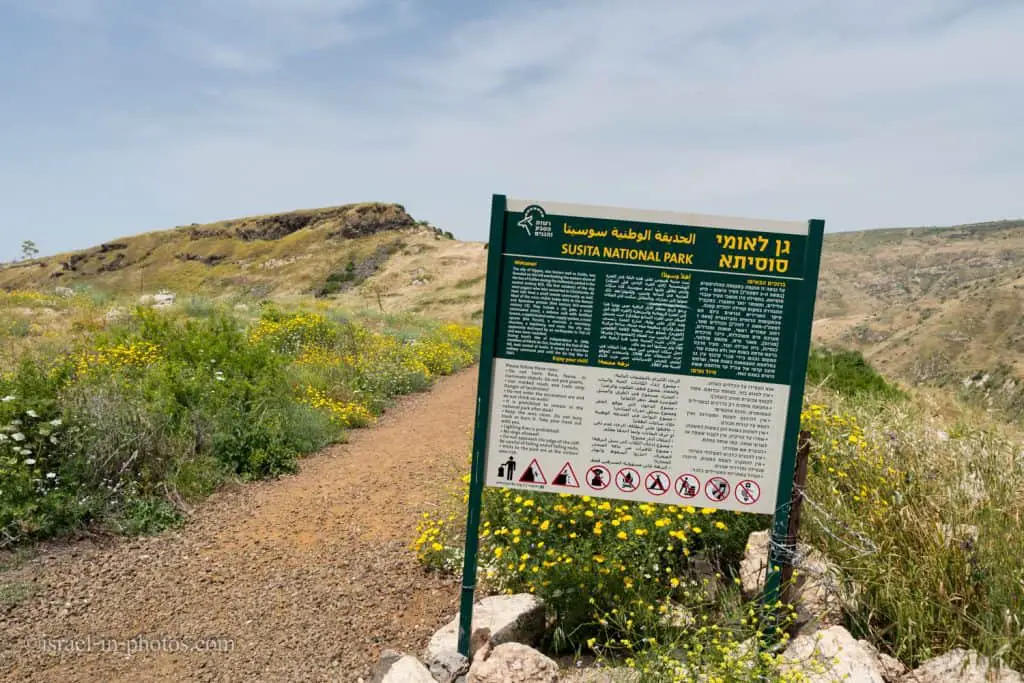
National Park
Update: on March 2023, this place was opened as an organized national park. Here is a video with additional details:
What does Sussita / Hippos mean?
Hippos and Sussita mean the same thing, just in different languages. Hippos (Greek) and Sussita (Aramaic) mean horse. But we do not know why the city received its name. One theory I found mentions the form of the ridge and its resemblance to a saddle. Another site mentioned that the ridge’s form resembles a horse’s head and neck. Both theories are similar to the way that nearby Gamla received its name.
Founded as a polis by the name Antioch of Hippos during the Seleucids, the city is named after the Greek word for horse, Hippos, and a common name of Seleucid monarchs, Antiochus. In the 3rd-century Mosaic of Rehob, the site is known by its Aramaic name, Sussita, a word meaning “horse” in the feminine gender, while the Arabic name, Qal‘at al-Ḥiṣn or Qal‘at al-Ḥuṣn, has been used by the country’s Arab inhabitants, meaning, “Fortress of the Horse/Stallion”. Other names include the alternate spelling Hippus, a Latinized version of the Greek name. The precise reason why the city received this name is unknown.
Source: Wikipedia

The Hike to Susita
Before we start our visit, here is a brief background about this place:
The city of Hippos, also known well as Susita, was founded on this hill overlooking the eastern shore of the Sea of Galilee during the Hellenistic period in the second century BCE. The first residents of the city were pagans who later converted to Christianity. At their side lived a small Jewish community as well. Most of the ruins visible today date to the Roman and Byzantine periods (first-century BCE-seventh century CE). They include a city gate, a main colonnaded street, a defense wall with fortified towers, a sophisticated water supply system, the main square (the Forum), a reservoir, a sanctuary, churches, a baptistery, and more. The city was apparently destroyed by an earthquake in 749 CE and was never resettled.
During Israel’s War of Independence in 1948, members of Kibbutz En Gev, located at the foot of the hill, took control of Susita. It was a front-line military command post until the Six-Day War in 1967.
Source: sign
At the parking lot, you can see a sign with a black trail marking that leads you to the city.


The trail goes uphill and is not long.
On Golan Heights, there is a danger of mines. Thus you should walk only on the marked trail.


Several cemeteries have been discovered around Hippos. Maybe it was one of them (since it was behind the gate, we could not get closer).

Decapolis
Decapolis literary means ten cities. And it was a group of ten Hellenistic towns on the eastern frontier of the Roman Empire.
They formed a group because of their language, culture, religion, location, and political status, with each functioning as an autonomous city-state dependent on Rome. They are sometimes described as a league of cities, although some scholars believe they were never formally organized as a political unit.
The Decapolis was a center of Hellenistic and Roman culture in a region otherwise populated by Jews, Nabataeans, and Arameans. In the time of Emperor Trajan, the cities were incorporated into the provinces of Syria and Arabia Petraea; several cities were later placed in Syria, Palaestina and Palaestina Secunda. Most of the Decapolis region is located in modern-day Jordan, except Hippos and Scythopolis (in Israel) and Damascus (in Syria).
Source: Wikipedia
As you can see, two of the ten cities are located in Israel. They are Hippos and Scythopolis, which is also known as Beit Shean.
Hecht Museum in Haifa has an exhibition dedicated to Hippos. And here is a map from the exhibit:

About Hippos
The ancient city of Antiochia Hippos (Sussita in Aramaic) was erected on the Sussita Mountain plateau, about 2 km east of the Sea of Galilee and 350 meters above it. The city walls surround the entire plateau and crown the mountain. Three riverbeds flow around the mountain and cut it off from its surroundings; Sussita Stream from the south, Noa Stream from the east, and Ein-Gev Stream from the north. The site is a National Park and part of the Sussita Nature Reserve on behalf of the Israel Nature and Parks Authority.
The mountain’s natural advantages and location were the main reasons for the first settlement. During the excavations, archaeologists identified prehistoric finds dating to the Pottery Neolithic and the Chalcolithic periods, but Hipposas a polis was established only in the middle of the second century BCE by the Seleucids. The polis flourished mainly during the Roman and Early Byzantine periods (1-5 centuries CE).
Hippos became famous as one of the cities of the Decapolis, a geographical-cultural region located today mainly in Jordan and Syria, except Hippos and Nysa-Scythopolis (Beit Shean), located in Israel. Hippos became an important Christian center during the Byzantine Period (4-7 centuries CE). It was a bishopric capital with up to eight churches. Hippos boundaries were not limited to the city walls but controlled an extensive territory: from south of the lake to its north and a wide portion of the Golan. Many townlets, mostly Jewish, were built in the Hippos’ region. Hippos had two harbors, the larger of which is located south of Kibbutz Ein-Gev.
Source: sign

Sussita Today
In 2000, under the direction of Profesor Arthur Segal and Doctor Michael Eisenberg, an international expedition began on behalf of The Zinman Institute of Archaeology at the University of Haifa, together with teams from the Polish Academy of Sciences and the Concordia University, USA. In 2012, Doctor Eisenberg initiated a new series of excavations with the participation of Concordia University and dozens of students and volunteers from Israel and around the world.
The Sussita saddle ridge was used, as today, as the main road leading to the east city gate. On either side of the eastern saddle are burial grounds. To the west of the path is an array of elaborately decorated mausolea, while on the east, there are mainly rock-hewn graves and sarcophagi. Another necropolis is located on a hill south of Sussita, where dozens of burial caves exist. On the way up the saddle ridge, the city cut a protective ditch to halt any besieger’s heavy machinery. At the top of the path are the remnants of the Roman city gate and a round basalt tower.
Source: sign

When you almost reach the top of the hill, you will start seeing a lot of remains. And it may be unexpected since this place is off the beaten path and not one of the most known national parks.
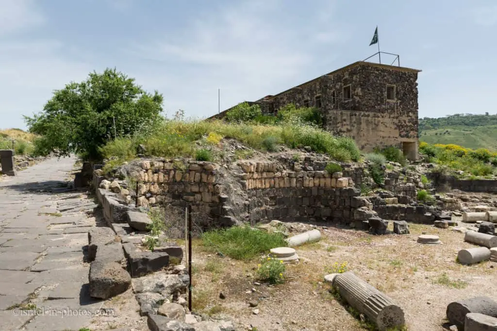
Decumanus Maximus
Exploring the city is easy. Follow the Decumanus Maximus, the main street, and you will see remains on both sides.
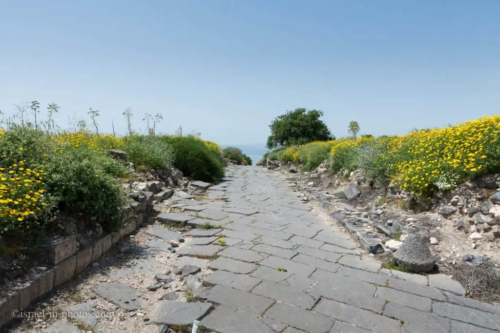
The city’s main street, the Decumanus Maximus, crosses the plateau from the gate on the east to the western part, about 550 meters long. Most of its pavers are still intact and meet several south-north streets (cardines), creating an orthogonal urban net with insulae incorporated in between. The two remaining modem IDF structures on either side of the Decumanus Maximus are still used today by the expedition.
Source: sign
You can find explanation signs near the IDF building. And from the plans I saw, it will be used in a new role after the renovation of this national park.
The Early Research
The archaeological research of Hippos began with the surveys of engineer Gottlieb Schumacher at the end of the 19 century and later by Mendel Nun, a member of the nearby Kibbutz Ein-Gev. Following the Independence War (1948), Sussita Mountain became one of the main IDF posts along the Syrian border until the Six-Day War (1967), when the military post was abandoned. During the construction of the IDF buildings, the Antiquity Department conducted salvage excavations, during which they unearthed a three-apsidal baptisterium and the city’s cathedral dated to the Byzantine period. This is an impressive cathedral where one can still see the monolithic granite and marble columns lying in uniform angles, as a testimony to the devastating earthquake which destroyed Hippos on January 18, 749. The earthquake and the city’s decline during the late phases of the Umayyad rule during the 8 century CE were the main agents for the abandonment of the city, never to be resettled.
In the 1990s, an Israeli-German research team studied Hippos’ water supply system. They found that originally, the city relied on dozens of water cisterns to collect rainfall. During the Early Roman period, the city built an aqueduct whose water source began 24 km away in the Golan. Once the aqueduct reached the Sussita saddle ridge, an elaborate stone pipe pressure system led the water up the mountain, where it was distributed to various areas of the city, ending in the main reservoir under the forum.
Source: sign
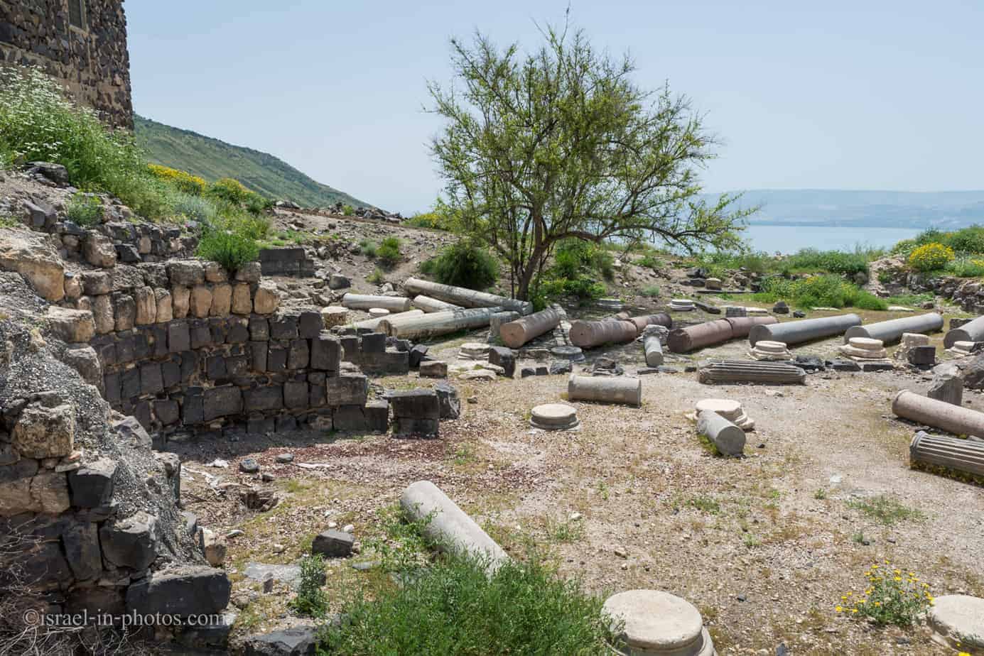


Roman Basilica
The city’s main square, the forum, is located about 80 meters to the west along the main street. It is a large Square court with basalt pavers, surrounded by three colonnades and a temple for the cult of the emperors (Kalybe) on its west.
Source: sign

To the right, just before entering the forum, is the Roman Basilica.
The basilica at Hippos-Sussita, as in other Roman cities, was the largest roofed structure in the city. The basilica was a civic structure, an imposing, roofed replacement for the open-air central square (the forum), and was built adjacent to it. It served as a market, with shops and money changers, and it was there that the chief magistrate held court.
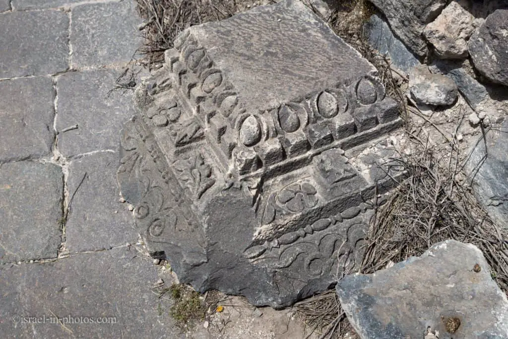
The ruins of the basilica at Hippos have been fully unearthed. It was built north of the forum and bordered the northern cliff. Its plan was rectangular (30 x 56 meters) with four rows of columns parallel to its four outer walls. The columns divided the interior into four aisles and a central hall, all of which were roofed. The roof of the central hall was higher than those of the aisles, allowing light to filter through the space between the roofs. Thousands of fragments of tiles, as well as iron nails from wooden beams – evidence of gabled roofing – were discovered in the heaps of ruins. There were three doorways on the southern, narrow side. The roof rested on 32 columns, and the basilica rose to approximately 15 meters. The lower portions of the inner walls were painted and adorned with stucco, and the upper parts featured stucco-carved figures. Very few of these have survived, and they are on display in the exhibition.
The basilica, built at the end of the first century CE, was destroyed in an earthquake in 363 CE. Several human skeletons discovered in ruins during excavation attest to the quake. One was that of a young woman, around whose neck was a gold pendant in the form of a dove. The pendant is on display in the exhibition.
Source: exhibition at Hecht Museum


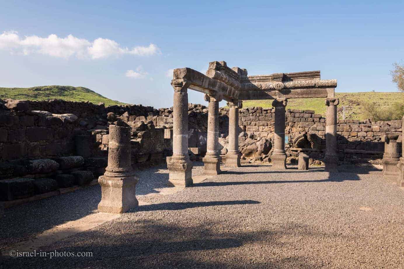
Churches
North of the forum lies the Hellenistic sanctuary (temenos), built at the end of the second century BCE. It is a rectangular enclosure identified by its wails built of basalt ashlars with drafted margins. Hellenistic and Roman temples were built within the temenos, later replaced by the Northwest church, which was uncovered by a team from Poland. West of the temenos, a cardo leads to the church’s atrium with its three mosaic-paved aisles and nave. 50 meters east of the Northwest church lies the Northeast church and its surrounding insula, which are currently under excavation by the Concordia team led by Profesor Mark Schuler.
Source: sign

And here is what it may have looked like:

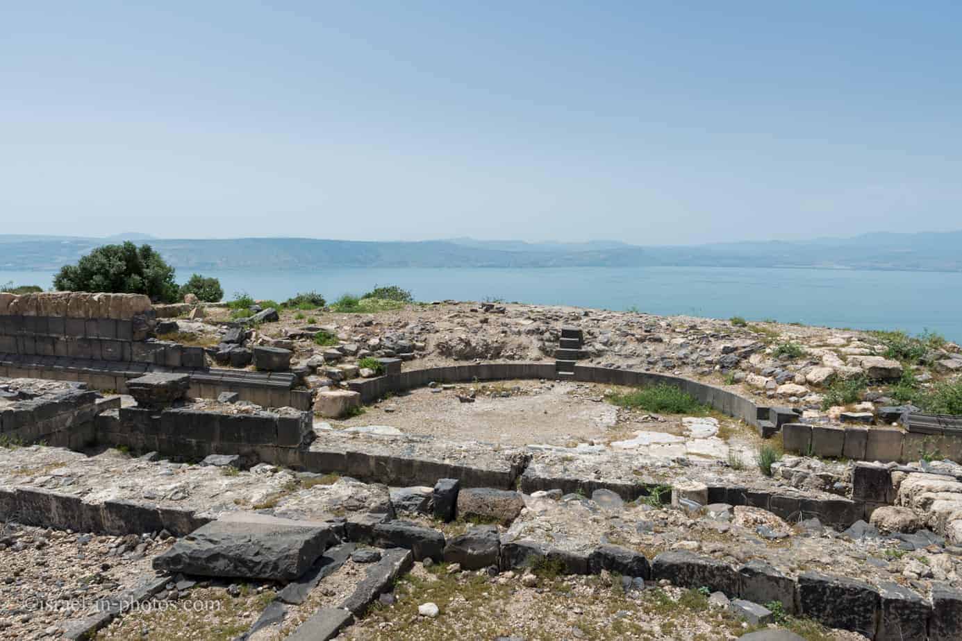
Odeon
The Odeon is located 70 meters west of the forum. It is a semicircular, small theater-like structure used for recitations. Though the seating arrangement has not survived, it is possible to calculate that the Odeion had 11 rows of seats and could house about 500 spectators. The Odeion was built in the second half of the first century CE and destroyed during the fourth century.
Source: sign

The Bastion
Some segments of the Roman fortification wall were exposed in various parts of the city, but the bastion, built on the edge of the southern cliff, is undoubtedly the most impressive. It combines a 50-meter-long condensed defense alignment, built with five chamber vaults and a tower in between. The bastion served as the main fighting platform towards the south and housed the heavy artillery (catapults and ballistae). The southern public bathhouse was built above and adjacent to the bastion. So far, excavations in the southern bathhouse have unearthed a palaestra, a hot room, and the pool.
Source: sign
And here are several additional photos from this national park:


Excavation
The city of Hippos was not fully excavated yet. Thus some areas are off-limits.
The living quarters situated on the western side of the city and the bathhouse are still excavated, and therefore, entrance is prohibited.
The city of Hippos is amid an exciting excavation and is not yet prepared for the public. It is, therefore, crucial not to deviate from the main path, climb walls, or descend into excavation pits. If you wish to experience the daily life at the dig and be a part of an international team, you are warmly invited to contact us.
http://hippos.haifa.ac.il
Source: sign
Throughout this article, I showed several photos from Hecht Museum in Haifa. And that is because they are conducting excavations at Hippos. See this website to join the summer 2022 excavation season in Sussita.

Susita Cable Car
In the War of Independence, after the establishment of Israel, the Syrian army invaded Israel and captured the mountain. This was a constant threat to Ein Gev residents. On the night between July 17 and 18, 1948, during the Ten Day Battles, the place was occupied by fighters, members of Kibbutz Ein Gev, and residents of the Jordan Valley. A forward position of the IDF was established in the place, which took advantage of the dominant topographical structure of Susita. This forward position was used by the IDF until the Six-Day War.
In the early 1950s, a jeep road was created, and a cable car was built to transfer supplies to the soldiers. To this day, you can still see the cable car built by Lieutenant Colonel David Leskov in the northwestern part of the city. There are also many remains on the mountain of communication trenches and firing positions that were part of the IDF post there. On the 19 Independence Day of the State of Israel, the commander of the post, Lieutenant Rami Zait, was killed. The monument to his memory is at the western end of the mountain, and two olive trees are planted next to it.
Source: Wikipedia
See the next section regarding directions on how to reach the cable car.
The Black Track
You can use the black trail to return to the parking lot or hike downhill to Ein Gev (and visit the cable car on the way).
The distance from the basilica to the parking is 710 meters and 34 meters descent. And the distance from the basilica to road #92 is 3.8 km and 324 meters descent. And if you want to reach the upper Susita cable car station, you need to walk along the black path toward Ein Gev for 1.5 km (150 meters descent).
Summary
Susita National Park (Hippos) is not big, and a typical visit will take 1 – 2 hours (without additional hikes). Thus you can combine it with Gamla, Korazim, Capernaum, Arbel, or any other points of interest in this area. You can find them in the guide to the Sea of Galilee. Alternatively, you can use the interactive map above to explore this area.
Have you ever been to Susita National Park? Tell us about your experience in the comments below.
That’s all for today, and I’ll see you in future travels!
Stay Tuned!
Additional Resources
Here are several resources that I created to help travelers:- Trip Planner with Attractions and Itineraries is the page that will help you create your perfect travel route.
- What is the Best Time to visit Israel? To answer this question, we will consider the weather, prices, holidays, festivals, and more.
- Information and Tips for Tourists to Israel will answer the most common questions tourists have about Israel (including safety, passports, weather, currency, tipping, electricity, and much more).
- Israel National Parks and Nature Reserves include a complete list, top ten, map, tickets (Israel Pass, Matmon, combo), and campsites.
- If you are looking for things to do, here are the pages for Jerusalem, Tel Aviv, Haifa, Sea Of Galilee, Akko (Acre), Eilat, Nazareth, Safed (Tzfat), and Makhtesh Ramon.


Hello! I have read that in Sussita National Park a mosaic with fish and loaves was found. Is it possible to see it inside the park? or is it somewhere else?
I will appreciate your information!
Hi Carlos,
Maybe because we visited Susita before it was officially reopened, we did not see the mosaic. I did some reading, and according to archeologists the quality of the mosaic (measured by the number of stones per area) is considered low. Thus, the mosaic probably was not moved. But I will know for sure after revisiting the park.
You can see photos and additional details about the mosaic here: https://travel.walla.co.il/item/3310813