City of David, Jerusalem – Visitors Guide
The City of David is considered the initial core settlement in Jerusalem. And using various tracks and tours, you can explore it.
Table of Contents
- 1 What is the difference between the City of David and the Tower of David?
- 2 Map
- 3 Opening Hours
- 4 Entrance Fee
- 5 Tours
- 6 Hallelujah Night Show
- 7 What is the City of David?
- 8 Trails
- 9 The Large Stone Structure
- 10 Royal Quarter (Area G)
- 11 Ancient Tomb Lookout
- 12 Water System – Warren’s Shaft
- 13 Canaanite Pool and Spring Citadel
- 14 Gihon Spring
- 15 The Tunnels
- 16 Hezekiah’s Tunnel (Siloam Tunnel)
- 17 Pool of Siloam
- 18 The Herodian Street and Drainage Channel
- 19 From the City of David to the Western Wall – Guided Tour
- 20 Beit Hatzofeh Observation Point
- 21 Givati Parking Lot
- 22 Drainage Channel During the Great Revolt
- 23 Common Questions
- 24 Summary
What is the difference between the City of David and the Tower of David?
Before we begin with the overview, let’s address a common question.
Since the City of David and the Tower of David bear David’s name, many people confuse them. The Tower of David, also known as the Jerusalem Citadel, is near the Jaffa Gate. And inside, you can find a museum dedicated to Jerusalem. Moreover, the Tower of David has no connection to King David. For additional information, see Tower of David.
The City of David is located on the other side of the Old City of Jerusalem, near the Dung Gate. It was part of ancient Jerusalem. Most tourists know it for Hezekiah’s Tunnel, also known as the Water Tunnel, but there are many other points of interest, and today, we will visit all of them.
Map
The City of David is near the Dung Gate on Ma’alot Ir David Street.
Directions for drivers: Link to Waze and Link to Google Maps
Directions for public transport: Link to Moovit
Interactive map of the area:
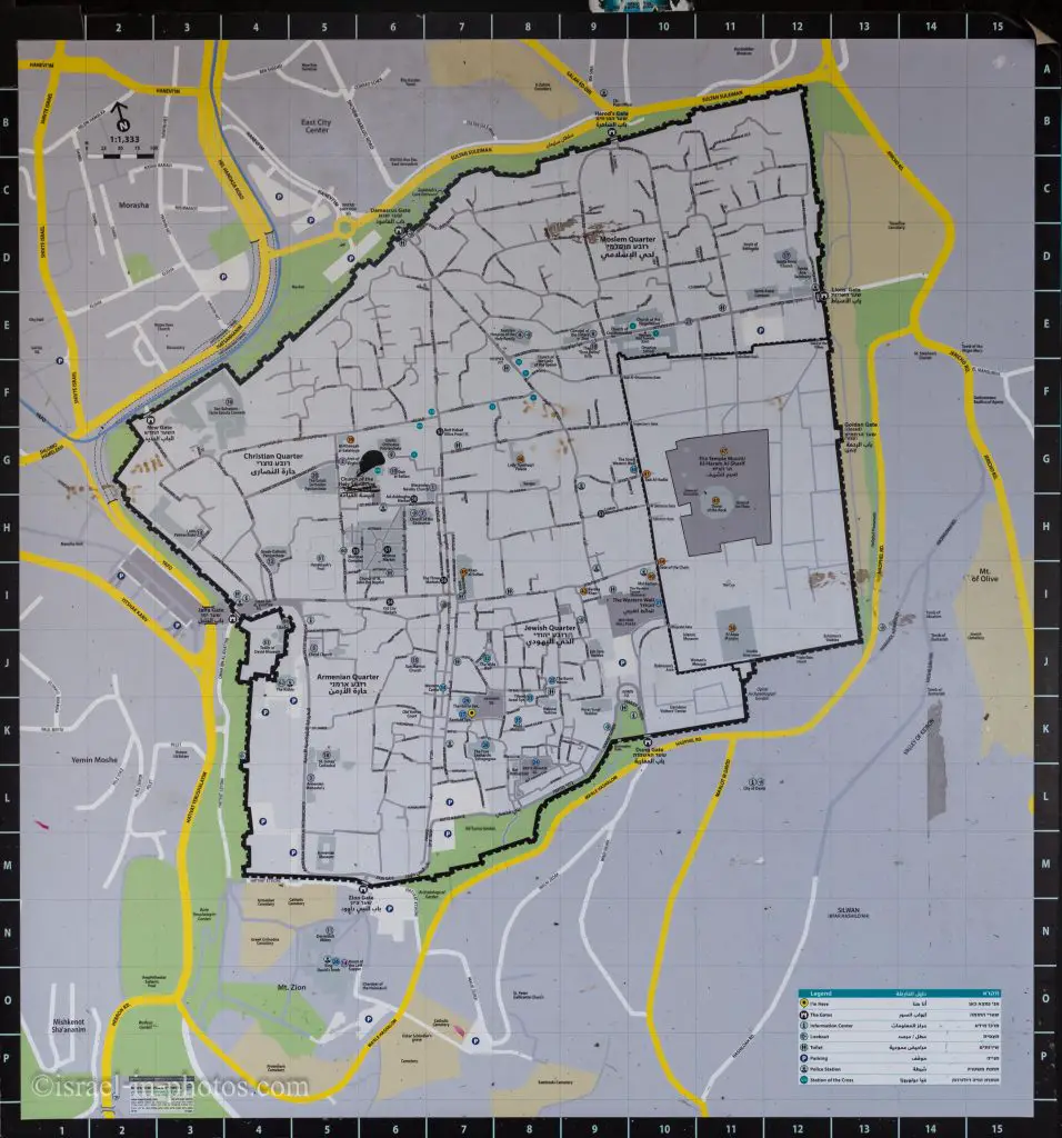
You can find the following map in several places in the Old City of Jerusalem.
Note: You can click on the map to enlarge it.
On the map above, you can see the City of David marked in the square L11.
Since we are discussing location, did you know the City of David was on Mount Zion?
For example, let’s take a look at 2 Samuel 5:7 (NRSV):
Nevertheless David took the stronghold of Zion, which is now the city of David.
According to the Bible, Mount Zion was in three places, one of which is the City of David. You can find additional information in the Mount Zion guide.
And there is the trail map:
Note: You can click on the trail map to enlarge it.
Directions
During one of our visits to the City of David, we used the First Station paid parking lot. There is a free shuttle to the Dung Gate and back. But there are many other ways as well. For detailed directions, check the guide to the Old City of Jerusalem.
Opening Hours
Sunday – Thursday: 08:00 – 17:00
Friday and holiday eves: 08:00 – 14:00
Saturday – closed.
Note: Tickets are sold up to two hours before the closure time.
Entrance Fee
You can visit the City of David or join one of the tours. Here are the different options (all prices are in NIS):
| Visit Type | Adult | Child (5-18)/Senior |
|---|---|---|
| Entrance to the City of David (without a tour) | 31 | 16 |
| The Biblical City of David – Guided Tour | 62 | 45 |
| The City of David – Western Wall Cornerstone – Guided Tour | 52 | 42 |
| HALLELUJAH – night show | 62 | 51 |
| Sifting activity at Tzurim Valley National Park | 26 | 21 |
| Zip Line at Mitzpe David | Single Zipline Ride – 152 Shared Zip Line – 220 |
Notes:
- You can purchase discounted tickets using Matmon, HTZone, the teachers’ association, credit card clubs, and other available options. You can find the complete list here.
- If you need a flashlight for the tunnels, you can rent one for your visit, and it costs 6 NIS.
- You can take optional transportation from the end (Pool of Siloam) to the starting point for 7 NIS.
If you are wondering what a Matmon card is or planning to visit several National Parks, then consider purchasing a combo ticket and check out the National Parks and Nature Reserves.
Note: Opening hours and ticket prices were updated as of August 2025. In any case, recheck the official site before visiting.
Tours
As you saw in the entrance fee section, you can join different tours. So this is an option. Later in this post, I will tell you about the time we joined the tour from the City of David to the Western Wall. Also, on another occasion, we visited the Archaeological Experience in the Tzurim Valley National Park. In both cases, we enjoyed the experience, and I would recommend considering these options (if they offer tours in your language).
Hallelujah Night Show
Besides tours, there is a nighttime light show called Hallelujah. Here are several photos from our latest visit:
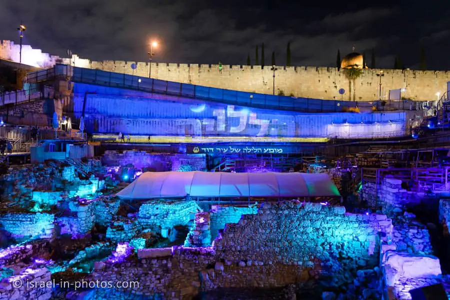
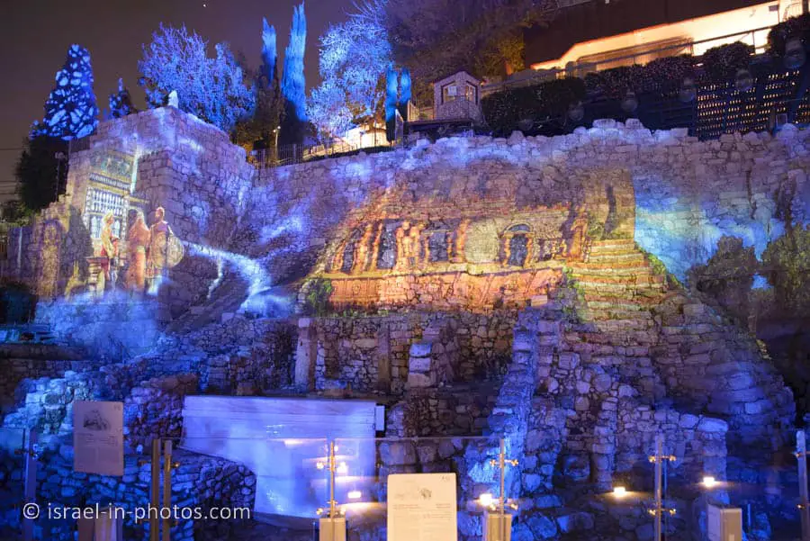


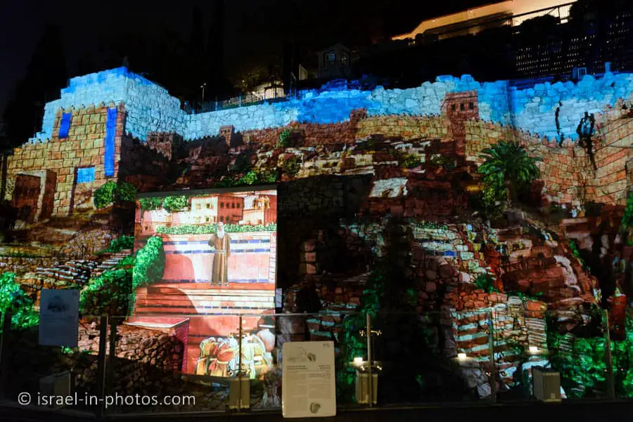
Our visit started with a short tour. Most of the tour was spent at the Givati excavations, and then we headed to the half-hour light show.
The show is in Hebrew. You can take headphones with simultaneous translation to other languages. The tour was in Hebrew and English.
We enjoyed the night show, and it was a lovely experience. Here is a short video from our visit:
You can find additional info and purchase tickets on the official website.
What is the City of David?
Before my first visit to the City of David, I had never considered the location of the Old City. I assumed its current location was the same during all periods. But if you ponder, you understand one simple thing. People can not survive without water. And there are no water sources in or near the Old City.
Here is an illustration of the site:

Of course, this photo is a combo of ancient and modern. But it explains how ancient Jerusalem looked.
When pilgrims arrived in Jerusalem, they first bathed in the Pool of Siloam (at the bottom). Then they walked up along the market and purchased whatever they needed. Towards the top of the illustration, you can see the outer Wall. Behind it is the modern Davidson Center – Jerusalem Archaeological Park. And only then did pilgrims reach the Temple Mount.
Thus, the City of David is considered the original core settlement in Jerusalem.
Note: The city of David also organizes tours at the Davidson Center.
Trails
There are two trails in the City of David. The trails are marked in red and yellow.
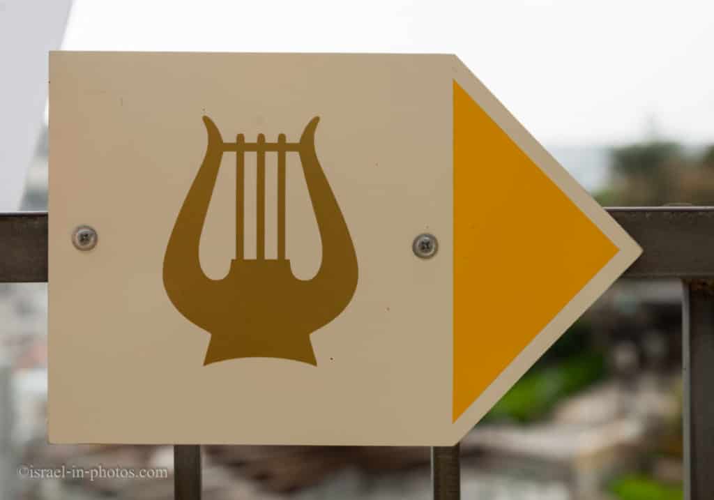
Both of the trails start and end at the same place. But after several points of interest, they split. The red trail leads you through the water tunnel, and the yellow goes through the dry tunnel. You can find the trail map above in the maps section.
And now, let’s enter the City of David.
The Large Stone Structure
The Large Stone Structure (point of interest #2) is situated beneath the ticket office, where all visits begin.
Eilat Mazar, an Israeli archaeologist, believes that the Large Stone Structure is a part of King Davis’s Palace.
The Large Stone Structure is the name given to a set of remains interpreted by the excavator, Israeli archaeologist Eilat Mazar, as being part of a single large public building in the City of David, presumably the oldest settlement core of Jerusalem. Mazar tentatively dated the findings to the tenth to the ninth century BCE. He chose this particular name for the alleged structure, because of its proximity to another site known as the Stepped Stone Structure. Mazar announced the discovery on the fourth of August 2005 and stated that she believed it might be the remains of King David’s palace as recorded in the Books of Samuel. The interpretation of the remains as those of one single building, the suggested date, and the association with King David have all been challenged by other well-known archaeologists.
Source: Wikipedia

One of the reasons she believes it was King Davis’s Palace is the discovery of a Proto-Ionic Capital of a column in the 1960s.
The Proto-Ionic Capital was discovered on the eastern slope of the City of David in the 1960s in an excavation conducted by Kathleen Kenyon. It was found broken in half, among ruins that had rolled down from the top of the hill over the years. Its design, which predates those of the Greeks and Romans, has been found both in and outside Israel in public and government buildings of the Bronze II period (Israelite period). Inside Israel, the design is familiar in finds uncovered in Megido, Hatzor, Ramat Rachel, the Shomron, and more. The capital is currently on display in the Israel Museum.
Source: official website
It is not a traditional Israelite symbol, and many researchers believe it was adopted from Tyre. Keeping Tyre in mind, let’s look at 2 Samuel 5:11 (NIV):
Now Hiram king of Tyre sent envoys to David, along with cedar logs and carpenters and stonemasons, and they built a palace for David.
Thus, as our guide (from the tour: “From the City of David to the Western Wall”) explained, some researchers believe that David did not have craftsmen to construct the palace. Therefore, he asked King Hiram for help. And the stonemasons from Hiram built this column. Furthermore, as mentioned above, this symbol was adopted and later appeared in many public and government buildings.
Moreover, when you look inside your wallet, you will probably see this symbol. It appears on the five NIS coins. The Bank of Israel says: “Typical capital of column from the Israelite period (10th-7th century BCE).” And since you are looking at a five NIS coin, I want to mention another interesting fact. The coin is not round, and it has twelve sides. That is a deliberate decision, and it symbolizes the twelve tribes.
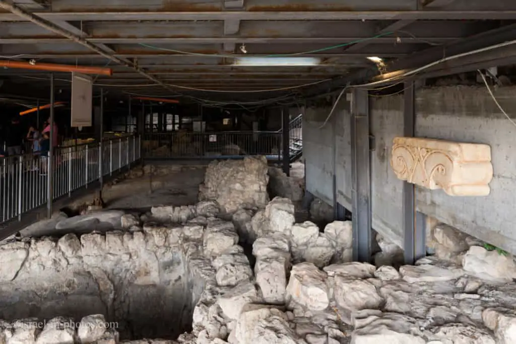
And now, let’s take the stairs down to the Royal Quarter (point of interest #3).
Royal Quarter (Area G)
Area G: The excavation area on the eastern slopes of the City of David, which was first excavated by the British archaeologist Kathleen Kenyon in the 1960s, and later by archaeologist Yigal Shiloh. Magnificent buildings from the First Temple period were found in this area, apparently part of the government complex of that time. The main building in this complex is called the House of Ahiel (after a clay shard with the name Ahiel found in the building).
Source: Israel Nature and Parks Authority.
Also, the Hallelujah Night Show is projected on these remains.
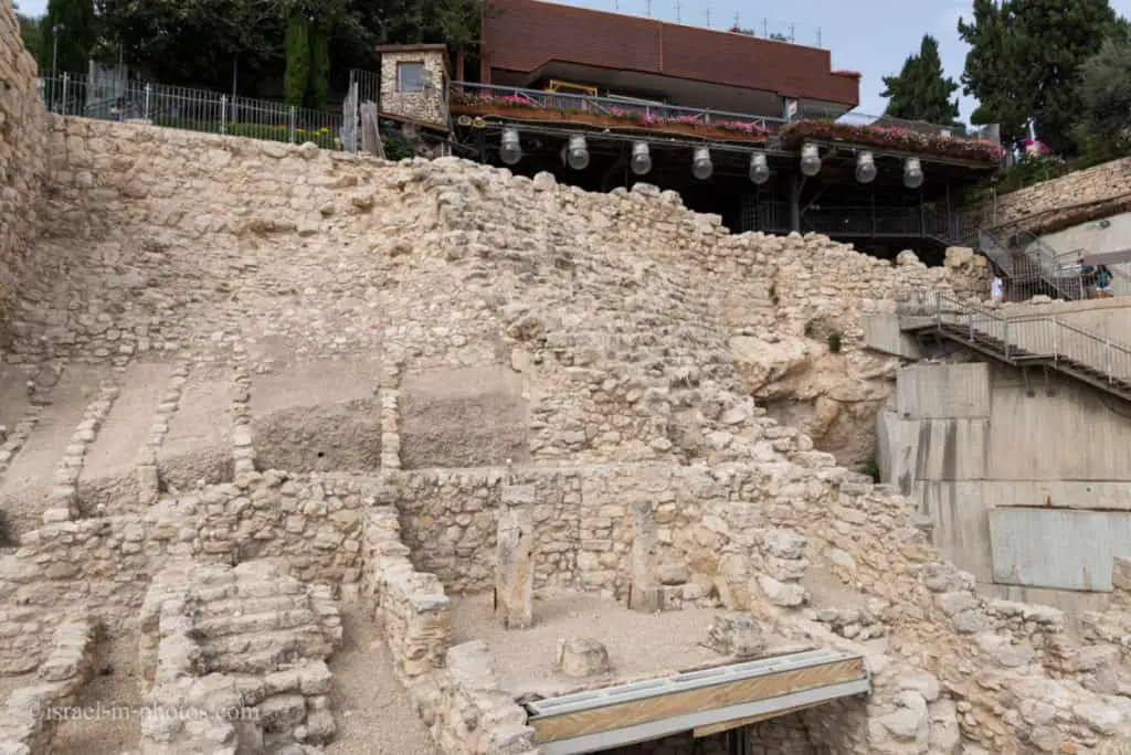
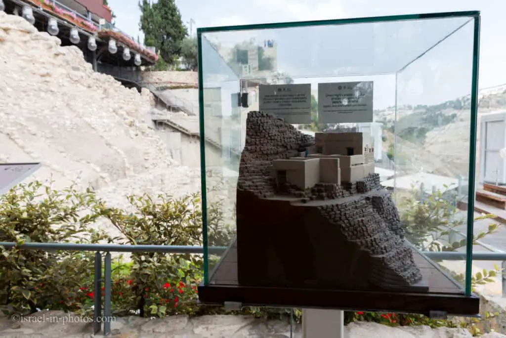
The inhabitants of ancient Jerusalem once built their homes on this hillside. The earliest structure unearthed here was part of an enormous Stepped Stone Structure that supported King David’s Palace or the Canaanite fortress that preceded it. In the early First Temple period, stately homes and an official archive were built upon the Stepped Stone Structure. Remains of these buildings were uncovered in excavations conducted by Yigal Shiloh (1978-1985). The opulent character of the homes and the nature of the artifacts found within them indicate that they belonged to Jerusalem’s elite, some of whom served as royal functionaries. The Royal Quarter went up in Flames when the city was destroyed by the Babylonians (586 BCE). In the early Second Temple period, the returnees to Zion rebuilt the walls of Jerusalem in the upper part of the excavated area, leaving the ruins before you outside the city.
Source: sign
House of Ahiel
In the bottom left corner, you can see columns. These are the remains of the house of Ahiel.
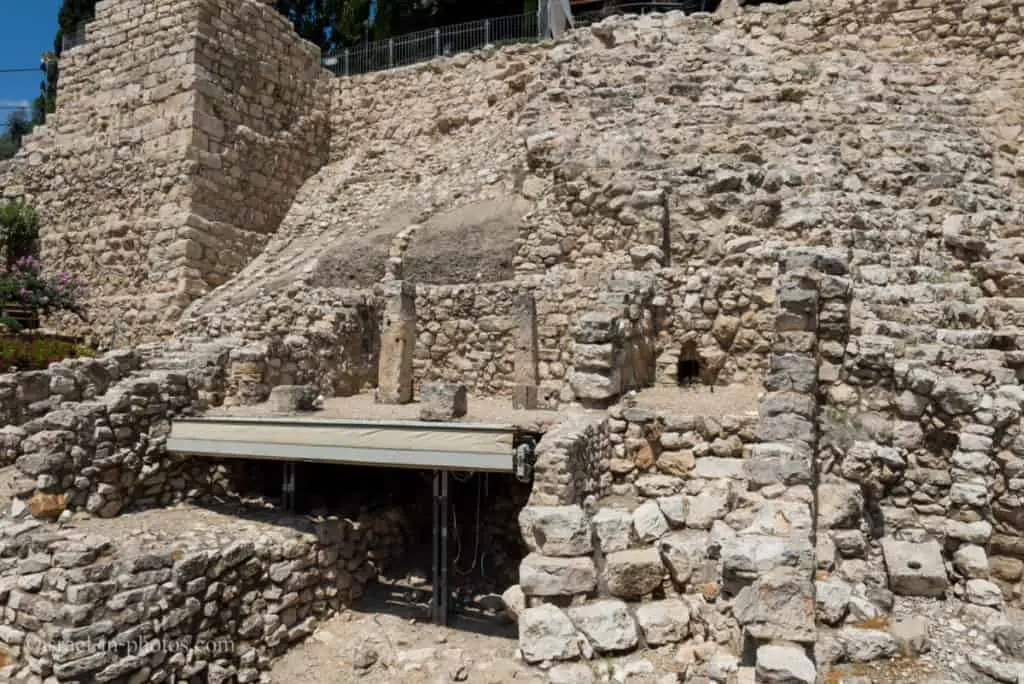
The name ‘Ahiel’ appears on potsherds Found among the ruins of this house. The House of Ahiel is a ‘four-room house”— a typical Israelite dwelling consisting of three parallel spaces closed off by a fourth. The roof beams were supported by pillars, part of which can be seen here. It is reasonable to assume that this/Was a two-story dwelling. To the right of the building is a stone toilet seat. Its presence adjacent to the house attests to the high standard of living of its residents.
Source: sign
And now, let’s head to Ancient Tomb Lookout (point of interest #4).
Ancient Tomb Lookout
At the Ancient Tomb Lookout, you will see the following sign.
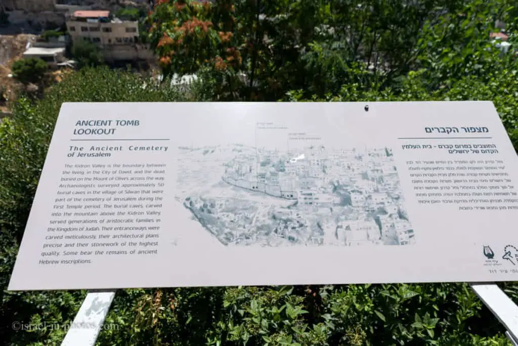
And if you take a close look, you can see the remains of the Ancient Cemetery of Jerusalem. More specifically, you can see tomb entranceways.
The Kidron Valley is the boundary between the living, in the City of David, and the dead, buried on the Mount of Olives across the way. Archaeologists surveyed approximately 50 burial caves in the village of Silwan that were r part of the cemetery of Jerusalem during the First Temple period. The burial caves, carved into the mountain above the Kidron Valley, served generations of aristocratic families in the Kingdom of Judah. Their entranceways were carved meticulously, their architectural plans precise, and their stonework of the highest quality. Some bear the remains of ancient Hebrew inscriptions.
Source: sign
Look at the holes in the Wall beneath the houses to the left.
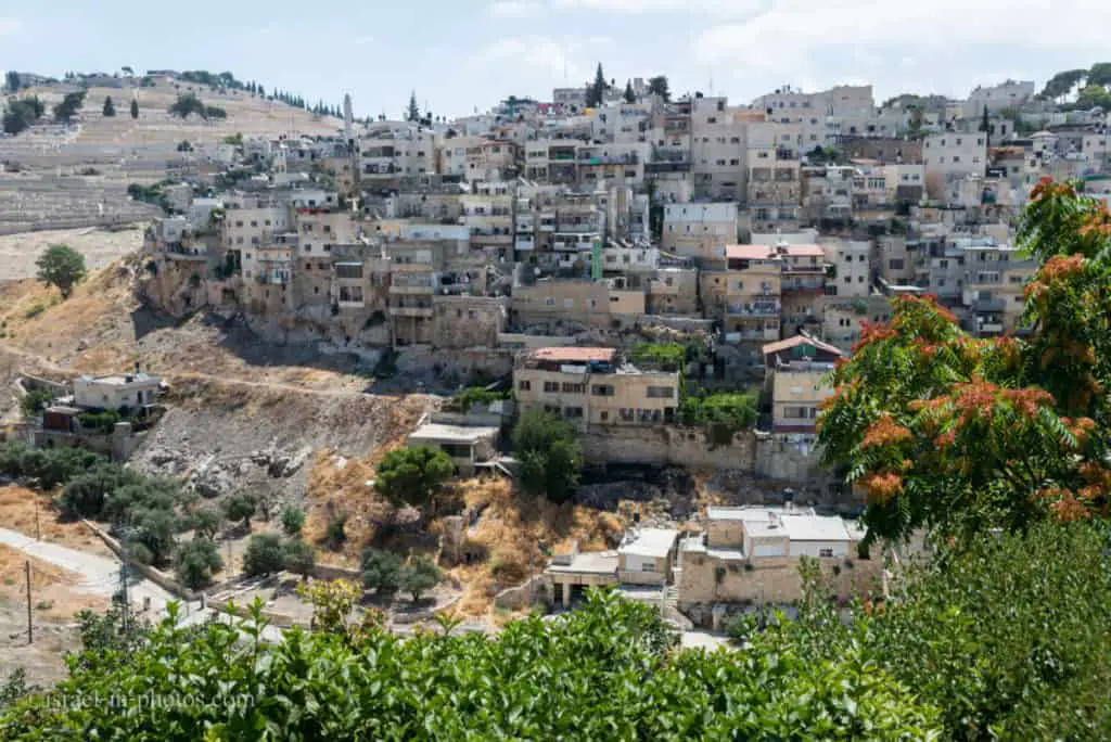
From the lookout, we continue going down the stairs till we reach Warren’s Shaft.
Water System – Warren’s Shaft
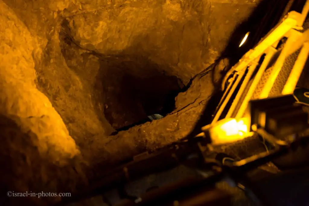
Warren’s Shaft: An ancient vertical shaft, 30 m in height, named after the British researcher Charles Warren who discovered it in 1867. For a long time, researchers assumed that the shaft was part of the ancient water system that gave the Canaanite residents of the city of Jebus access to the Gihon Spring in times of siege. Since the 1995 excavations, the accepted assumption is that the shaft was only made during the period of the Kingdom of Judah and that the Canaanites drew water from a large pool excavated in the rock within the city’s fortification walls.
Source: Israel Nature and Parks Authority.

This water system is a complex of rock-cut tunnels and associated fortifications, which were constructed to ensure the safe and steady supply of water to the ancient city in times of strife and siege, as well as in times of peace. As the Gihon Spring, Jerusalem’s only water source was located in the valley outside the city wall. The settlers took special care to fortify it and thus quarried an underground tunnel to allow safe access to it.
Source: sign

The Importance of a Water Source and Its Protection
In ancient times, before the early settlers learned how to collect end store rainwater in reservoirs or direct water across distances in aqueducts, they settled near natural springs. Therefore, the ancient settlement was founded here, next to the spring.
As the settlement developed, the threat of invasion by foreigners wishing to control the area and surrounding resources inevitably arose. To protect against such attacks, fortification walls were built around the cities, and special care was taken to fortify the area of the spring. The local topography posed a challenge for the inhabitants since, for security reasons, it was preferential to build their homes on the top of the hills, and the source of the spring was in the valley. The settlers’ solution was to cut a subterranean tunnel through the bedrock to access their water source. The tunnel reached above the spring. Water was usually drawn with a rope and drawing bucket, and it seems that a pulley may have been utilized to increase the efficiency of the process.
Source: sign
Quarrying and Building a Water System
Two water systems were uncovered in the City of David. “Warren’s Shaft System” was constructed in the Middle “Bronze Age II (ca.1800 BCE). Approximately 1000 years later (the 8th century BCE), it was replaced by a more sophisticated water system named the “Siloam Tunnel’.
Quarrying and building a water system was a complicated task. A large group of workers was required to cut the massive blocks of stone (some up to 4-5 tons in weight), transport the blocks to the site and incorporate them in the fortification walls. Also, qualified professionals were needed to plan and oversee the quarrying of the tunnels through the bedrock. These ancient foremen certainly had good knowledge of geology. They were also familiar with hydrology in respect to the nature of the spring.
The task of rock quarrying required suitable tools. “Warren’s Shaft System” was cut with bronze tools, while the later Siloam Tunnel was hewn with iron tools. The “Siloam Inscription” incised on the rock wall of the tunnel indicates that axes were used to cut the rock. Signs of these tools are visible on the rock walls of the water systems. Besides, proper lighting was required to facilitate the quarrying activity. In “Warren’s Shaft System” several ceramic oil lamps were found.
Source: sign
Canaanite Pool and Spring Citadel
Using the hidden tunnel, we reached the point of interest #7 – The Canaanite pool and spring citadel.
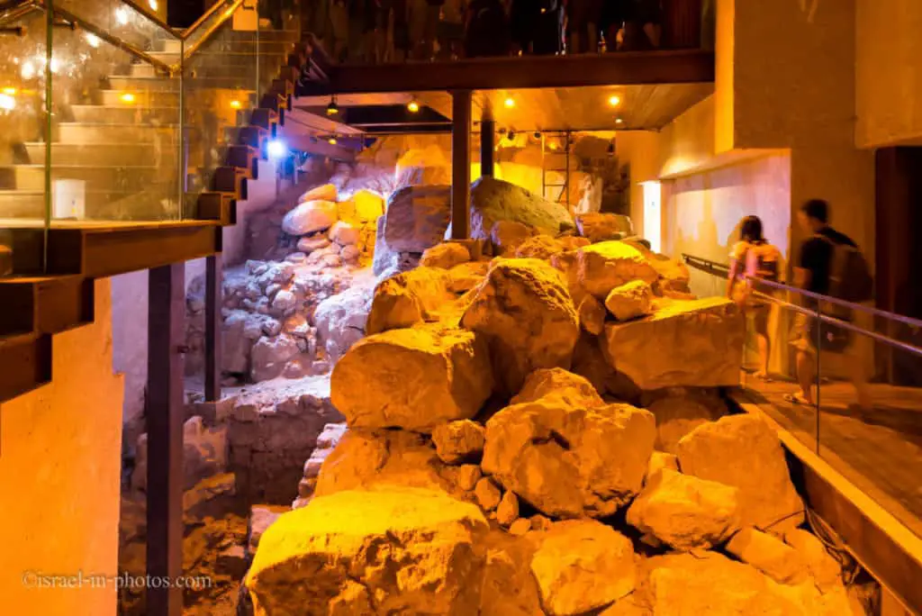
The Gihon Spring fortifications: In the archaeological excavations carried out in recent years a vast system of fortifications was uncovered, encompassing the Gihon Spring and protecting it against enemies, with a huge tower built of enormous rocks. The Gihon Spring fortifications have been dated to the Canaanite period (18th century BCE).
Source: Israel Nature and Parks Authority.

There is a short movie illustrating how the City of David probably looked. As you can see in the following photograph, the Canaanite Pool and Spring Citadel are at the bottom of the mountain, protected by a wall.

With the culmination of fifteen years of archaeological excavations, defined as one of the most complex and unique projects ever conducted in Israel, a Canaanite fortress with gigantic dimensions has finally been exposed, dating back to the 18th century BCE. The fortress, excavated at the City of David National Park, was uncovered very slowly due to the fact that parallel to the painstaking work carried out by dozens of workers led by Professor Ronny Reich of Haifa University and Eli Shukron of the Antiquities Authority, the site continued to host hundreds of thousands of visitors annually.
The Spring Citadel protects the biblical Gihon Spring with a huge fortification which isolates access to the spring, making it possible to reach the waters of the Gihon from the west only, from within the city. It is the largest fortress found in all of Israel to date between the Canaanite cities from the aforementioned period, and it seems that it is essentially the largest fortress found in Israel until the days of King Herod.
Source: gojerusalem.com
Gihon Spring
The Gihon Spring: The underlying factor in the development of ancient Jerusalem was the Gihon Spring, one of the largest and most abundant springs of the central mountain ridge. Thanks to this spring, there was a human settlement here already in prehistoric times, which grew and increased from the Canaanite period and on. King Solomon was anointed by the waters of this spring, as it says in I Kings 1:38-39: “so they went down and had Solomon ride on King David’s mule and brought him to Gihon; there Zadok the priest took the horn of oil from the tent and anointed Solomon. Then they blew the trumpet, and all the people said, “Long live King Solomon!”
Source: Israel Nature and Parks Authority.
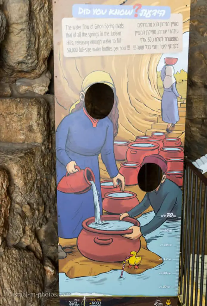
The Tunnels
At this point, you need to choose which trail you will be taking. There are two tunnels, and they are:
- If you prefer the wet route, take Hezekiah’s Tunnel (point of interest #10 on the trail map). Hezekiah’s Tunnel is also known as Siloam Tunnel. Its length is 533 meters, and the walk takes approximately 40 minutes (one way). The maximum water depth is 70 cm. The narrowest parts of the tunnel are about 60 cm wide. The minimum recommended age is five years.
- The Canaanite Tunnel (point of interest #9 on the trail map) is also known as the dry tunnel. Its length is 115 meters, and the walk takes approximately 5 minutes (one way). The narrowest parts of the tunnel are about 40 cm wide.
Which of the tunnels should you choose?
The answer probably should be none for claustrophobic people, people with health problems, and pregnant women. In other words, consider not using the tunnels.
If it is winter (the water is cold), you do not have a flashlight or proper shoes (we took water sandals), or you prefer staying dry, then take the Canaanite Tunnel.
Note that both tunnels end at different points. Thus, you will see slightly different points of interest. Check the trail map for additional info.
Hezekiah’s Tunnel (Siloam Tunnel)
Hezekiah’s Tunnel (Siloam Tunnel, Shiloah Tunnel): “This same Hezekiah closed the upper outlet of the waters of Gihon and directed them down to the west side of the city of David” (2 Chronicles 32:30). The tunnel is long and winding (533 m in length, and as the crow flies – 320 m), carved out to bring water from the Gihon Spring in the Kidron Valley outside the city walls into the Pool of Siloam within the walls of the city of David.
Source: Israel Nature and Parks Authority.
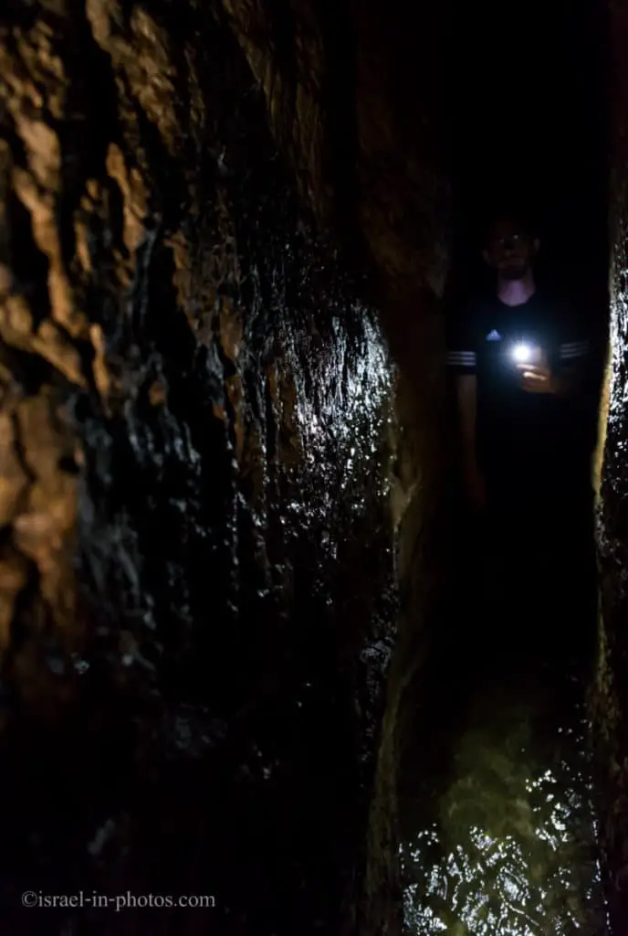
Hezekiah’s Tunnel is a remarkable engineering feat. Beyond the hard work, it had to be exact.
The curving tunnel is 583 yards (533 m) long and by using the 12 inch (30 cm) altitude difference between its two ends, which corresponds to a 0.06 percent gradient, the engineers managed to convey the water from the spring to the pool.
Moreover, the tunnel was excavated by two teams from opposite sides. And they met.
Many people chuckle since, recently, constructors created tunnels for the train to Jerusalem. And when the teams from opposite sides met, they had a 1-meter shift. Thus, such accuracy with basic tools suggests a high level of mastery.
According to the Siloam inscription, the tunnel was excavated by two teams, one starting at each end of the tunnel and then meeting in the middle. The inscription is partly unreadable at present, and may originally have conveyed more information than this. It is clear from the tunnel itself that several directional errors were made during its construction. Recent scholarship has discredited the idea that the tunnel may have been formed by substantially widening pre-existing natural karst. How the Israelite engineers dealt with the difficult feat of making two teams digging from opposite ends meet far underground is still not fully understood, but some suggest that the two teams were directed from above by sound signals generated by hammering on the solid rock through which the tunnelers were digging.
Source for both quotes: Wikipedia
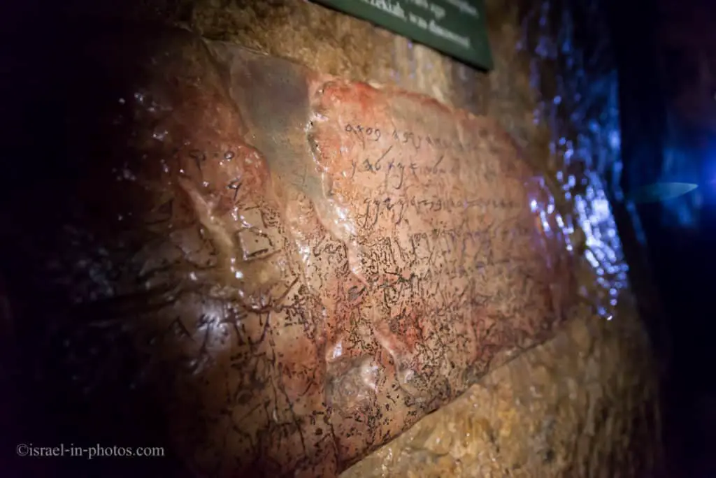

Going through Hezekiah’s Tunnel took about 35 minutes. Since the tunnel is narrow and everybody goes in a single line, the duration also depends on the number of people in the tunnel.
The exit point from Hezekiah’s Tunnel is at the Byzantine Pool of Siloam (point of interest #16).
Pool of Siloam
Pool of Siloam: An ancient pool at the point where the Gihon Spring flows into the city of David. Today, the water flows into a rectangular pool from the Byzantine period, but in the past, it flowed into a larger pool that has been only partially uncovered in recent excavations.
Source: Israel Nature and Parks Authority.

In the photo above, you can see the Byzantine Pool of Siloam. And if we take the stairs up, we will reach the larger pool (from the Second Temple period). In the next photo, you can see how it probably looked.
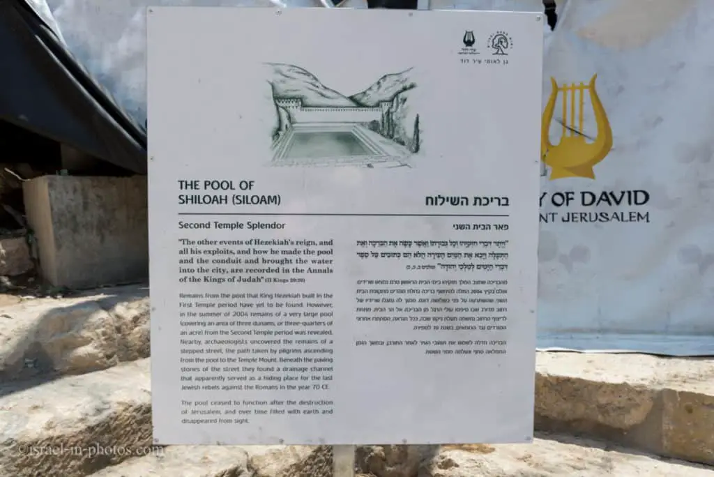
Note: As you can see, all the signs are displayed in both Hebrew and English.
“The other events of Hezekiah’s reign, and all his exploits, and how he made the pool and the conduit and brought the water into the city, are recorded in the Annals of the Kings of Judah” (IL Kings 20:20)
Remains from the pool that King Hezekiah built in the First Temple period have yet to be found. However, in the summer of 2004, remains of a vast pool (covering an area of three dunams, or three-quarters of an acre) from the Second Temple period was revealed. Nearby, archaeologists uncovered the remains of a stepped street, the path taken by pilgrims ascending from the pool to the Temple Mount. Beneath the paving stones of the street, they found a drainage channel that served as a hiding place for the last Jewish rebels against the Romans in the year 70 CE.
The pool ceased to function after the destruction of Jerusalem, and over time filled with earth and disappeared.
The importance of the Pool of Shiloah during the Second Temple period is known from the ancient sources. Water drawn From the Shiloah was poured on the Temple altar on the festival of Sukkot (Tabernacles). Shiloah water was used in the purification rite performed after contact with the dead. Archaeologists Reich and Shukron suggest that the pilgrims also used the pool as a ritual bath in which to purify themselves before ascending the Temple.
Source: sign
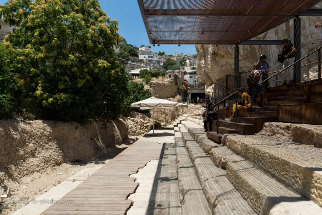
From the Pool of Siloam, you can walk in the Drainage Channel (point of interest #17) or take the shuttle to the starting point (at an additional fee as mentioned in the entrance fee section).
We preferred walking.
The Herodian Street and Drainage Channel
Before entering the drainage channel, I want to give basic instructions (similar to Hezekiah’s Tunnel).
The route to the Western Wall is about 600 meters long and takes approximately half an hour. The path to the Givati excavations is 450 meters long and takes approximately 20 minutes. The walk is one-way and requires bending over. The tunnel is illuminated, and the narrowest parts of the tunnel are about 60 cm wide. And the minimum recommended age is five years.
Claustrophobic people, people with health problems, and pregnant women should consider taking the shuttle I mentioned above.
Path of the Pilgrims
Before you is a stone-paved plaza From the Second Temple period that served as a promenade for visitors to the Shiloah (Siloam) Pool. The promenade’s roof was supported by a row of stone columns, parts of which have been found at the site. Near the plaza are remains of a stepped road that continued northward along the Tyropoeon Valley to the area of Robinson’s Arch. This was the route used by pilgrims to ascend from the Shiloah (Siloam) Pool to the Temple Mount. The road was built on a grand scale and may have been dozens of meters wide. West of the road is the main drainage channel of Second Temple Jerusalem. The channel’s walls were constructed of hewn stones, and it was roofed with stone slabs.
Source: sign
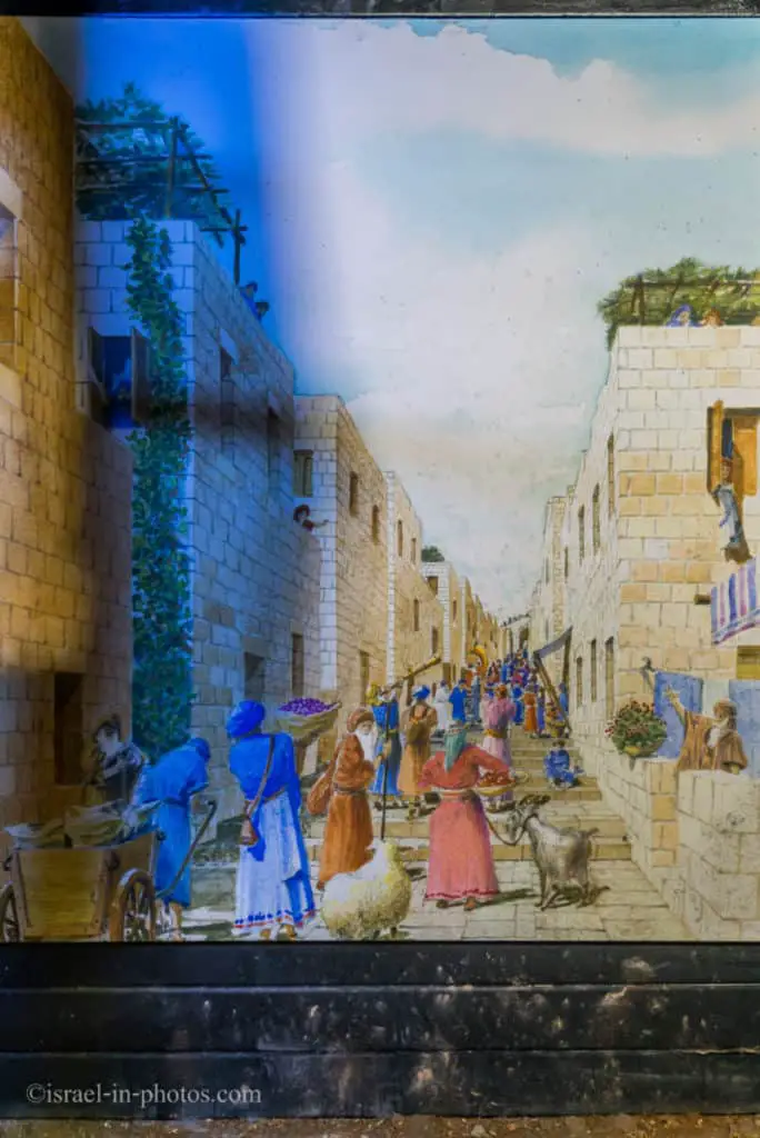
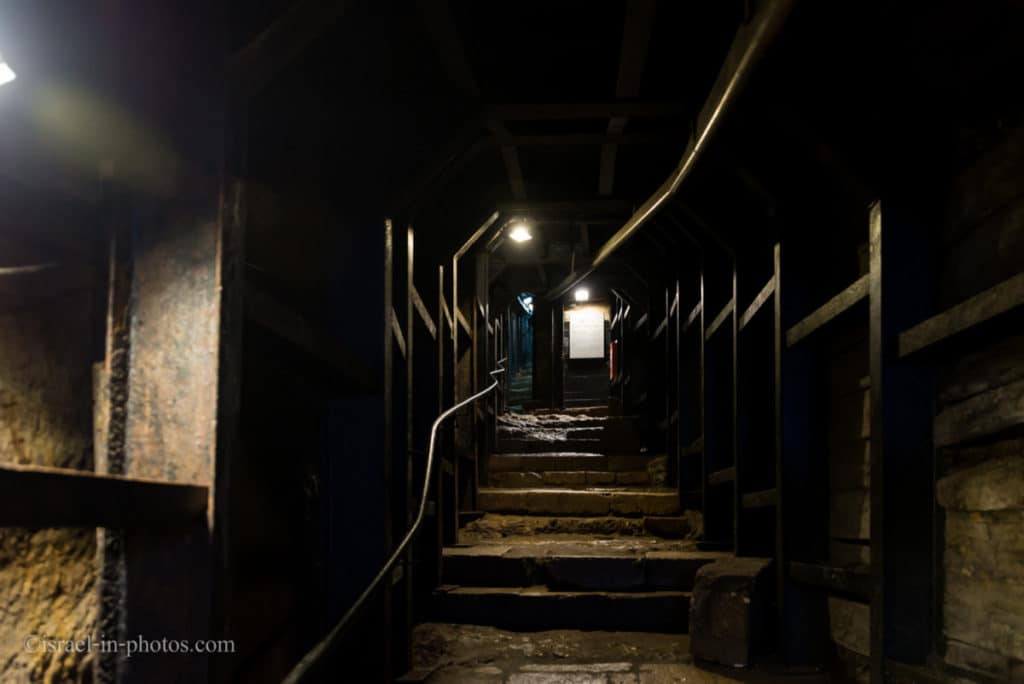
When you start trekking through the tunnel, at the beginning, you are walking on the Herodian Street. And at some point, it changes to the Drainage Channel.
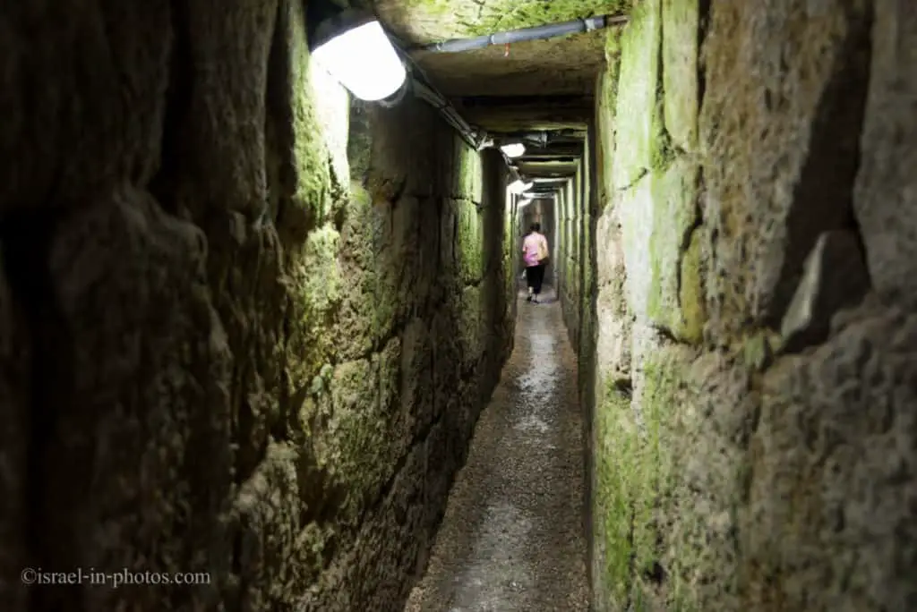
Although the Drainage Channel leads to the Western Wall (specifically to the Davidson Center), it is inaccessible due to the locked gate. You can only go from the City of David to the Western Wall as part of their guided tour.
Thus, if you take the drainage channel, you will exit at Givati excavations.
I will tell you about the Givati excavations and show the rest of the drainage channel in the next section.
At this point, I would like to mention that the visit described above took us over three hours.
From the City of David to the Western Wall – Guided Tour
The City of David is an active archeological site. And only a few years ago, as new sections of the drainage channel were uncovered, they created a new tour. The tour is called “From the City of David to the Western Wall.” And as the name suggests, you start in the City of David and then walk underground to the Western Wall (specifically to the Davidson Center).
Beit Hatzofeh Observation Point
Our tour started at the observation point (point of interest #1 on the trail map).
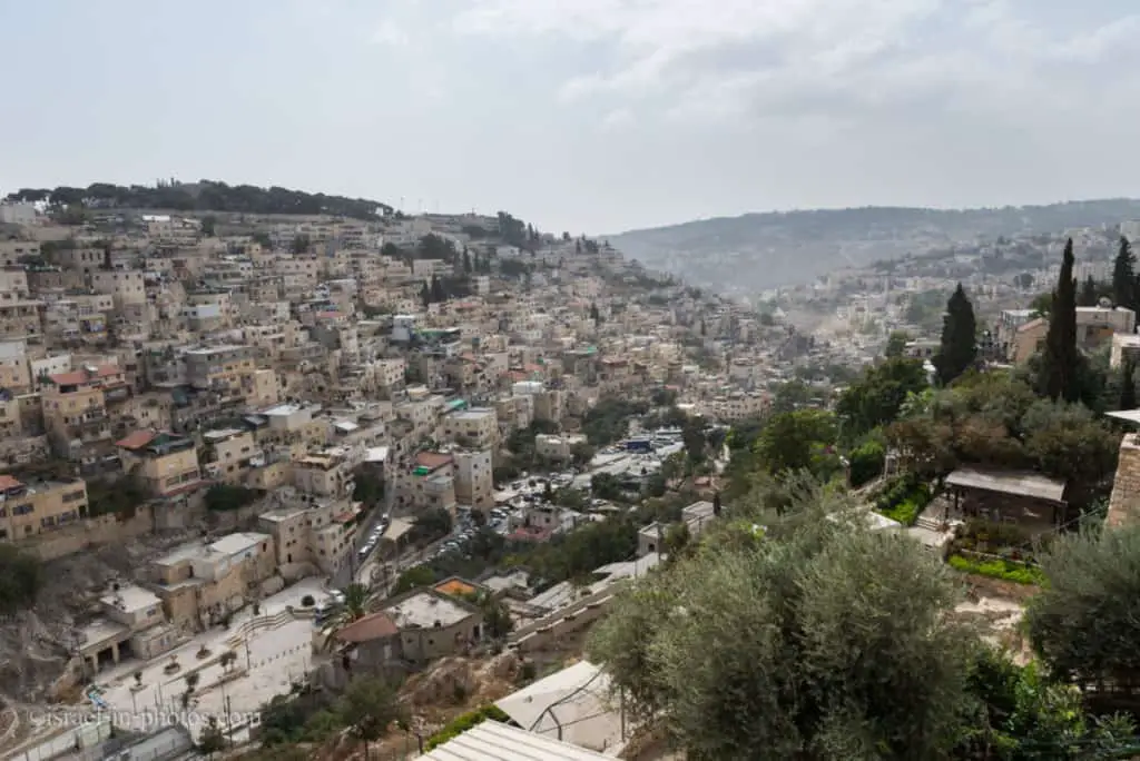
After a short review, we visited the Large Stone Structure and the Royal Quarter. But I already told you about them.
Thus, we will skip to the Givati parking lot excavations (point of interest #19).
Givati Parking Lot
Although the trail map indicates Givati Excavations, our guide referred to it as Givati Parking Lot.
Let’s start by explaining the name. Givati is an Israel Defense Forces infantry brigade. This site used to be a parking lot till it became an archeological site. How do the two facts combine? In 1986, there was a terrorist attack against soldiers from the Givati Brigade who completed a swearing-in ceremony at the Western Wall. And the parking lot was named after that attack.

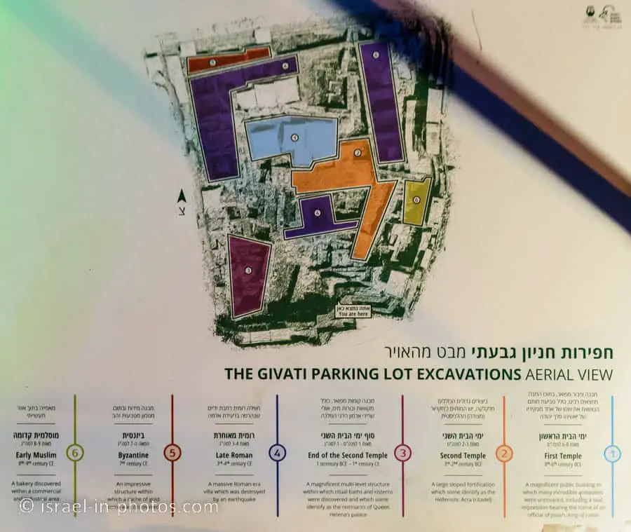
Since 2007, Doron Ben-Ami of Hebrew University and Yana Tchekhanovets of the Israel Antiquities Authority have been conducting a comprehensive excavation in the Givati Parking Lot, located in the Tyropoeon Valley, west of the entrance to the City of David.
Excavation in the area by Ronny Reich and Eli Shukron had begun years earlier but was subsequently stopped.
The Givati Parking Lot marks the largest active archaeological excavation in Jerusalem today. It is continuously uncovering different layers of the city’s life from the Middle Ages to ancient times. The main finds include the basement floor of a large residential building from the end of the Second Temple period that may have been part of the royal property of Queen Helene, a queen who converted to Judaism and lived in the city during that period.
Besides, a massive residential building from the Roman period (measuring about two dunams or half an acre) yielded findings such as a gold earring inlaid with pearls and precious stones and a Roman boxer figurine, used as a weight. In a nearby building that dates from the Byzantine period, 264 gold coins were discovered. The coins have been dated to 613 CE, the eve of the destruction of the city at the hands of the Persians. Above these layers, several layers of settlement from the Muslim period were found.
Source: official website

Our guide shows the findings from this site, including the coins mentioned above.

Drainage Channel During the Great Revolt
Then, we entered the Drainage Channel (mentioned above) and headed towards the Western Wall.
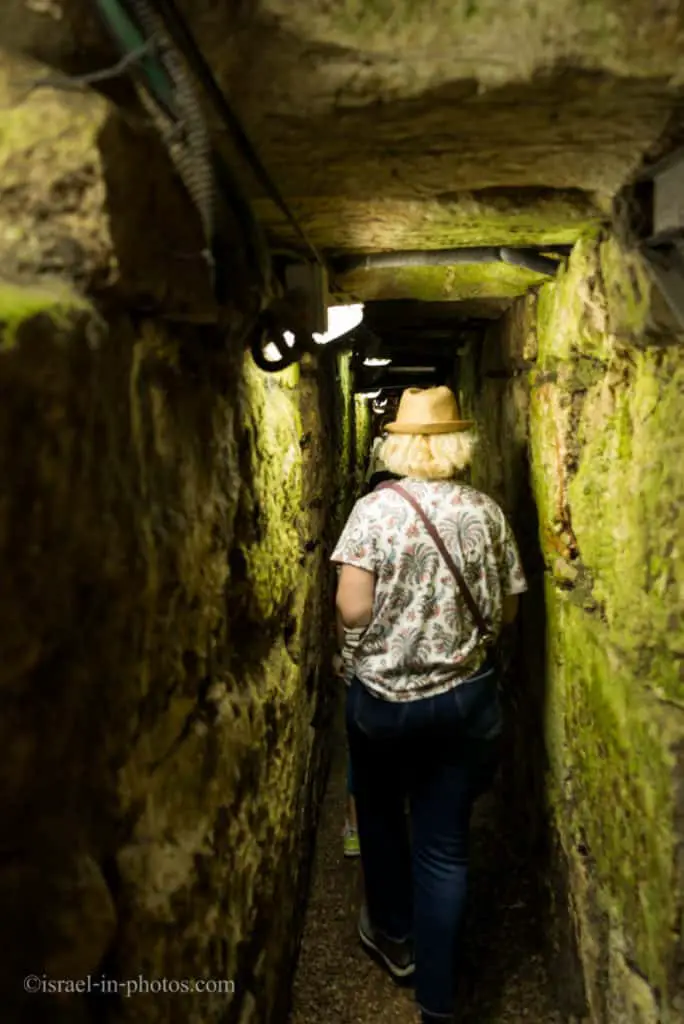
The drainage channel can be a good source of archeological finds. Even today, people lose jewelry, coins, and other items in the sewers.

But this drainage offers more findings. And that is because some Jews hid there during the Great Revolt.
In the drainage channel archaeologists discovered various objects from the Second Temple period that had fallen from the street above. Among the Finds were thousands of bronze and silver coins, a golden bell similar to the ones that adorned the high priest’s robes, and a clay seal marked with the Aramaic words “Pure For God” used by Temple officials to approve produce and goods for the holy services.
Some of the finds date from the year 70 CE after the city fell to the Romans. At that time, many inhabitants fled to the channels to seek refuge, only to be discovered by the Romans and put to death. Below the broken pavement of the road, archaeologists discovered the refugees’ meager belongings: food utensils taken into hiding, coins minted during the revolt, and even a Roman sword. This drainage channel was uncovered to the north for many more dozens of meters.
Source: sign on site.
We exited the drainage at Davidson Center. Then, our guide gave some explanations about this place and the Trumpeting Place Cornerstone. About one hour and twenty minutes after the tour started, it ended. And our guide left us to explore the Davidson Center.
Common Questions
The city of David is considered the original core settlement in Jerusalem. Thus, at some point in history, it was the same. But over the centuries, Jerusalem expanded, and today, the City of David is only a small part of it.
The City Of David is near the Old City (Dung Gate) in Jerusalem.
The city of David is considered the original core settlement in Jerusalem.
Hezekiah’s Tunnel is 533 meters long, and a regular walk takes about 40 minutes.
Approximately 40 minutes, but this time may vary depending on the number of people. It can vary between 20 and 60 minutes.
Currently, the maximum water depth is 70 cm.
Summary
We have visited the City of David several times in recent years, exploring both the standard route through the dry tunnel and the alternative route through the wet tunnel. Or their tours, “From the City of David to the Western Wall” and “The Biblical City of David”. Or even off-site activities, such as the Archaeological Experience in the Tzurim Valley National Park. We always learned something new and enjoyed all our visits. Thus, if you love archeology and history or enjoy exploring, I suggest adding them to your to-do list.
Moreover, since their tours are not expensive, I would suggest joining one.
Have you been to the City of David? Tell us about your experience in the comments below.
That’s all for today, and I’ll see you on future travels!
Stay Tuned!
For additional points of interest nearby, check out Jerusalem.
Additional Resources
Here are several resources that I created to help travelers:- Trip Planner with Attractions and Itineraries is the page that will help you create your perfect travel route.
- What is the Best Time to visit Israel? To answer this question, we will consider the weather, prices, holidays, festivals, and more.
- Information and Tips for Tourists to Israel will answer the most common questions tourists have about Israel (including safety, passports, weather, currency, tipping, electricity, and much more).
- Israel National Parks and Nature Reserves include a complete list, top ten, map, tickets (Israel Pass, Matmon, combo), and campsites.
- If you are looking for things to do, here are the pages for Jerusalem, Tel Aviv, Haifa, Sea Of Galilee, Akko (Acre), Eilat, Nazareth, Safed (Tzfat), and Makhtesh Ramon.





Thanks for all the details and explanations. Can someone take the dry and the wet tunnel at the same price by returning to the starting point?
Hi Natan,
This is an interesting question, but I do not know since I have never tried it (each path takes at least several hours).
I guess that you cannot do it. After each tunnel, you have to return to the starting point. Since you buy tickets for a specific time, if you return after three hours, the color of the wristband you received will be different than the one currently allowed to enter. Hence, they probably will not let you in.