Arbel National Park – Visitors Guide (with Tracks)

Arbel National Park and Nature Reserve is located on Mount Arbel by Tiberias. It offers tracks with stunning views and history.
Map
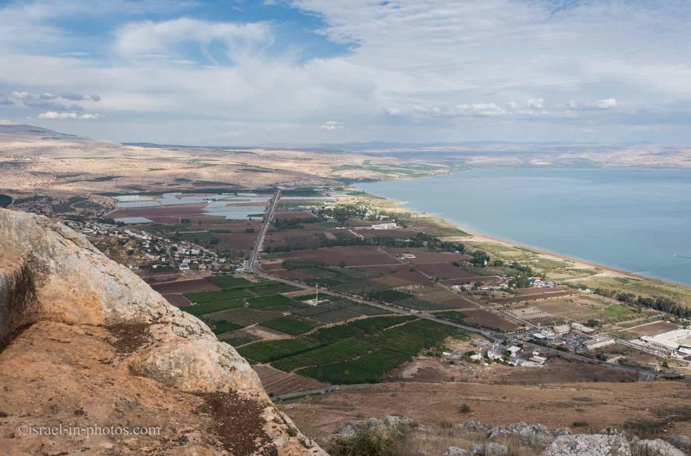
Arbel is situated north of Tiberias and overlooks the Sea of Galilee. You can see Arbel National Park and Nature Reserve on the left side of the following map.

And on the following map of the area, you can also see the Ancient Synagogue of Arbel and Arbel Nature Reserve:
Directions for drivers: Link to Waze and Link to Google Maps
Directions for public transport: Link to Moovit
Interactive map of the area:
Tracks
Here is the map from the official brochure you receive at the entrance.
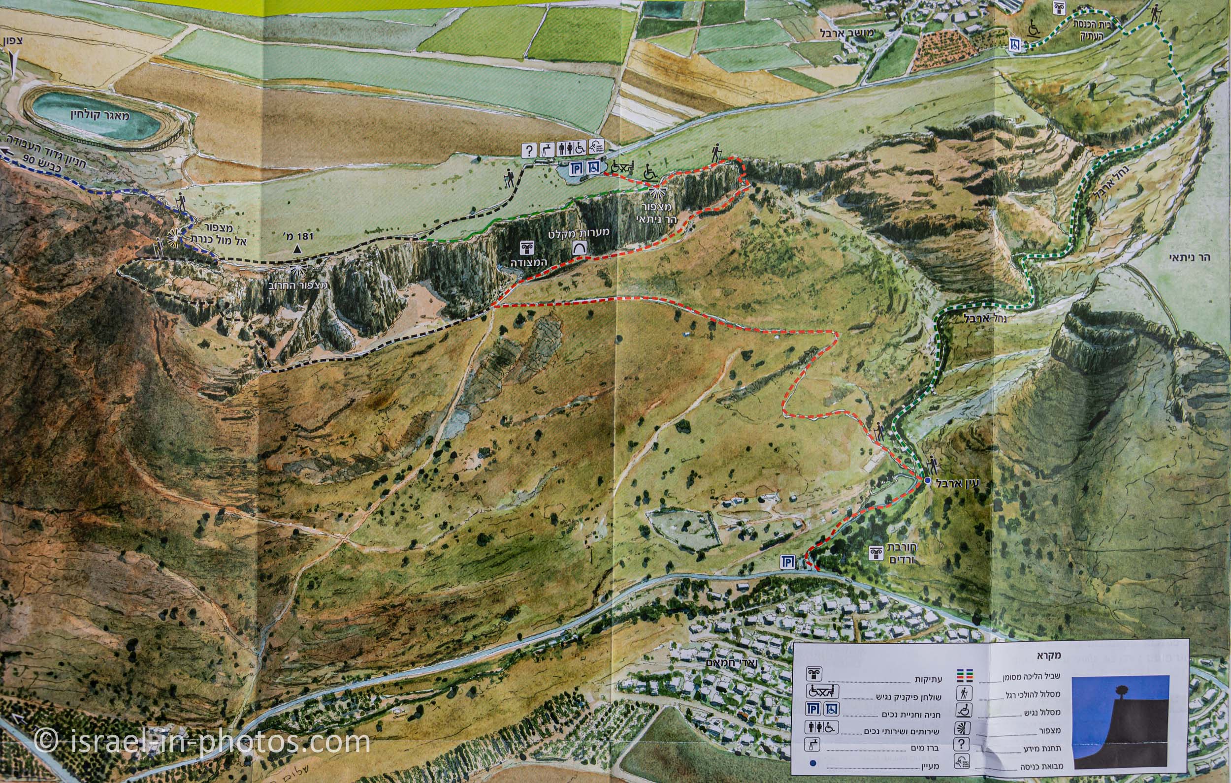
Note: you can click on the map to enlarge it.
Also, in the official brochure Israeli Nature And Parks Authority propose six hikes. And I will list them now so that you can come prepared.
| # | Track Name | Starting Point | Description | Approximate Duration (hours) | Hike Difficulty | Notes |
|---|---|---|---|---|---|---|
| 1 | The Short Track – Carob Lookout | The Main Parking (black track) | The Carob lookout path will take you from the main parking lot (at the top center of the map) to the Carob lookout and back. | 0.5 | Easy | This is an accessible path. |
| 2 | Loop Track – Fortress and the Caves | The Main Parking | It begins at the parking lot and continues to the Carob lookout (black). From there, it descends west along the cliff’s edge and meets the red trail, which reaches the fortress and the caves. From the fort, continue east on the red path and climb back to the parking lot. | 3 | Medium – Fortress and the Caves is a loop track with steep descent and ascent. | This path is suitable for experienced hikers. It involves some rock climbing and rope walking (both with handles). |
| 3 | Labor Battalion Rest Area Hike | The Main Parking | The route begins at the parking lot, continues to the Carob lookout (black track), and continues along that trail for another 200 meters to its junction with the blue trail. The blue trail reaches the Kinneret lookout and continues down the slope to the Labor Battalion Rest Area. | 2 | Medium – Labor Battalion Rest Area trail follows a steep slope. | One directional hike, and you need another car at the Labor Battalion Rest Area. |
| 4 | Arbel Spring Hike | The Main Parking | The trail begins at the parking lot and continues along the black path to the Carob lookout. From there, it descends to the caves and Arbel Spring (at the mountain’s base). | 2 – 3 | Medium – The track follows a steep slope requiring hand-and-foot-holds on the cliff. | One directional hike, and you need another car on the road near Hamam. |
| 5 | The Synagogue Path | The Synagogue Parking | The Synagogue loop track is short and easy. It begins at the small parking lot at the side of the road near Moshav Arbel (at the top right corner of the map), reaches the synagogue and the Arbel Talmudic-era village, and returns to the parking lot. | 0.5 | Easy | This is an accessible path. |
| 6 | Synagogue and Arbel Spring Track | The Synagogue Parking | Synagogue to the Arbel Spring trail begins at the small parking near the synagogue. It reaches the synagogue and continues descends using a fairly steep green track via burial caves to the Arbel Spring. | 1.5 – 2 | Medium | One directional path. |
Note: hikes #1 and #5 are easy, and the rest are for experienced hikers (not suitable for small children – probably eight or older). Also, #1 and #2 are the most popular tracks.
Directions
If you are reaching by car, enter “Arbel National Park and Nature Reserve” into Waze or Google Maps, which will take you there. There is a big free parking lot on site (at no extra cost beyond the entrance fee).
When I look at Moovit, I see that the nearest bus stops at Wadi Hamam Intersection. And from there, it is a 3.3 km walk to the park entrance. Thus a more expensive and convenient option would be reaching Tiberias and taking a cab from there.
Opening Hours
Sunday – Thursday and Saturday: 8:00 – 17:00 (16:00 in winter).
Friday: 8:00 – 16:00 (15:00 in winter).
On holiday eves, usually 8:00 – 13:00.
Note: Since the pandemic, the Israel Nature and Parks Authority has started limiting the number of people in each park. Thus, reservations are recommended through the official site (you can find the link below).
The entrance to the park closes one hour before the time mentioned above. And the last entry to trails down the cliff is three hours before the closing time.
Entrance Fee
Adult 24 NIS, child 10 NIS, and student 20 NIS. Free for National Parks annual subscribers.
If you visit multiple National Parks, consider purchasing a combo ticket. Additional information is available at National Parks and Nature Reserves.
Note: opening hours and ticket prices were updated in December 2022. In any case, recheck the official site before visiting.
Mount Arbel
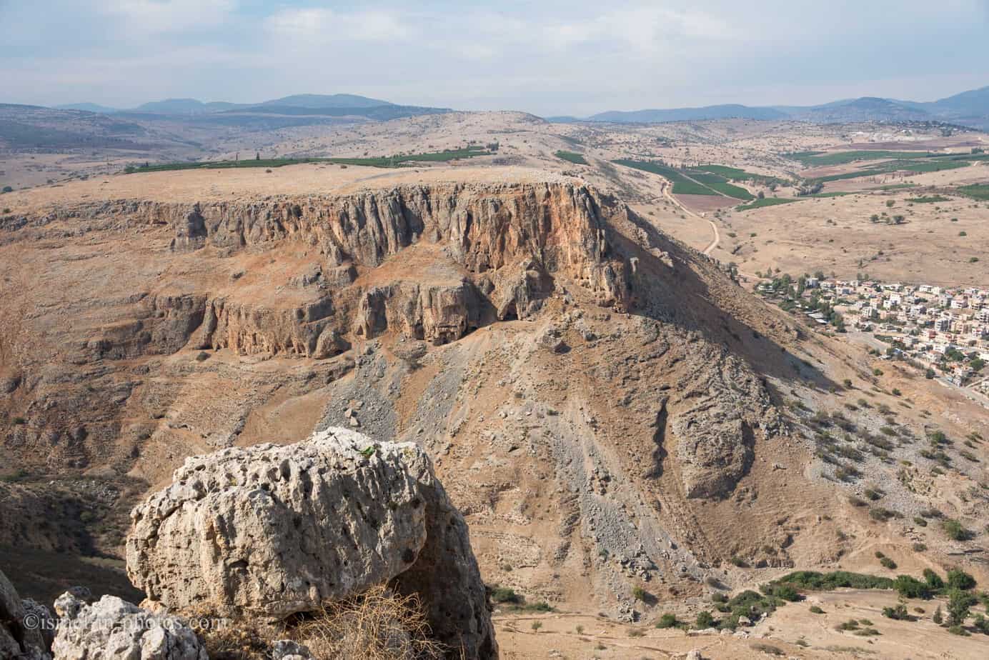
Mount Arbel is a mountain in The Lower Galilee near Tiberias in Israel, with high cliffs, views of Mount Hermon in the Golan Heights, trails to a cave-fortress, and ruins of an ancient synagogue. Mt. Arbel sits across from Mount Nitai; their cliffs were created as a result of the Jordan Rift Valley and the geological faults that produced the valleys.
There are four villages on the mountain: Kfar Zeitim, Arbel, Kfar Hittim, and Mitzpa. The peak, at 181 meters above sea level (380 meters above the surrounding area), dominates the surroundings (much of the area is below sea level) and from the lookout atop the mountain, almost all of the Galilee into the Golan Heights including Safed, Tiberias and most of the Sea of Galilee, is visible.
History
Nearby are the ruins of an ancient Jewish settlement with a synagogue from the fourth century CE with pews and columns.
Dug into the mountain itself are some cave dwellings, expanded from natural caves. There are documented Jewish cliff dwellings dating back to the Second Temple period in the area. The existing fortification walls protecting some of these caves are from the 17th century and were built by Ali Bek, son of the Druze emir Fakhr ad-Din al-Ma’ani. Josephus writes about how Herod the Great, with the help of Roman soldiers, defeated some of the last rebels who supported the Hasmonean king Antigonus and had taken refuge in the cliffs of Mt Arbel.
Source for both quotes: Wikipedia
Arbel in the Bible
Arbel is mentioned once in the Bible in Hosea 10:14 (New International Version):
the roar of battle will rise against your people,
so that all your fortresses will be devastated—
as Shalman devastated Beth Arbel on the day of battle,
when mothers were dashed to the ground with their children.
This is the first mention, and it is attributed to the eighth century BCE. Later Arbel is mentioned in the Books of the Maccabees 1, Josephus Flavius, and other sources.
When to Visit Arbel National Park?
We visited Arbel Nature Reserve and National Park during the winter. You can visit this park all year round, but keep in mind that it gets boiling in this area in summer. Thus, I would suggest other seasons. Moreover, since all trails have many rocks, which become very slippery after rain, wait at least twenty-four hours from the last rain before visiting this nature reserve.
Mount Nitai Viewpoint – Nitai of Arbel
We parked at the main parking, which appears at the top center of the map, and as you can see, there are several trails and half a dozen points of interest. We planned to make a loop trail that consists of red, green, and black tracks (variation of #2). It will cover the Arbel Fortress, the Caves, and two viewpoints (the Carob viewpoint and Mount Nitai viewpoint). And then drive to another parking (in the top right corner) to see Arbel Synagogue.
The main parking is close to Mount Nitai viewpoint. Thus we headed there first.
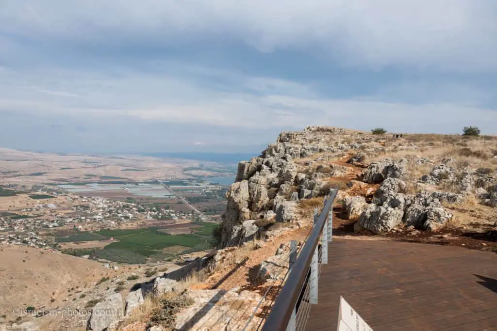
Where the name Nitai comes from? The mount is named after Nittai of Arbela.
Nittai of Arbela was av beit din or vice-president of the Sanhedrin under the Nasi Joshua ben Perachyah at the time of John Hyrcanus (134–104 BCE). In Jerusalem Talmud Moed II 76d he is called Mattai of Arbela, which is also found in ancient and linguistically reliable manuscripts of the Mishnah, such as Codex Kaufmann, Codex Parma A, and the Cambridge Codex. The confusion in the rendering of his name seems to be due to faulty textual transmission, i.e., the Hebrew mem being separated graphically into two parts, which looked, respectively as a nun and a yod, thus Mattai became Nittai. Arbela was a city of the Galilee not far from Tiberias.
Source: Wikipedia
In the following photo, you can see the sign telling about the defense line of Mount Nitai, and in the distance, you can see the sign pointing to red and green trails.
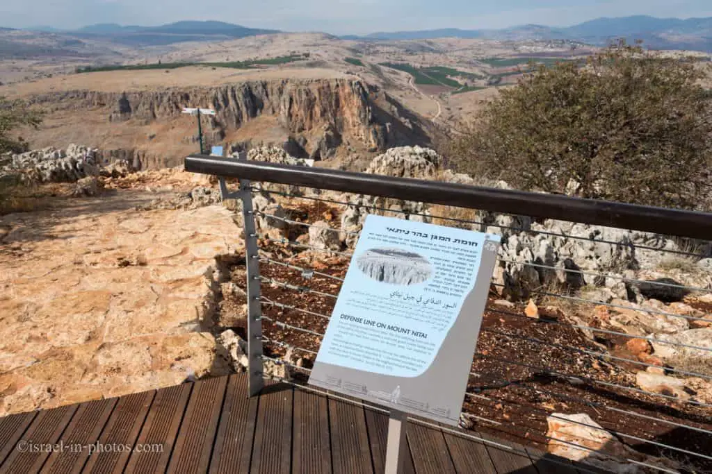
On top of Mount Nitai, a wall with guard towers facing west was found. Why west? They expected the Roman army to come from the road to the west.
Archeological findings indicate that this was the defensive line of the caves. Josephus Flavius (at the beginning of the First Jewish–Roman War in the year 66 CE) described it as: “walls the caves in Lower Galilee in the neighborhood of the lake of Gennesaret.”
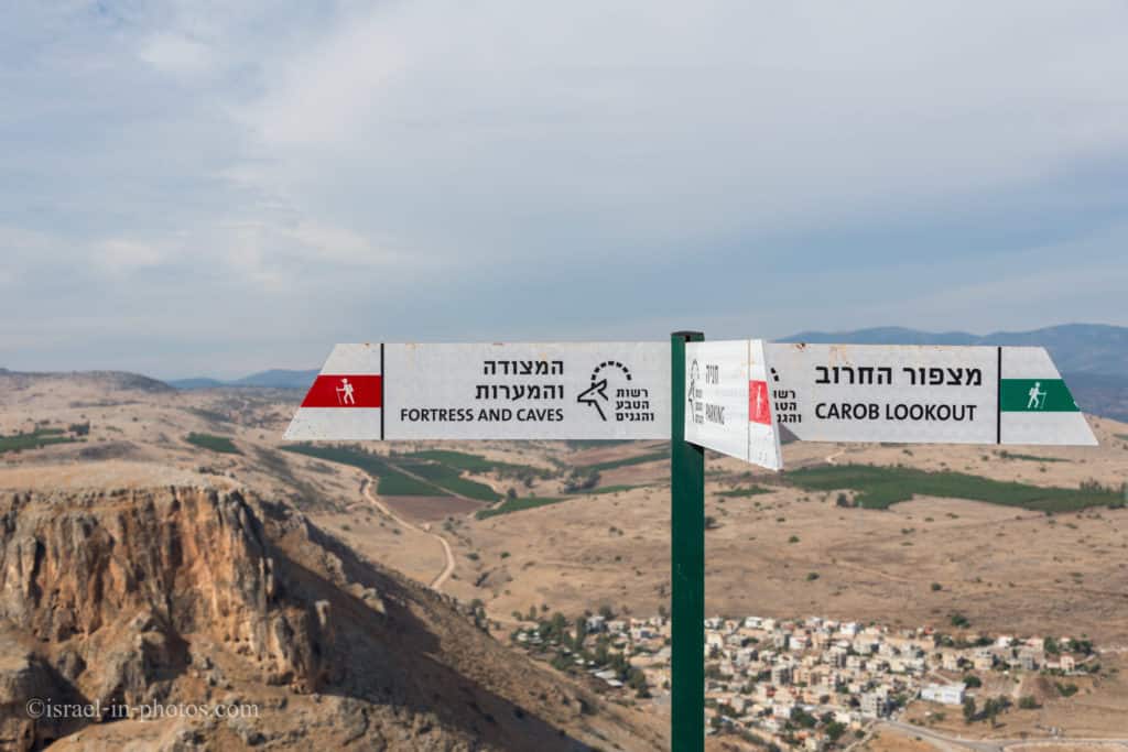
Since we saw the red trail sign towards the Fortress and the Caves, we decided to follow this path. And it was a mistake.