

Banias – Hermon Stream Nature Reserve – Visitors Guide

You can explore the rich history (Caesarea Philippi, Temple of Pan) and amazing nature (Banias waterfall) of Banias via four trails.
Map
Banias Nature Reserve is located in Golan Heights. It has two entrances, and on the following map, I marked them.
Note: the following links will lead you to the spring entrance. You can find additional information below.
Directions for drivers: Link to Waze and Link to Google Maps
Directions for public transport: Link to Moovit
Interactive map of the area:
This Nature Reserve is extensive and has two entrances (Springs and Waterfall). Over the years, we visited it many times, and this post is a combination of those visits to two different areas of the Banias.
Here is the map of this National Park:

Note: you can click on the map to enlarge it. And in the following sections, you will see parts of this map with trail markings.
Directions
If you are driving to this park, enter its name into the navigation app (wondering which app to use, then see Useful Apps in Useful Information For Tourists To Israel). You can enter “Hermon Stream (Banias) Nature Reserve” into Waze. Also, keep in mind there are two entrances to this nature reserve. Select the required one.
Getting to this Nature Reserve using public transport is inconvenient. For example, reaching Banias from Tel Aviv will require at least three buses, a 1.5 km walk by road #99, and more than four hours. Here is a link to Moovit, where the destination is already set. Just enter your starting position, and you will get the updated directions.
Tracks
The map above shows two main areas: Banias Spring (#1 on the chart) and Banias waterfall (#37 on the diagram). Near each area, there is an entrance and a parking lot.
As you can see from the map photo, there are four trails. The trails allow visiting each area separately. Three of them are loop hikes. And the blue way that leads from the springs to the waterfall is a one-way trail. If you choose it, you will need two cars, one in each parking lot.
| Track Color | Description | Starting Point | Ending Point | Hiking Duration (minutes) | Point of Interest on the Way |
|---|---|---|---|---|---|
| Yellow | Loop trail to the Crusaders’ city and back | Banias springs parking | Banias springs parking | 45 | 1-8, 11-17 |
| Purple | Loop trail to the Agrippa II palace and back | Banias springs parking | Banias springs parking | 45 | 1-8, 21-26 |
| Blue | The one-way trail from the springs to the waterfall | Banias springs parking | Banias waterfall parking | 90 | 1-8, 31-37 |
| Red | Loop trail that leads to the waterfall via the Suspended Trail | Banias waterfall parking | Banias waterfall parking | 45 | 35-37, 41-43 |

Besides the four suggested trails by Israel Nature and Parks authority, I propose another two options.
- Yellow – Purple: you can combine both trails to make a slightly longer hike that will allow seeing more. Start by following the yellow path till the point of interest #16. Then instead of exiting through the rotating gate, you take the purple trail towards the Palace of Agrippa II (point #24).
- Banias Waterfall: I loved Banias Suspended Trail, but if you do not have enough time (or already took one of the hikes from Banias springs), you can go to the waterfall directly from the waterfall parking lot. It will take approximately 20 minutes.
Note: the trail marking across this nature reserve is clear, and you do not need any extra maps besides the one you get in the booklet.
Opening Hours
Sunday – Thursday and Saturday: 8:00 – 17:00 (16:00 in winter).
Friday: 8:00 – 16:00 (15:00 in winter).
On holiday eves, usually 8:00 – 13:00.
Note: Since the pandemic, the Israel Nature and Parks Authority has started limiting the number of people in each park. Thus, reservations are recommended through the official site (you can find the link below).
Entrance Fee
Adult – 28 NIS, child – 14 NIS, and students – 24 NIS. And free for National Parks annual subscribers.
If you are going to visit several National Parks, then consider purchasing a combo ticket. You can find additional info at National Parks And Nature Reserves.
Note: opening hours and ticket prices were updated in September 2022. In any case, recheck the official site before visiting.
Swimming
Entering the water at Banias Nature Reserve is forbidden. And if you want a place where kids can play in the water, check out the nearby Tel Dan Nature Reserve and Horshat Tal National Park.
Lodging
There is a variety of options for lodging in this area. You can stay in a hotel or rent an apartment in nearby villages and cities (like Kiryat Shmona). To see available places and prices, check out this map from booking.com.
Booking.comIf you prefer camping, consider Horshat Tal (complete list of campsites in National Parks).
Names
Why does this nature reserve have several names? Banias spring emerges at the foot of Mount Hermon. It flows through a canyon for 3.5 km, which leads to the most impressive waterfall in Israel. Nine kilometers from its source, the Hermon stream meets the Dan River, forming the Jordan River.
The paragraph above explains the Hermon Stream name. Where does the name Banias come from? This photo may give you a hint:
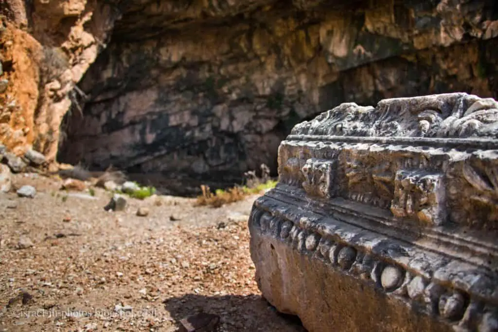
Water gives life, and people settle next to water resources. Near the spring, archaeologists found remains of the temple to Pan, which gave the site its name: Paneas or Pameas (pronounced Banias in Arabic).
Remains of a temple built by Herod the Great stand in front of the cave. After Herod’s death, his son Philip inherited this area, and in 2 BCE Philip founded his capital near the Banias Spring, calling it Caesarea Philippi.
Note: unless stated otherwise, all quotes were taken from the official website.
Do not confuse Caesarea Philippi, this site, and Caesarea National Park. The latter was founded by Herod the Great and located on the Middeterenian sea’s seashore.
Note: for additional information about the ancient city, see Caesarea Philippi.
What is the Meaning of Banias?
Banias is how Paneas is pronounced in Arabic. And Banias springs are called after the temple to the Greek god Pan which once stood in Caesarea Philippi.
Banias Springs
Note: Banias is an important Christian pilgrimage destination. For additional information about Jesus’s visit and what happened there, see Caesarea Philippi.
The first three trails start at Banias Springs. So let’s visit this area and then head to the trails.
When you enter the Banias springs area, you will see the springs and the cliffs.

We will follow the trail to points of interest #3 – The Temple of Pan.
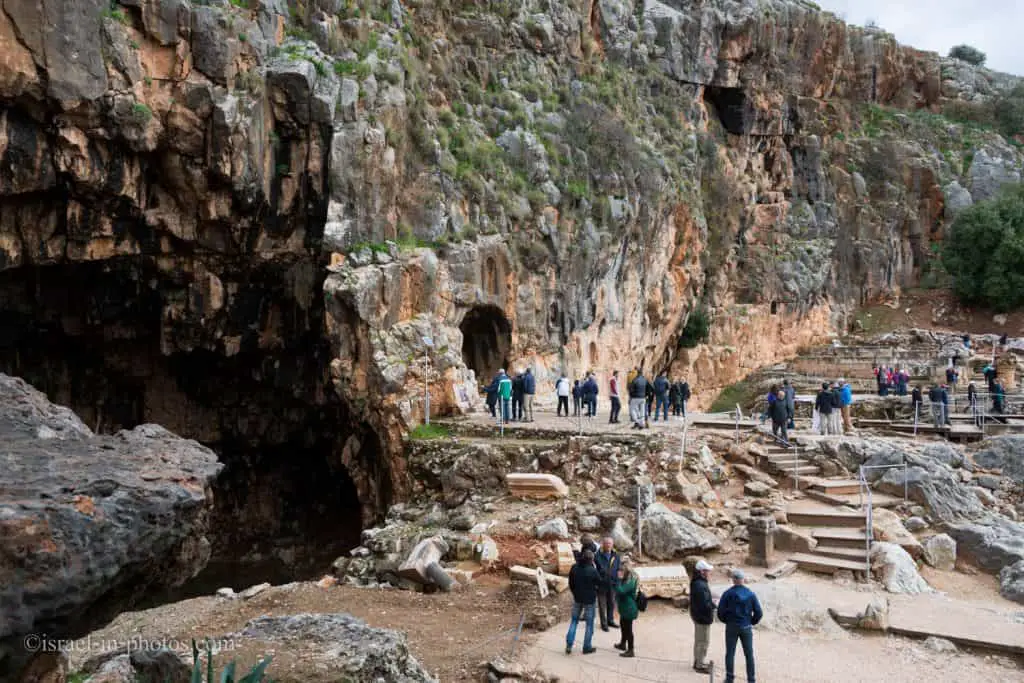
At the bottom of the photo above, you can see where the Temple of Pan once stood. And here is a picture of the proposed reconstruction of this site.

When the Greeks arrived at Banias, they were impressed by nature, especially the springs’ cave. Thus they decided to dedicate this cave to Pan.

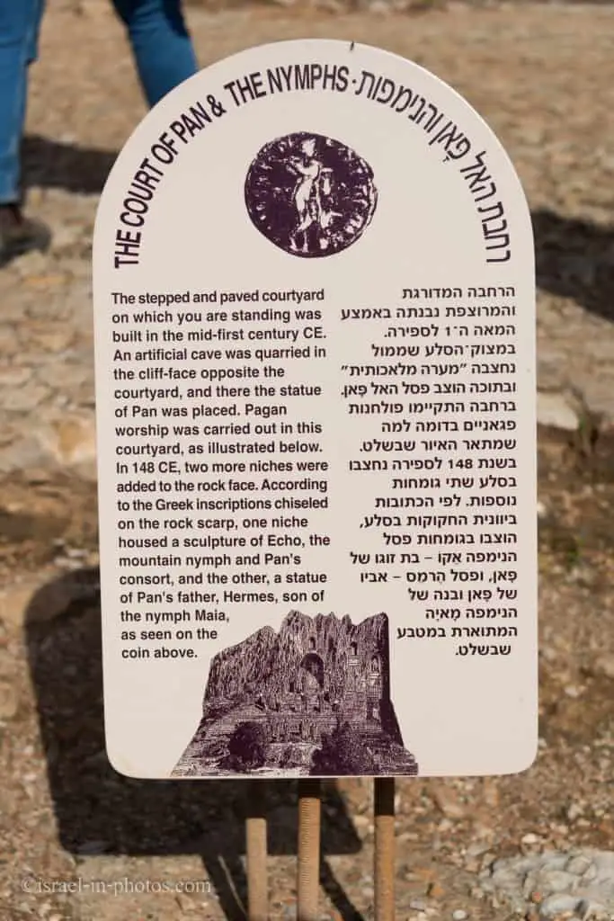
There are signs in this area telling about each building. Here is one of them.
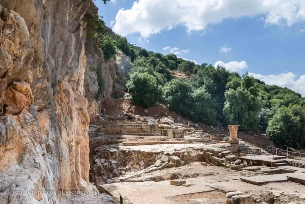
And here is the view of this area from the other side:

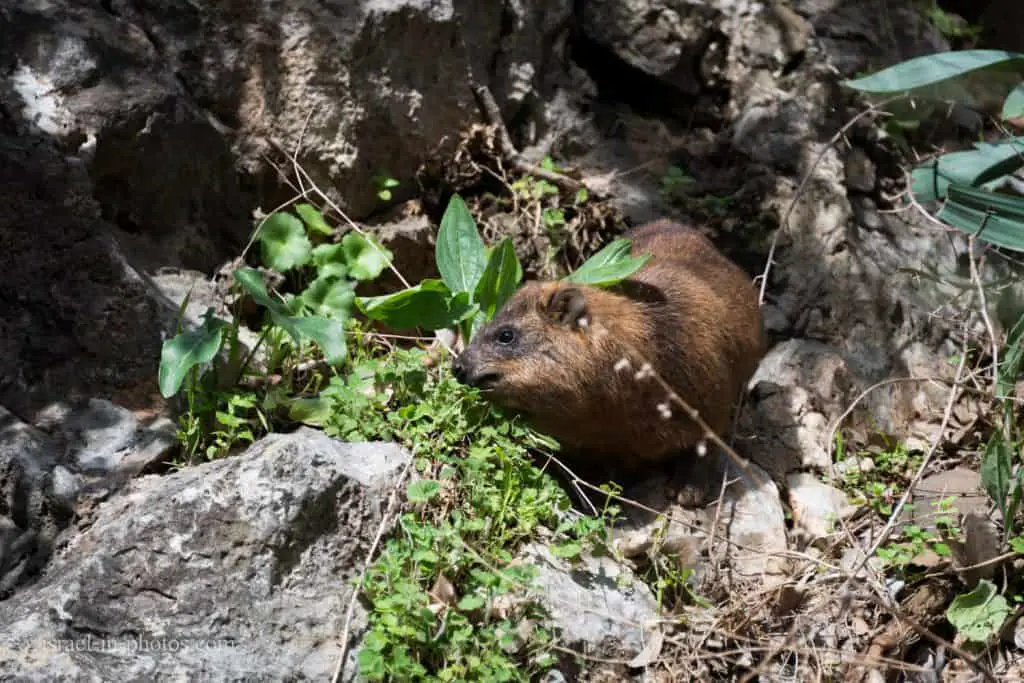
Also, while in this area, if you go to the side, towards the greenery, you might spot Rock hyrax.
Yellow, Purple, and Blue Trails – The Beginning
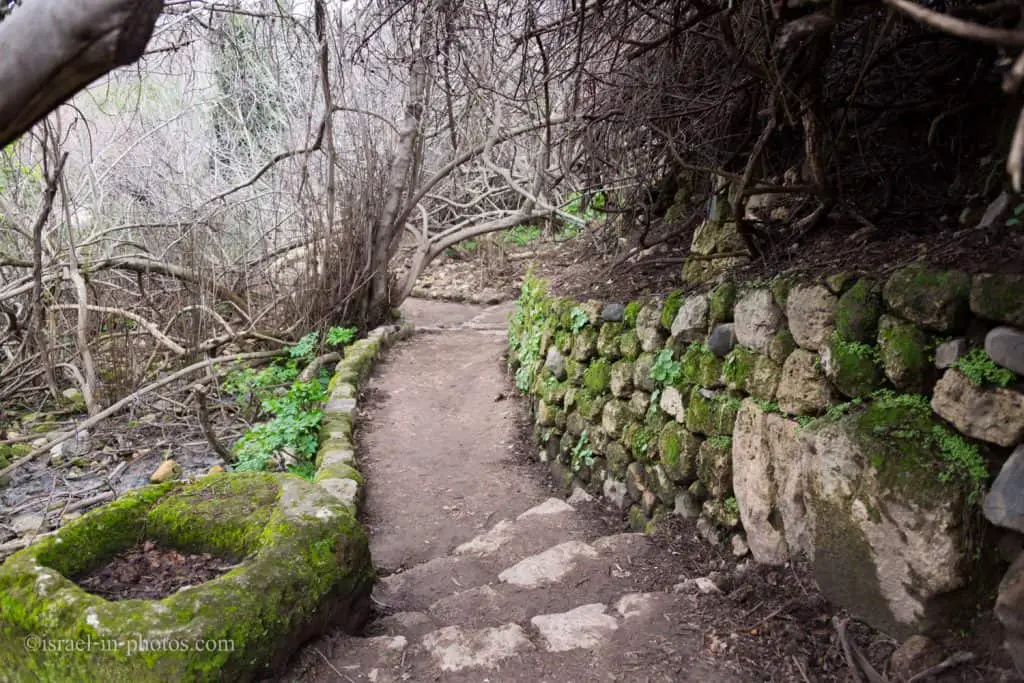
If you follow the water, you will see the beginning point of the three trails not far from the restrooms.
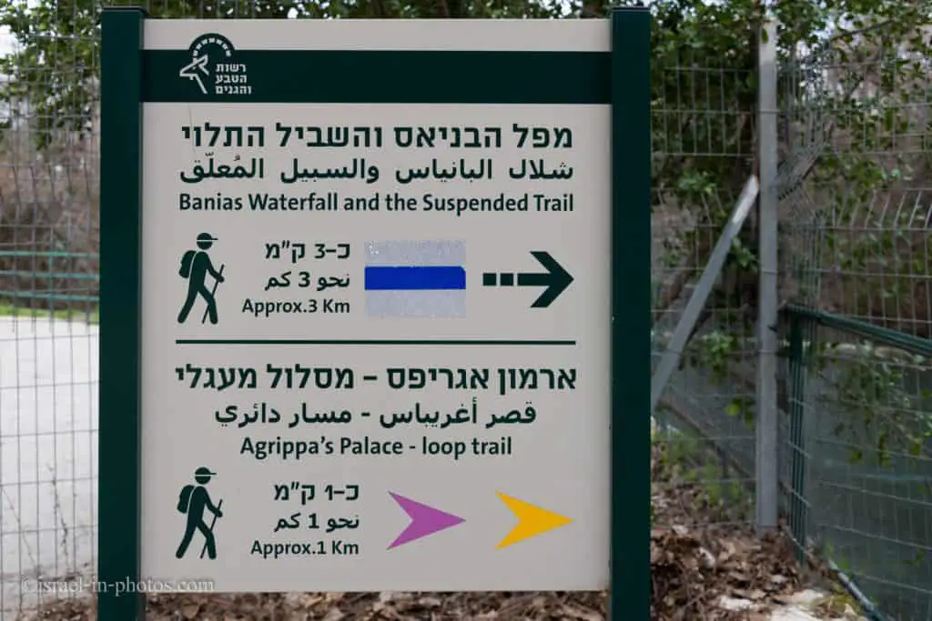
Since the Yellow, Purple, and Blue trails have a shared part, we will start with it and then take each track separately.
The Roman Bridge
We will continue until we reach the Roman bridge (#6 on the map). Near the bridge, you can see the meeting point of Govta and Hermon streams. And during the winter, the water flow here is impressive.

Hydroelectric Station
This station (#7 on the map) supplied electricity to the nearby villages till 1967.

Water Powered Flour Mill
The trail continued until we reached the point of interest #8, the Water Powered Flour Mill.

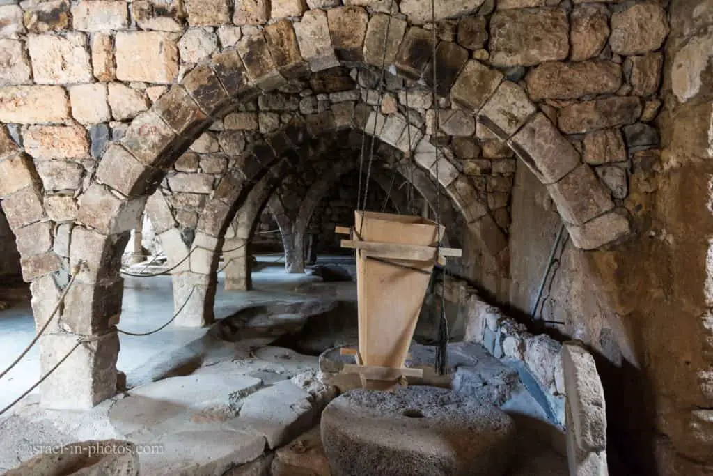
There are three milling wheels in the watermill, and one is still operational. And here is a schema describing its operation.

Usually, during weekends, when there are many visitors, you can buy Druze Pita bread with fillings in a nearby building.

After the watermill, the trails split. If you are short on time, take the purple path to the Palace of Agrippa. And if you want to make a longer hike, take the yellow trail, and towards the end (near the point of interest #16), do not exit the one-way gate. Instead, continue the purple path toward the Palace of Agrippa. This way, you will see both of these trails.
And lastly, if you are here for nature, and have a car in each parking lot, take the blue trail.