
Banias – Hermon Stream Nature Reserve – Visitors Guide
You can explore the rich history (Caesarea Philippi, Temple of Pan) and amazing nature (Banias waterfall) of Banias via four trails.
Table of Contents
- 1 Map
- 2 Tracks
- 3 Opening Hours
- 4 Entrance Fee
- 5 Swimming
- 6 Lodging
- 7 Names
- 8 What is the Meaning of Banias?
- 9 Banias Springs
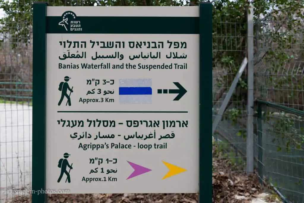
- 10 Yellow, Purple, and Blue Trails – The Beginning
- 11 Water Powered Flour Mill
- 12 The Yellow Trail
- 13 The Purple Trail
- 14 Banias Waterfall
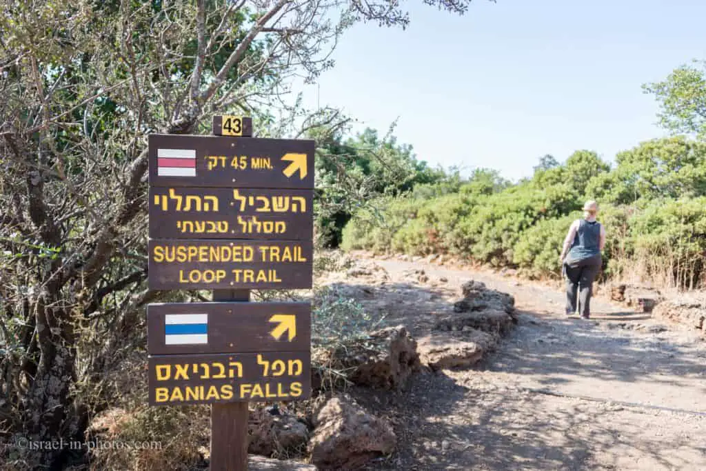
- 15 Banias Suspended Trail – The Red Trail
- 16 Common Questions
- 17 Latest News
- 18 Summary
Map
Banias Nature Reserve is located in Golan Heights. It has two entrances, and on the following map, I marked them.
Note: the following links will lead you to the spring entrance. You can find additional information below.
Directions for drivers: Link to Waze and Link to Google Maps
Directions for public transport: Link to Moovit
Interactive map of the area:
This Nature Reserve is extensive and has two entrances (Springs and Waterfall). Over the years, we visited it many times, and this post is a combination of those visits to two different areas of the Banias.
Here is the map of this National Park:

Note: you can click on the map to enlarge it. And in the following sections, you will see parts of this map with trail markings.
Directions
If you are driving to this park, enter its name into the navigation app (wondering which app to use, then see Useful Apps in Useful Information For Tourists To Israel). You can enter “Hermon Stream (Banias) Nature Reserve” into Waze. Also, keep in mind there are two entrances to this nature reserve. Select the required one.
Getting to this Nature Reserve using public transport is inconvenient. For example, reaching Banias from Tel Aviv will require at least three buses, a 1.5 km walk by road #99, and more than four hours. Here is a link to Moovit, where the destination is already set. Just enter your starting position, and you will get the updated directions.
Tracks
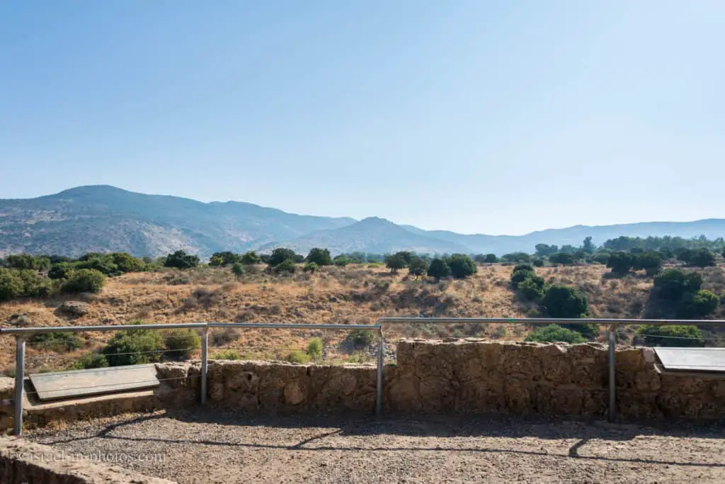
The map above shows two main areas: Banias Spring (#1 on the chart) and Banias waterfall (#37 on the diagram). Near each area, there is an entrance and a parking lot.
As you can see from the map photo, there are four trails. The trails allow visiting each area separately. Three of them are loop hikes. And the blue way that leads from the springs to the waterfall is a one-way trail. If you choose it, you will need two cars, one in each parking lot.
| Track Color | Description | Starting Point | Ending Point | Hiking Duration (minutes) | Point of Interest on the Way |
|---|---|---|---|---|---|
| Yellow | Loop trail to the Crusaders’ city and back | Banias springs parking | Banias springs parking | 45 | 1-8, 11-17 |
| Purple | Loop trail to the Agrippa II palace and back | Banias springs parking | Banias springs parking | 45 | 1-8, 21-26 |
| Blue | The one-way trail from the springs to the waterfall | Banias springs parking | Banias waterfall parking | 90 | 1-8, 31-37 |
| Red | Loop trail that leads to the waterfall via the Suspended Trail | Banias waterfall parking | Banias waterfall parking | 45 | 35-37, 41-43 |

Besides the four suggested trails by Israel Nature and Parks authority, I propose another two options.
- Yellow – Purple: you can combine both trails to make a slightly longer hike that will allow seeing more. Start by following the yellow path till the point of interest #16. Then instead of exiting through the rotating gate, you take the purple trail towards the Palace of Agrippa II (point #24).
- Banias Waterfall: I loved Banias Suspended Trail, but if you do not have enough time (or already took one of the hikes from Banias springs), you can go to the waterfall directly from the waterfall parking lot. It will take approximately 20 minutes.
Note: the trail marking across this nature reserve is clear, and you do not need any extra maps besides the one you get in the booklet.
Opening Hours
Sunday – Thursday and Saturday: 8:00 – 17:00 (16:00 in winter).
Friday: 8:00 – 16:00 (15:00 in winter).
On holiday eves, usually 8:00 – 13:00.
Note: Since the pandemic, the Israel Nature and Parks Authority has started limiting the number of people in each park. Thus, reservations are recommended through the official site (you can find the link below).
Entrance Fee
Adult – 28 NIS, child – 14 NIS, and students – 24 NIS. And free for National Parks annual subscribers.
If you are going to visit several National Parks, then consider purchasing a combo ticket. You can find additional info at National Parks And Nature Reserves.
Note: opening hours and ticket prices were updated in September 2022. In any case, recheck the official site before visiting.
Swimming
Entering the water at Banias Nature Reserve is forbidden. And if you want a place where kids can play in the water, check out the nearby Tel Dan Nature Reserve and Horshat Tal National Park.
Lodging
There is a variety of options for lodging in this area. You can stay in a hotel or rent an apartment in nearby villages and cities (like Kiryat Shmona). To see available places and prices, check out this map from booking.com.
Booking.comIf you prefer camping, consider Horshat Tal (complete list of campsites in National Parks).
Names
Why does this nature reserve have several names? Banias spring emerges at the foot of Mount Hermon. It flows through a canyon for 3.5 km, which leads to the most impressive waterfall in Israel. Nine kilometers from its source, the Hermon stream meets the Dan River, forming the Jordan River.
The paragraph above explains the Hermon Stream name. Where does the name Banias come from? This photo may give you a hint:
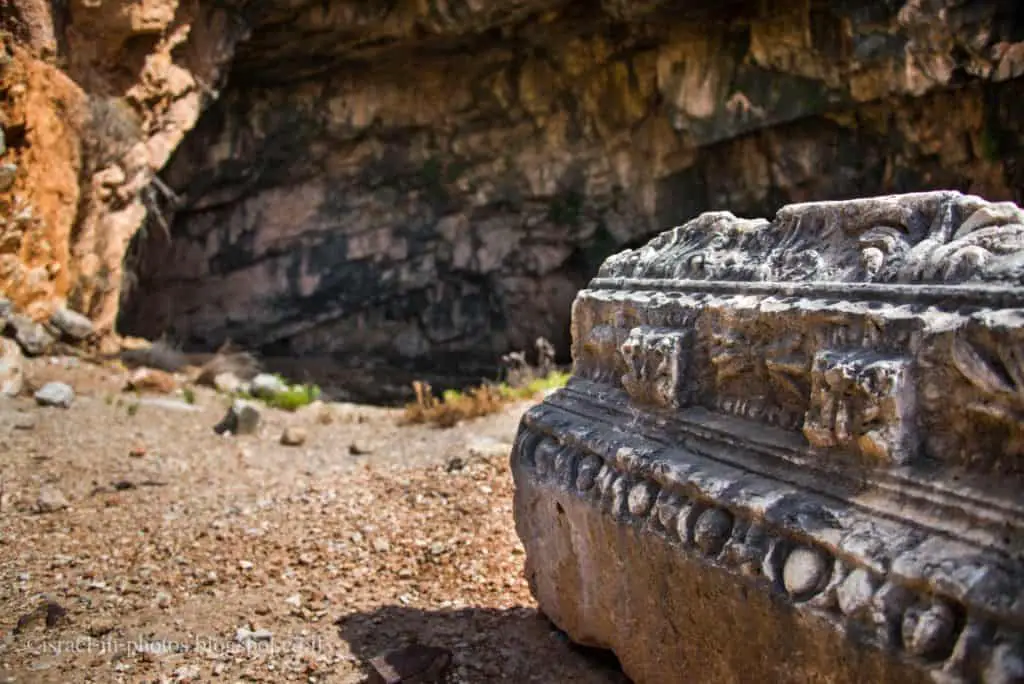
Water gives life, and people settle next to water resources. Near the spring, archaeologists found remains of the temple to Pan, which gave the site its name: Paneas or Pameas (pronounced Banias in Arabic).
Remains of a temple built by Herod the Great stand in front of the cave. After Herod’s death, his son Philip inherited this area, and in 2 BCE Philip founded his capital near the Banias Spring, calling it Caesarea Philippi.
Note: unless stated otherwise, all quotes were taken from the official website.
Do not confuse Caesarea Philippi, this site, and Caesarea National Park. The latter was founded by Herod the Great and located on the Middeterenian sea’s seashore.
Note: for additional information about the ancient city, see Caesarea Philippi.
What is the Meaning of Banias?
Banias is how Paneas is pronounced in Arabic. And Banias springs are called after the temple to the Greek god Pan which once stood in Caesarea Philippi.
Banias Springs
Note: Banias is an important Christian pilgrimage destination. For additional information about Jesus’s visit and what happened there, see Caesarea Philippi.
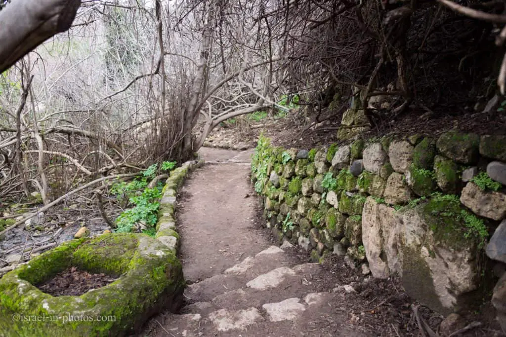
The first three trails start at Banias Springs. So let’s visit this area and then head to the trails.
When you enter the Banias springs area, you will see the springs and the cliffs.

We will follow the trail to points of interest #3 – The Temple of Pan.
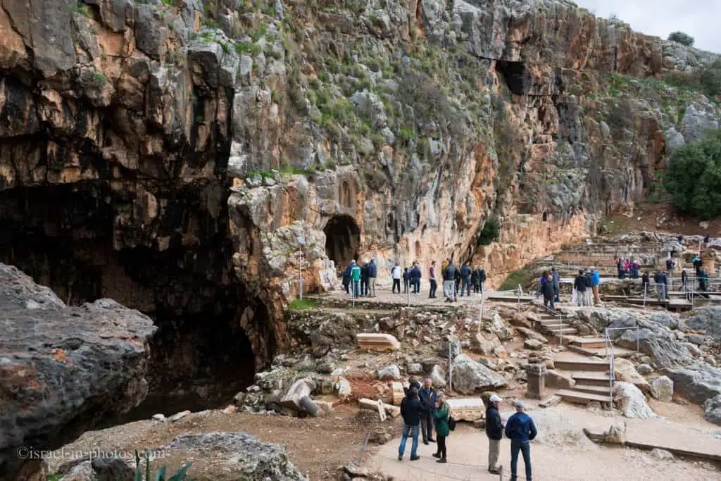
At the bottom of the photo above, you can see where the Temple of Pan once stood. And here is a picture of the proposed reconstruction of this site.

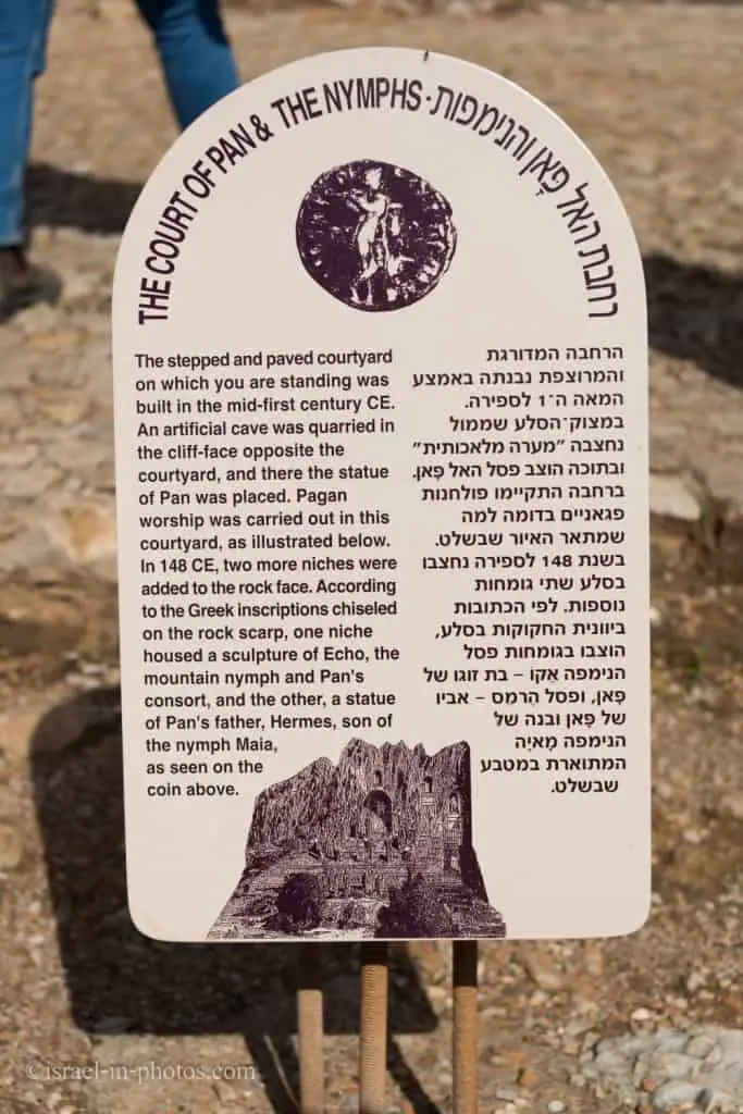
When the Greeks arrived at Banias, they were impressed by nature, especially the springs’ cave. Thus they decided to dedicate this cave to Pan.

There are signs in this area telling about each building. Here is one of them.
And here is the view of this area from the other side:

Also, while in this area, if you go to the side, towards the greenery, you might spot Rock hyrax.
Yellow, Purple, and Blue Trails – The Beginning
If you follow the water, you will see the beginning point of the three trails not far from the restrooms.
Since the Yellow, Purple, and Blue trails have a shared part, we will start with it and then take each track separately.
The Roman Bridge
We will continue until we reach the Roman bridge (#6 on the map). Near the bridge, you can see the meeting point of Govta and Hermon streams. And during the winter, the water flow here is impressive.

Hydroelectric Station
This station (#7 on the map) supplied electricity to the nearby villages till 1967.

Water Powered Flour Mill
The trail continued until we reached the point of interest #8, the Water Powered Flour Mill.

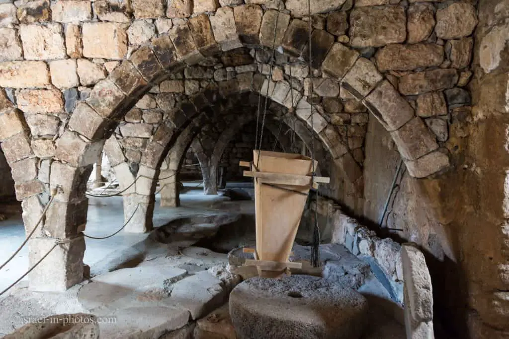
There are three milling wheels in the watermill, and one is still operational. And here is a schema describing its operation.

Usually, during weekends, when there are many visitors, you can buy Druze Pita bread with fillings in a nearby building.

After the watermill, the trails split. If you are short on time, take the purple path to the Palace of Agrippa. And if you want to make a longer hike, take the yellow trail, and towards the end (near the point of interest #16), do not exit the one-way gate. Instead, continue the purple path toward the Palace of Agrippa. This way, you will see both of these trails.
And lastly, if you are here for nature, and have a car in each parking lot, take the blue trail.

The Yellow Trail
After the watermill, you will have to choose a trail. You can select the yellow path or the purple one. We will review both.
As you continue along the yellow path, you will pass under the bridge of road #99. You will also see there a demolished bridge. The Syrians demolished the destroyed Syrian bridge (marked as #11 on the map) during the Six-day war when they retrieved their forces.
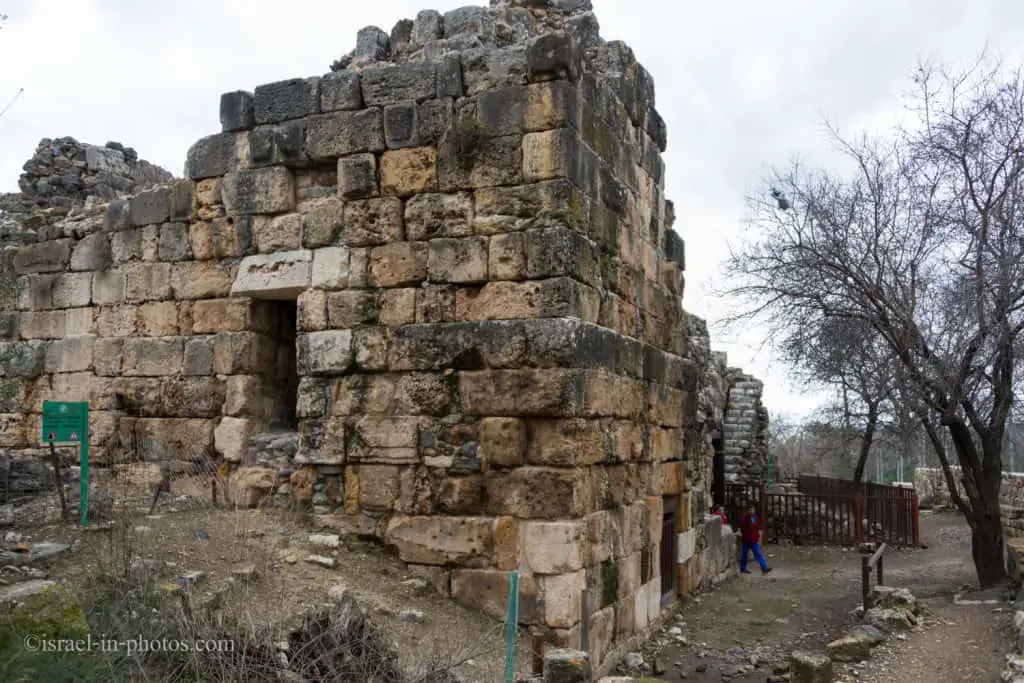
Mamluke Gate
As we continue walking along the Saar stream (not far from Saar falls), we will see some stairs and a building. That is the Mamluke Gate (marked as #12 on the map).

These are the most impressive remains of the middle ages. It is a big room, and its height is seven meters. The thickness of its walls is about two meters, with two openings. One leads inside the fortress and the other outside. There was a bridge above the Saar stream, but it was destroyed during the 19th century.
The trail continues along the Crusader city wall (#14), and it will lead you through the dry moat (#15).
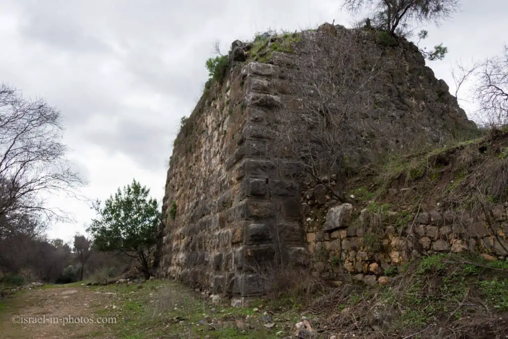
Corner Tower
Soon you will reach the Corner Tower (marked as #16 on the map).

In the northern corner of Crusader city, you can see the remains of a Syrian house built on top of the corner house. And on the following sign, you can see that this structure has parts of five different periods.

You can either follow the yellow trail and return to Banias springs or take the purple path back to the Palace of Agrippa from the Corner Tower.
The Purple Trail
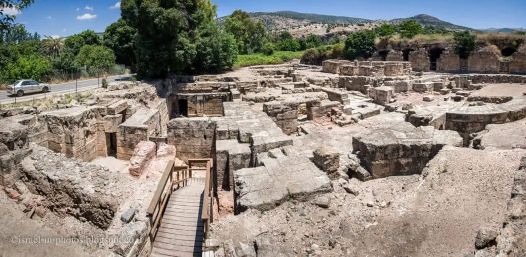
If you choose the purple trail after the water-powered flour mill, you will soon reach the Palace of Agrippa (marked as #24).
Who was Herod Agrippa II?
Herod Agrippa II was the grand-grandson of Herod the Great.
Herod Agrippa II (AD 27/28 – c. 92 or 100) officially named Marcus Julius Agrippa and sometimes shortened to Agrippa, was the eighth and last ruler from the Herodian dynasty. He was the fifth member of this dynasty to bear the title of king, but he reigned over territories outside of Judea only as a Roman client. Agrippa was overthrown by his Jewish subjects in 66 and supported the Roman side in the First Jewish–Roman War.
Source: Wikipedia
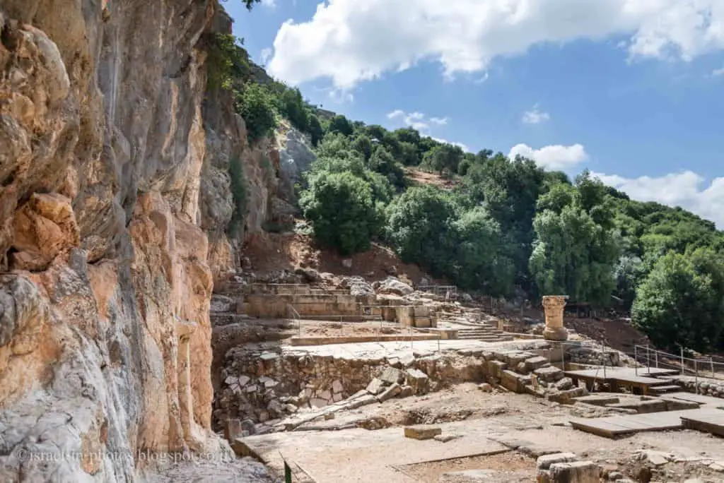
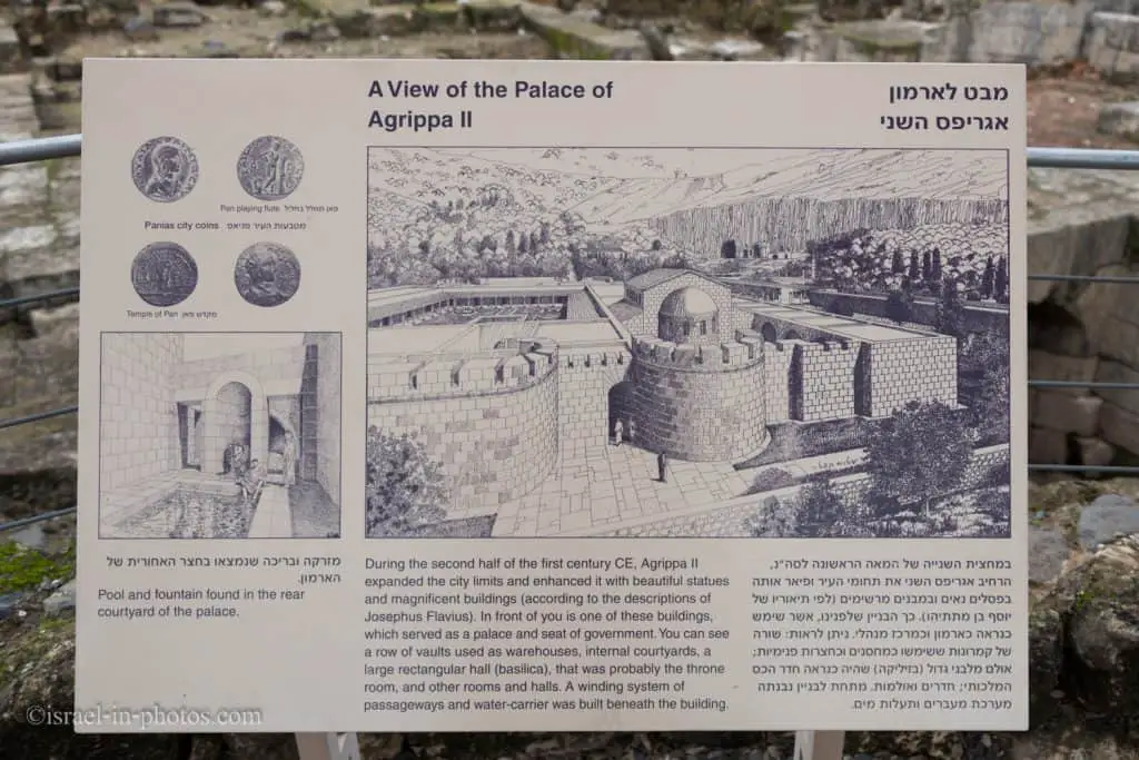
Palace Of Agrippa II
A public building that was built at the beginning of the first century BC was also uncovered at the archaeological site. The building covered more than 2,000 sq.m. and was one of the largest and most magnificent in Israel. Researchers believe that it was the palace of Agrippas II.
Source: official site

Looking closer at the photo above, you can see Nimrod Fortress on top of the mountain to the right.
And here is what it probably looked like:
Inside the Palace Of Agrippa II, you can find the remains of an old Synagogue.
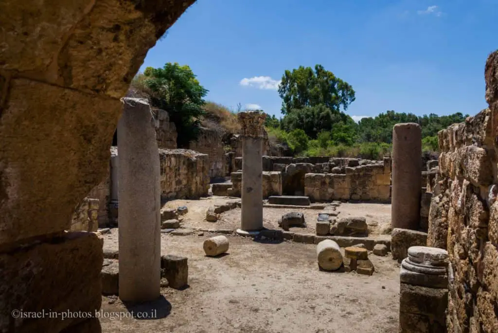
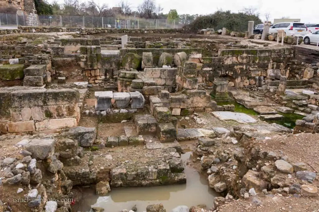
The purple trail will lead you back to the Banias springs, and just as you pass the entry gate, you will see excavation area B to your left.
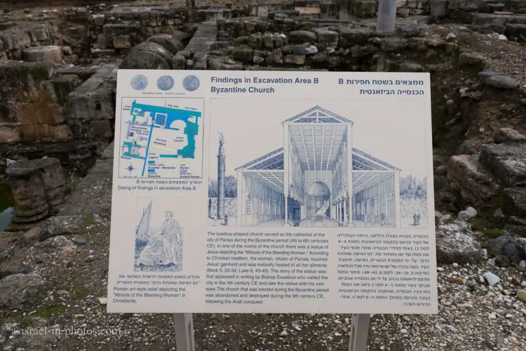
Byzantine Church
In excavation area B (marked as #17), you can see the remains of a Byzantine church.
And this is how it looked with the “Miracle of the Bleeding Woman” relief.
Banias Waterfall
And now, let’s drive to the waterfall parking. You can enter the site with the same ticket (that you already purchased at the Springs entrance). If you want to see the waterfall, you can either hike the red trail or go straight down to the waterfall. It will take approximately 20 minutes to reach the waterfall if you go directly to the waterfall.

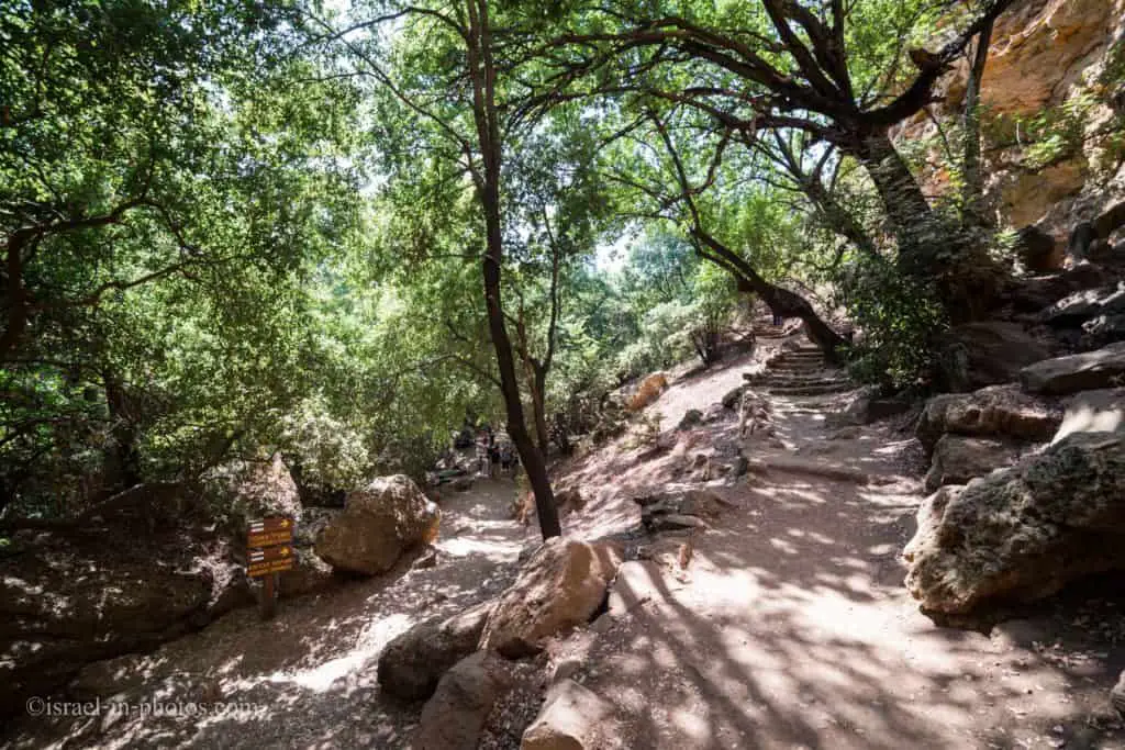
Banias Suspended Trail – The Red Trail
The suspended trail was constructed recently. And if you have not visited Banias for more than five years, you probably have not been there yet. It is about an hour-long trail starting at waterfall parking. This loop trail goes through the suspended track and waterfall and returns to the waterfall parking.
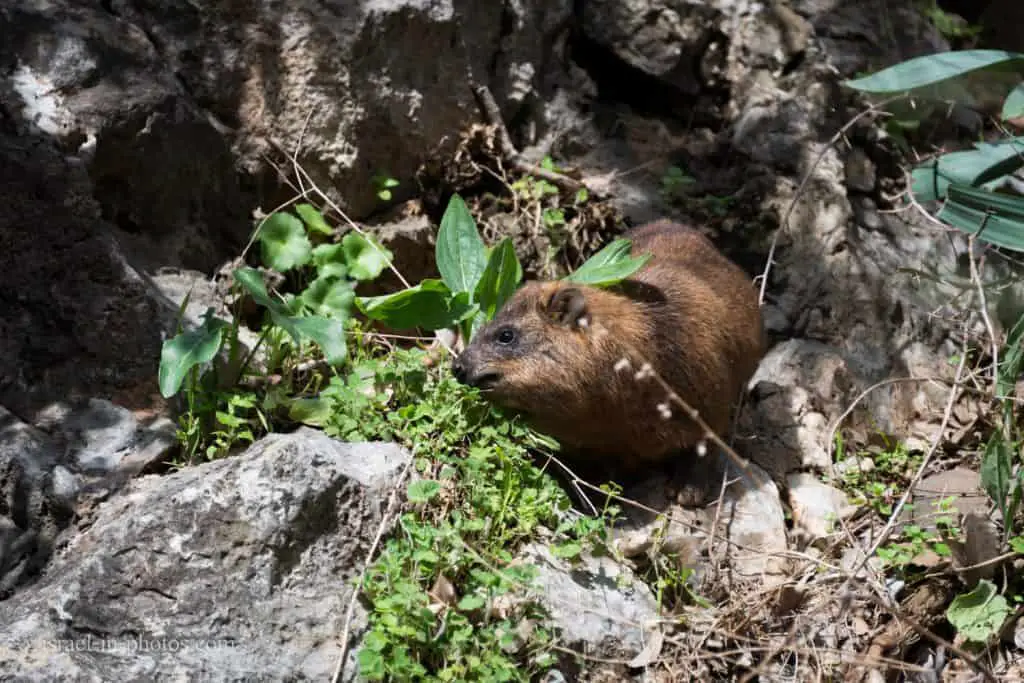
We arrived early and were among the first visitors. Probably because of that, we saw rock badgers.

I did not expect to find rock badgers there. Usually, I see them in Ein Gedi and Rosh HaNikra grottoes.
You will reach the first viewpoint as you enter the waterfall gate and go straight for five minutes. On top of the mountain in the center, you can see Nimrod Fortress.
And on this viewpoint, you can select the trail. We choose the suspended path.

The suspended trail starts with a light flat walk. Afterward, you start going down towards the stream. The down part is also not hard, and the walk would be a breeze if you do not have a specific health condition. But, this part has stairs, so it is unsuitable for baby strollers.

My first reaction was amazement. It was hard to believe we were still in Israel. The last time we saw similar views was in Switzerland.

Nature, water, and silence. As I said, hard to believe we are in Israel.
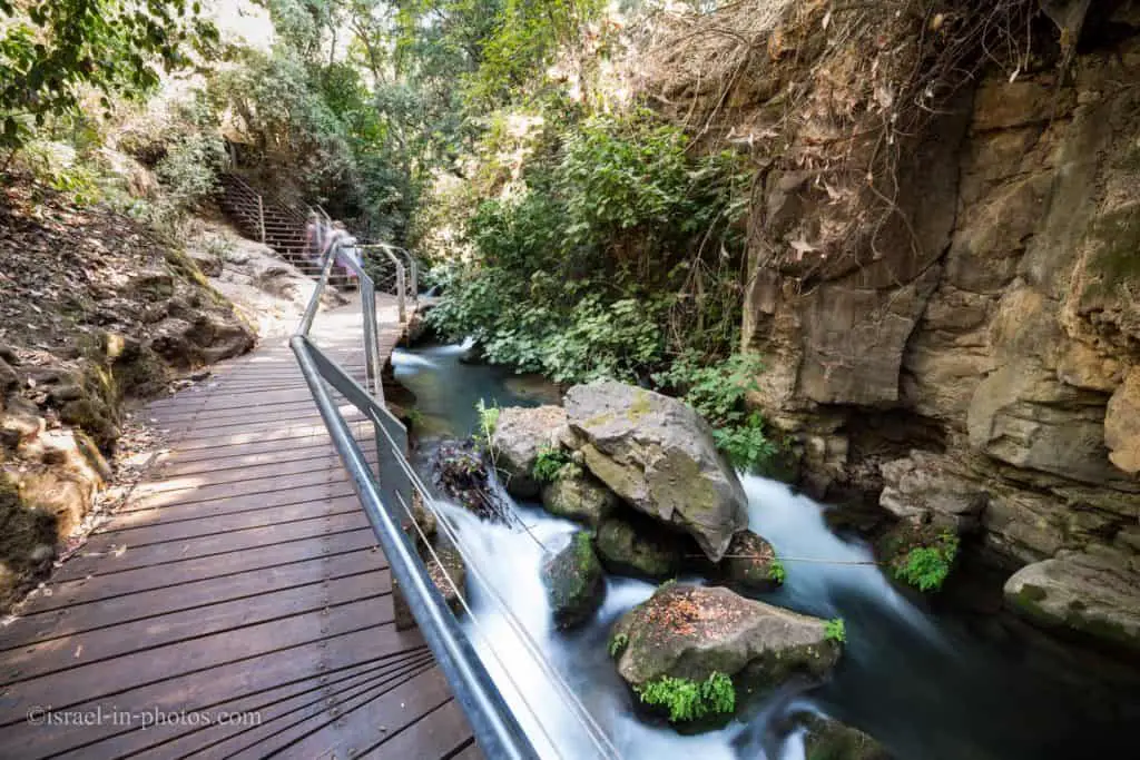
The suspended trail is not long. You can pass this part in 5-10 minutes. But, despite its’ shortness, definitely worth a visit.
The Hanging Trail – the Nature and Parks Authority has made part of the stream accessible by means of the “hanging trail”, 100 meters long, along which you can walk close to the rushing waters.
At the exit from the suspended trail and at the top of the photo, you can see signs pointing to the waterfall.

While walking along the stream, we saw small ponds with fish.

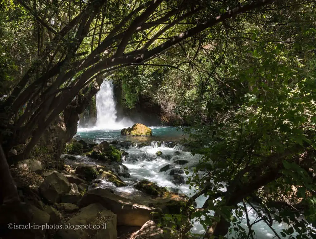
After about an extra twenty-minute hike, we reached the Banias waterfall. It is one of the most beautiful waterfalls in Israel.
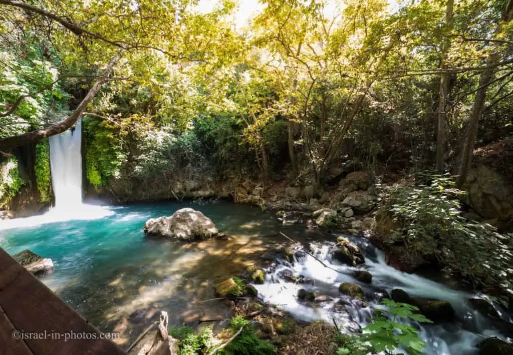
The Banyas Waterfall is the most powerful waterfall in Israel – it falls 10 meters with enormous force and noise into a beautiful pool surrounded by vegetation. You can view the waterfall (and get wet from the splashing water) from the well-built wooden boardwalk. The noise of the flowing water and the spectacular sight make this a most enjoyable experience.
A broader view of the Banias waterfall:

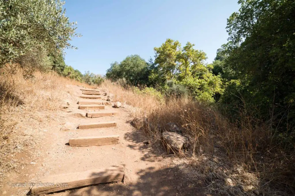
And here we are on our way back. On the left is the trail we came from, and on the right, the stairs lead back to the waterfall parking.
Note: if you love waterfalls, check out the nearby Saar Falls.
Common Questions
Entering the water at Banias Nature Reserve is forbidden. And if you want a place where kids can play in the water, check out the nearby Tel Dan Nature Reserve and Horshat Tal National Park.
Banias Nature Reserve is located in Golan Heights.
Banias is how Paneas is pronounced in Arabic. And Banias springs are called after the temple to the Greek god Pan which once stood in Caesarea Philippi.
Latest News
44 Byzantine gold coins were discovered
Summary
Banias – Hermon Stream Nature Reserve is among Israel’s most beloved nature reserves. And I think there are several reasons for its popularity.
First of all, there is water, including the waterfall. Secondly, there is a lot of greenery. Both these facts make the trails not only beautiful but shaded (and cooler) as well. And thirdly, at Banias springs, you can find significant archeological remains. That makes the site versatile, and whether you love nature or archeology, it is worth a visit!
We enjoyed all our trips. What about you? Have you ever visited the Banias Nature Reserve? What is your favorite trail? Tell us in the comments below about your experience.
That’s all for today, and I’ll see you in future travels!
Stay tuned!
Additional Resources
Here are several resources that I created to help travelers:- Trip Planner with Attractions and Itineraries is the page that will help you create your perfect travel route.
- What is the Best Time to visit Israel? To answer this question, we will consider the weather, prices, holidays, festivals, and more.
- Information and Tips for Tourists to Israel will answer the most common questions tourists have about Israel (including safety, passports, weather, currency, tipping, electricity, and much more).
- Israel National Parks and Nature Reserves include a complete list, top ten, map, tickets (Israel Pass, Matmon, combo), and campsites.
- If you are looking for things to do, here are the pages for Jerusalem, Tel Aviv, Haifa, Sea Of Galilee, Akko (Acre), Eilat, Nazareth, Safed (Tzfat), and Makhtesh Ramon.


I swam in the pool below the falls in 1978, with a number of Israeli soldiers, during a hot august it was a free secluded site then.
🙂
Times changed. Today there is a wooden deck with railing and you can’t get too close to the water.
a little below the waterfall ends the territory of the reserve, which is actually only a small section of Banias, there is still a Syrian tank that fell into the gorge, and there is completely free entrance and swimming. This is my favorite site, it goes from Kibbutz Snir to Shear Ishuv. the trail has markings, red and white stripes and black and white, very beautiful and a lot of greenery.
Спасибо за информацию Валентина.
What should I write in the way to get to where the inverted tank is?
Сирийский перевёрнутый танк находитса за пределом (южнее) националного парка.
Самый короткий путь – зеленая тропа с кладбища Кибуца Снир (дорога 9991 перед въездом в Кибуц Снир).
Waze: https://ul.waze.com/ul?ll=33.23505317%2C35.67663074&navigate=yes&utm_campaign=default&utm_source=waze_website&utm_medium=lm_share_location
Карта местности: https://israelhiking.osm.org.il/poi/OSM/node_999336598?language=he
Great post.
Thanks a lot. Glad you liked it.
Like!! Really appreciate you sharing this blog post.Really thank you! Keep writing.
Thank you.
Great post! Thanks
I’m glad you found it helpful, Oleg.