Yarkon National Park – Yarkon Springs Compound – Visitors Guide
Yarkon Springs in Yarkon National Park is good for a picnic, hiking along the Yarkon River, or staying at the campground.
Note: This article contains information about Yarkon Springs. If you are interested in the other Yarkon National Park compound, check out Tel Afek (Antipatris).
Table of Contents
Map
Yarkon National Park is in central Israel between Petah Tikva and Rosh Haayin.
Directions for drivers: Link to Waze and Link to Google Maps
Directions for public transport: Link to Moovit
Interactive map of the area:
Yarkon National Park has two compounds with two separate entrances. I marked both regions on the map above, and you can also see them on the following map.

Note: you can click on the map to enlarge it.
On the right side of the map, you can find Tel Afek. You will see Antipatris Fort, the British water pumping station, the artificial lake, paddling pools, and other points of interest.
And on the left side of the map, you can find the Yarkon Springs area. You can walk along the Yarkon River in this region and see the Yarkon bream pool, Al-Mir flour mill, and several other places. Also, the camping area is situated in the Yarkon Springs area.
No road inside the park connects Tel Afek and the Yarkon Springs area. There is only a hiking trail between the two parts of the park. That means that you have to choose in advance where to park your car and hike from there. If you want to drive from one part of the park to another, you must exit and drive around the national park.
Trails at Yarkon National Park
There are several options for hikes. The first two options would be a short hike in each area (about half an hour to an hour). You can also extend these hikes by visiting the Water-Lilly Ponds in the middle of the map (marked as #6 on the map above). Then, a typical hike will take about one and a half to two hours. And the longest walk includes visiting both areas. If you have a car parked in each region, it will take about two hours. Otherwise, you must return to the initial point, a four-hour walk.
Note: sometimes, the gates that allow hiking from one park’s compound to another are closed. Thus, if you plan to walk from one area to another, contact the Israel Nature and Parks Authority in advance.
Directions
You can reach the entry to Yarkon Springs from road #40 or use the links above the interactive map.
Note: there are many parking spaces inside each section of the park.
Opening Hours
Sunday – Thursday and Saturday: 8:00 – 17:00 (16:00 in winter).
Friday: 8:00 – 16:00 (15:00 in winter).
On holiday eves, usually 8:00 – 13:00.
Note: Since the pandemic, the Israel Nature and Parks Authority has started limiting the number of people in each park. Thus, reservations are recommended through the official site (you can find the link below).
Entrance Fee
Adult – 28 NIS, child – 14 NIS, and student – 24 NIS. Free for National Parks annual subscribers.
If you visit several National Parks, consider purchasing a combo ticket. For additional information, see National Parks and Nature Reserves.
Note: the entry ticket is valid for both areas on the same day.
Note: opening hours and entrance fee were updated in April 2024. In any case, recheck the official site before visiting.
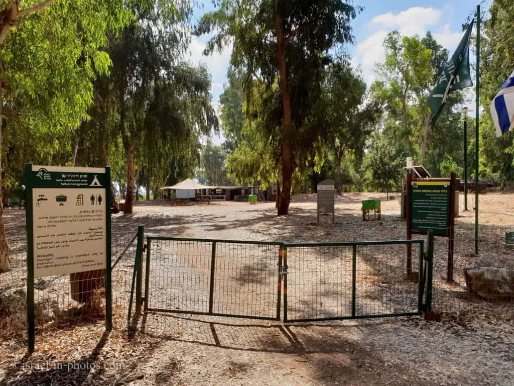
Camping
If you are looking for a place to spend the night in this area, Yarkon Campsite can be a good alternative. It is located inside Yarkon Springs, and you can see it on the map above between points #10 and #12.
The lodging options include tents, staff rooms, and a caravan park. You can find additional information, including pricing and availability, at the official site.
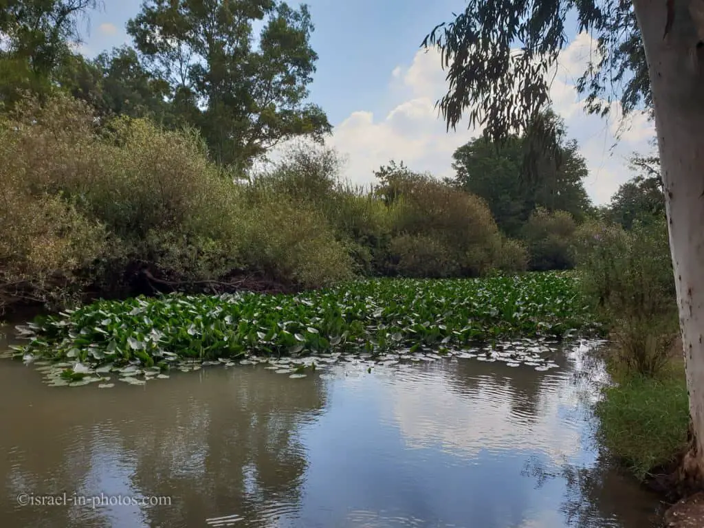
Yarkon River
Since life begins with water, let’s start with a short review of the Yarkon River.
In Arabic, the Yarkon river is called “Al-Auja” – meandering. The total length of the river, from the springs at Rosh Ha’Ayin to the sea, is 27.5 km, and within the boundaries of the national park, it is 17.7 km. In the past, the Yarkon was the coastal river with the greatest flow capacity in Israel: the water flowing from its springs produced an annual quantity of 220 cubic meters. However, in 1955 the government began pumping water from the Yarkon to the Negev via the National Water Carrier. The Yarkon lost its power, and the quantity of spring water flowing in it gradually declined. The decrease in the quantity of water reduced Yarkon’s self-cleansing capability.
In the 1960s, a momentum of construction began around the river – the cities of the Dan region and other towns around it were built up, and industrial and domestic sewage flowed into the river, leading to severe pollution.
Towards the 1970s, sewage treatment facilities were established in the region, but the wastewater was of poor quality, and the pollution of the river continued. Today, as part of the “Yarkon Redemption” project, the wastewater treatment facilities have been upgraded, and a system of green basins was constructed to deal with the wastewater before it reaches the river. The upgrading and pre-treatment improved the quality of the sewer and the condition of the river in general. Simultaneously, accidents do happen occasionally, and the quality and capacity of the water are not stable. Nature and Parks Authority believe that rivers must be rehabilitated by using source water only.
Note: unless stated otherwise, all quotes were taken from the official site.
After all this intro, let’s start our visit by walking along the Yarkon River.
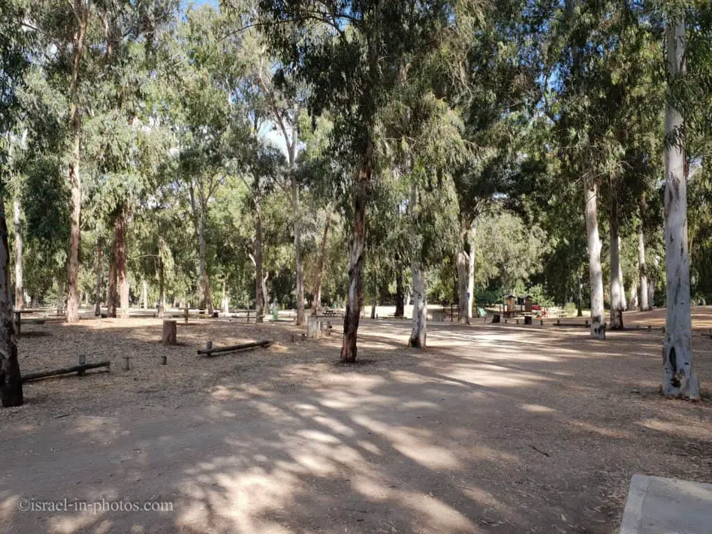
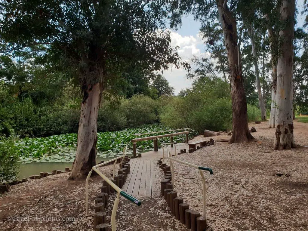
As you can see from the photo above, there are many parking spaces and picnic tables.
A walking path has been prepared and wooden piers installed along the river. During the walk along the path, ancient agricultural facilities come into view. These facilities exploited the river’s water over the years: the Kasser farm, the Al-Mir flour mill, and the pumps building.
The Pillbox
We parked near the southern restrooms and, after a short walk, reached point #7 – the Pillbox.
The Railway Station and the “Pillbox” – the Palestine Railway line was built in 1922, on the initiative of Petah Tikva residents in order to connect the region to the mainline that went from Emek Yizre’el southward, to Egypt. The railway transported agricultural produce to the ports of Haifa and Yafo, as well as passengers on the Petah Tikva – Rosh Ha’Ayin line, and was called the “Hebrew Railway”. The “pillbox” was built by the British during the Arab revolt that occurred between 1936 and 1939. It is a small structure that served as a post for the guard who watched over the railway line and the bridge above the river from rioters. On the structure the British crown and the letters P.R.R.D. are painted, which is the name of the Palestine Railway guard detail.

The original plan was to reach point #6, but the gate was closed. Thus, we could not get closer to the Pillbox as well.

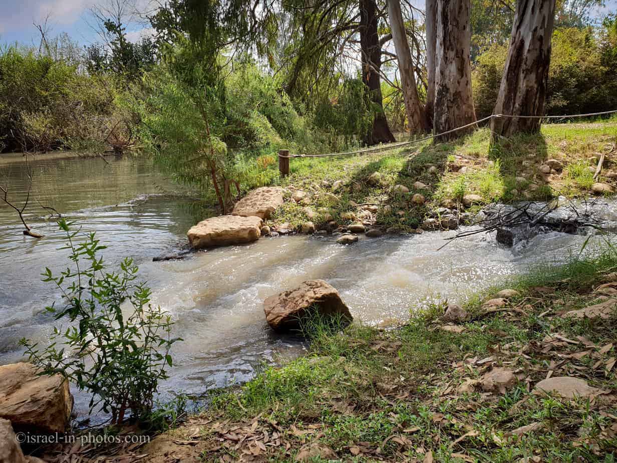
We continued walking along the Yarkon River, and near the water authority survey dam (point #9), we found a spring.

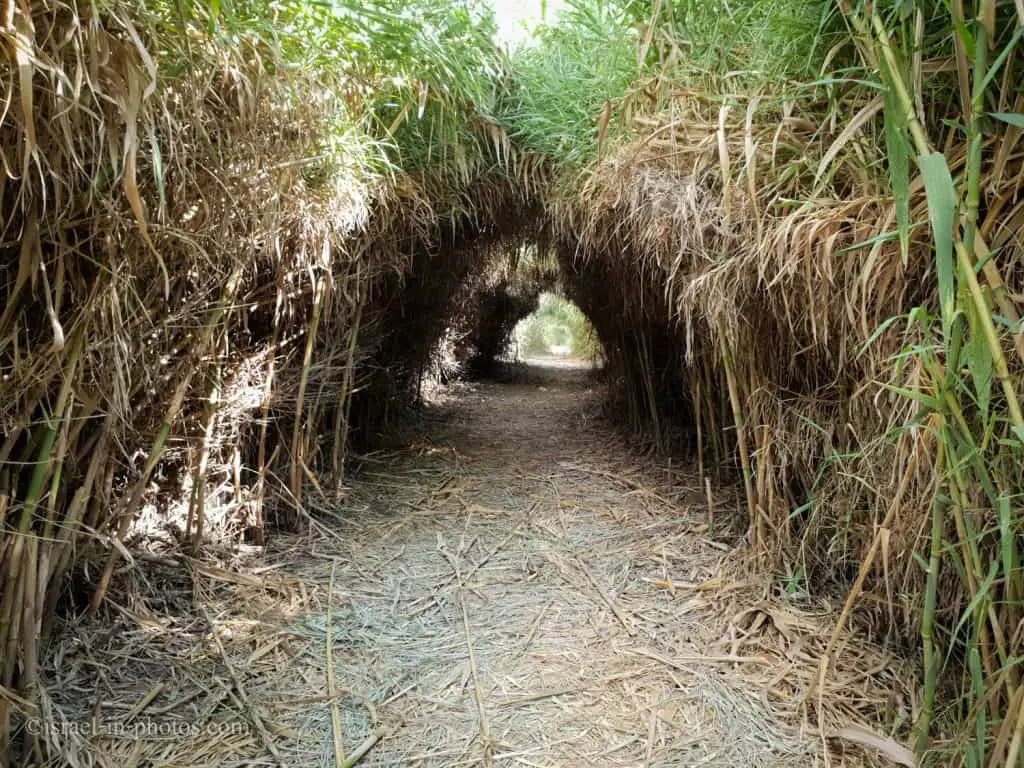
Papyrus
Further on the way, we saw Papyrus plants and a short explanation. Everybody knows that the Egyptians used Papyrus to create paper. However, the fact that Papyrus is mentioned five times in the Bible is less known.
Exodus 2:3 (New International Version):
But when she could hide him no longer, she got a papyrus basket for him and coated it with tar and pitch. Then she placed the child in it and put it among the reeds along the bank of the Nile.


While walking along the river, we saw several signs on the side, so we headed there.

The Iridescent Toothcarp Pool
This small pool is marked as #9 on the map. Though the official site mentions the Yarkon Bream, the sign on-site mentions the Iridescent Toothcarp.
The Yarkon Bream Pool – the Yarkon bream (Acanthobrama Telavivensis) is an endemic species that used to be widespread in Israel’s coastal streams, but had almost disappeared due to pollution and drying up of the streams. In order to prevent the eradication of this species, individuals were grown in a breeding facility, and their descendants were returned to the river into a pool located to the east of the Al-Mir flour mill, within a fenced-off area, protected from human disturbance and pollution.
Note: for additional information about the Yarkon Bream, check out Ein Afek Nature Reserve.
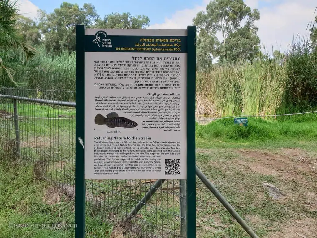
The Iridescent Toothcarp is a fish that lives in Israel in the Galilee, coastal streams, and even in the Enot Tsukim Nature Reserve near the Dead Sea. In the Yarkon River, the Iridescent Toothcarp became extinct due to poor water quantity and quality. To restore the Iridescent Toothcarp to the Yarkon, individuals were collected from the Taninim Stream and were placed in the pool you see here. The purpose of the pool is to allow the fish to reproduce under protected conditions (without predators). The fry are expected to hatch in the spring and summer; we will introduce them at selected sites along the Yarkon.
We have already successfully reintroduced an extinct fish to the Yarkon — the Yarkon bleak (Acanthobrama Telavivensis), where large and healthy populations now live — and we hope to repeat this success now as well.
Source: sign


The Al-Mir Flour Mill
Near The Iridescent Toothcarp Pool, you can find The Al-Mir Flour Mill (point #10).
Here, you can see a diagram that explains how the flour mill operated.
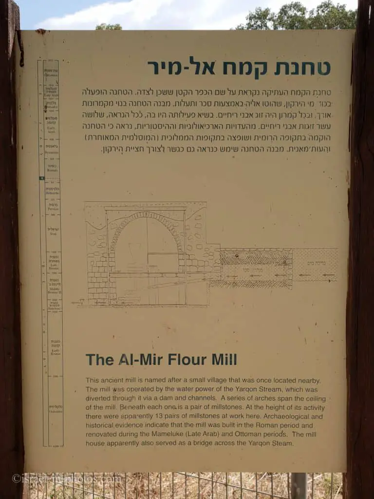
The Al-Mir Flour Mill – an old flour mill that was in operation during the Ottoman period, one of the largest pools in Palestine. The flour mill is named for the Arab village Mir which existed here in the 19th century. An ancient dam collected the water in the river channel and diverted it to the mill.
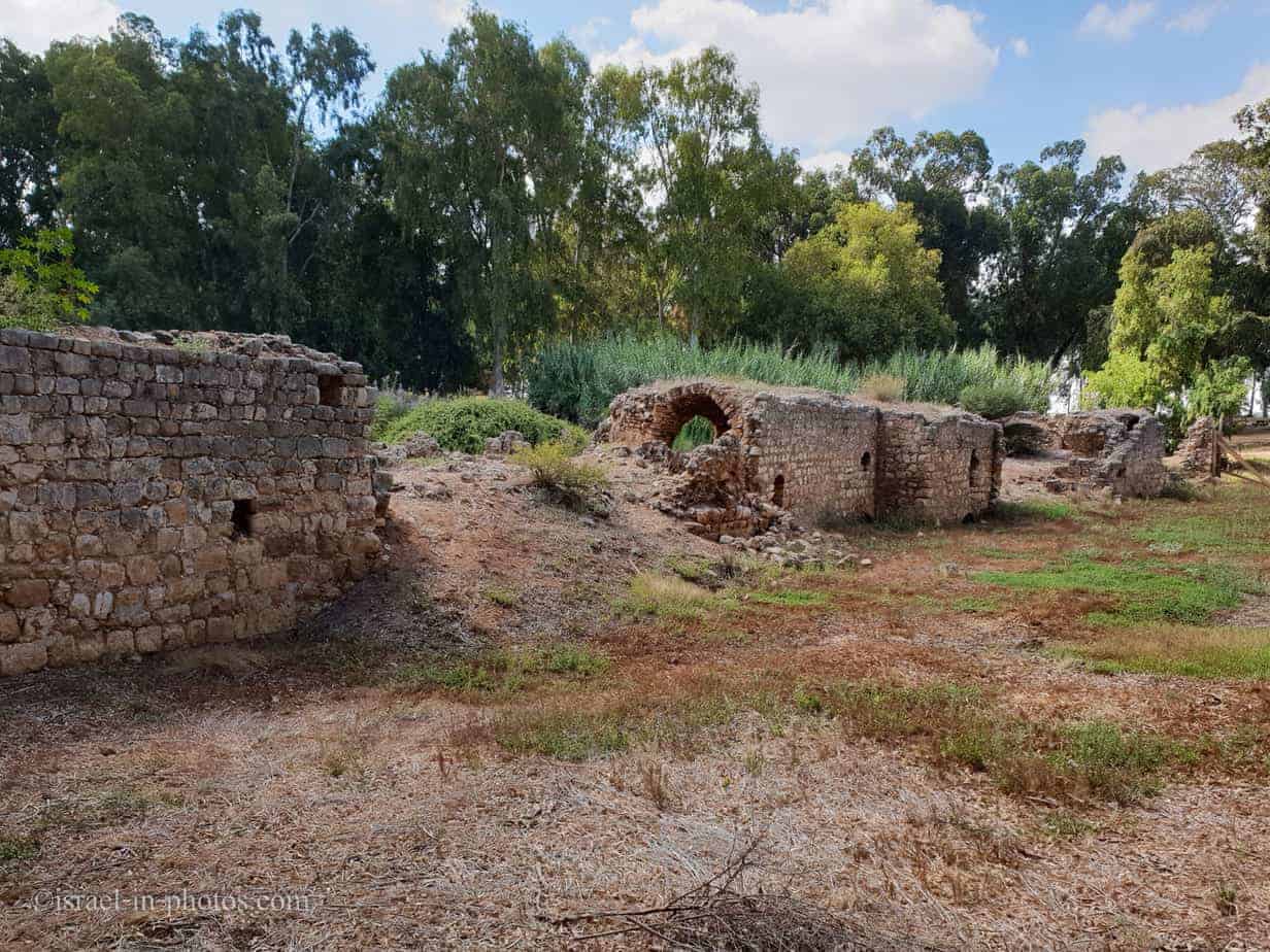
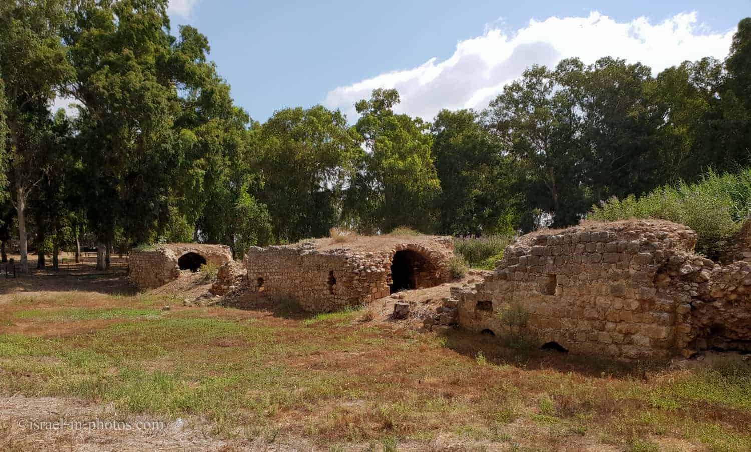
This is a rather long building. At the top of its activity were thirteen pairs of millstones.
The Romantic Trail
Near The Al-Mir Flour Mill, you can find the entrance to the Romantic Trail.
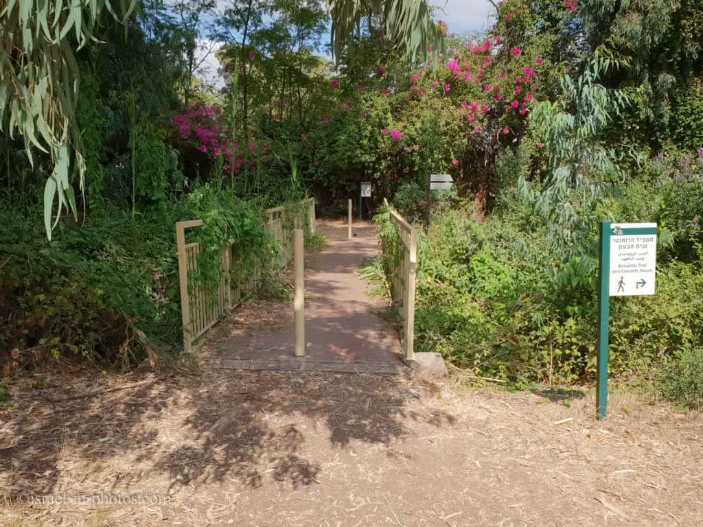
The “Romantic” Path – a beautiful path roofed over with vegetation, leading to the “concrete house.”
We wanted to use the Romantic Trail to reach the Concrete House (point #13), but the gate was closed. So, a bit disappointed, we returned to the car. We had a small picnic and headed home.
Summary
Yarkon Springs is a lovely place with water, greenery, and history. This park is mainly used for picnics, barbeques, and other activities.
And if you are interested in the other Yarkon National Park compound, check out Tel Afek (Antipatris).
Have you ever been to Yarkon Springs? Tell us about your experience in the comments below.
That’s all for today, and I’ll see you in future travels!
Stay Tuned!
Additional Resources
Here are several resources that I created to help travelers:- Trip Planner with Attractions and Itineraries is the page that will help you create your perfect travel route.
- What is the Best Time to visit Israel? To answer this question, we will consider the weather, prices, holidays, festivals, and more.
- Information and Tips for Tourists to Israel will answer the most common questions tourists have about Israel (including safety, passports, weather, currency, tipping, electricity, and much more).
- Israel National Parks and Nature Reserves include a complete list, top ten, map, tickets (Israel Pass, Matmon, combo), and campsites.
- If you are looking for things to do, here are the pages for Jerusalem, Tel Aviv, Haifa, Sea Of Galilee, Akko (Acre), Eilat, Nazareth, Safed (Tzfat), and Makhtesh Ramon.