Church of the Redeemer, Jerusalem – Full Guide
The Lutheran Church of the Redeemer in the Old City offers stunning views and a lovely archeological museum.
Table of Contents
Map
The Lutheran Church of the Redeemer is located on Muristan Road in the Christian Quarter inside the Old City Of Jerusalem. And about 50 meters away from the Church of the Holy Sepulchre.
Directions for drivers: Link to Waze and Link to Google Maps
Directions for public transport: Link to Moovit
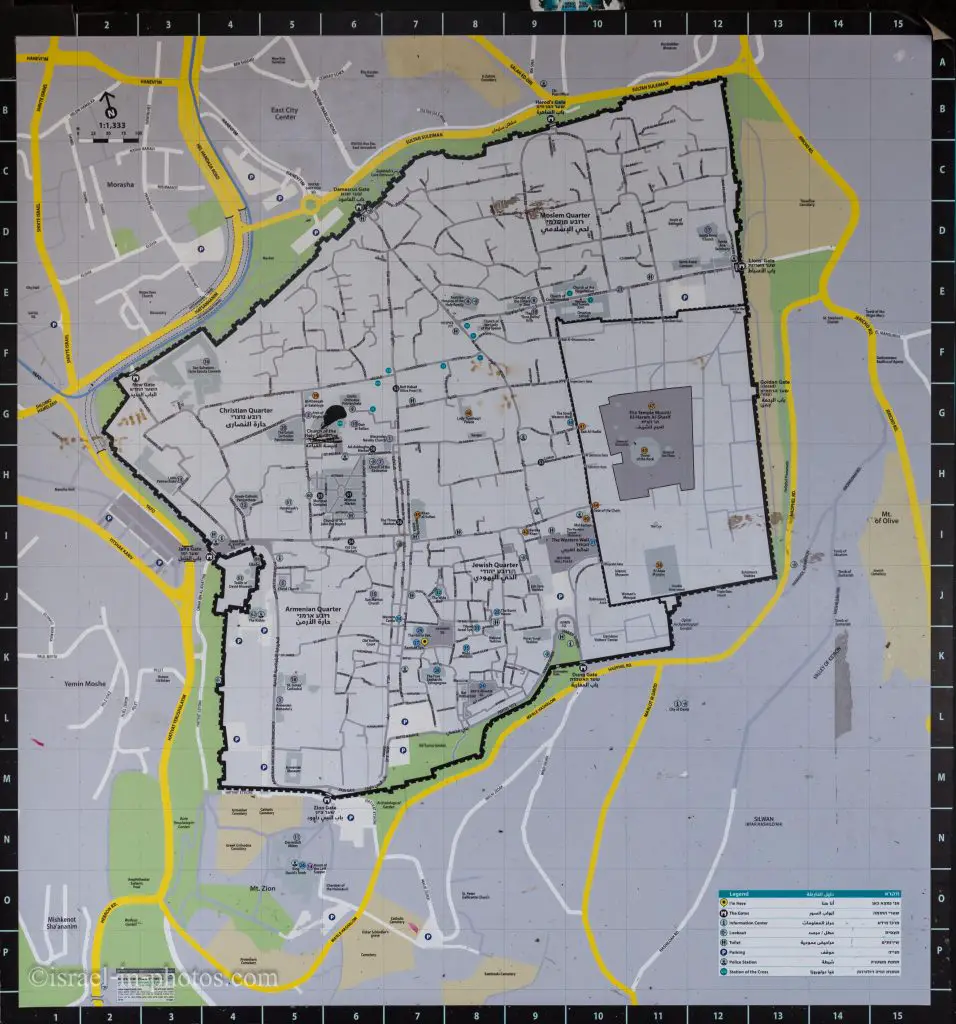
Interactive map of the area:
You can find the following map in several places in the Old City of Jerusalem.
Note: You can click on the map to enlarge it.
The church is marked as #7 (in square H6).
Directions
My favorite way to reach the Old City is using Park and Ride. Park and Ride mean leaving your car at one of the free parking lots near the Jerusalem Light Rail (in my case, and if you are arriving from the center of Israel, it is the Ammunition Hill parking). And then take the Jerusalem Light Rail to City Hall station. The City Hall, located at Safra square, is a short walk from the Jaffa gate.
At the Old City post, you will find other suggestions for reaching the Old City and the Lutheran Church of the Redeemer.
Opening Hours
While checking the official site, I saw different opening hours on various pages. Thus, I assume the broader opening hours are for the Church (including the tower). Which are: Monday – Saturday: 10:00 – 17:00
And the more limited hours are for the museum. And they are:
Monday – Saturday: 9:00 – 12:00 and 13:00 – 15:30.
The museum is closed on Saturday.
But, if you want to be sure that the Church of the Redeemer will be open, I suggest visiting during the narrower opening hours.
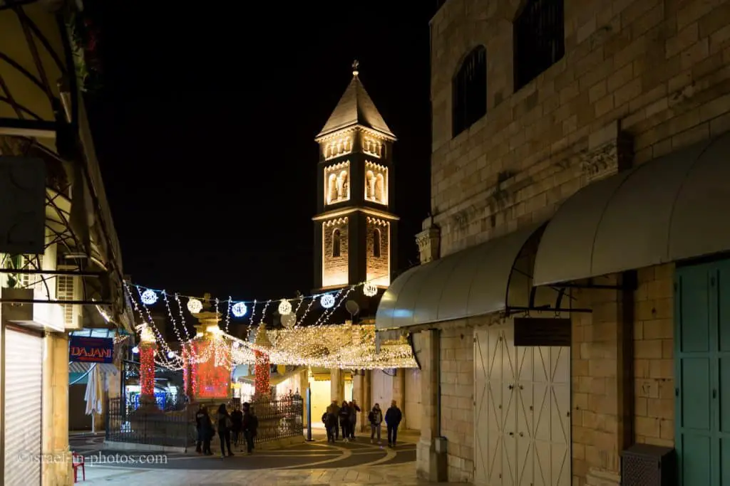
Entrance Fee
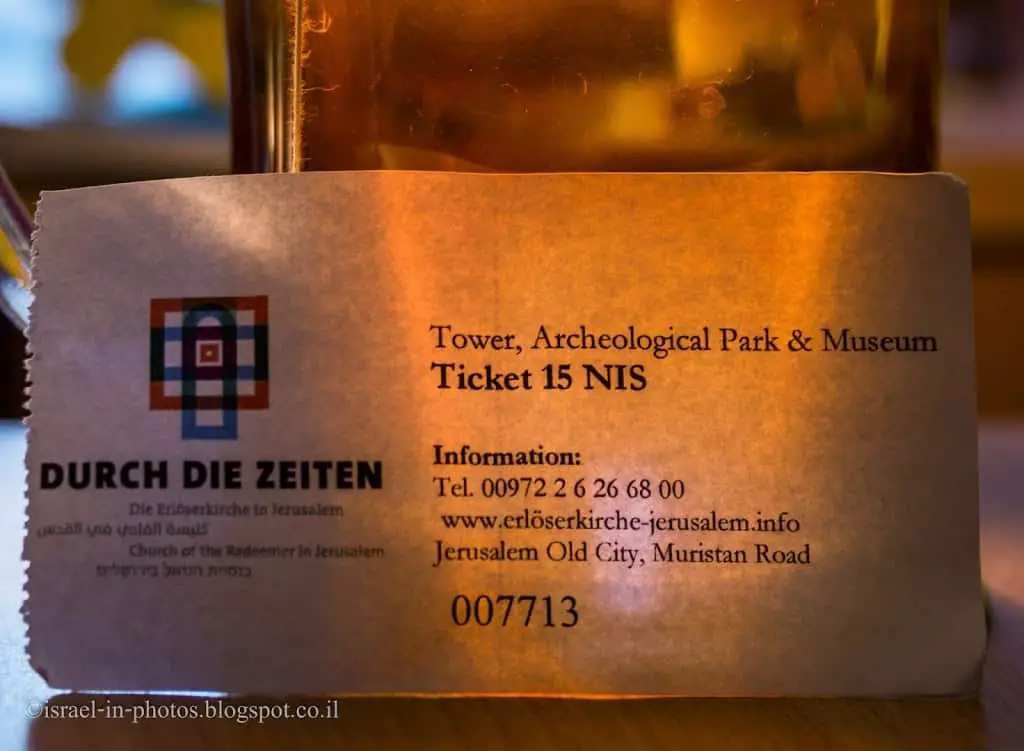
A self-guided museum, Church, and tower visit cost 15 NIS per person.
And on Monday – Saturday at 10:00 and 14:00, you can join a half-hour guided tour. The price of the tour is 40 NIS per person.
Moreover, there are tours for groups. If you are interested, then check out the official site.
Here is a photo of our tickets:
Dress Code
As in all religious sites, you are requested to dress modestly. Also, women can take a light scarf to cover the head and shoulders.
History
The area around the present-day Church of the Redeemer came into the possession of Prussia in 1869. Initially, it was decided to reconstruct the Crusader-period Church of St. Maria Latina (12th century AD), which was still preserved in ruins. As a result of excavations and investigations at the site, it was decided that a new building would be more feasible – the present Church of the Redeemer. Conrad Schick, an architect, and the most famous archaeologist was living in Jerusalem at this time, found under the name of St. Maria Latina a wall that he interpreted as the city wall from Herod the Great (37-4 BC). It was on this that the foundation stone was set on behalf of the German Kaiser in 1893.
The Church of the Redeemer was built in the years 1893 to 1898 according to plans by Friedrich Adler. It lay exactly two meters above her predecessor from the Crusader period.
The Lutheran Church of the Redeemer in Jerusalem was inaugurated on Reformation Day 1898, in the presence of Kaiser Wilhelm II.
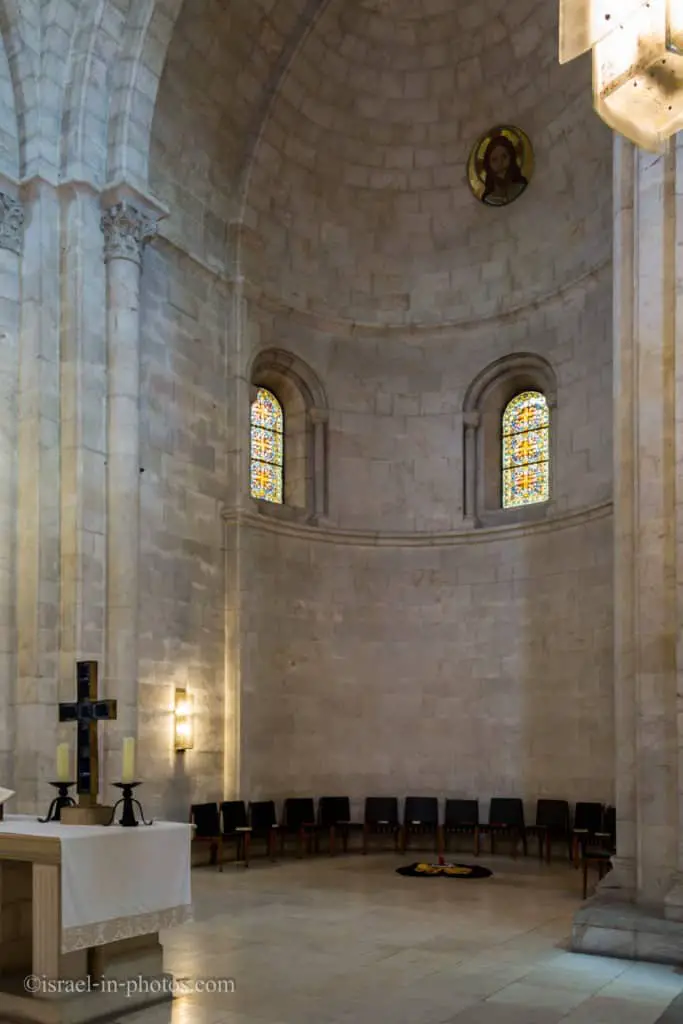
The Romanesque Revival-style church is today the center of the German, Arabic-speaking, and other Protestant churches of Jerusalem. The present appearance of the church dates to the renovation in the years 1970-1974. The medallion and the glass windows in the main apse impart an impression of the church’s former character.
Note: unless stated otherwise, all quotes were taken from the official site.
Concerts
I just wanted to let you know that you can join the Church of the Redeemer concerts. There are organ concerts, choirs, and others. You can find additional information about concerts at cicts.org.
There is also music in the services. And since we mentioned services, let’s elaborate on that topic.
Services
According to the Christian Information Center, the following services take place:
Sunday
9:00 Worship in Arabic
9:00 Holy Communion in English
Also, at 9:00 am, the bells ring with full, melodic tones heard throughout the Christian Quarter.
10:30 Abendmahl in German
And according to redeemermusic.com, there is music in the services.
The Ev. German Church in Jerusalem celebrates every Sunday at 10:30 a Lutheran Eucharistic service in the Church of the Redeemer.
The community attaches great importance to a careful liturgical and musical arrangement of worship services; For each Sunday a divine service sheet appears, in which among other things the complete sermon text and the titles of the different pieces of music are listed. The church ministers are sung according to the Protestant hymn book, issue Baden.
Monday – Friday
12:00 Andacht in German
Exterior
The following photo shows you the bell tower and the Church of the Redeemer entrance.
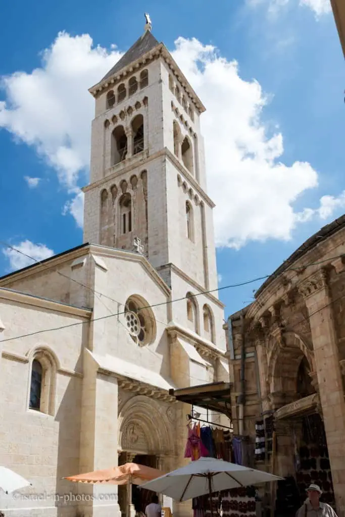
In the bottom left corner, you can also see arches. That is one of the entrances to the Aftimos market in Muristan. As you probably noticed, this Church is situated on Muristan Road. So what is Muristan?
In Persian, Muristan means hospital. And this site was the location of the first hospital of the Knights Hospitaller. Today it is a complex of streets and shops.
And now, let’s enter the Church.
The Tower
As soon as you enter, you will see a small stand where you buy tickets (you can see a photo of a ticket in the entrance fee section). And after purchasing tickets, we will turn to the right and take the stairs to the tower.
The climbing does not take that much time, but the stairs are pretty narrow, and you use the same stairs both to go up and down. Luckily, there was nobody besides us.

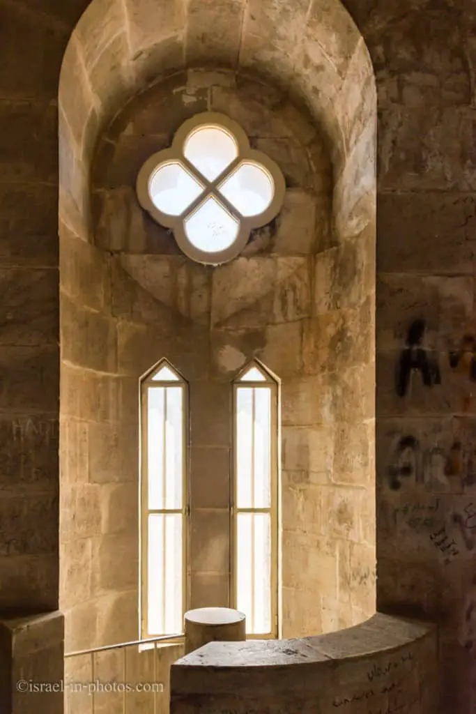
But just in case, I make some sounds before climbing to ensure there is nobody else. There are also two stops on the way up. Here is one of them.
As you almost reach the top, you will encounter the bells.

The tower of the Church of the Redeemer was built to a design created by Kaiser Wilhelm II. It offers a magnificent panoramic view of the Old Town and much of the New Town. From here, you can see the former Jewish Temple Mount, today the Haram esh-Sharif with the Dome of the Rock and the Al Aqsa Mosque. In the other direction, you can look to Mount Scopus with the Hebrew University and the Mount of Olives with the Church of the Ascension, the Jewish cemetery, and the “Auguste Victoria Compound,” which houses the GPIA.
Panoramic Views
Church of the Redeemer is a popular place among photographers due to the spectacular views from the tower.
You can see all four directions from the top of the tower, but it is a small place. So I guess they do not take big groups there.
Eastern View
To the east of the Church of the Redeemer is the former Jewish Temple Mount, today the Haram esh-Sharif with the Dome of the Rock and the Al Aqsa Mosque. One can also see beyond the Kedron Valley to Mount Scopus with the Hebrew University and the Mount of Olives with the Church of the Ascension, the Jewish cemetery, and the “Auguste Victoria Compound,” which houses the GPIA.
Looking towards Temple Mount:

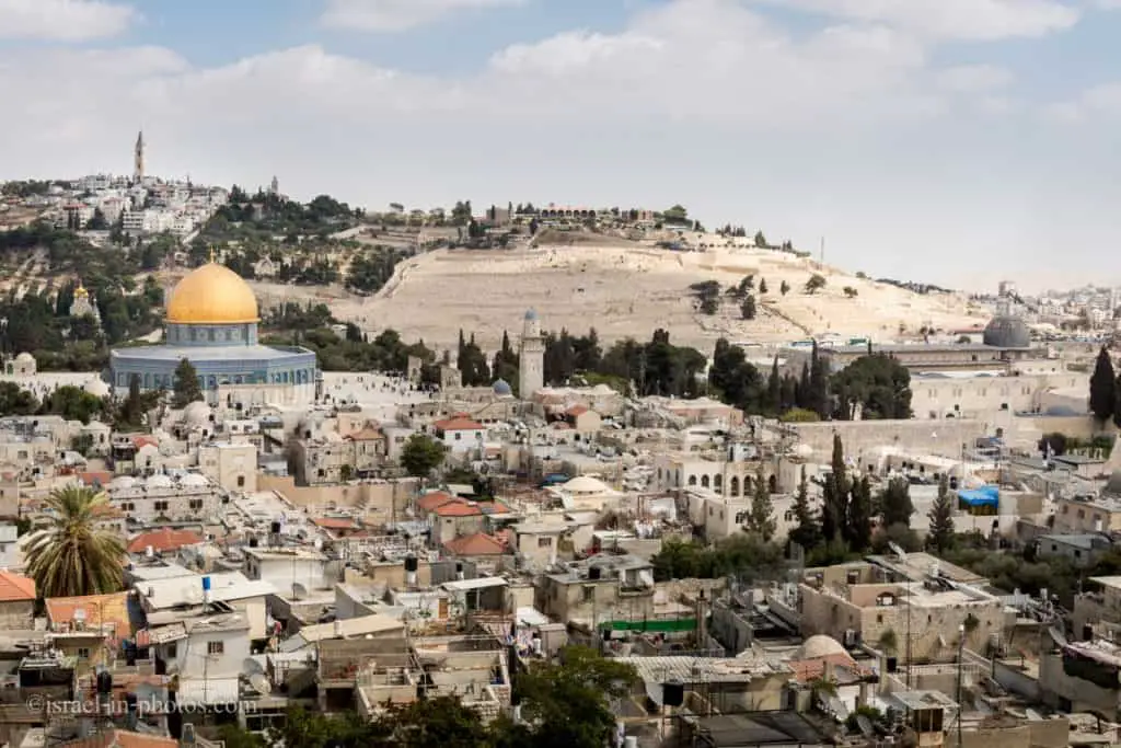
You can see the top of the Church of the Redeemer. Farther away from the Dome of the Rock and on the mountain above it, Augusta Victoria Hospital. They conduct many organ concerts in the Augusta Victoria church. And on the left side, you can see the Muslim quarter and the Hebrew University further away (on the mountain in the top left corner).
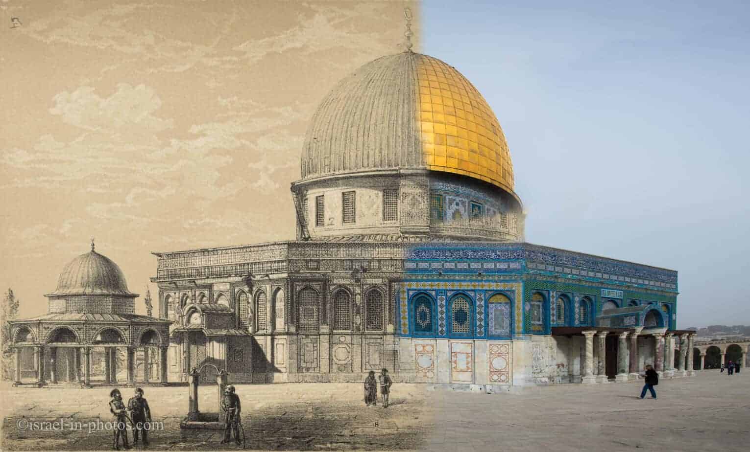
And in the next photo, we look a little to the right. On the left, you can see the Dome of the Rock, and on the right, Al Aqsa Mosque. Beneath Al Aqsa Mosque is the Western Wall (you can only see the top of the Western Wall from here). And in the background, there is the Mount of Olives.
Closeup on the Dome of the Rock:
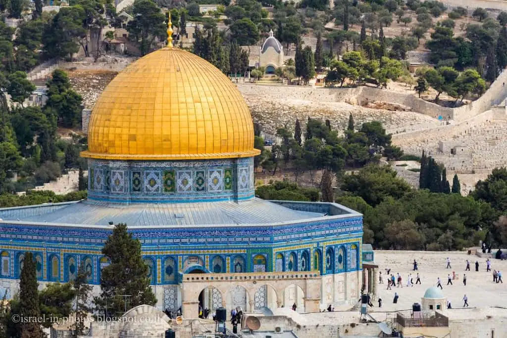
I took the photo with a 28 – 300 mm lens at 230 mm on a full-frame camera to give some distance perspective.
Note: see 14 Best Views of Jerusalem for a list of additional viewpoints in the city.
South and West Panorama
To the south, you look across David Street to the Jewish Quarter with the Western Wall. The city of David is beyond the city walls.
In the southwest, one looks over the Armenian Quarter to the Dormition Abbey. Further west, the so-called Tower of David stands out in front of the New City’s panorama.
Just west of the Church of the Redeemer is the so-called “Muristan” in the Christian Quarter of the city. The Franciscan Church of the Saviour dominates the northwest of this area.
The following photo shows the Christian quarter (right side) and the Jewish quarter (left side).
In the Christian quarter, you can see Muristan. The Muristan (“Hospital” in Persian) is a complex of streets and shops. The site was the location of the first hospital of the Knights Hospitaller. The Muristan fountain is in the bottom-right corner.
The reconstruction of Hurva Synagogue (in the far end, a little to the right) was completed several years ago. Today you can see not only one arch (as it was until about 15 years ago) but the whole building. And in the photo, you can see the upper level with the dome.
If you look further ahead and a little to the right, you will see Dormition Abbey on Mount Zion.
Christian and Jewish quarters:
The photo above amazes me. I have been to Jerusalem many times, and I have never walked on the roofs on the left. Some tours included roof walks, and I have been to several, but not in this area.
Multi-level City
The Old City in Jerusalem is a multi-level city. When new construction was made, it was on top of previous buildings. So, there are layers upon layers. It is heaven for archeologists :)
You have seen the photo above of Temple Mount. But where is the mount? The Dome of the Rock is on the same level as the buildings around it. When the temple was built, it was on a hill. The Western Wall plaza is much lower than the temple mount. How much?
“In the past, it stood as high as 60 meters (about 197 feet); it now stands only 40 meters (131 feet) tall at its highest exposed point, with the rest remaining underground.” – Western Wall Heritage Foundation.
When Israel gained control over Jerusalem’s Old City (during Six-Day War), the state bought many houses in the Western Wall. These houses were demolished, which allowed the revealing of the Western Wall as seen today.
North View
In the photos below, you can see the Church Of The Holy Sepulchre, close to The Lutheran Church of the Redeemer.
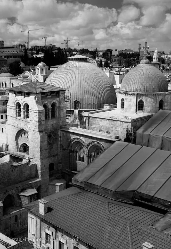
Just north of the Church of the Redeemer is the precinct of the Church of the Holy Sepulchre, the holiest place in Christendom. To the northeast of this one overlooks the Arab Quarter with the Austrian Hospice, St. Anne’s Church on the Pool of Bethesda, and the Via Dolorosa.

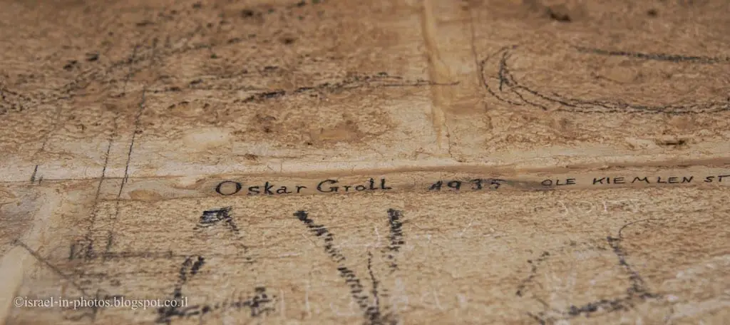
Graffiti inside the Church of the Redeemer’s tower:
And now, let’s go down towards the excavations. While passing through the Church, I took a photo of the interior.
Archeological Park – Excavations
A sensational discovery was made during excavations for the new church in 1893. The builders came across a wall that was interpreted as the city wall from the time of Jesus by contemporary scholars and mentioned by the Jewish historian Josephus Flavius. The so-called “Second North Wall” of Jerusalem was found.
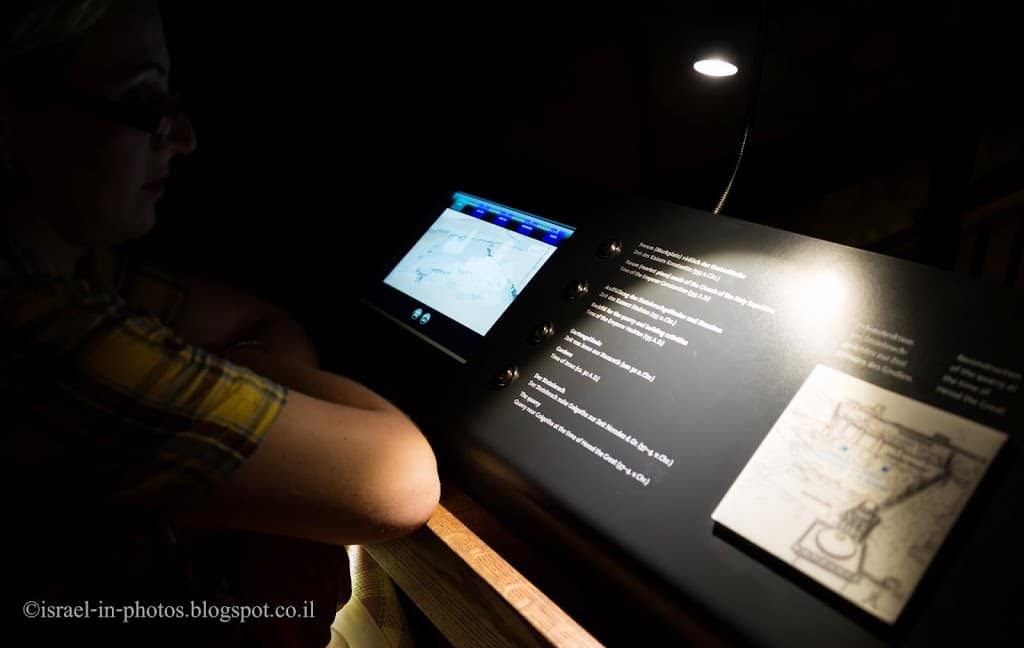
Beneath the main hall, you will find “Archeological Park & Museum” (this is what the ticket says). In there, you have several stands with tablets and a dedicated app. You can choose the language, what interests you, and see the appropriate movie.
Ancient Quarry
They found several interesting things while digging under the Church of the Redeemer. First of all, they found a quarry. Stones from the whole area were collected and used to construct the temple. I have mentioned the height of the temple mount before, and quarries added height since the surrounding area became lower.
Secondly, they found that old city walls passed beneath the Church. That means that the Church Of The Holy Sepulchre was not the Church, but its location was outside the city walls when Jesus lived. It makes sense since graveyards in that period were outside of the cities. Though people have believed this theory for many years, today, researchers think it is not the Old City’s second wall. You can find additional information in the Second Wall section below.
But what about Via Dolorosa? Over the centuries, the route has changed several times. And probably when it was modified, the old city had grown, and the walls were in a different place (when Jesus lived).
Second Wall?
The structure mistakenly called the “Second Wall” proved in its lowest layers (fieldstones) to be part of Hadrian’s structure to the south of the sanctuary built in 135 AD. It was raised further over the following two centuries to become a terrace wall (worked stones) and probably served as a retaining wall for the forum created at the beginning of the 4th century AD to the south of Constantine’s Church of the Holy Sepulchre.
The area north of the east-west wall was heaped up gradually during the 2nd and 3rd centuries AD. In the process, the wall made of fieldstones with the perpendicular smaller walls (the foundations of otherwise undecipherable Hadrianic buildings) gradually became a raised terrace wall. Worked stones were used for this purpose.
When finally at the beginning of the 4th century AD, Hadrian’s temple was demolished, and the Church of the Holy Sepulchre was built, the east-west wall at its present height that today runs along the nave of the church probably served as the retaining wall of the forum created to the south of the Holy Sepulchre. The associated stone flagged ground is about on the same level as the ancient cardo to the east of the Holy Sepulchre, i.e., at +752.60m MSL.
Because of its interpretation as a city wall, the terrace wall mistakenly identified as the “Second Wall” was described in the secondary literature as wider than it is: instead of the actual width of 1.60m, it “grew” in the work of H. Vincent and A.M. Steve to an impressive 3m. Only towards the south did the wall have a fairly “flat” surface. To the north, it had cavities and gaps and was not intended to be seen. To the east, beyond today’s visitor bridge, one can see one of possibly two vertical seams in the brickwork. From this point, the wall swung on its eastern side by 6° to the north.
So, where is the second wall? We still do not know for sure. The best resource I found about The First Wall (The Old Wall), and the Second and Third Walls can be found here.
Sounding
The sounding under the Church of the Redeemer goes down to a former quarry that was in use until the 1st century BC. In this area was also found a garden area of Jewish Jerusalem (1st century AD) and the vast layers of rubble from the time of the founding of Colonia Aelia Capitolina (2nd century AD).
The sounding reaches down to the natural rock. There, in an area of 2.90 x 3.60m, are the signs of an old quarry. The broken ashlars measured between 0.60 to 0.90m wide, 0.90 to 1.10m long, and 0.60 to 0.70m high. This quarry was mentioned first by C. Warren (Muristan excavation), then also C. Schick (Alexander Hospice, later Muristan excavation), H. Vincent, and finally K. Kenyon (“Area C”).
It has now become evident during further excavations in the Church of the Holy Sepulchre that it must have been a large quarry site, which must have spanned from David Street to under today’s Holy Sepulchre and Alexander Hospice. But unlike in Kenyon’s “Area C,” there was no final layer with finds from the 7th century BC lying indirectly on the quarry. The quarry in the area of the Church of the Redeemer will, therefore, have been used until the 1st century BC.
The approximately 2m-thick layer of soil above the natural rock is not uniform. Several (at least three) horizontal layers were deposited here over each other, probably with considerable time intervals. The top layer and the stone wall in the north of the sounding limit the stratum. The excavators have described them as a garden. The soil here was plowed 20cm deep. The wall was probably used to partition the land. It is likely that here several garden areas lay side by side. This matches very neatly the name given by Josephus of the nearby city gate in the northern section of the “First Wall” as “Gennat Gate” – “Garden Gate” (Bell 4.2 V § 146). There are many indications that Nahman Avigad has already correctly located this gate structure during his excavations south of David Street in the Jewish Quarter.
The quarry may have been used both for the construction of the Old Testament city expansion south of present-day David Street at the end of the 8th century BC and for the later construction of Herod’s Quarter in the 1st century BC.
A 5.50m-thick layer of debris was dumped onto the former garden area in around 135 AD on the orders of emperor Hadrian. That corresponds to the 8m-high embankment in Kenyon’s “Area C.” The aim of this measure was already indicated above: because Hadrian wanted to extend his city Aelia Capitolina to the northern extent of that of Herod Agrippa I in a way that made architectural sense, he had to fill in the former quarry site, including the roughly 100m-wide valley that extended from east to west.
The fill material consisted of rubble that Hadrian had fetched from the city that Titus destroyed in AD 70. Remains of walls, bricks, pottery, and plaster were piled up here. The date is evident from the fact that the latest coins found here are from the time of the first Jewish Revolt against Rome (66-70 AD).
The slope of the layers beneath the Church of the Redeemer points to the area having been filled from the south. The material was probably brought from the other side of David Street and dumped here toward the north. This also explains the intermixing in these layers of the 1st-century AD material with that of the Iron Age, i.e., from the time of the Old Testament, because the buildings of the Jewish city of the Hasmoneans was founded directly on the ruins of the Old Testament city extension of King Hezekiah of the late 8th century BC.
Thus a surface was created out of the lowest layer of the east-west wall now visible in the excavation, together with other smaller walls that run perpendicular to it. The surface consisted partly of mortar, partly of rammed earth with insignificant building remains and stood next to the large Roman temple that Hadrian had built in what is now the Muristan.
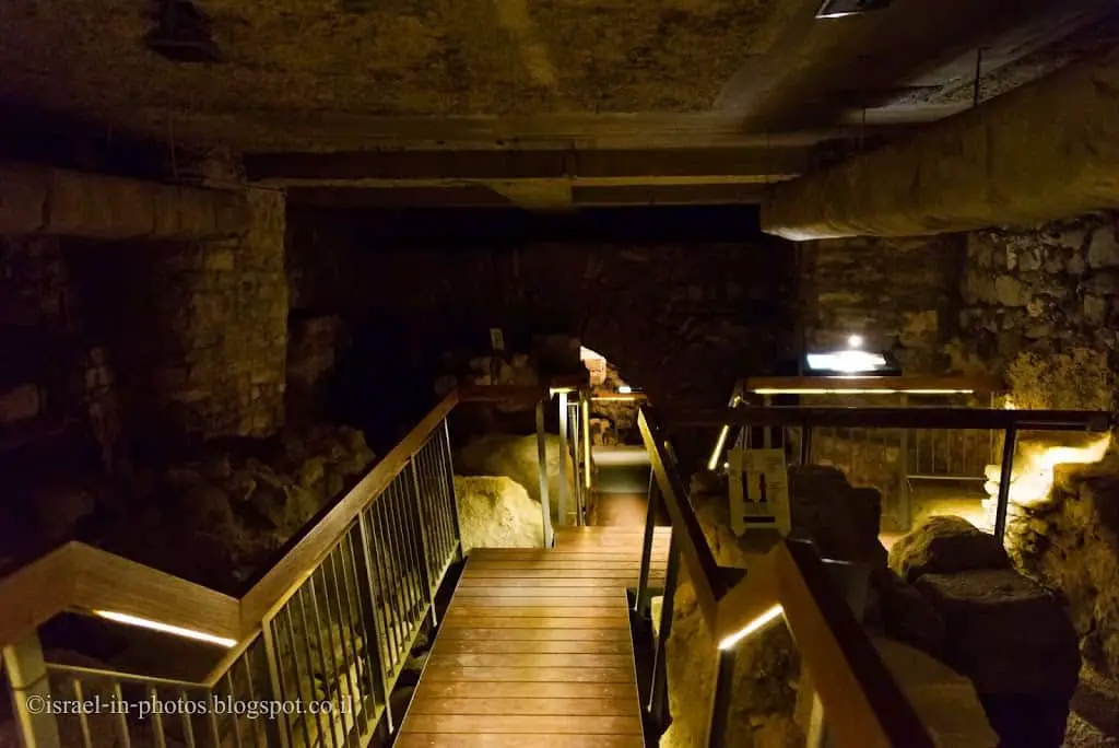
The main hall in the archaeological park and museum:
Mosaic
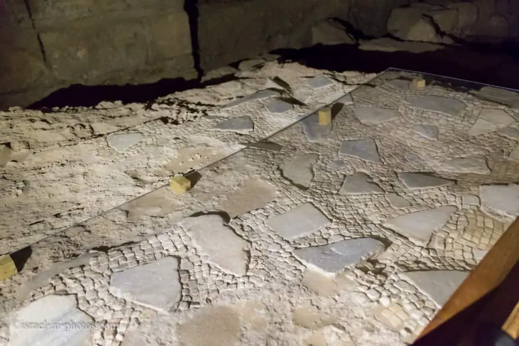
The mosaic located 2.10 m below the present church floor belonged to the Church of St. Maria Latina from the 12th century AD.
No predecessor of the medieval church of St. Maria Latina could be found beneath the Church of the Redeemer. Of the church itself, only part of the floor mosaic remains, severely damaged by later building and remodeling measures. The mosaic was based on a layer of mortar that has been used to level the substrate. The mosaic itself is composed of recycled marble pieces and white (and a few greys, black and red) “tesserae” (mosaic stones). That the mosaic belonged to the crusade-period church is suggested by the fact that it is at the same level as the contemporaneous yard area adjacent to the church, now the cloister of the Provost’s Office.
That is the end of the excavations section. And we climb one floor until we reach the garden.

Museum – Exhibition
While enjoying this splendid garden, you will see an exhibition sign near one of the rooms. You can find a small museum with various exhibits from this area.
The exhibition in the medieval cloister presents exhibits from the history of the Church of the Redeemer and of the surrounding residential area, the “Muristan,” and describes the relevant archaeological problems and methods. The focus of interest are the finds from the time of Herod the Great, Jesus of Nazareth, and the emperors Hadrian and Constantine. A further focus is the history of the “Muristan” and pilgrim life in the Middle Ages. The tour “Through the Ages” ends with the current church work of the “Protestant in Jerusalem” and other Protestant churches active in this space.
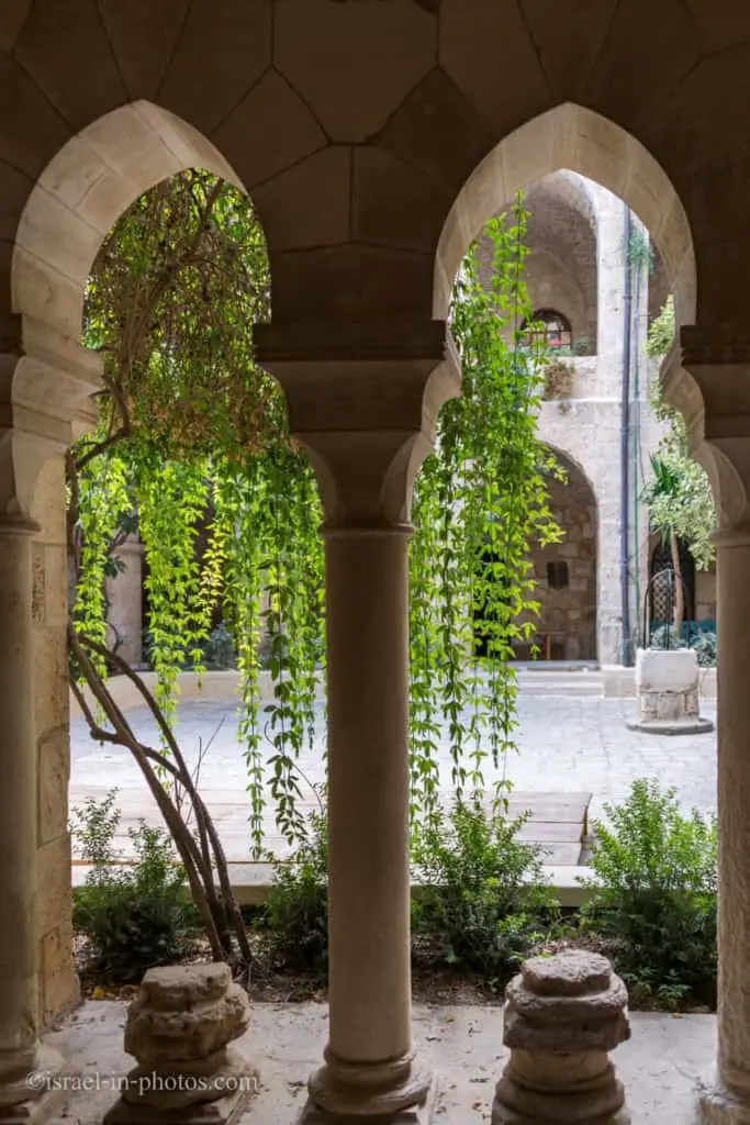
The exhibition is our last stop during this visit, and from the museum, you return to the garden and exit the Church.
The market in front of the Church of the Redeemer:
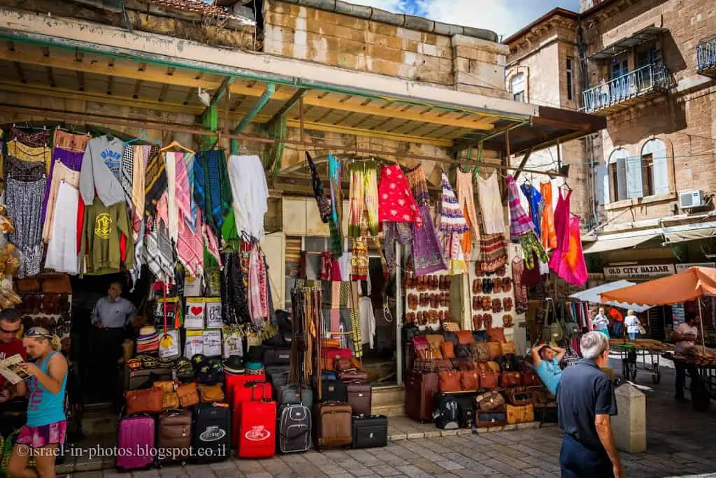
How Much Time Does a Visit to the Church Of The Redeemer Take?
The duration of your visit depends on many factors (you might decide to make a two-hour time-lapse at the tower), but the typical visit will take 0.5 – 1 hour.
Summary
Church of the Redeemer is a less popular point of interest in the Old City of Jerusalem. Nonetheless, if you have the time, I suggest paying a visit. It is not only a holy place, a historical and archeological site, but it is also one of the best viewpoints in the Old City.
Have you ever been to the Church of the Redeemer? Tell us about your experience in the comments below.
That’s all for today, and I’ll see you in future travels!
Stay Tuned!
Additional Resources
Here are several resources that I created to help travelers:- Trip Planner with Attractions and Itineraries is the page that will help you create your perfect travel route.
- What is the Best Time to visit Israel? To answer this question, we will consider the weather, prices, holidays, festivals, and more.
- Information and Tips for Tourists to Israel will answer the most common questions tourists have about Israel (including safety, passports, weather, currency, tipping, electricity, and much more).
- Israel National Parks and Nature Reserves include a complete list, top ten, map, tickets (Israel Pass, Matmon, combo), and campsites.
- If you are looking for things to do, here are the pages for Jerusalem, Tel Aviv, Haifa, Sea Of Galilee, Akko (Acre), Eilat, Nazareth, Safed (Tzfat), and Makhtesh Ramon.





We love the Church of the Redeemer, Jerusalem! The Church itself is a large space constructed from stone, simply decorated, with a very fine acoustic. At the far right end, there is a door into a substantial courtyard with cloisters, and a coffee shop which serves excellent teas and coffees …. and cakes!
The crowning structure is the tower. Purchase a ticket, and the stairs take you to the top of the tower, with a stunning view over the Old City. It is really worth while going up there, but note: the stair is narrow, and you cannot pass someone going the other way. So call up or down, to make sure it is ok for you to go up, or down! Make sure you have a camera – you will regret it if you do not.
John & Jeni, Edinburgh, Scotland