Taninim Stream Nature Reserve – Visitors Guide
Taninim Stream Nature Reserve is full of nature, wildlife, and archeological remains. And families love it due to the short tracks.
Table of Contents
- 1 Map
- 2 Tracks
- 3 Directions
- 4 Opening Hours
- 5 Entrance Fee
- 6 Basic Info
- 7 The Names
- 8 Archeology and History
- 9 Show Room
- 10 The Ancient Reservoir
- 11 The Eucalyptus Grove
- 12 The Aqueduct Route
- 13 The Roman Dam
- 14 Quarry and pipe factory
- 15 Byzantine flour mills
- 16 Wildlife
- 17 Ottoman flour mill
- 18 The Lower Aqueduct
- 19 Summary
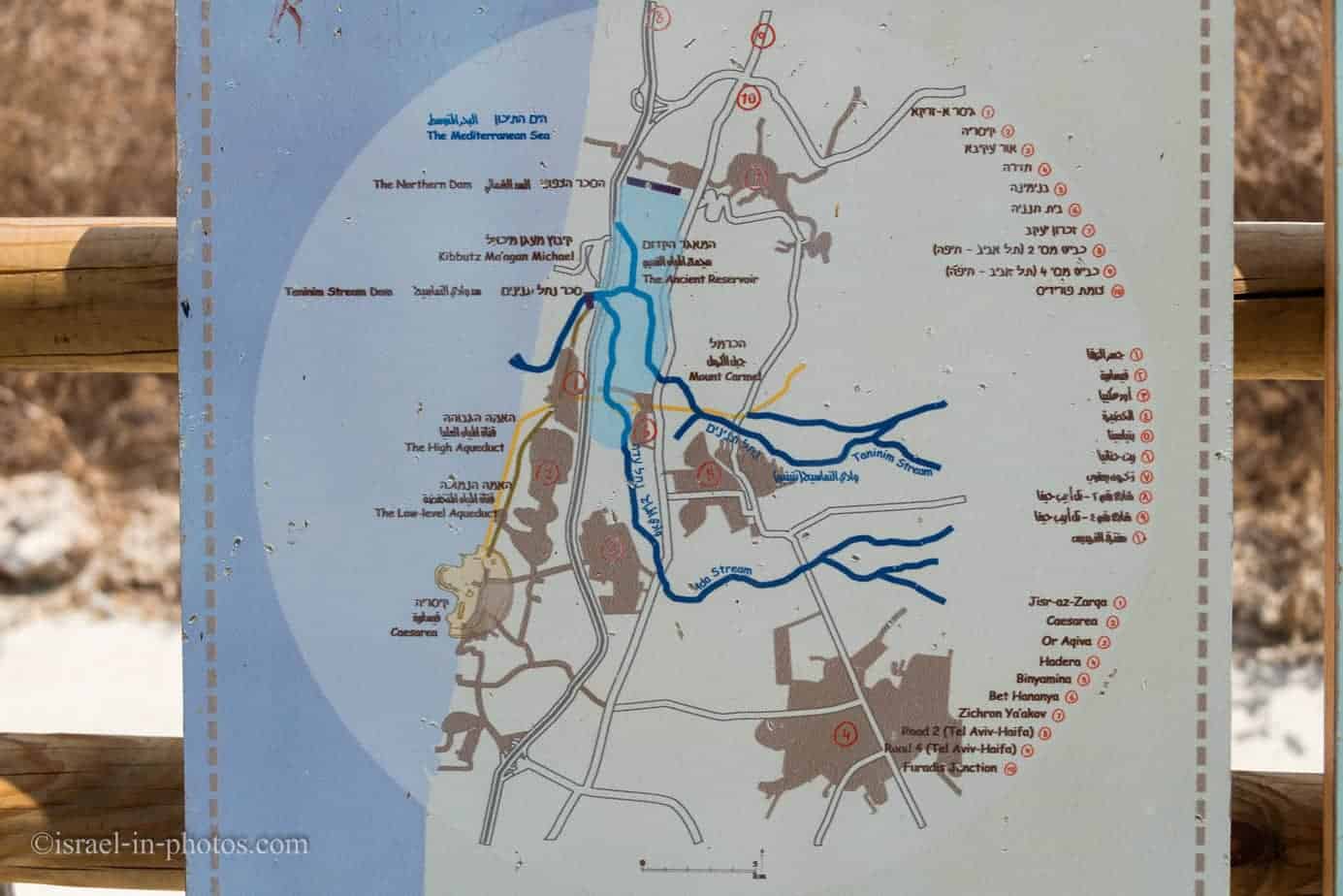
Map
Taninim Stream Nature Reserve is located not far from Caesarea National Park and adjacent to Jisr al-Zarqa.
Directions for drivers: Link to Waze and Link to Google Maps
Directions for public transport: Link to Moovit
Interactive map of the area:
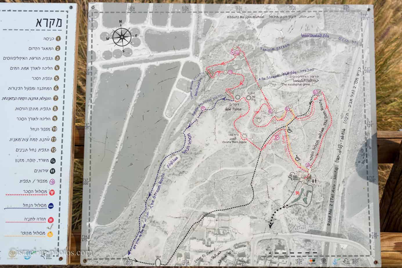
Note: you can click on the site plan to enlarge it.
Tracks
There are four tracks at Taninim Stream Nature Reserve.
| # | Name | Color of the Route | Description | Visit Duration (hours) |
|---|---|---|---|---|
| 1 | The Dam route | Red | This trail has both a water segment and a dry section. Similar to the stream track, it is not a loop trail. Moreover, it does not start at the nature reserve’s entrance. Thus, you have to combine them with other routes. | 1 |
| 2 | The Stream trail | Blue | Leads you along the Taninim stream to the sea and back. | 3 |
| 3 | Mini track | Orange | This wheelchair-accessible path takes you to the water regulatory device and back. | 0.5 |
| 4 | The aqueduct route | Black | This trail has both a water segment and a dry section. Similar to the stream track, it is not a loop trail. Moreover, it does not start at the nature reserve’s entrance. Thus you have to combine them with other routes. |
Directions
If you are reaching by car, enter the “Taninim Stream Nature Reserve” into Waze or Google Maps, and it will take you to the free parking by the entrance.
If you use public transport, you can take a bus to Jisr al-Zarqa (#68, #768, #171, and others). Here is already a preset link to Moovit. Just enter your starting point, and you will get the updated directions.
Opening Hours
Sunday – Thursday and Saturday: 8:00 – 17:00 (16:00 in winter).
Friday: 8:00 – 16:00 (15:00 in winter).
On holiday eves, usually 8:00 – 13:00.
Note: Since the pandemic, the Israel Nature and Parks Authority has started limiting the number of people in each park. Thus, reservations are recommended through the official site (you can find the link below).
Entrance Fee
Adult 24 NIS, child 10 NIS, and student 20 NIS. Free for National Parks annual subscribers.
If you visit multiple National Parks, consider purchasing a combo ticket. Additional information is available at National Parks and Nature Reserves.
Note: opening hours and ticket prices were updated in January 2023. In any case, recheck the official site before visiting.
Basic Info
The Taninim Stream Reserve is located on the southern Carmel coast, between Kibbutz Ma’agan Michael and Jisr al-Zarqa. The 470-dunam reserve is situated on the middle calcareous sandstone (kurkar) ridge and in the area to the West of it. The Ada and Taninim streams, originating-in the Menashe Heights, flow through the reserve.
The Hebrew name for the stream and the reserve, taninim, means crocodiles. In the past, crocodiles made their homes in the wetland area and the stream. Part of the reserve is a vestige of the Kebara Swamp, which Baron Edmond de Rothschild purchased and started to drain to enable settlement of the area. The swamp was drained between 1922 and 1932.
Taninim Stream is a flowing stream, the last of Israel’s coastal streams whose water is clean and saline. A rich ecological system of flora and fauna thrives in the stream and on its banks.
Source: sign
The Names
Taninim Stream Nature Reserve has several names. And all of them consist of two words, either in Hebrew or English. Taninim means crocodiles in Hebrew. And Nahal means stream in Hebrew. Thus, sometimes people refer to this nature reserve as Taninim Stream, Nahal Taninim, and Crocodile Stream.
And as you can guess, it is called after crocodiles that lived there up to the beginning of the 20th century. We will discuss crocodiles in the wildlife section.
Archeology and History
From Prehistory to the Romans
In prehistory, the first inhabitants of the area lived in the Kabara Cave in Carmel, east of Einmah Tesah. Humans lived in the cave some 60,000 years ago, and at intervals even in later periods. Some of their food comes from the abundance of animals in the Kabara swamps, including fish, wild boars, water deer, and hippos.
Thousands of years later, during the Persian and Hellenistic periods and perhaps even earlier, ships docked in the Nahal Taninim estuary, near Tel Taninim. Abd during the Roman period, with the flowering of Caesarea, the region experienced upheaval. The Crocodile stream started to flow to Caesarea in two aqueducts. The “tall” aqueduct was well-constructed with calculated overcoming obstacles of marshy infrastructure and hill barriers. It drew water from the springs of Nahal Taninim River in Shuni and Amikam, and its waters were of drinking water quality.
Later the Romans built a dam. Behind the dam, a large lake was created, and from it, via the “low” aqueduct, the water was sent to Caesarea for various uses, but not for drinking.
Notes:
- Unless stated otherwise, all quotes were translated from the official site.
- If you are interested in the prehistoric period, check out Nahal Mearot Nature Reserve.
From the Byzantine till Modern Times
During the Byzantine, Crusader, and Ottoman periods, the lake water was used to operate flour mills.
From the end of the Crusader period until the first half of the 19th century, the area was deserted, and the lake from the Roman period became the great Kebara swamp.
In 1834, people who came from Egypt with Muhammad Ali’s army settled in Jasser a-Zarqa. Later, people from other places joined them. They made a living from fishing in marshes and seas, pottery, and making mats of Goma plants and reed.
In 1922, lands were purchased using Baron Rothschild’s funds. In the same year, they began to dry the area to prepare for agricultural cultivation. On the grounds of Kabara, the settlements of Maagan Michael and Beit Hanania were erected.
Show Room
After entering this nature reserve, you will see several small buildings. One of them is the showroom.
On Saturdays, a short movie is screened in the showroom every half hour. The film tells the story of Taninim Stream Nature Reserve, both from the archaeological and wildlife perspectives.
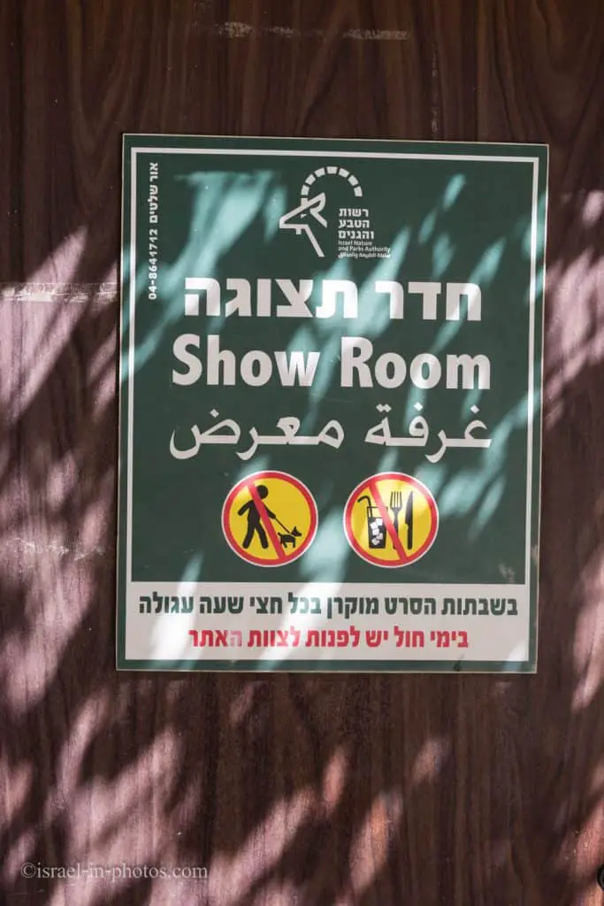
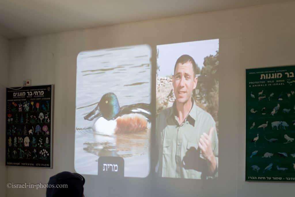
If you visit on a regular day (not Saturday), ask the staff to play the movie.
The Ancient Reservoir
After watching the short movie, we started walking. And our first stop was at the ancient reservoir (point of interest #2 on the map).
As mentioned in the archaeology and history section, the city of Caesarea needed water. Thus, initially, Romans built the “tall” aqueduct. As the town grew and required more water, the Romans decided to make another aqueduct.
However, the water level in this area (at that time, it was Kebara swamp) is two meters lower than in Caesarea. Thus, they constructed two dams (we will see one of them shortly). The barriers created a large reservoir, which flooded 6,000 dunams of the valley. And this water was channeled to Caesarea via the “low” aqueduct.
And we will continue along the Dam route toward the aqueduct. As you walk, if you look to your left, you will see Mount Carmel.

Today, the entire area is dry land (mainly used for agricultural purposes). But when the Ancient Reservoir existed, the whole area was flooded.
By the way, you can hike in this area of Mount Carmel. See the guide to Ramat HaNadiv for additional details.
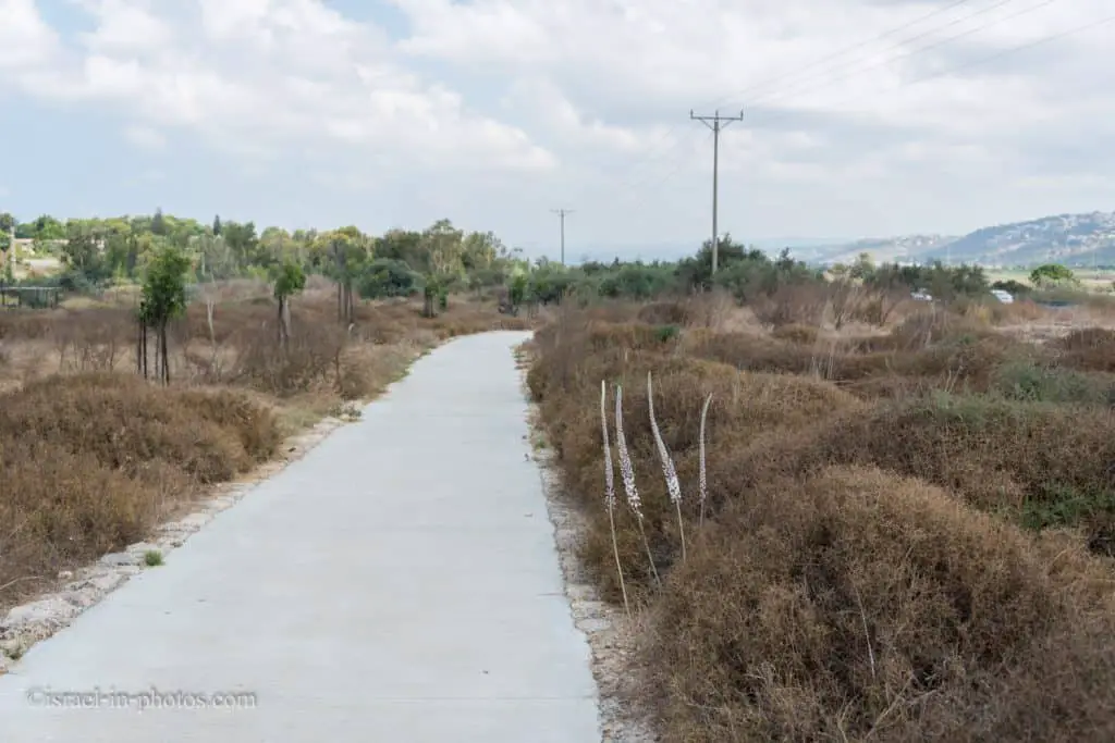
The Eucalyptus Grove
Point of interest #3 is the eucalyptus grove. And it is the overnight and nesting grounds for herons and other birds. And as always with wildlife, if you are interested in seeing it, come early or towards sunset.


The Aqueduct Route
At this point, you will see the water segment of the aqueduct route. That is the unfinished aqueduct.
The unfinished aqueduct is a section of several hundred meters long that was hewn and abandoned, probably because the aqueduct builders realized that the height of the aqueduct was not enough to stream water from the river to Caesarea. Today the unfinished aqueduct provides a pleasant experience on a “wet” 260-foot walkway.
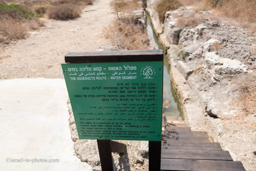
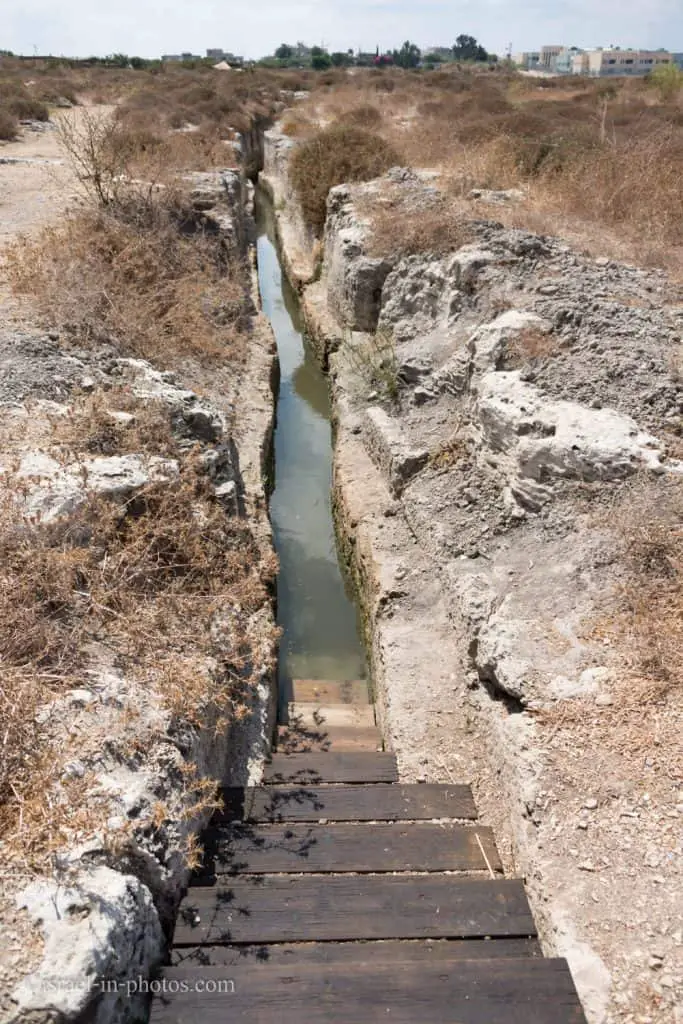
If you are interested in walking in the water, then you should bring suitable shoes. And since the water is a maximum of 40 cm deep, you probably can even roll up the pants and walk.
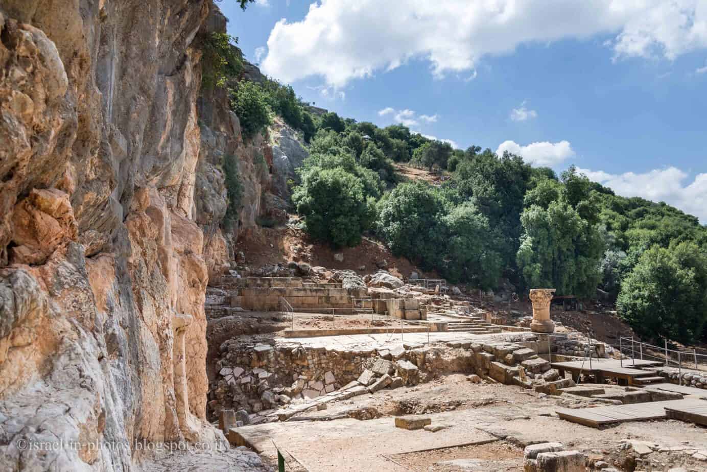
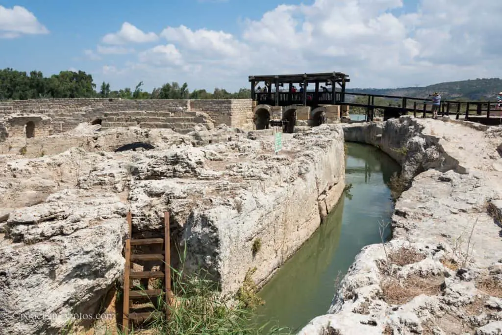
The Roman Dam
Here is a scheme of the Roman dam with later adjustments.
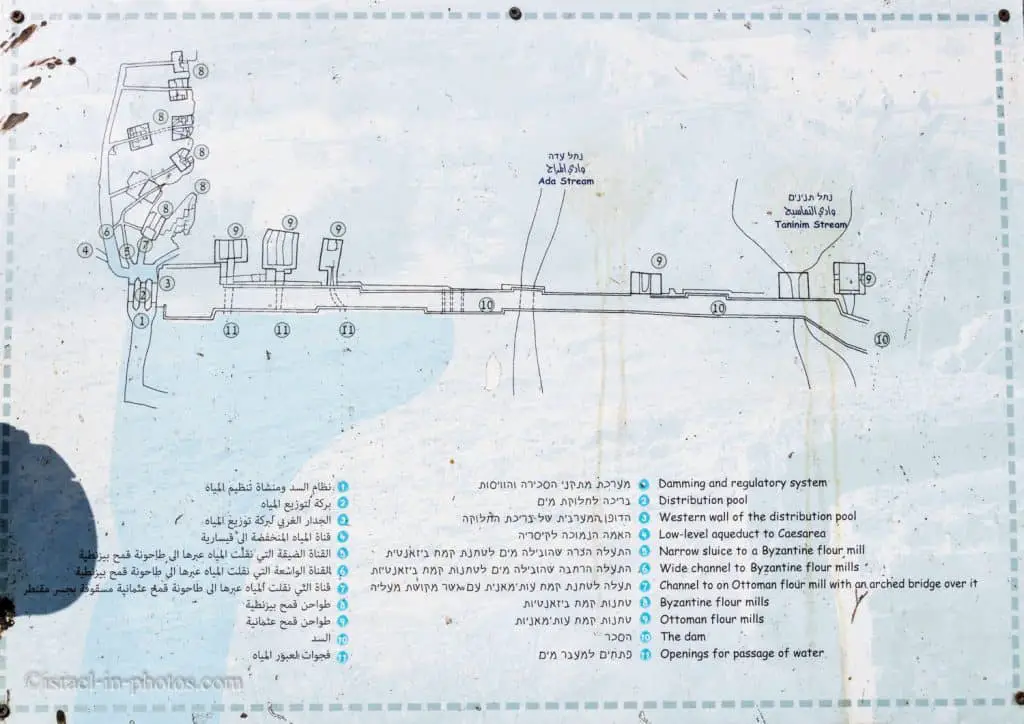
As you can see, the dam blocks both the Taninim and Ada streams. And over the years, many additions were made. Byzantine and Ottoman flour mills were constructed nearby, and appropriate channels were added.
The Roman dam was the foundation of a sophisticated water plant, designed to raise the level of the Tanin stream so that it could be gravitationally flowing to Caesarea, the largest city in Israel in those days.
The dam is a massive stone wall – 194 m in length and 4 m wide at its head and 10 m at its base. The width of the barrier is uneven because, over the years, it has added support to prevent its collapse.
The dam blocks the breach that broke through Nahal Ada and Nahal Taninim in the Kurkar Ridge. Another dam, about 2 km north of it, blocked the Kabara Valley to the north. The barriers accumulated the streams and the springs of the Kabara Valley and formed a substantial 6,000-acre lake.
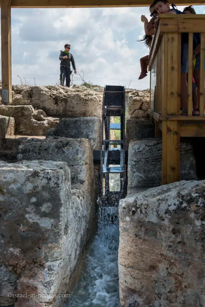
Water Regulation Facility
One of the main parts of the dam is the water regulation facility (POI #8 on the site map).
The heart of the dam is the regulation facility. Liftable wooden doors released water from the lake to the aqueduct. The dam’s wooden doors have been restored, lifting water from the lake. Restoring an entirely ancient dam to a lake recreation is one of the wonders of the site, perhaps unique in the world.

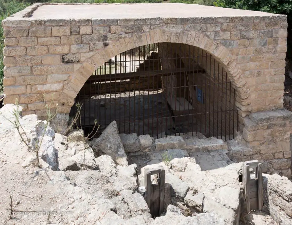
Quarry and pipe factory
Near the water regulation facility, you can find the quarry and pipe factory (POI #6 on the site map).

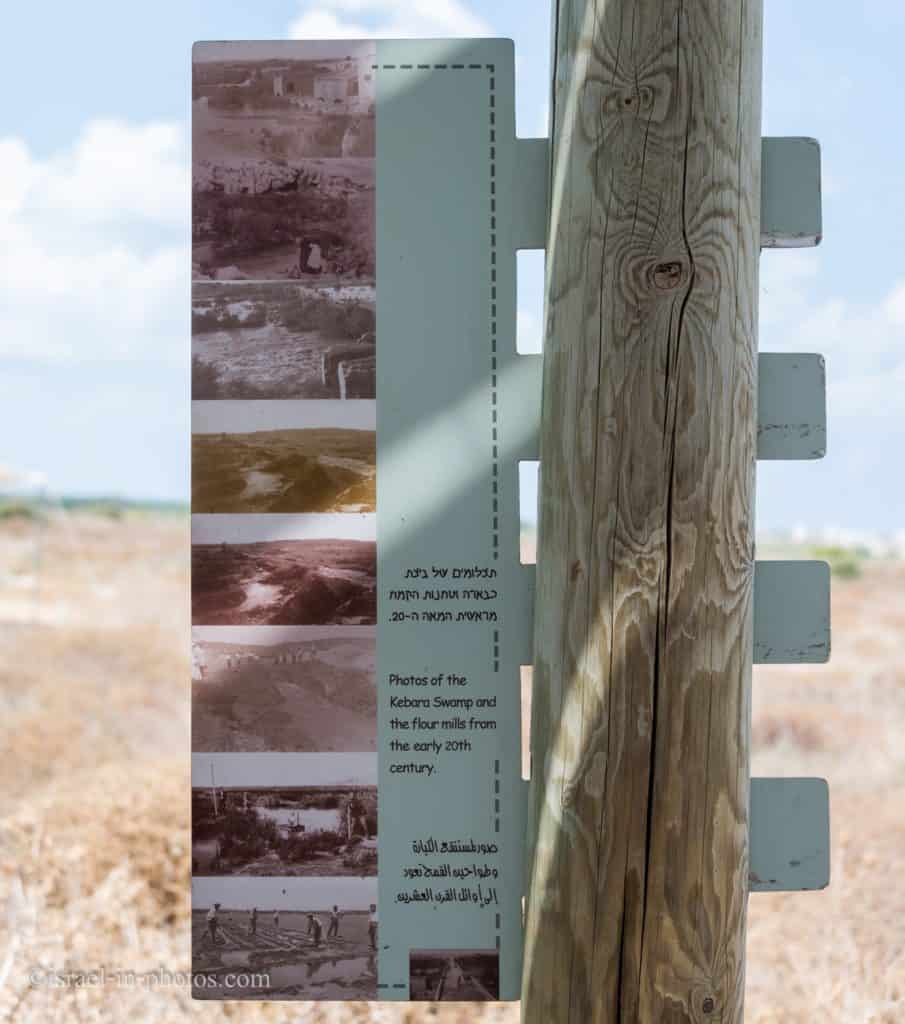
The Roman stone quarry was later converted to a clay pipe factory. Why was a pipe factory needed here? The primary purpose was to produce pipes to drain the Kabara swamp.
The Kabara swamp was drained between 1922 and 1932. A clay pipe factory was established here by Baron de Rothschild, who purchased the land in the Kabara valley to develop this area.
The manufacture of the pipes was unsuccessful, and clay pipes imported from France were used to drain the swamp. The drainage was accomplished by crisscrossing the 6,000 dunams of the swamp with a network of pipes, the total length of which was 50 kilometers. The pipes capped 3,000 springs and directed their flow to an outlet channel.
Source: sign on site.
From the pipes factory, we rushed along the red trail to the Byzantine flour mills.
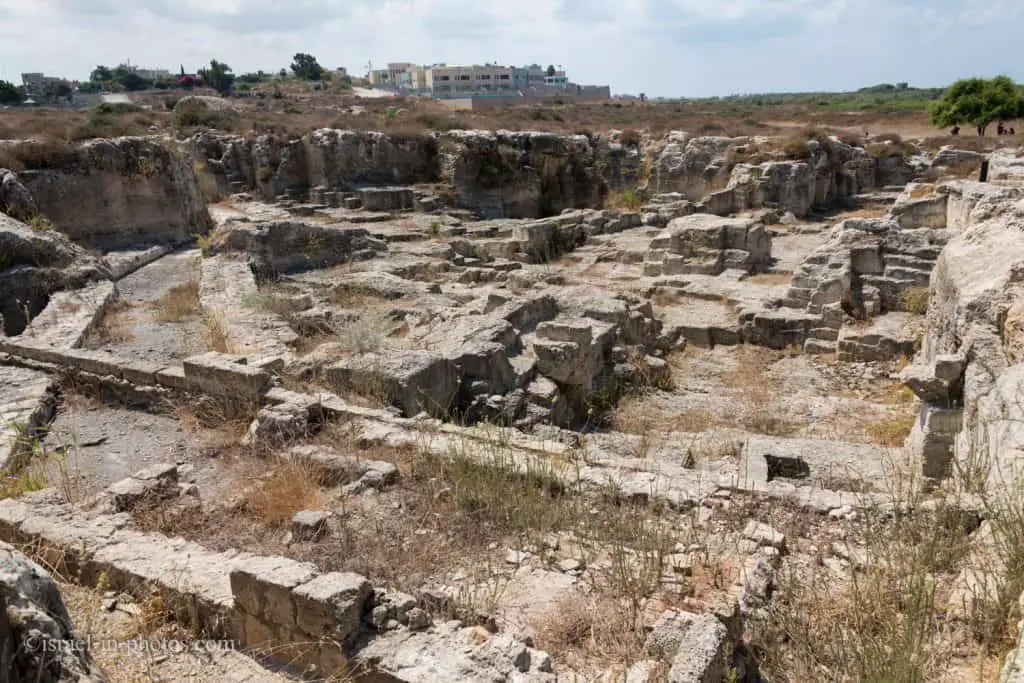
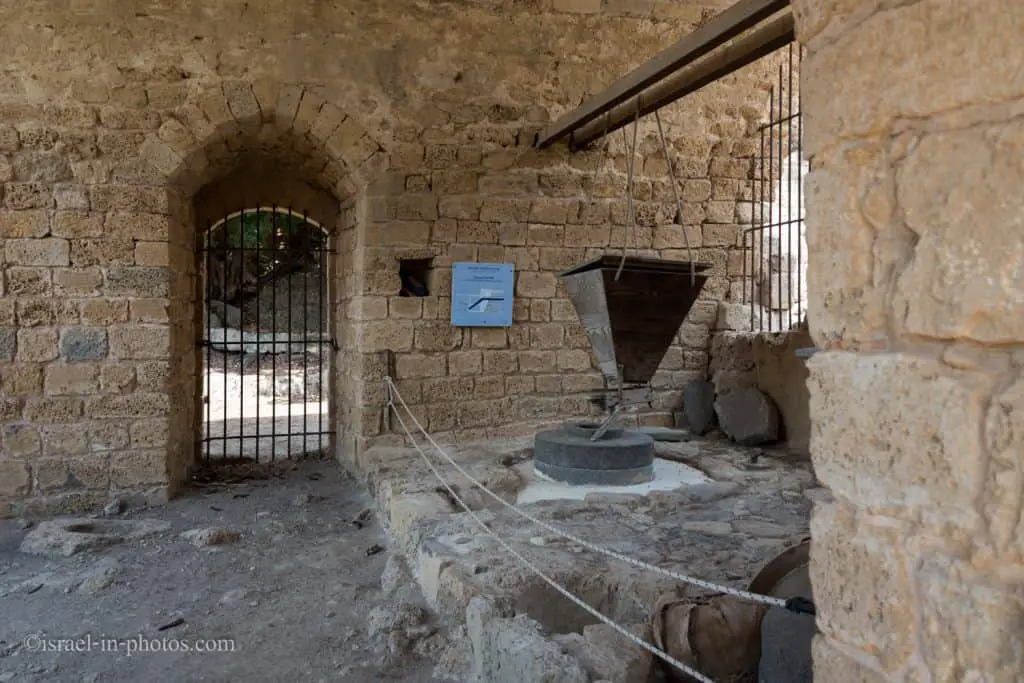
Byzantine flour mills
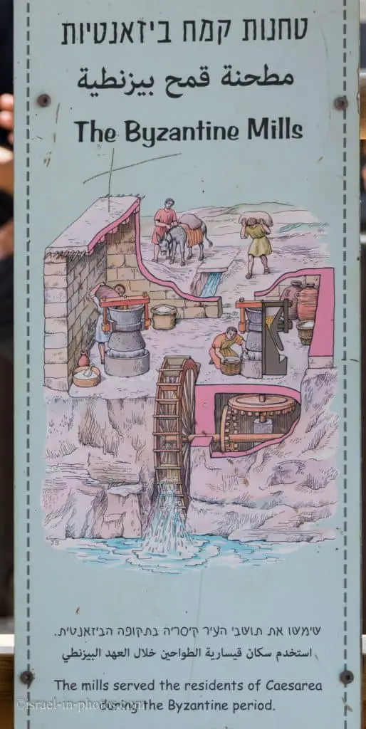
We hurried to the Byzantine flour mills (POI #7 on the site map) because one of the guides was about to make a presentation, and he offered to join us.
The guide gave a short explanation, and then he operated the wheel.
On the western side of the dam, there are many quarries in the kurkar ridge, including the remains of flour mills that operated during the Byzantine and Late Ottoman periods. The Byzantine-period mills operated with a vertical wing wheel, a phenomenon not known elsewhere in Israel. A few paddle wheels have been restored, and two of them can be operated by the water stored nowadays in the lake.
And from the Byzantine mills, we continue along the wooden bridge to the top of the dam.


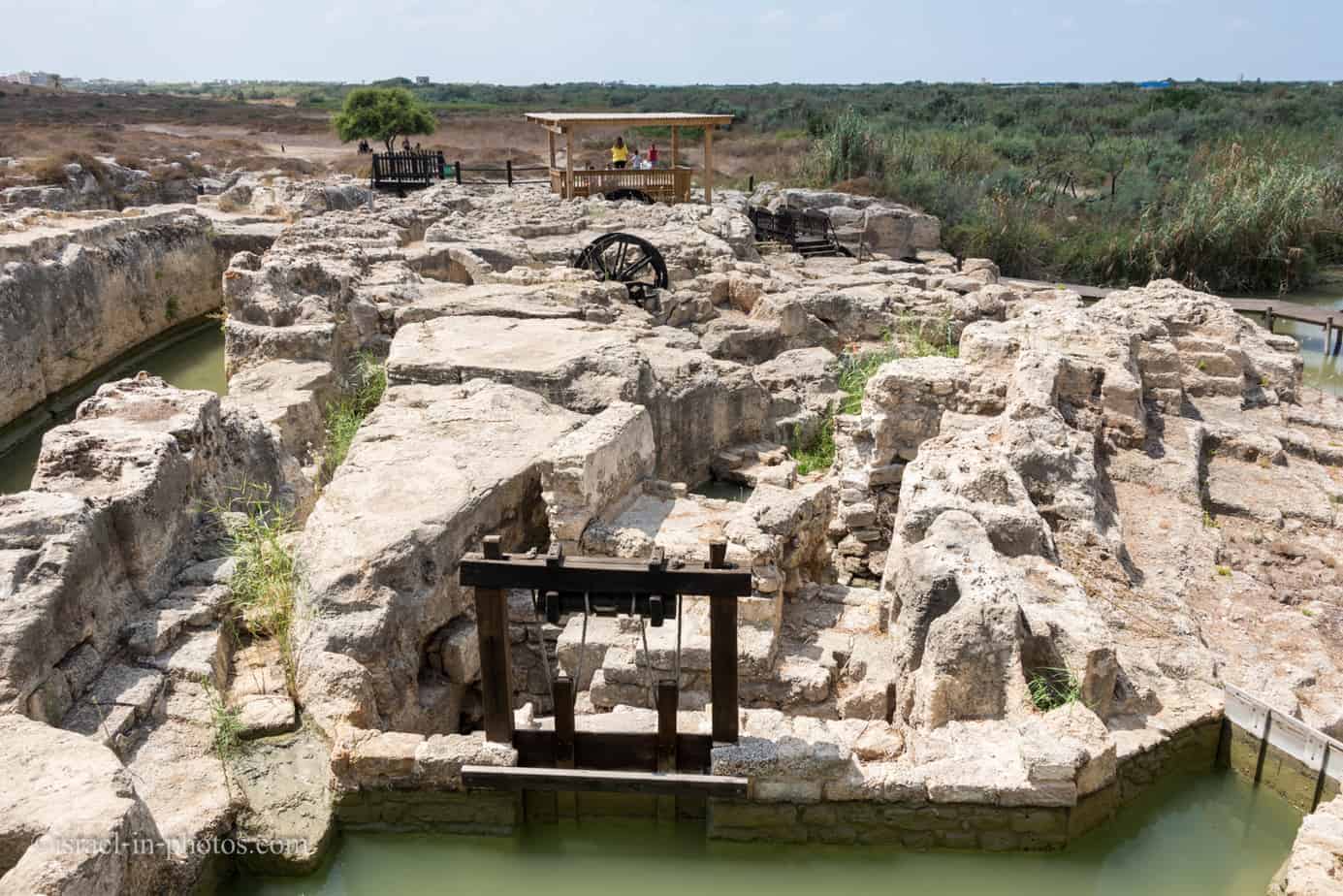
And here is a broader view of the Byzantine mills from the dam.

Wildlife
As we walked on top of the dam, we saw a sign about crocodiles. So let’s talk about wildlife.
Note: For more information about animals and wildlife, check out Zoos and Aquariums in Israel.

There are no crocodiles at Taninim Stream Nature Reserve. The last crocodile in Nahal Taninim was hunted in 1912. The existence of alligators in the creek indicated by ancient sources, and the Greek name of Tel Taninim near the estuary was Crocodilopolis (the city of alligators).
It is possible that during the Roman period, alligators from the Nile were brought here for showcases in Caesarea. While other scholars believe that the alligators were a remnant of tropical livings preserved here.
Despite their relative salinity, the clear water that flows here is abundant all year round. There is a great variety of animals. In the water live softshell turtles and swamp turtles, stream crabs, frogs, toads, and Hylinaes.
The survey conducted in the stream found that in its waters, there are 14 species of fish, including the endemic species Lebanon Hayarkon. A far more prominent fish is the catfish – a large mustache-like predator. In the stream also lives a checkered water snake. He is not poisonous. Hidden in the eel and barrel and around the fish ponds is a swamp cat – a medium-sized cat that can swim and fish. The mongoose will also be happy to leap into the water at the sight of a fish or any other prey.
Note: you can see the last crocodile at The Steinhardt Museum of Natural History.

Birds
During my visits, I saw mostly different species of birds. And one of the reasons is that nearby, in Kibbutz Ma’agan Michael, they grow fish in ponds. Thus, if you want to photograph wildlife, bring a long lens.
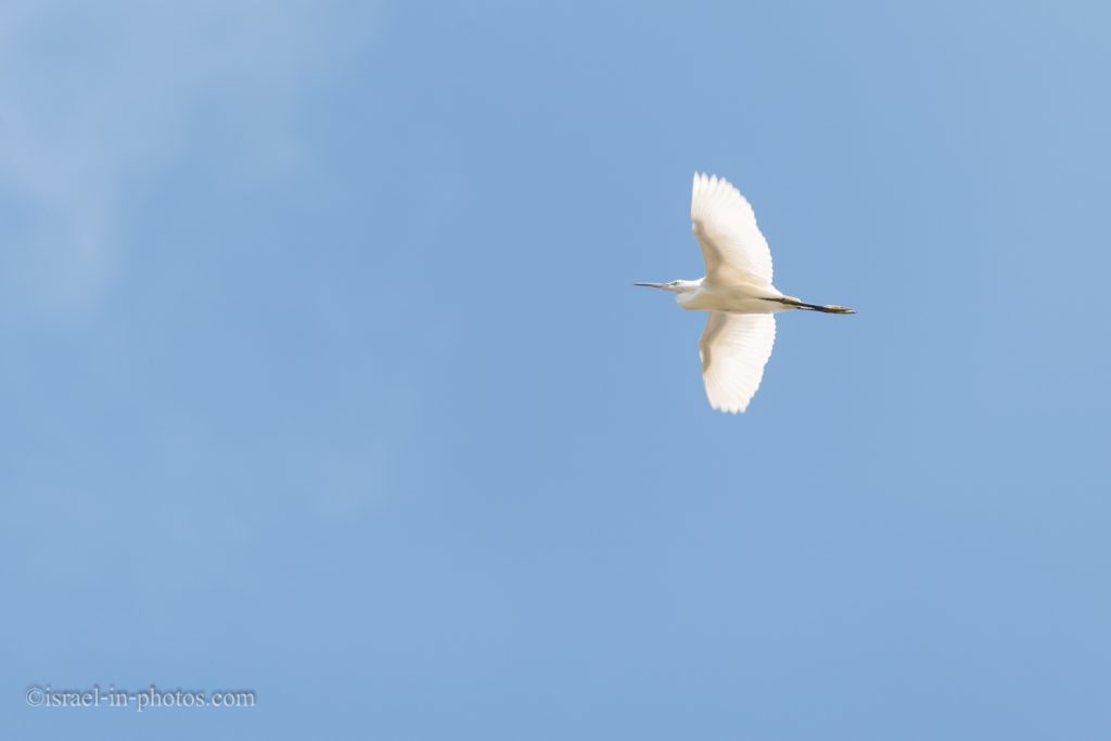
In the eucalyptus grove north of the Roman dam, no less than five species of birds are nesting. From the heron family, you can find the little egret, night heron, squacco heron, purple heron, and cattle egret.
The white-throated kingfisher and pied kingfisher dig nests in the vertical banks of the stream.
Plain Tiger butterfly can be seen across the reserve. He is noticeable due to the orange wings and black with white dotted edges. Plain Tiger butterfly is attracted to the Cynanchum plants on the banks of the stream.

And as I mentioned before, if you want to see wildlife, you should come either early or towards sunset.
Ottoman flour mill
Towards the end of the dam, you will see the Ottoman flour mill (POI #11 on the site map).
This mill was restored during the development of the nature reserve.
From that point, the red trail continues along Taninim stream for a while.


At some point, the red and the black trails (the Dam route and the Aqueduct routes) merge into one.
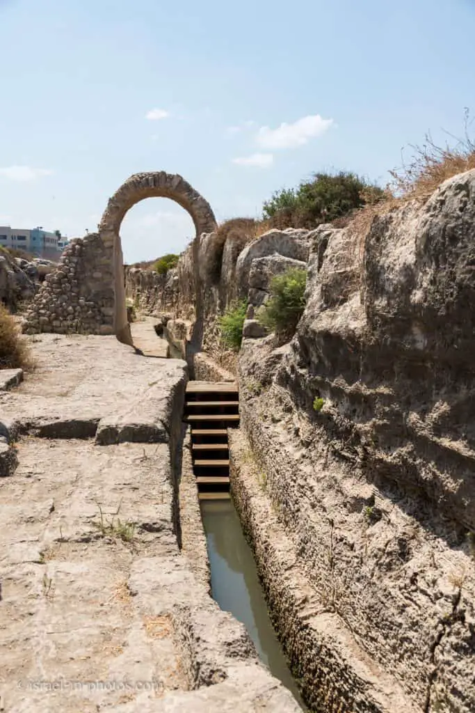
The Lower Aqueduct
In this part, we see the lower and unfinished aqueduct.

This aqueduct was built before the construction of the dam, to channel drinking water to Caesarea. Part of the aqueduct was cut into the rock. The part that passes through the stream bed was constructed of stone blocks. The aqueduct, which was 10 to 50 cm wide, was roofed with stone slabs. Its floor is 3.2 meters above sea level – too low to channel water to Caesarea by force of gravity. When the builders realized their mistake, construction was halted.
Source: sign
From the aqueduct, we followed the red trail back to the parking. Completing the Dam path took us about one and a half hours, and the whole visit to Taninim Stream Nature Reserve was about two hours (we waited for the movie to start).
Summary
Taninim Stream Nature Reserve is not a big site. And a typical visit will take up to several hours. But despite its size, there are things to be seen. And if you are visiting with children, you can take the aqueduct route and enjoy the water part of the trail.
Moreover, if you toured Caesarea National Park and wondered where the water came from, this is the place to visit. In summary, if you love engineering or wildlife, then consider visiting this nature reserve.
Have you ever been to Taninim Stream Nature Reserve? Tell us about your experience in the comments below.
That’s all for today, and I’ll see you on future travels!
Stay Tuned!
Additional Resources
Here are several resources that I created to help travelers:- Trip Planner with Attractions and Itineraries is the page that will help you create your perfect travel route.
- What is the Best Time to visit Israel? To answer this question, we will consider the weather, prices, holidays, festivals, and more.
- Information and Tips for Tourists to Israel will answer the most common questions tourists have about Israel (including safety, passports, weather, currency, tipping, electricity, and much more).
- Israel National Parks and Nature Reserves include a complete list, top ten, map, tickets (Israel Pass, Matmon, combo), and campsites.
- If you are looking for things to do, here are the pages for Jerusalem, Tel Aviv, Haifa, Sea Of Galilee, Akko (Acre), Eilat, Nazareth, Safed (Tzfat), and Makhtesh Ramon.