Amud Stream Nature Reserve – Visitors Guide with Tracks
Amud Stream Nature Reserve in northern Israel offers nature tracks with a lot of vegetation, lovely ponds, and history.
Table of Contents
Map
Amud Stream Nature Reserve is located not far from Safed.
Directions for drivers: Link to Waze and Link to Google Maps
Directions for public transport: Link to Moovit
Interactive map of the area:
When we entered this nature reserve, we received a brochure with explanations and a map. Since a part of the route was under reconstruction, the guide drew the suggested way. He marked it with red arrows.

Note: you can click on the map to enlarge it.
Upper Amud Stream and Lower Amud Stream
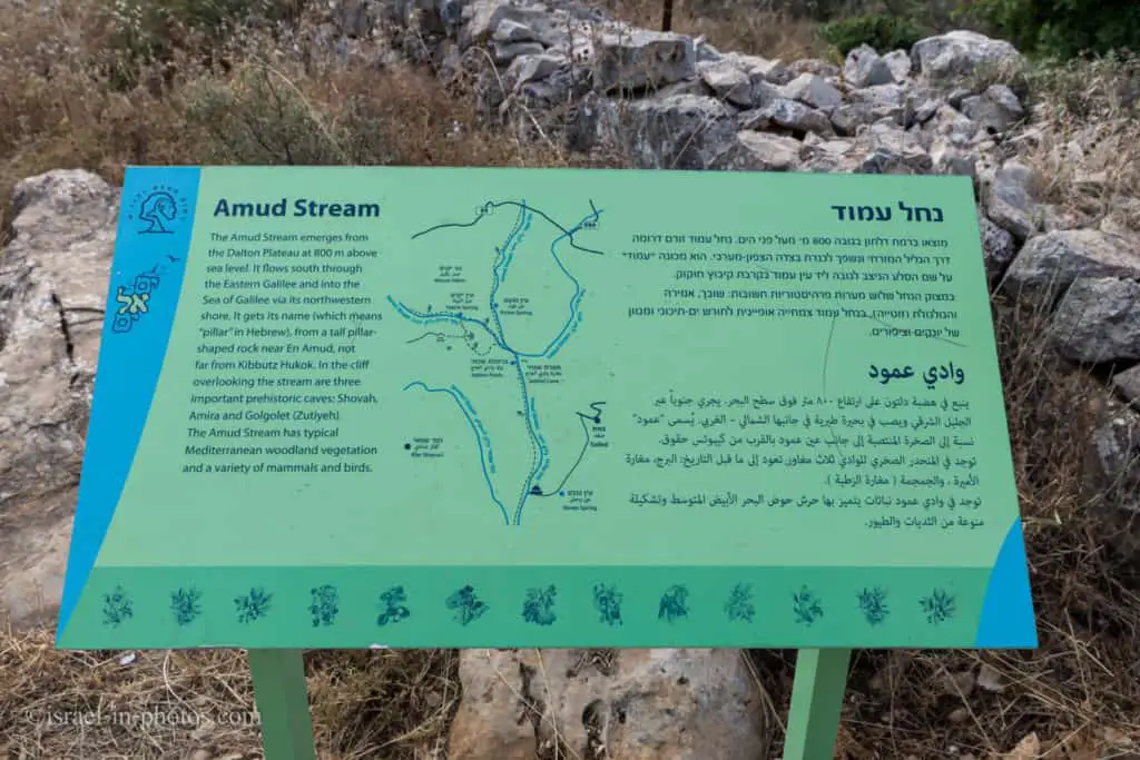
The source of the stream, Ramat Dalton, is located 800 meters above sea level. It flows south through eastern Galilee to the northwest part of the Sea of Galilee, which is around 200 meters below sea level. Usually, people hike either in the upper or lower part of the Amud Stream. Each section is about five km long and offers its points of interest.
At Upper Nahal Amud, you can find En Tina police station, En Yakim, The Orchard, and The Sekhvi Pools. And at the Lower Nahal Amud, you will see Prehistoric caves, The “Amud,” The En Shavshevet and En Amud springs, and the Chera lookout point.
Amud Stream Nature Reserve is located at the upper Amud Stream. Let’s briefly go over the tracks at the lower Amud Stream and then visit the nature reserve.
Tracks at Lower Amud Stream
Here is an interactive map from israelhiking.osm.org.il where the most popular trails are marked:
And here are the details of those tracks:
| # | Name | Color of the Track on the Map above | Description | Distance (km) | Total climb and descent (meters) | Notes |
|---|---|---|---|---|---|---|
| 1 | The classical track | Blue | One directional trail starts by road #85 and ends near road #8077. | 6.1 | 480 | This track requires two cars. |
| 2 | To the pools and back | Green | Reaching the nearest water ponds and returning. | 0.9 | 40 | Starting by road #8077. |
| 3 | To the National Water Carrier of Israel and back | Red | This trail can be easily extended or shortened. | 4.1 | 384 | Starting by road #8077. |
Tracks at Upper Amud Stream
The parking, cafeteria, restrooms, and night camp are at point #1. And this is where the tracks start.
Here is an interactive map from israelhiking.osm.org.il where the two most popular tracks are marked:
And here are the details of those tracks:
| # | Name | Color of the Track on the Map above | Description | Distance (km) | Total climb and descent (meters) | Notes |
|---|---|---|---|---|---|---|
| 1 | The trail we took | Blue | The suggested loop track. | 4.1 | 374 | The guide told us that this path would take about two hours. |
| 2 | To the water and back | Red | Reaching the nearest water ponds and returning. | 2.8 | 230 | Take the black trail till the end (till you reach Basmat Tab’un) and return the same way. |
The route I mentioned above was the suggested one, but you can take another path, including taking the green trail or further incorporating the Israeli National Trail.
Note: you can find the description of the tracks of the Lower Amud Stream below.
Opening Hours
Sunday – Thursday, and Saturday:
- Entry to the long trail: 8:00 – 14:00 (13:00 during winter).
- Entrance to the short track: 8:00 – 15:00 (14:00 during winter).
And the nature reserve is open till 17:00 (16:00 during winter).
Friday and holidays eve:
- Entry to the long trail: 8:00 – 13:00 (12:00 during winter).
- Entrance to the short track: 8:00 – 14:00 (13:00 during winter).
And the nature reserve is open till 16:00 (15:00 during winter).
Entrance Fee
Adult – 28 NIS, child – 14 NIS, and student – 24 NIS. Free for National Parks annual subscribers.
If you visit several National Parks, consider purchasing a combo ticket. For additional information, see National Parks and Nature Reserves.
Note: opening hours and ticket prices were updated in December 2022. In any case, recheck the official site before visiting.
Contact Information
Phone: 04-6999984
Origin of the Name
Amud refers to an inanimate standing object. For example, a lamppost or a pillar. In this case, it relates to the natural stone pillar located near Kibbutz Hukok. Hence, this river is called after that rock.
Campsite
Amud Stream Nature Reserve has a campsite with various amenities like solar lighting, a drinking fountain, bonfire areas, picnic tables, and restrooms. But there are no showers. You can find additional information here.
Upper Amud Stream Track

As I mentioned, we started with the red trail.
Fauna
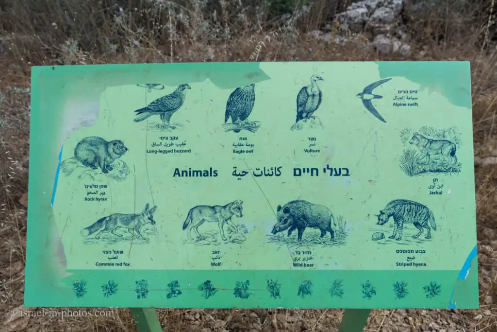
Water means life. And it also means animals. Here is a sign with a list of animals you might run into. But the chances are low since most animals are afraid of humans. I visited this nature reserve several times and never saw any of them.
Wildlife at the nature reserve is very plentiful, thanks to the abundance of water, vegetation, and lofty cliffs.
At Nahal Amud Nature Reserve and in the surrounding area a continuum of open spaces has been left, allowing the stable existence of diverse populations of animals. Within the reserve, there is a large population of wild boar, and a permanent population of Palestine mountain gazelles numbering around 100 individual, as well as hyenas, wolves, jackals, weasels, mongooses, porcupines, martens, European badgers, red foxes, rock hyraxes, various species of rodents, and a few species of bats.
Many reptiles live in the river, and it is a significant breeding ground for the Near Eastern fire salamander, the Middle Eastern tree frog, and the marsh frog of the amphibian group, a group that is in danger of extinction due to a severe loss of wetland habitats in Israel.The ornithological world by the stream is also prosperous: in the thickets and open scrub a large selection of songbirds can be found; birds of prey such as the long-legged buzzard, lesser kestrel, Bonelli’s eagle, Egyptian vulture, and common kestrel nest or stay in the cliffs of the stream; and the snake eagle nests in the well-developed trees. In the past, the nesting grounds here housed some 40 vultures, and cinereous vultures and horned owls were also seen here. In the niches, the red-rumped swallow, Alpine swift, and little swift hatch their eggs.
Recently, the wallcreeper has been observed in the cliffs of Lower Nahal Amud, and in the limestone cliffs lives a species of endemic snail called the Arbel cristataria.
Note: unless stated otherwise, all quotes were taken from the official site.
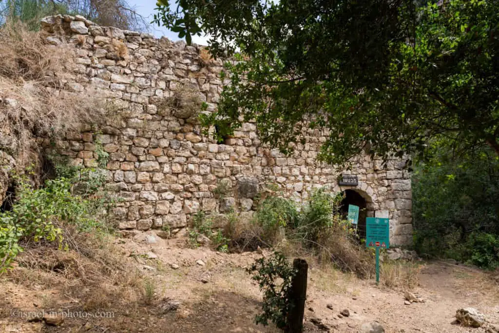
En Tina Police Station
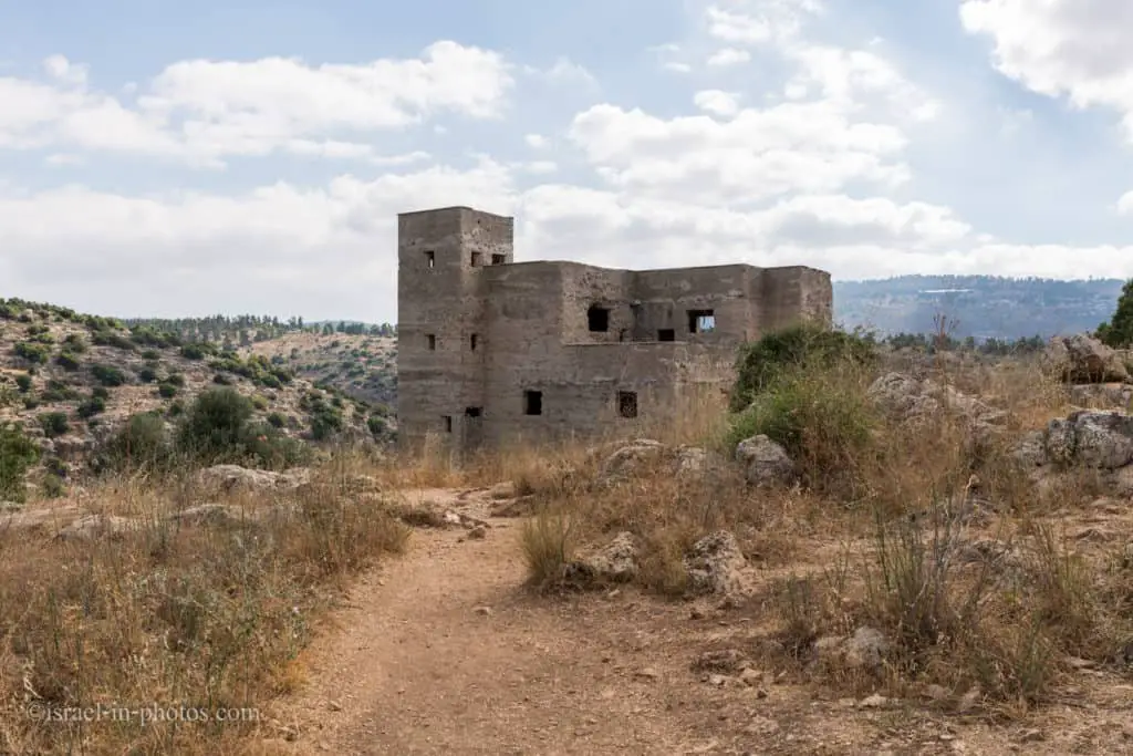
The red trail led us to the En Tina police station (point of interest #2 on the map above).
En Tina police station – an abandoned, concrete building, pocked by bullets, built by the British during the “Arab Revolt” (1936-1939). The building was intended to guard the pumping station at En Yakim – the spring that rises at the foot of the hillside. Entering the building is prohibited because of the risk of collapse.
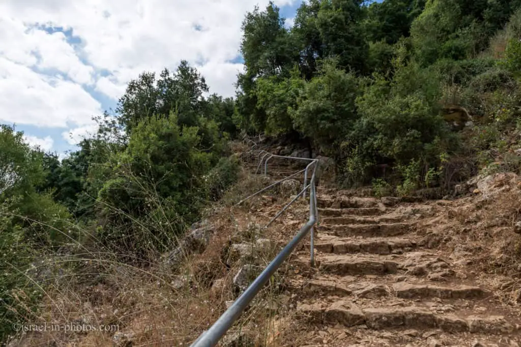
After the police station, the descent begins. Most of this trail’s part is stairs-free and has a moderate decline.
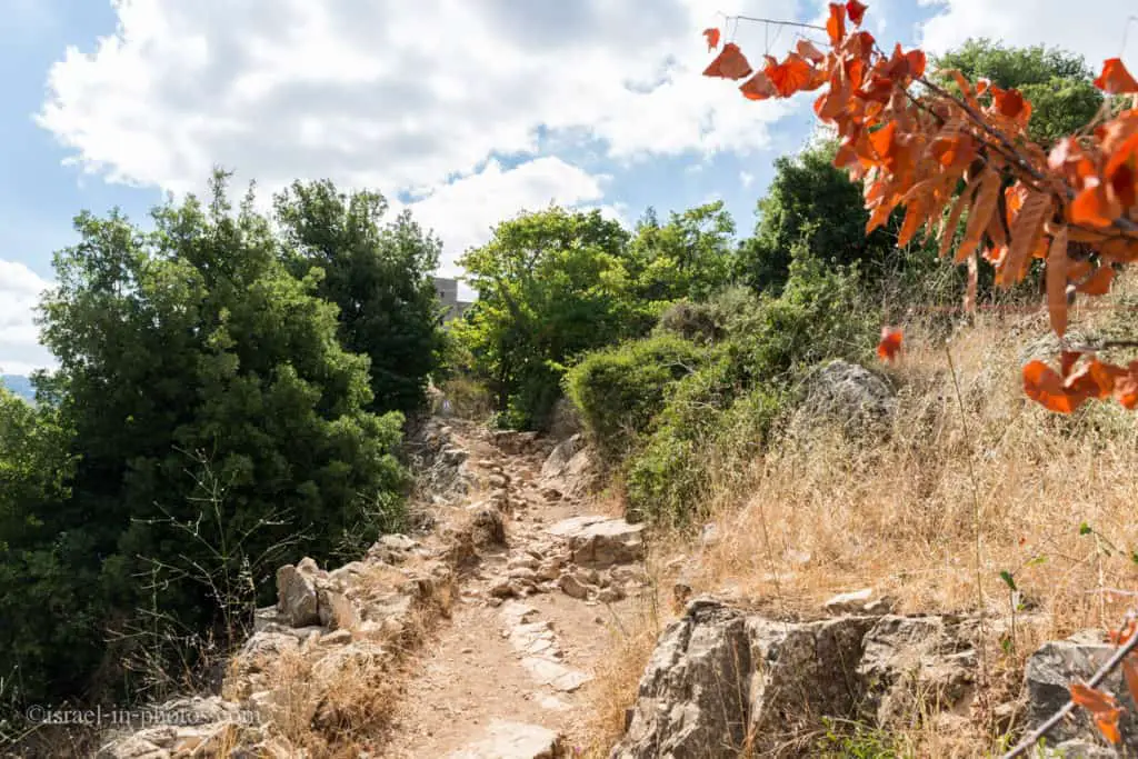
Towards the end of the descent, there are stairs. In any case, do not take baby strollers and use a baby sling instead.
En Yakim
At the end of the descent, point #4, we reached En Yakim.

En Yakim – a full spring that flows all year round. There is a Mandate-era fortified pumping station. These pumps brought water up from the spring to Safed. As a result of pressure by Nature and Parks Authority, pumping from the spring stopped in 1995, and all the spring water now flows into the stream. Near the spring is a large walnut tree. The name of the spring commemorates the Yakim watch – Yakim was one of the priestly families that moved to Galilee after the destruction of the Second Temple. Leading from the spring is an aqueduct that in the past served all the flour mills along the spring and the orchards.
If you want to continue to visit the pools, you should take the black route. But we, as I mentioned previously, continued along the blue trail.
Keep in mind that if you travel with kids and go straight to the pools, there is a high chance that you will spend there all your time and will not see anything else ;)

While walking along the blue trail, you can see the aqueduct.
The Orchard
Number 7 on the map is the orchard. These terraces are used to grow fruits using ancient methods.
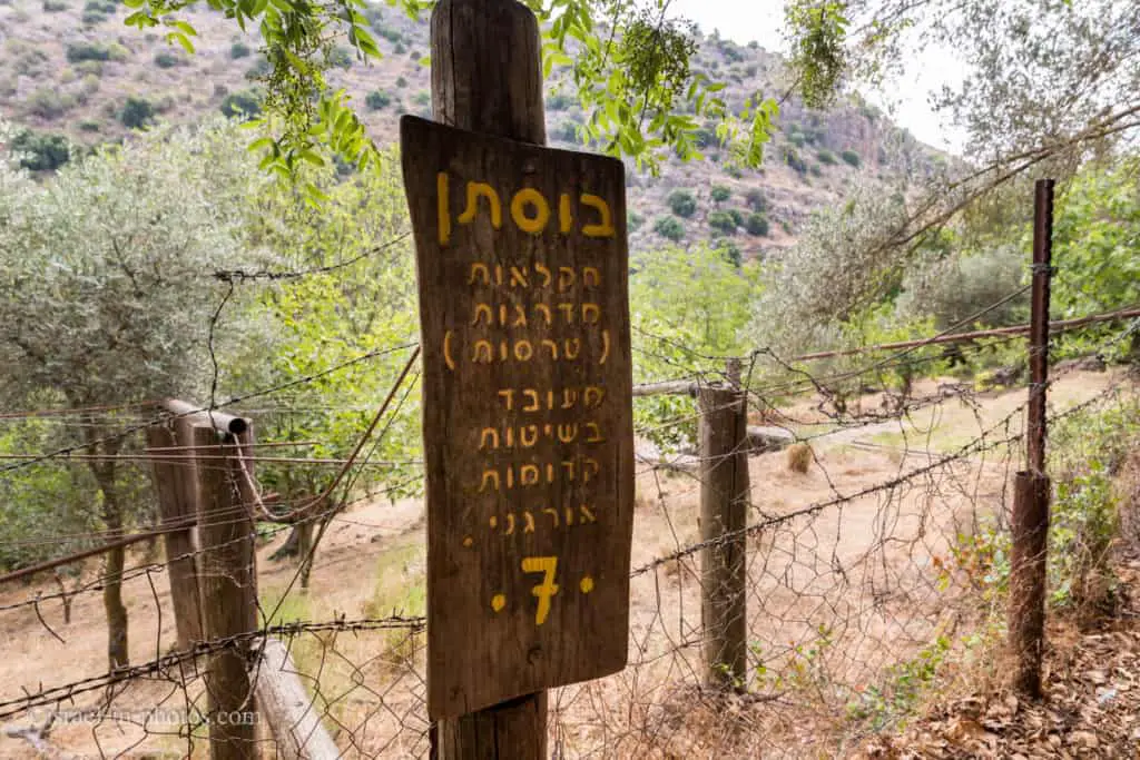
Entrance to the farm is prohibited.
If you are wondering about terraces, here is a short explanation from Wikipedia:
In agriculture, a terrace is a piece of the sloped plane that has been cut into a series of successively receding flat surfaces or platforms, which resemble steps, for the purposes of more efficient farming. This type of landscaping is therefore called terracing. Graduated terrace steps are commonly used to farm on hilly or mountainous terrain. Terraced fields decrease both erosion and surface runoff, and may be used to support growing crops that require irrigation, such as rice. The Rice Terraces of the Philippine Cordilleras have been designated as a UNESCO World Heritage Site because of the significance of this technique.


The only animals we saw that day were some fish and lizards.


Fulling Mill
At point number 9, you can find a water-powered wool processing machine. The water moved the wheels that operated heavy wooden mallets, beating the woven fabric.
This fulling mill operated during the 16th century when the wool industry was at its height in Safed.
Point of interest#10 is undergoing reconstruction, and further passage is not allowed. Hence, we took the bridge to the other side of the river and used the black trail to make our way back to En Yakim.

Wading in the Water
The black trail from points of interest #10 to #5 offers a variety of small pools. You can use the pools to cool yourself and let the children play.
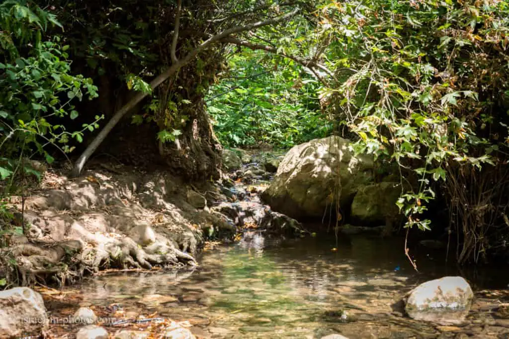
Since there are many rocks, I would advise bringing water sandals or any other footwear you can use to enter the water.
Most pools are shallow, and their depth is about 20 cm to 1 meter. But this, of course, depends on the season. We visited in July, and the summer is the driest season.

Once I visited during March, and the water almost reached the bridge in the photo above.


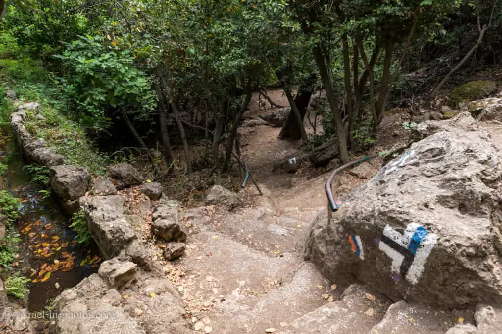
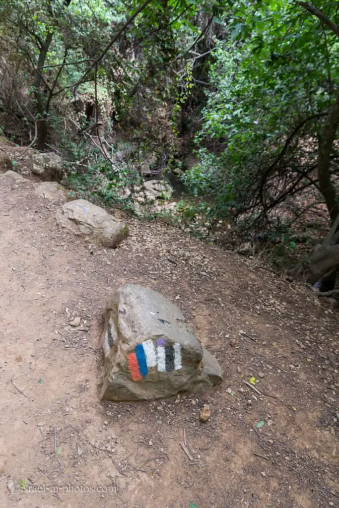
Israel National Trail also passes here. Israel National Trail has three colors. By looking at the marking, you can know the direction. White symbolizes the snow at Hermon, meaning you are going to the north. And orange represents the Eilat mountains, explaining you are going to the south. Israel National Trail is drawn as steps. And in this case, white is the highest, meaning we were heading north.
Along the black path, you can also find the remains of old buildings. But this part is mainly dedicated to wading in the water.
There are many beautiful spots, and you will enjoy the fresh water. But keep in mind that rocks are slippery. Thus, use common sense before any activity.


Summary
The described loop route at the upper Amud Stream Nature Reserve took about two and a half hours. It was fun not only for us but for our daughter as well.
Most of the route is shaded, and there are many pools. Thus you can visit it during different seasons. But I recommend early spring as the water level is the highest and nature starts to bloom.
For additional attractions in the area, check out the guide to the Sea of Galilee.
Have you ever been to Amud Stream Nature Reserve? Tell us about your experience in the comments below.
That’s all for today, and I’ll see you in future travels!
Stay Tuned!
Additional Resources
Here are several resources that I created to help travelers:- Trip Planner with Attractions and Itineraries is the page that will help you create your perfect travel route.
- What is the Best Time to visit Israel? To answer this question, we will consider the weather, prices, holidays, festivals, and more.
- Information and Tips for Tourists to Israel will answer the most common questions tourists have about Israel (including safety, passports, weather, currency, tipping, electricity, and much more).
- Israel National Parks and Nature Reserves include a complete list, top ten, map, tickets (Israel Pass, Matmon, combo), and campsites.
- If you are looking for things to do, here are the pages for Jerusalem, Tel Aviv, Haifa, Sea Of Galilee, Akko (Acre), Eilat, Nazareth, Safed (Tzfat), and Makhtesh Ramon.