

Wells and Pits Trail, Britannia Park – Visitors Guide

Wells and Pits Trail is a loop hiking track near Bet Shemesh. Ans it is one of the most popular hiking paths in this region.
Map
Wells and Pits Trail is located not far from Tel Azekah in Britannia Park, which is near the city of Bet Shemesh. And the easiest way to reach it is by entering its name into Waze.
Directions for drivers: Link to Waze and Link to Google Maps
Directions for public transport: Link to Moovit
Interactive map of the area:
And here is a map of Britannia Park:

Notes:
- You can click on the map to enlarge it.
- On the map above, the trail is marked in red color.
Parking
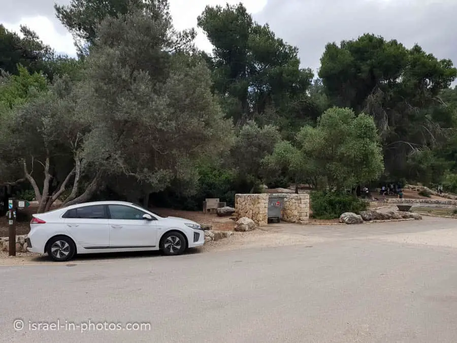
There are many free parking places in Britannia Park. And there is also free parking and a picnic area near the starting point of this trail.
Opening Hours
The KKL signs and website does not list opening hours. It only says: “Staying in the forest after dark is prohibited unless the required safety measures are taken.” Moreover, there is no artificial light, so visit only during the day.
Note: I visited Britannia Park many times, including on weekends and holidays, and it was always open.

Trails
There are many trails in Britannia Park. Pits and Wells trail is one of the popular tracks. I also marked a shorter version of the same path on the following map.
Here is an interactive map from israelhiking.osm.org.il where the hiking trails are marked:
And here are the details of the marked trails:
| # | Name | Color of the Trail on the Map above | Description | Distance (km) | Total climb and descent (meters) | Notes |
|---|---|---|---|---|---|---|
| 1 | Wells and Pits Trail | Red | This trail starts at the water well parking, goes through different points of interest, and returns to the same place. | 3.57 | 218 | Completing this trail at a moderate pace took us 2.5 hours. Not suitable for baby carriages. |
| 2 | Wells and Pits Trail – Short loop trail | Blue | This is a shorter variation of the same we did several years ago. | 1.49 | 97 | Not suitable for baby carriages. |
What Ages is the Wells and Pits Trail Suitable for?
According to the KKL website, the track suits families with kids over ten years old. Our experience was a little different. My older daughter (11) had no problem completing this path. My youngest daughter (3) completed about 70% of the trail (and I carried her the rest of the way). Thus, children over six years old can probably complete this trail (depending on the weather).
Since most families make several stops, you should bring food (fruits, sandwiches, and other snacks) and plenty of water (two liters per person is the recommended amount).
Entrance Fee
Free.
The Beginning of the Trail
And now, let’s start hiking.
As mentioned, we start at the water well parking lot, which got its name thanks to a water hole carved into the rock beside it.


The path climbs next to a restored terrace in the heart of a planted forest mixed with forest trees and passes various remains. Here are several photos from that part of the path:


Hurbat A-Rasm
You will see stairs to your right when you reach the following hole.

Though the trail continues straight, taking the stone stairs uphill to your right will lead you to Hurbat A-Rasm within several minutes.
Hurbat A-Rasm shows the remains of a rural settlement. Excavations revealed the remains of a mansion from the Hellenistic period.
Khirbat al-Rasem is an archaeological site within the Britannia Park in the Upper Lowlands. The site is at the top of a hill on the path to the wells and cisterns, about a kilometer south of Tel Azkah, near the Elah Valley, and 11 kilometers from Tel Marsha. The site is rural and is not identified with any settlement mentioned in the sources. The main remnant on the site is a large square structure (30 x 30 meters), a central courtyard surrounded by rooms. Caves, pits, steps on the slope, and a stone structure probably used as a tombstone were found around the building. The site was discovered by Yehuda Dagan during the Shefalah survey and was excavated between 1997-2003. The settlement on the site existed intermittently for a thousand years, from the Iron Age to the Roman period.
Source: Wikipedia
Here are several photos:


Tel Shiklon
The path continues to the intersection of the red trail and green road. And we continue following the red path to Tel Shiklon.

As we climb to the top, we can see the previous hill we visited (Hurbat A-Rasm).

