Kule Forest – Givat Koah Forest – Visitors Guide
Kule Forest (Givat Koah Forest) near Elad offers hiking trails, picnic areas, memorials, ruins, and even a Roman mausoleum.
Note: sometimes Kule Forest is also called Elad Forest.
Table of Contents
Map
Kule Forest (Givat Koah Forest) is located south of Elad, near Rosh Haayin.
Enter “Givat Koah Forest” into the navigation app to get there. You can also drive along Road #444 until you turn to Road #465. After several minutes on #465, you will see a turn left to the Alexandroni memorial. Turn to the dirt road and park by the monument.
Directions for drivers: Link to Waze and Link to Google Maps
Directions for public transport: Link to Moovit
Interactive map of the area:
Here is a map of Kule Forest (Givat Koah Forest):
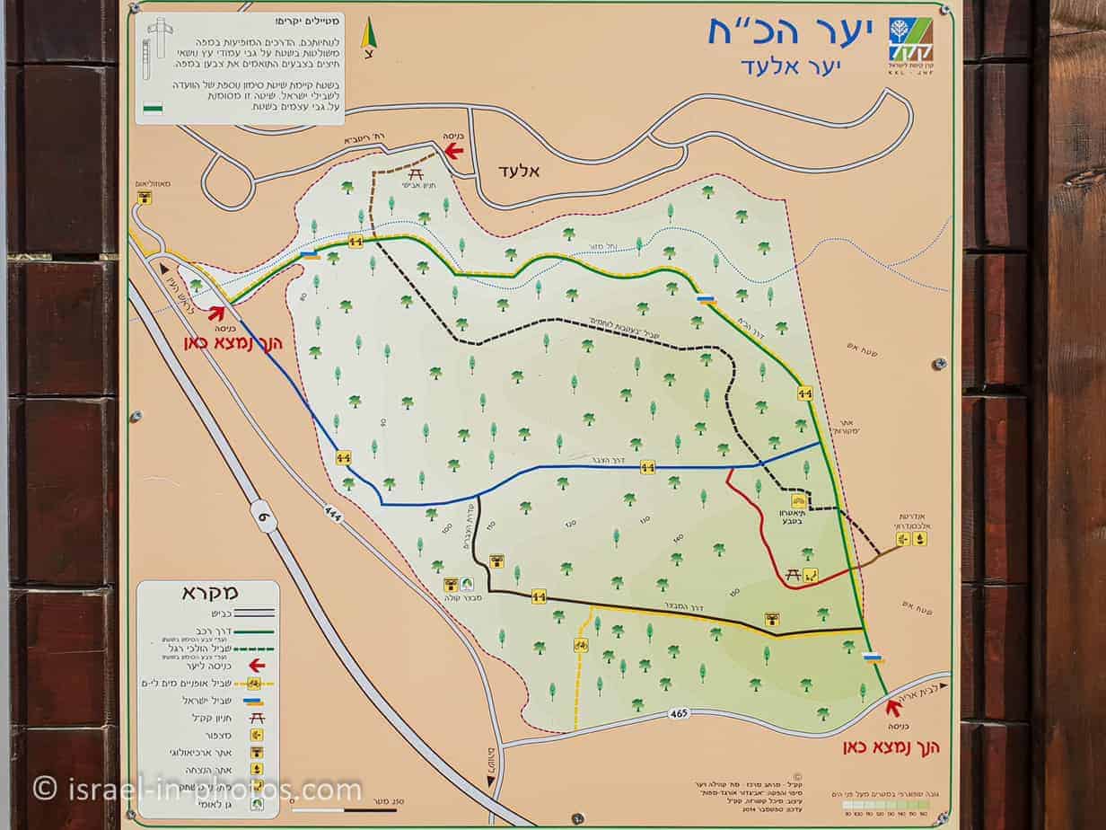
Note: you can click on the map to enlarge it.
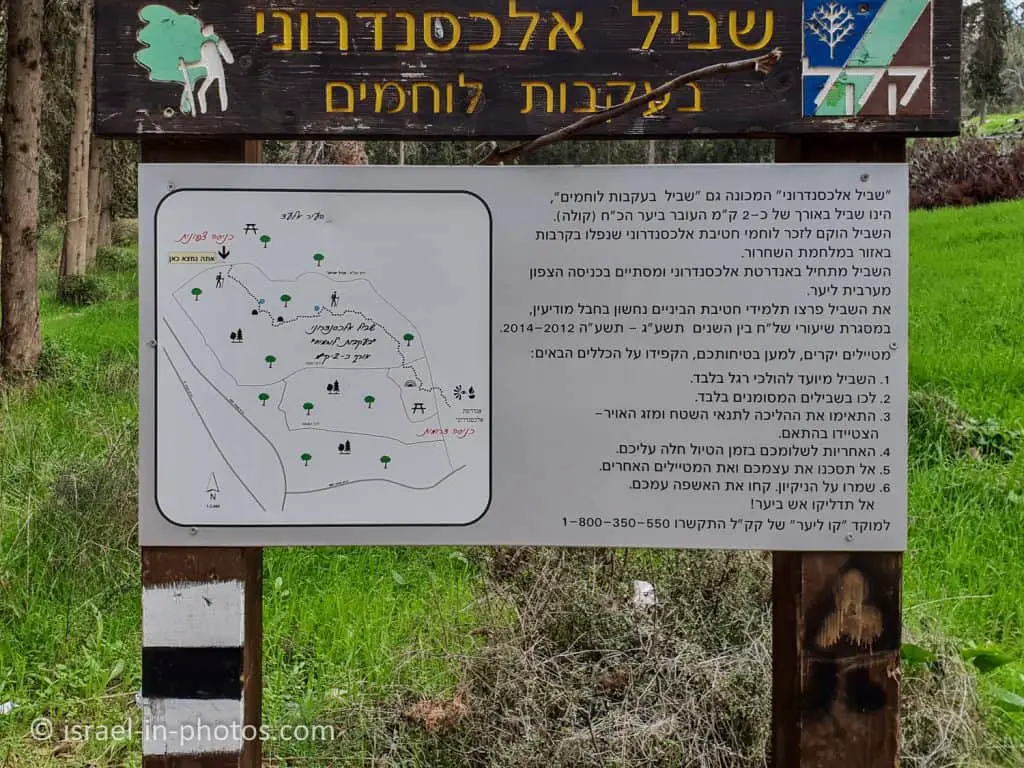
As you can see from the map, there are two picnic areas. One is near the Alexandroni memorial (near the bottom right of the map), and the other is near Elad (near the top left corner).
Trails
Many trails, including the Israeli National Trail, pass through this forest. And you can combine them into a loop or one-way trail. And here is an interactive map from israelhiking.osm.org.il where the trail that we did is marked:
And here are the details of these tracks:
| Name | Color of the Trail on the Map above | Description | Distance (km) | Total climb and descent (meters) | Notes |
|---|---|---|---|---|---|
| Loop Trail | Blue | Take the black trail from the Alexandroni memorial, then continue using the Israeli National Trail to the mausoleum. And return using the blue and black trails. | 5.5 | 186 | You can make this route longer or shorter (by skipping the mausoleum and driving to it later). |
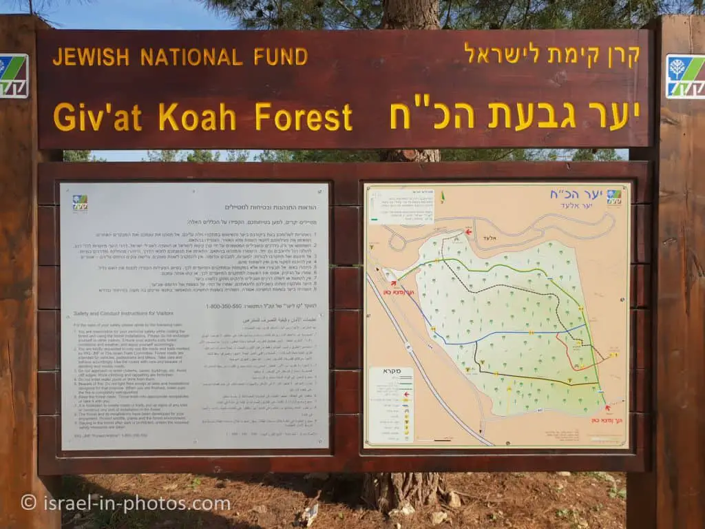
Here is the sign with the map that you can find at the parking by the Alexandroni memorial:
Entrance Fee
Free.
Opening Hours
You can visit at any time. Just finish before dark, as there is no illumination along the route.
Names
This forest has three names. They are:
- Kule Forest – Kule was an Arab village. You can find its remains in the park.
- Koah Forest – in Gematria, Koah is 28. Twenty-eight soldiers from the Alexandroni brigade died during the Kule fights, and this name commemorates them.
- Elad Forest is located near the city of Elad, hence the name.
Now, I will take you along the trail mentioned.
Alexandroni Memorial
We parked near the Alexandroni Memorial, which is also the place where we began our hike.
At the memorial, you can find a short description of the events. It also explains the origin of the name Koah (see the Names section above).
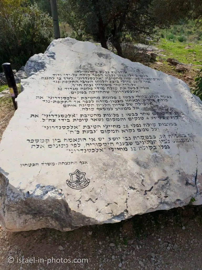
And here are the names of the fallen soldiers:


Following the Warriors Trail
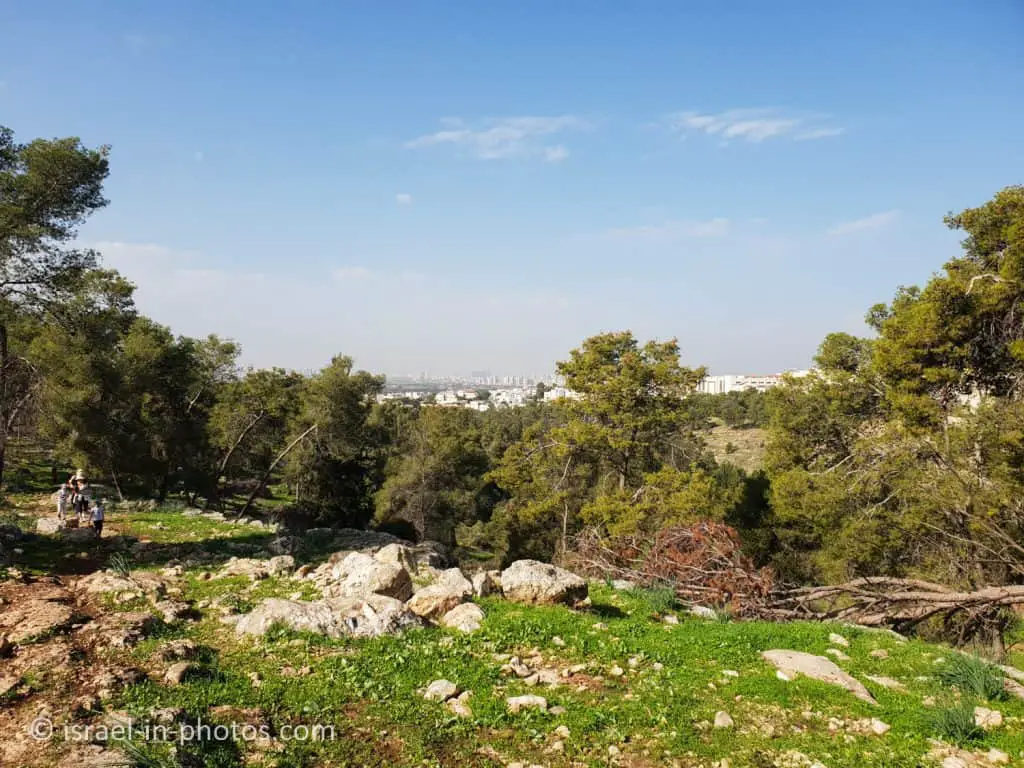
From the Alexandroni memorial, we took the black trail called Following the Warriors.
The length of this trail is about 2 km, and it was made in 2012 – 2014 by junior high students to commemorate the memory of the soldiers who fell during the Independence War.
As you can see from the following photo, the trails are marked clearly, and you can hike without a dedicated trail map.


Many people love having picnics in this forest. And if you go hiking during the weekend, you will see them.


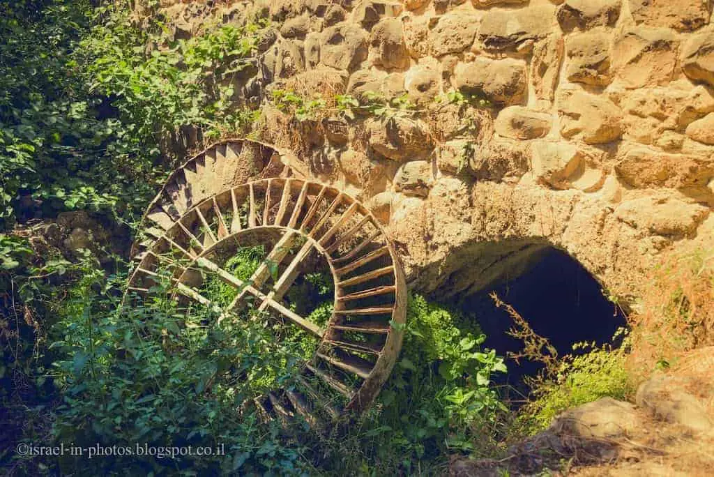
We continued along the black trail until we saw the first sign. This sign told us about the water cistern found nearby. It is a common bell-shaped water cistern, one of many archeological remains found in this area.


Cork oak (Quercus suber) is a medium-sized, evergreen oak tree. From its bark, people produce cork. After peeling, the outer layer grows back for ten years. This way, people continue using the same tree for 150-200 years.
We visited Kule Forest in December 2020, and though it was still winter, we saw Cyclamen.


Further, on our way, we saw a bat cave. But the entrance to this cave is forbidden.


According to the archeological findings, many constructions were found in this area. People needed stones to build them. The next sign we saw told about an ancient quarry in this area.


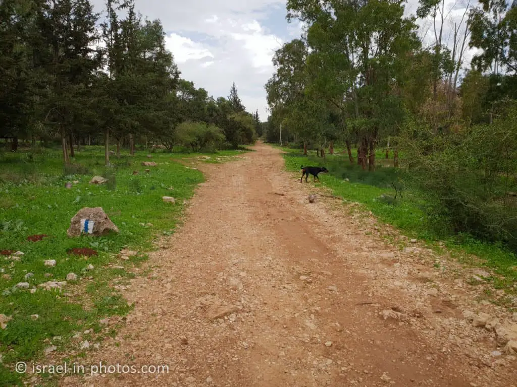
We reached the end of the black trail and continued to the mausoleum using the Israeli national trail.
Mazor Mausoleum
As I mentioned above, you do not have to walk here. Mazor Mausoleum is located by road #444, and you can see it from the road. Moreover, you can get off the road nearby and park by the mausoleum. Thus, you can drive here.


This impressive Roman building was used as a landowner’s family burial vault at the beginning of the 4th century CE. The temple-like facade is Classical in style, with two pillars in the center and two elaborate doorposts. Through the single opening, which was once dosed by a stone door, one enters the burial chamber, in which there are remnants of two sarcophagi. The next room is a columbarium with about 60 recesses used for raising doves in pagan rites of the Roman period. The original entrance to this room was through an aperture high on the eastern wall, accessible by a ladder. In a later period, a mihrab or Mecca-facing prayer niche was added to the southern wall of this large room. The building became a holy place for Muslims known as Makam Nebi Yihiya and remained intact due to its sanctity. Three cisterns and several rock-hewn tombs surround the building.
Source: sign


We started making our way back from the mausoleum. But we did not follow the same path. On the way back, we wanted to see the Kule fortress.

Kule Fortress
The fort is located by road #444, and you can see it from the road. But you can not get off the road nearby. You either have to drive by the mausoleum or use road #465.

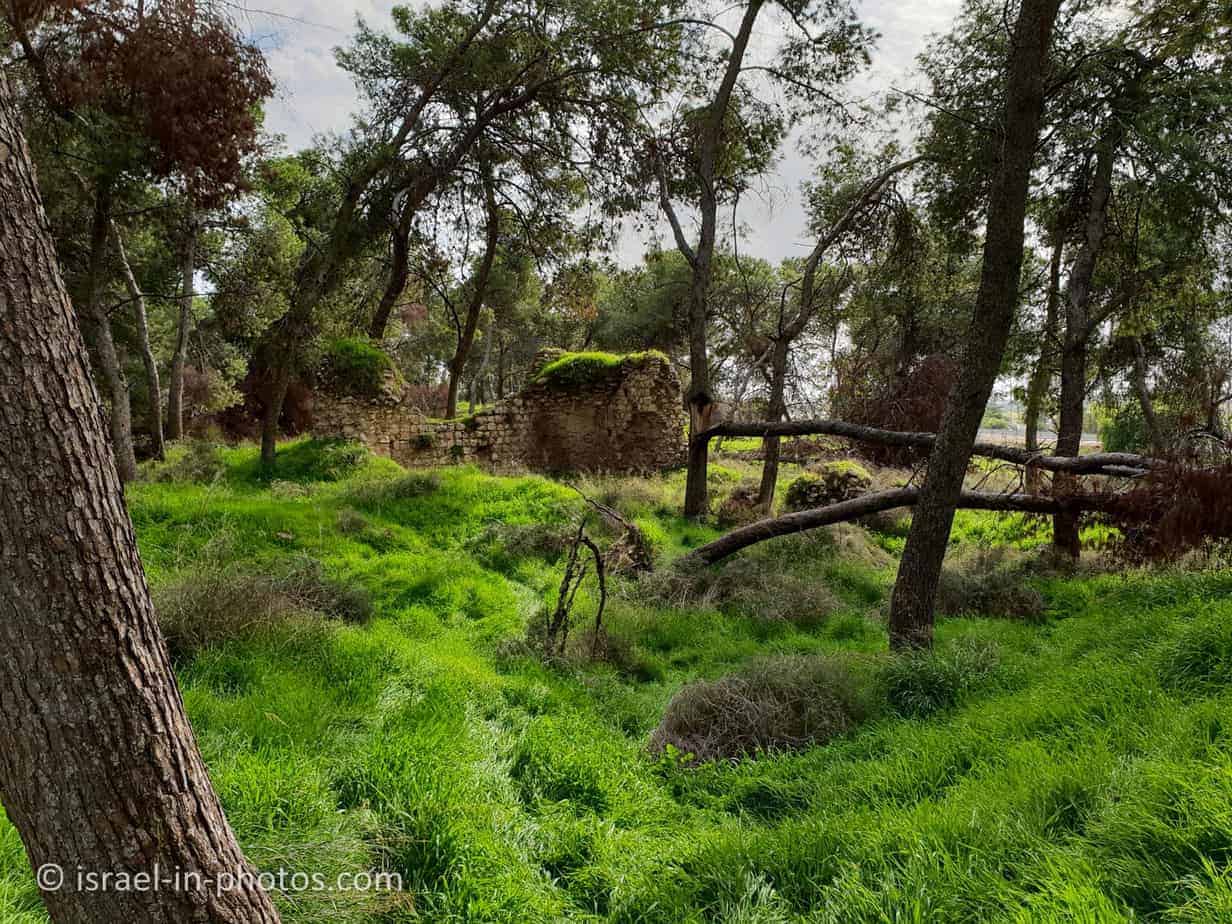
Kule means tower in Turkish. There was an Arab village here until 1948. But as you look at the buildings, you realize they do not look like an Arab village. That is because the village was constructed on top of buildings built by Crusaders.
The remains of the Crusader fortress Kule are located in the western part of the forest. The fort included a large structure and a tower built of large and impressive stones. The place belonged to the Hospitaller Order, which built an administrative center here in the late 12th century.
Scattered around the Crusader structure are the islands of the Arab village of Kule. Its name may be derived from the word Kule (Turkish: tower). Hassan Selma, one of the famous leaders of the “Arab Revolt” and a sworn fighter against the Jewish community, came out of this village. On November 30, 1947, Selma was responsible for attacking the bus traveling from Netanya to Jerusalem, which signaled the start of the War of Independence. On May 31, 1948, Hassan Selma emerged at the head of a force that managed to repel Etzel fighters from Rosh HaAyin. He was wounded during the battle and died of his wounds a few days later.
Warning: The Crusader structure is not signed and regulated. Do not climb the tower!
Source: KKL


There is some mixup on the trail map. The blue trail passes here, though according to the map in the forest, it was supposed to be the black trail. And we used it to return to the Alexandroni memorial.
Summary
The hike at Kule Forest took us about three hours. It is a wonderful route that allows seeing different things. And you can always make the hike shorter or longer. Moreover, there are places for picnics, and this forest is close to the center.
If you are looking for additional attractions, I suggest the recently reopened nearby Migdal Tsedek National Park. Within a short drive, you can also reach Neot Kedumim and Yarkon National Park – Tel Afek.
Have you visited Kule forest? Tell us about your experience in the comment below.
That’s all for today, and I’ll see you in future travels!
Stay Tuned!
Additional Resources
Here are several resources that I created to help travelers:- Trip Planner with Attractions and Itineraries is the page that will help you create your perfect travel route.
- What is the Best Time to visit Israel? To answer this question, we will consider the weather, prices, holidays, festivals, and more.
- Information and Tips for Tourists to Israel will answer the most common questions tourists have about Israel (including safety, passports, weather, currency, tipping, electricity, and much more).
- Israel National Parks and Nature Reserves include a complete list, top ten, map, tickets (Israel Pass, Matmon, combo), and campsites.
- If you are looking for things to do, here are the pages for Jerusalem, Tel Aviv, Haifa, Sea Of Galilee, Akko (Acre), Eilat, Nazareth, Safed (Tzfat), and Makhtesh Ramon.