Caesar Trail and Khirbet Hanoot – Visitors Guide
Caesar Trail is a hiking trail near Bet Shemesh that leads you through Roman stairs, Khirbet Hanoot, and other remains.
Table of Contents
Map
Caesar Trail is in USA Park, near the city of Bet Shemesh. This is a one-way trail (that can be extended to a loop path), and you can start at Khirbet Hanoot or the olive press by road #375 (near the intersection of #375 and #3855).
Directions for drivers: Link to Waze and Link to Google Maps
Directions for public transport: Link to Moovit
Interactive map of the area:
And here is a map of USA Park:

Notes:
- You can click on the map to enlarge it.
- On the map above, the trail is marked in dark red color.
Parking
There are free parking lots at Khirbet Hanoot and by the mentioned oil press.
Opening Hours
The KKL signs and website does not list opening hours. It only says: “Staying in the forest after dark is prohibited.” Moreover, there is no artificial light, so visit only during the day.
Trails
There are many trails in USA Park. And today, we will visit the Caesar Trail.
Here is an interactive map from israelhiking.osm.org.il where the hiking trail is marked:
And here are the details of the marked trails:
| # | Name | Color of the Trail on the Map above | Description | Distance (km) | Total climb and descent (meters) | Notes |
|---|---|---|---|---|---|---|
| 1 | Caesar Trail | Blue | You can start at Khirbet Hanoot (green point on the map) or the olive press by road #375 (red point on the map). | 3.1 | 227 | If you want to go downhill, then start at Khirbet Hanoot. |
You can extend it to a loop path by hiking in two directions on the same path or do what we did (I will describe below).
Entrance Fee
Free.
Why is this path called Caesar Trail?
On the side of the road, a millstone bearing Hadrian’s name was found. It is possible that the emperor did go up this road when he visited Jerusalem in 130 AD, and this road may have been paved in honor of his visit.
Source: KKL
The Olive Press
We started our visit at the olive press parking lot. It was the first on our way, and I usually prefer hiking uphill (less stress on the knees).
We saw the Caesar Trail sign and the olive press when exited the car.


The restored olive press shows the last step. After crashing the olives elsewhere, they were brought here. Then oil was extracted using the pressure of a “screw device.”
The Red Trail
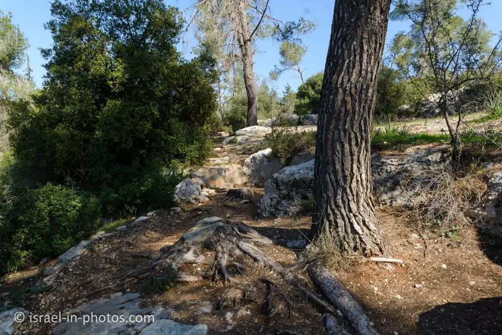
We started hiking uphill on the red trail towards the Roman stairs. Here are several photos from that section of the route:
Roman Milestone
After about twelve minutes, we saw columns.
On the right side of the path, there are four fragments of round rock pillars. These are the remains of the Roman millstones. Millstones were placed on the roadsides of the Roman Empire and indicated the distance from the start of the road, usually from a major city. The empire rulers often took advantage of the millstones and wrote dedicatory inscriptions that strengthened their status. For the most part, the rulers left their predecessors’ millstones, so there could be several millstones in one place.
Source: KKL


Note: you can see a preserved Roman Milestone near The Mizgaga Museum.
Here are several additional photos of the path:


Note: as you can see from the photos, there are many rocks, and even some climbing is required. And though it is not a hard trail (suitable for families), you cannot use baby strollers.
The Roman Stairs
Before we get to the Roman stairs, I want to mention something.
It took us about 50 minutes to get to the Roman stairs (830 meters and 67 meters climb), which was much more than I anticipated. And by this point, we already realized that my youngest daughter (barely three years old) would not complete the track by herself. Thus I want to mention a small parking lot by road #375 near the stairs. And after visiting the stairs, we returned to the parking lot, where my wife and kids waited for me to return to the car and pick them up.


These stairs belong to a Roman road from Jerusalem to Beit Guvrin. The stairs helped to overcome the problematic topography of this section of the road. It is unclear if the stairs were used as a base for something or if they were revealed as in their current state.
Source: sign


Khirbet Hanoot
As I mentioned, I returned to the car, and from the small parking lot, we drove to Khirbet Hanoot.
Khirbet Hanoot is currently undergoing a transformation. The old parking lot, which serves as a starting point for hiking along Caesar Road and Ein Mata, is getting a serious upgrade. KKL added tables and taps of drinking water and made the parking lot accessible to people with disabilities. An accessible path was paved to the beautiful mosaic that glorified the Byzantine church.
Archeological excavations were recently conducted in Khirbet Hanoot on behalf of the Antiquities Authority and KKL. At the entrance to the parking lot, a large pool was uncovered, the walls of which are still covered with plaster. A little further on, a large wine press was uncovered, where the tread surface was covered with white mosaic stones.
We knew a long time ago that the stone walls, a remnant of the Mamluk Khan who lived here in the Middle Ages, were built on the remains of a Byzantine church. The beautiful mosaic floor, which is between its walls, testifies to this. The floor, which was discovered in 1985 in a salvage excavation conducted by the archaeologist Eli Shenhav, is decorated with rows of medallions growing out of vines. The medallions depict animals and plants. The mosaic even bears a dedicatory inscription in ancient Greek, and this is a translation: “During the time of the most beloved devotee and priest and head of the monastery Theodoros, the entire work of adding the niche, the equipment and placing the panels of the end of the church together with the diaconicon, was carried out from the ground up, in April of the 12th indication (indication – 15-year time unit, a method used in certain periods to divide time).
The excavations in the church revealed other parts of it, including the remains of a crypt (underground chamber). The excavations are underway, and we hope to bring you more detailed information once it is finished.
Source: KKL

Storage Pool
To the left of the entrance, you will see a storage pool. The size of this storage pool is 12.5 * 6.5 meters. And it was built in the Byzantine period.


Goliath’s Tomb
Behind the storage pool, you can see a small hill. Some believe that this may be Goliath’s tomb.
Eli Shenhav believes that a hill of stones at the entrance to the Khirbet Hanoot parking lot (near the water pool) is important. A large hill of stones on the way down from Jerusalem to Gaza and Ashkelon is described by an unknown traveler from the 6th century CE, known as the traveler from Piacenza. He writes about a large hill of stones marking the grave of Goliath. According to the passenger’s testimony, the mound of stones was created since it was customary for passers-by to throw stones at the grave until a large mound covered it. It is possible that the wave of stones standing today at the entrance of the KKL parking lot, which is about seven meters high, is the same ancient hill of stones.
Source: KKL
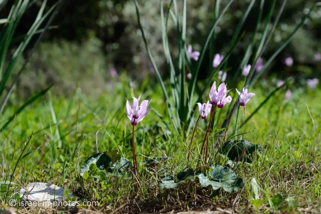
Near the storage pool, you can see a trail. The same path becomes the red trail and leads to the olive press.
We hiked along this trail a bit, and here are several photos from there:


As you can see from the photos, there are flowers. And that is because we visited at the end of January. Spring and the end of winter is my favorite season for nature hikes.
And now, let’s return to the entrance and follow the road to the east to see the church.
Remains of a Byzantine Church
The church found at Khirbet Hanoot was probably part of a monastery.
Maybe the monastery served Christian pilgrims who went from the coastal plain to Jerusalem and Bethlehem.
A big mosaic floor (10X4.2 meters) was found in the church’s main hall. It is decorated with geometric shapes and figures of animals.
In the eastern end of the church there is a staircase leadind to a burial chamber beneath the floor.
Source: sign
Here are several photos of the church:


The Big Wine Press
You can see the remains of a big wine press near the church.
The big wine press (14.8X8 meters) operated during the Byzantine period, probably as part of the nearby church. Initially, there was a small winepress stepping surface and a cistern. Later the big wine press was installed, which included three levels.
The lower level is the stepping surface. In the center, a small hole was created. Thus hole was used to squeeze the remaining juice from the grapes using a screw machine (after it was pressed by foot).
From the stepping surface, the juice was drained into an underground cistern (depth: 1.75 meters). Fermentation rooms were built around the stepping surface (the middle level).
The remaining mosaics at the upper level tell us that the wine press had one more level.
Source: sign


Summary
This is a lovely family trail with many points of interest. The only downside is that it is a one-way trail unless you go back and forward or do the same as we did.
Since many other points of interest are nearby, you can always combine a visit with other places. You can find additional attractions on the interactive map at the top of this page.
Have you ever been to Caesar Trail? Tell us about your experience in the comments below.
That’s all for today, and I’ll see you in future travels!
Stay Tuned!
Additional Resources
Here are several resources that I created to help travelers:- Trip Planner with Attractions and Itineraries is the page that will help you create your perfect travel route.
- What is the Best Time to visit Israel? To answer this question, we will consider the weather, prices, holidays, festivals, and more.
- Information and Tips for Tourists to Israel will answer the most common questions tourists have about Israel (including safety, passports, weather, currency, tipping, electricity, and much more).
- Israel National Parks and Nature Reserves include a complete list, top ten, map, tickets (Israel Pass, Matmon, combo), and campsites.
- If you are looking for things to do, here are the pages for Jerusalem, Tel Aviv, Haifa, Sea Of Galilee, Akko (Acre), Eilat, Nazareth, Safed (Tzfat), and Makhtesh Ramon.