

Tel Beer Sheva National Park – Visitors Guide to Biblical Tel

Tel Beer Sheva is Biblical tel, and together with Megiddo and Hazor, they were declared by UNESCO as world heritage sites.
Note: You can find information about the other two mentioned national parks at Tel Megiddo National Park and Tel Hazor National Park.
Map
This national park is located several kilometers east of the modern city of Beer Sheva. It is located close to roads #40 and #60. And the easiest way to reach it is by entering “Tel Beer Sheva” into Waze.
There is free parking on site.
Directions for drivers: Link to Waze and Link to Google Maps
Directions for public transport: Link to Moovit
Interactive map of the area:
And here is a map of this national park:

Note: you can click on the image of the map to enlarge it.
Weather
Tel Beer Sheva National Park is located in the Negev desert. Therefore I would not recommend visiting in the Summer (temperatures can reach above 40 C). Spring is the best season for a visit. And, of course, take plenty of water, hats, and sunscreen.
Moreover, do not visit the desert after the rains. Floods in the Negev desert can be dangerous, and unfortunately, there were cases in Israel when people died in desert floods.
Note: we visited during dry winter days.
Opening Hours
Sunday – Thursday and Saturday: 8:00 – 17:00 (16:00 in winter).
Friday: 8:00 – 16:00 (15:00 in winter).
On holiday eves, usually 8:00 – 13:00.
Note: Since the pandemic, the Israel Nature and Parks Authority has started limiting the number of people in each park. Thus, reservations are recommended through the official site (you can find the link below).
Entrance Fee
Adult 14 NIS, child 7 NIS, and students 12 NIS. Free for National Parks annual subscribers.
If you visit several National Parks, then consider purchasing a combo ticket. You can find additional info at National Parks And Nature Reserves.
Note: opening hours and ticket prices were updated in August 2022. In any case, recheck the official site before visiting.

Hiking Trails
This is not a big national park. And completing the suggested loop trail (see the map above) took us more than one hour.
UNESCO World Heritage Site
The biblical tels of Beer Sheba, Hazor, and Megiddo were inscribed in 2005 by the United Nations Educational, Scientific, and Cultural Organization (UNESCO) as World Heritage Sites with outstanding universal value. They fit representatives of the 200 biblical tels in Israel, which were flourishing cities in the past.
These cities were established alongside ancient commercial roads and near prosperous agricultural areas and were ruled by a central government. They made their mark on the history of the land of Israel and the people of Israel. Archaeological finds in these tels attest to urban planning, including gates, walls, temples, palaces, storerooms, stables, and water systems. The discoveries also represent an encounter between the local culture and the cultures of Egypt, Syria, Lebanon, and the lands of the Aegean Sea. These cities existed during the Canaanite aid Israelite periods, from the third to the first millennia BCE.
Source: sign

History
“Then he went up from there to Beersheba. And the Lord appeared to him the same night and said, ‘I am the God of your father Abraham; do not fear, for I am with you. I will bless you and multiply your descendants for my servant Abraham’s sake.’ So he built an altar there and called on the name of the Lord, and he pitched his tent there; and there Isaac’s servants dug a well” (Gen 26:23-25).
The 15 strata of the mound have revealed finds from the Chalcolithic period; settlements and administrative cities from the Israelite period (the Iron Age); a fortress from the Persian period; a temple from the Hellenistic period; a fortress from the Herodian (Early Roman) period and the Early Muslim period. The main stratum to be seen on the mound is Stratum 2, a city dating from the Israelite period (the Iron Age), which was built during the reign of one of the kings of Judah, apparently Hezekiah, and had approximately 300 inhabitants.
The city’s layout followed the topography and was unique in terms of its internal planning: It included peripheral streets parallel to the line of the city wall and streets perpendicular to them. All the streets intersected at the city gate square, which served for defense and as the seat of the city’s judges and merchants. Planning also included drainage channels beneath the streets to conduct rainwater from the roofs and courtyards to the main channel that passed beneath the gate and exited the city.
The extensive water system planned within the city strengthened it during times of war. The town featured 75 dwellings and a number of public buildings, including storehouses, basements, structures for its commanders, a governor’s palace, and a temple.
The Stratum 2 city was destroyed in a conflagration, probably during the campaign of Sennacherib in Judah in 701 BCE. “Now in the fourteenth year of king Hezekiah did Sennacherib king of Assyria come up against all the fortified cities of Judah, and took them” (2 Kings 18:13).
Source: sign


The Altar
Near the entrance, you can find the altar.
A stone altar was used for making sacrifices. The altar was found during the excavation in pieces, its stones incorporated into the walls of the storehouse. Today, the original altar (with its four horns) is on display in the Israel Museum, and a reconstruction stands at the entrance to the national park. The altar was apparently taken apart at a time of religious reform. According to the finds, archaeologists attribute the dismantling of the altar to the time of Hezekiah, king of Judah, at the end of the 8th century BCE.
Source: official site


It took us five minutes from the altar (#1 on the map) to reach the city gate (#2 on the map).

The Well
Outside the city gate, you can find one of the deepest wells (#3 on the map) in Israel.
“Then Abimelech came to him from Gerar with Ahuzzath, one of his friends, and Phichol the commander of his army. And Isaac said to them, ‘Why have you come to me, since you hate me and hate sent me away from you?’ But they said, We have certainly seen that the Lord is with you’. So we said, ‘Let there now be an oath between us, between you and us; and let us make a covenant with you…” It came to pass the same day that Isaac’s servants came and told him about the well which they had dug, and said to him,We have found water.’ So he called it Shebat. Therefore the name of the city is Beersheba to this day” (Genesis. 26:26-33).
Some people connect this well with the one mentioned in Genesis.
The well was dug to a depth of 70 meters and received its water from the aquifer. It served the town’s inhabitants as well as travelers.
Source: sign


The Gate
The city gates: the outer gate stands next to the well, and behind it is the main gate. Two tall towers guarded the main gate. The towers have not been preserved, but the remains of the first floor of a watchtower can be seen, with stone benches inside.
Source: official site


And now, let’s enter the city.
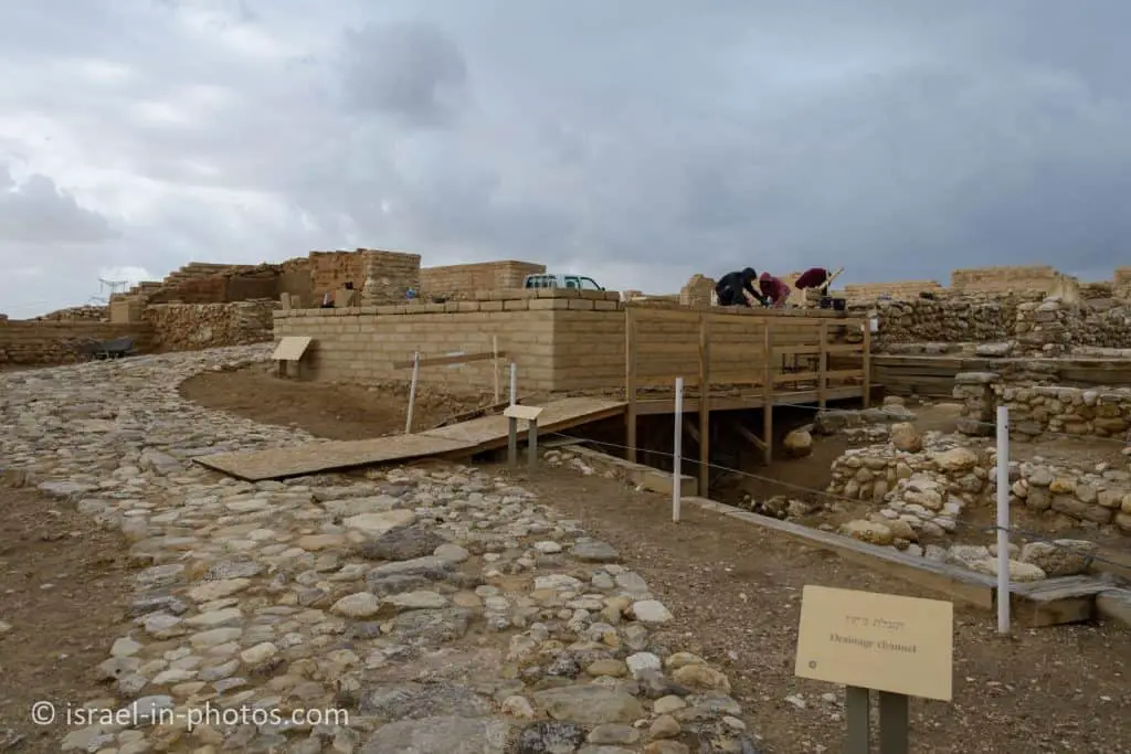
Our latest visit was during the winter of 2022, and reconstruction work was underway.
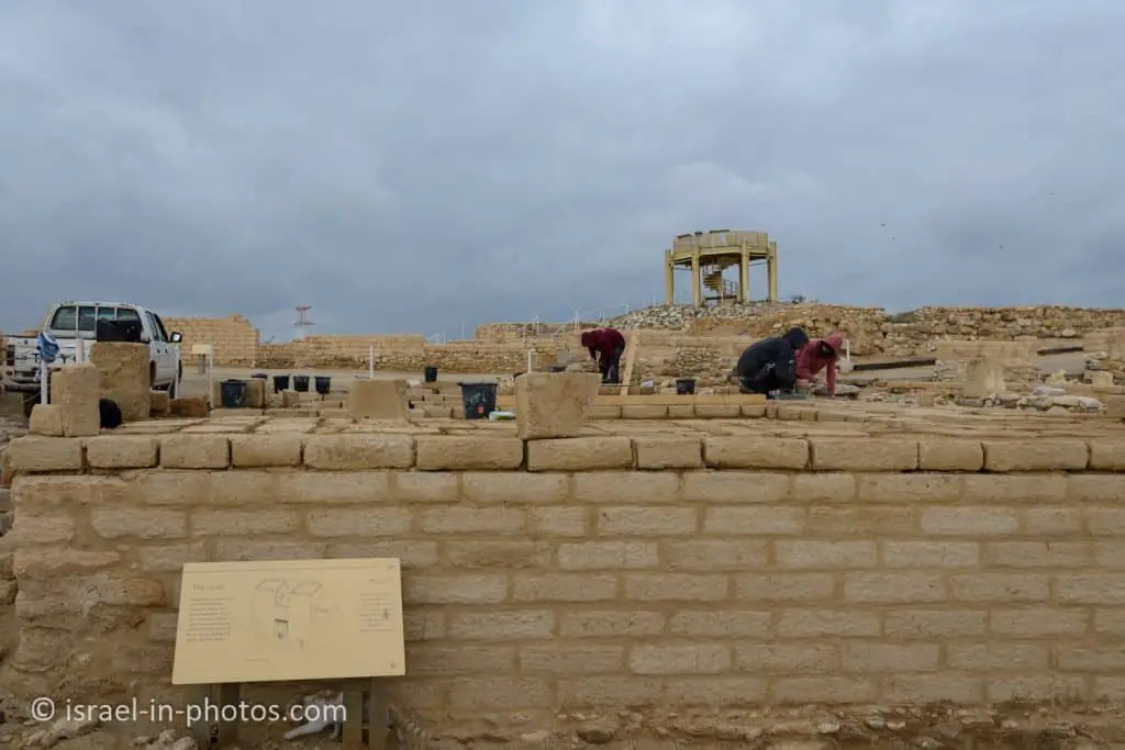
At the top of the photo above, you can see the viewpoint. The path goes in a semi-circular way to the view.


You can find typical Israelite houses in this park, also known as the four-room house.