Tel Arad National Park – Canaanite City and Ancient Fortresses
Tel Arad National Park is located in the South of Israel, northwest of the modern city of Arad. Tel Arad consists of lower and upper cities.
Table of Contents
Map
Tel Arad National Park is about 7 km northwest of the modern city of Arad.
Directions for drivers: Link to Waze and Link to Google Maps
Directions for public transport: Link to Moovit
Interactive map of the area:
Opening Hours
Sunday – Thursday and Saturday: 8:00 – 17:00 (16:00 in winter).
Friday: 8:00 – 16:00 (15:00 in winter).
On holiday eves, usually 8:00 – 13:00.
Note: Since the pandemic, the Israel Nature and Parks Authority has started limiting the number of people in each park. Thus, reservations are recommended through the official site (you can find the link below).
Entrance Fee
Adults 14 NIS, children 7 NIS, and Students 12 NIS. And free for National Parks annual subscribers.
If you visit several National Parks, then consider purchasing a combo ticket. You can find additional info in National Parks And Nature Reserves.
Note: opening hours and ticket prices were updated in February 2019. In any case, recheck the official site before visiting.
Campsite – Canaanite Khan
If you are looking for a place to spend the night, you should know that Tel Arad offers a night camping option.
The camping ground provides a closed building with mattresses and heating. It also contains six accessorized accommodation cabins, a site for private tents and a site for caravans. There are drinking water and toilets, hot showers, a cooking area, outdoor lighting, electricity points, etc.
Source: unless stated otherwise, all quotes were taken from the official site.
For available options and prices, check the official site.
Tel Arad has two parts: the lower and upper cities (which are pretty close). Let’s start from the bottom up.
Canaanite Arad – Lower City
The lower city was inhabited only in the Early Bronze Age (3150-2200 BCE). At approximately 100 dunams (25 acres), Arad was one of the country’s largest cities of its day, and a solid 1,200-meter wall surrounds it. The city’s streets, plazas, and buildings were meticulously planned, including a reservoir in the lowest part of the city to which surface runoff was channeled.
We started our hike from the lower city. And this is the view from the outside:
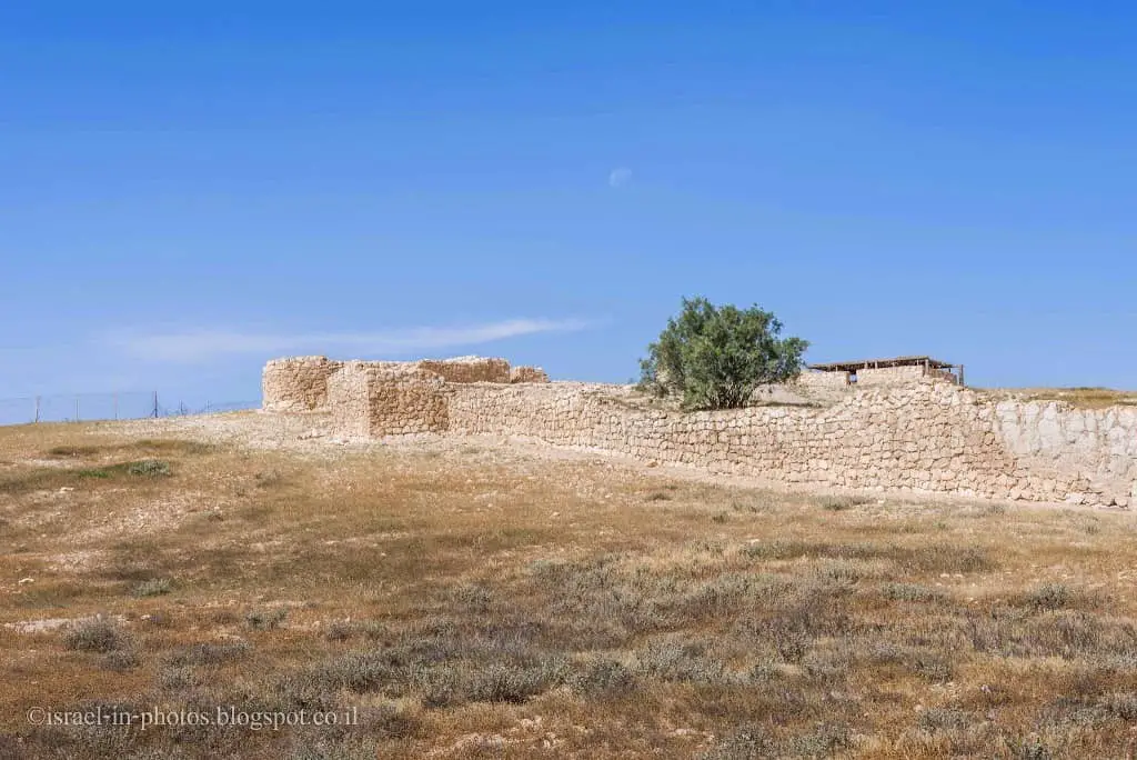
Canaanite Arad was a planned city from the beginning of the Canaanite urbanization period. It is surrounded by a wall divided into public buildings and residential areas. The rich findings discovered in the excavations demonstrate a range of economic resources such as agriculture, non-irrigated farming, grazing, art, and trade. Arad was an urban center for the inhabitants of the region.

Residential homes: The houses in Arad were built uniformly, in style called the “Arad House” – a broad stone structure, with a floor lower than street level, with one or two steps descending into it. Stone benches were built along the walls. At the center of each hall, a stone base stood a wooden pillar to support the flat roof. Alongside the central hall, there were often one or two side rooms, which probably served as storehouse and kitchen. Only the bases of the walls of the Arad houses have survived, and the complete picture was obtained from a small clay model of a house discovered in the excavations. The model is displayed in the Israel Museum in Jerusalem.
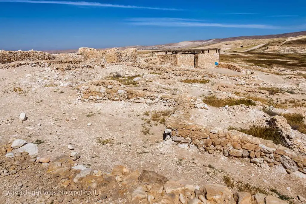
In this photo, you can see the walls of the lower city, and back in the distance on the hill is the upper city:
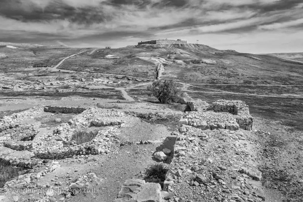
Fortifications: Canaanite Arad was surrounded by a strong wall, 1,200 m. long, 24 m. thick, which seems to have risen to a height of 5 meters. Wicket gates were installed in the wall, and towers protruded from it. The wall generally followed the watershed line on the hill. At present, it is known that there was one gate in the wall, but there may have been others.
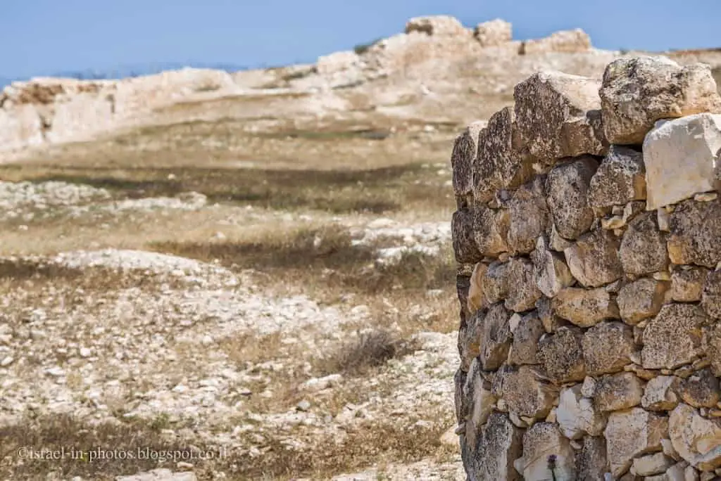
Part of the 1200-meter wall:
Flora and Fauna
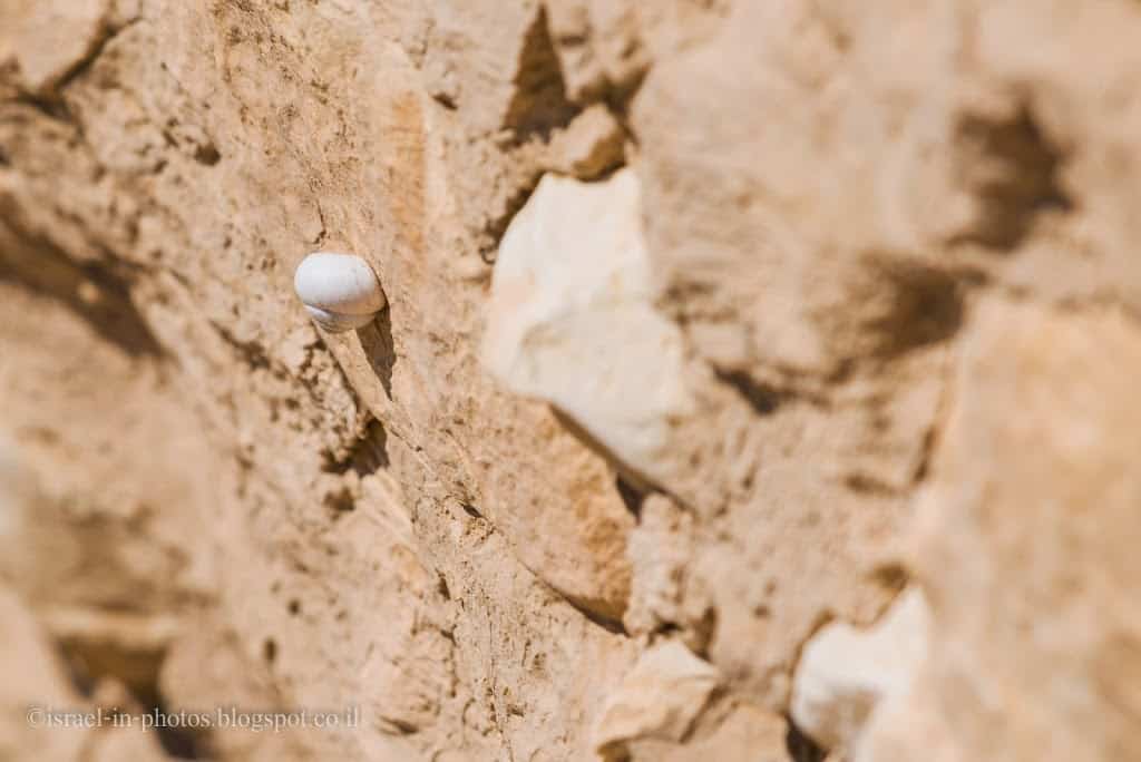
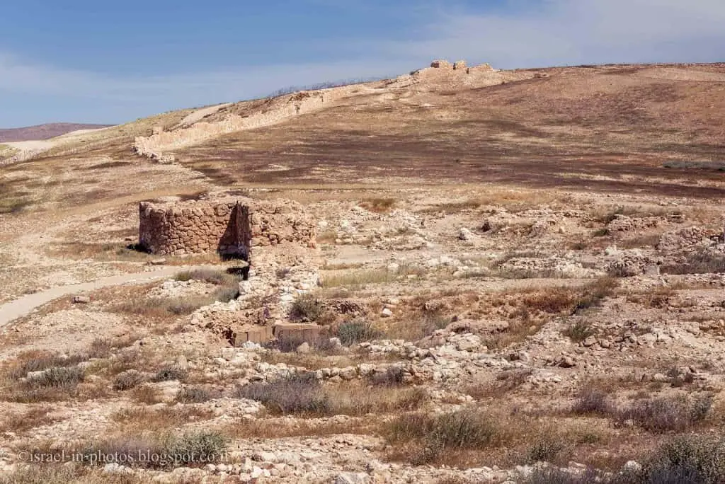
Despite its limited area, there are a number of species of rare plants and animals in the Tel Arad National Park.
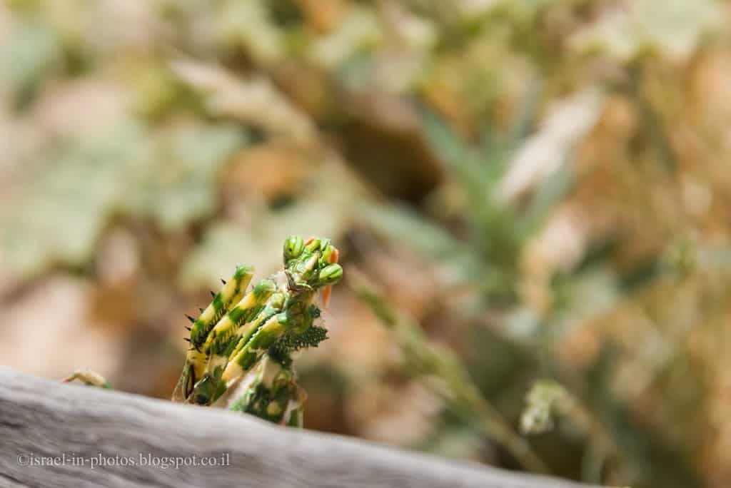
The Persian lily (Fritillaria persica), growing in the vicinity of nearby Tel Krayot, is at the southernmost distribution boundary of this species. The Judean Iris (Iris atrofusca), blooming at the end of February and beginning of March, is a species endemic to the loess soil of the Northern Negev, for which Tel Arad constitutes a shelter.
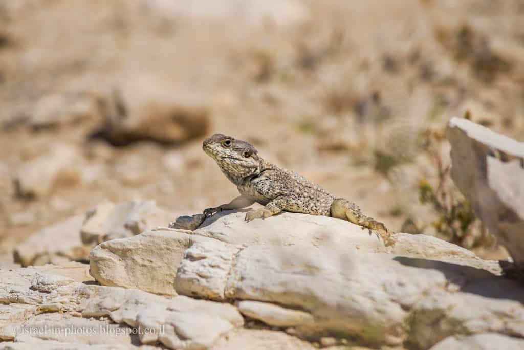
The Beer Sheva fringe-fingered lizard (Acanthodactylus beershebensis) is a species unique to the loess soil of the Northern Negev. The greater Egyptian jerboa (Jaculus orientalis) is also found here – a fidgety rodent with a tuft at the end of its tail, which is an endangered species in Israel.
The Fortresses at The Top of The Tel – Upper City
Then we reached the upper city. You can get there on foot or by car (additional parking nearby).
The fortress presently on the site is a fortified building (50X50 m.), and it was a link in the series of fortifications of the Judean Kingdom. In the Kingdom period, six fortresses were built in Arad, one on top of the other. A unique temple and a remarkable water facility were discovered in the fortress. Nature and Parks Authority has performed preservation and reconstruction works on the temple and has prepared a pathway for visitors leading down into the water facility.
A view from the upper city towards the lower one:

The Temple
In the north-western corner of the fortress, the remains of a temple were found, apparently Judean, that was in use from the 9th to the end of the 8th century BC, i.e., concurrently with the Temple in Jerusalem. It is one of the few temples remaining from Biblical times. The temple in Arad was built according to the plan of the Tabernacle described in the Bible. It consisted of three parts: the inner courtyard, the temple, and the Holy of Holies.
In the heart of the courtyard, there was a square altar built of small stones and faced with unchiseled stones. This altar complies with the Biblical prohibition against making an altar of rocks chiseled utilizing a metal tool.
The temple is located west of the courtyard. Three steps lead up from it to the Holy of Holies. At the sides of the entrance to the Holy of Holies stand two incense altars, and there is a monument within it. Within the boundaries of the temple were found ostraca (pottery shards bearing inscriptions) on which were written the names of the priestly families mentioned in the Bible (Meramot, Ezra 8:33, and Pashkhur, Jeremiah 100:1).
The use of the temple appears to have been discontinued in the 8th century BC. The entire site became covered with dust while the fortress continued to function. The cause may have been the religious reform by Kings Hezekiah and Josiah, who stopped the worship in the outlying cities and concentrated it in Jerusalem. The altar at Tel Be’er Sheva was also dismantled in that period.
We finished our visit to the upper city, ending our visit.
History
Tel Arad is one of the most important archaeological sites in Israel, on which were found the remains of a fortified Canaanite city and fortresses from the time of the Kings of Judah.
Canaanite Period
In the Early Canaanite period (Early Bronze Age, 3100-2950 BC), Arad was the only large city in the Negev. Its residents earned their living from cultivating field crops, such as wheat, barley, peas, chickpeas, and sheep breeding. Another source of meat was hunting. The residents of the Canaanite city tilled their fields with a harnessed plow and used donkeys for transport.
The Arad Canaanites traded with other Canaanite cities, and of exceptional economic value was the trade-in asphalt, which was harvested from floating lumps in the Dead Sea and was used by the Egyptians for mummification. Arad also supplied olive oil to Egypt and received copper in exchange. Arad may have been part of the “Copper Road,” the metal provided by Egypt to the countries of the Middle East. Trade with Egypt is evidenced by the Egyptian clay vessels found on the Tel, as well as a broken vessel on which the name of the Egyptian Pharaoh Na’armar was engraved (32nd century BC).
Israelite Period
Canaanite Arad was abandoned in 2600 BC for reasons unknown. The place remained desolate for about 1,500 years until the early Israelite period. At the beginning of that period, a small settlement was established on top of the hill, at the north-eastern corner of Canaanite Arad. The houses were built in a cluster around a central courtyard. This style of settlement is usually attributed to the Israelite settlement period. Later, six Israelite fortresses were constructed on this place, one on top of the other. The remains of a Hellenistic fort (4th-1st centuries BC) were also found on this tel.
Ostraca in some languages were discovered in the Arad Fortress: about 100 in Hebrew, about 85 in Aramaic, and a few in Greek. 17 Hebrew inscriptions were written at the time of King Jehoiakim (608-598 BC). “The hand of the Babylonians was heavy” on Jehoiakim, and the Edomites, living in the Southern Negev, exploited this situation and moved northwards.
Ostraca were also found on the Tel from the Persian period, this piece of evidence that at that time Arad served both as a military citadel and a way station.
Summary
Tel Arad is a nice park for a several-hour hike. The only downside is the weather. It is boiling there in the summer, thus either visit during the cooler hours of the day or even better visit in Spring.
Have you ever been to Tel Arad National Park? Tell us about your experience in the comments below.
That’s all for today, and I’ll see you in future travels!
Stay Tuned!
Additional Resources
Here are several resources that I created to help travelers:- Trip Planner with Attractions and Itineraries is the page that will help you create your perfect travel route.
- What is the Best Time to visit Israel? To answer this question, we will consider the weather, prices, holidays, festivals, and more.
- Information and Tips for Tourists to Israel will answer the most common questions tourists have about Israel (including safety, passports, weather, currency, tipping, electricity, and much more).
- Israel National Parks and Nature Reserves include a complete list, top ten, map, tickets (Israel Pass, Matmon, combo), and campsites.
- If you are looking for things to do, here are the pages for Jerusalem, Tel Aviv, Haifa, Sea Of Galilee, Akko (Acre), Eilat, Nazareth, Safed (Tzfat), and Makhtesh Ramon.

