Karta Ruins – Short Track by Atlit – Visitors Guide
You can find a short-loop family track at Karta Ruins Nature Reserve. You can enjoy nature and archeological remains on this track.
Table of Contents
Map
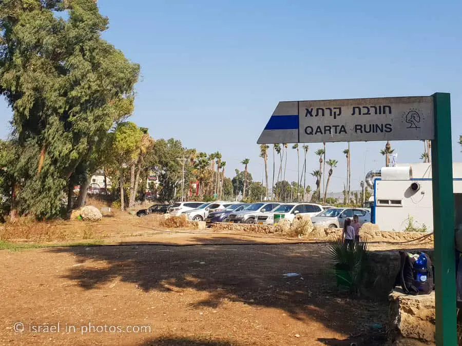
Karta Ruins is located near Atlit, not far from Haifa.
Directions for drivers: Link to Waze and Link to Google Maps
Directions for public transport: Link to Moovit
Interactive map of the area:
Note: the directions above will take you to the Limor picnic area.
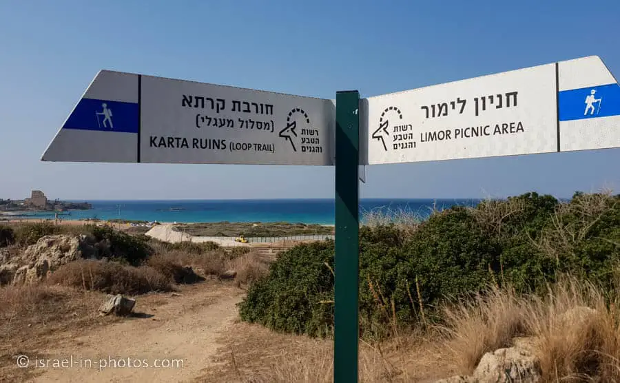
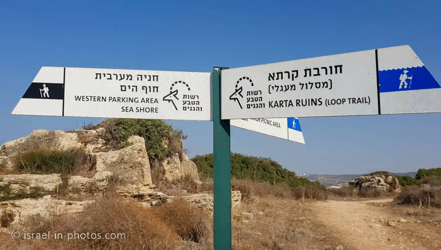
There are two possible starting points. You can begin at the Limor picnic area (as we did) or the western parking area. See the tracks section below for additional details.
Opening Hours
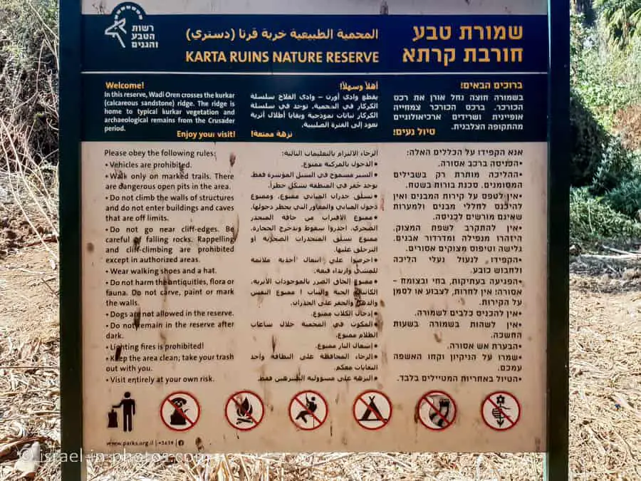
As you can see from the following photo, you should visit Karta Ruins Nature Reserve only during the daytime.
When to visit Karta Ruins?
You can visit this place all year round. But since there is little shade along the tracks, I suggest visiting only during cooler hours/days. Moreover, winter and spring (January – March) are the best seasons to see flowers.
Entrance Fee
Free.
Tracks
Here is an interactive map from israelhiking.osm.org.il where the hiking trails are marked:
And here are the details of the marked trails:
| # | Name | Color of the Trail on the Map above | Description | Distance (km) | Total climb and descent (meters) | Notes |
|---|---|---|---|---|---|---|
| 1 | Karta Ruins from the Limor picnic area | Blue | This trail starts at the Limor parking and returns to the same place. | 1.1 | 50 | You can hike this trail in any direction. There is one semi-steep incline/decline, and if you prefer to climb it, start walking to the north from the parking lot. |
| 2 | Karta Ruins from the Western parking area | Red | Similar to the previous track. The only difference is the starting/ending point. | 1.3 | 58 |
Limor Picnic Area
And now, we will start our hike at the Limor picnic area.
At the Limor picnic area, you can find picnic tables, including accessible tables, a playground for kids, and free dirt parking lot. Here are several photos:


Note: I did not see restrooms in the picnic area. But there are toilets at the nearby gas station.
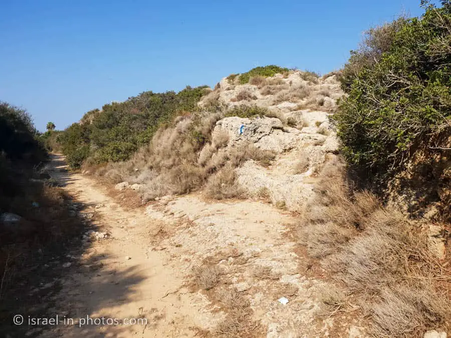
The trail with blue markings from the picnic area will lead you to Karta Ruins. And as I mentioned above, if you prefer to go up on a semi-steep incline, follow the northern blue marking.
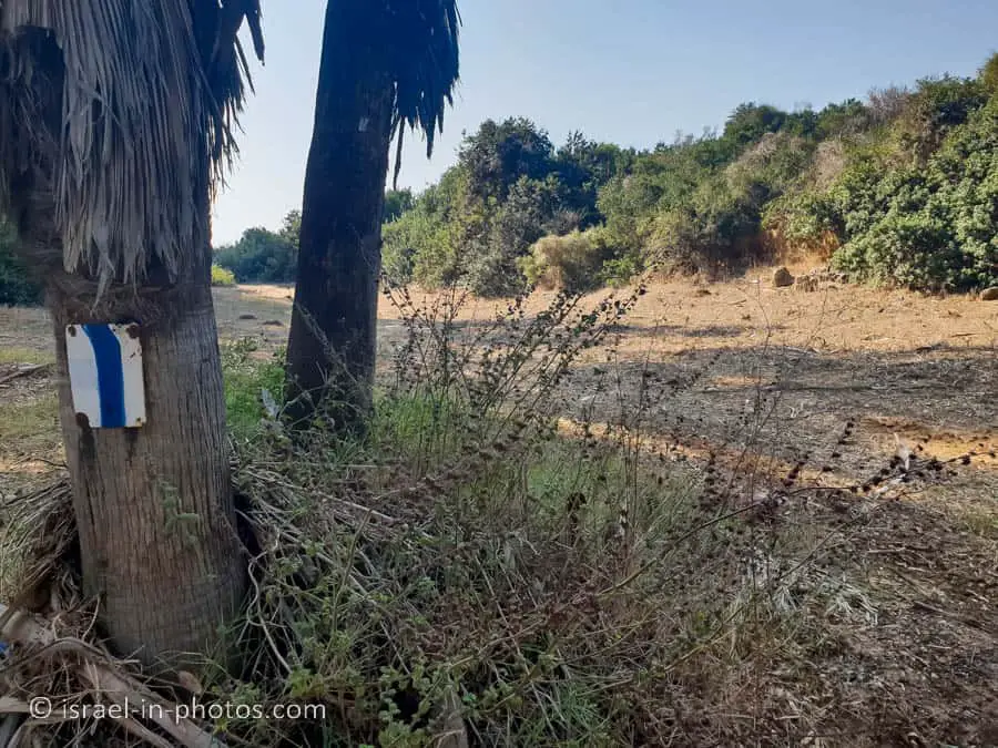
Karta Ruins Track
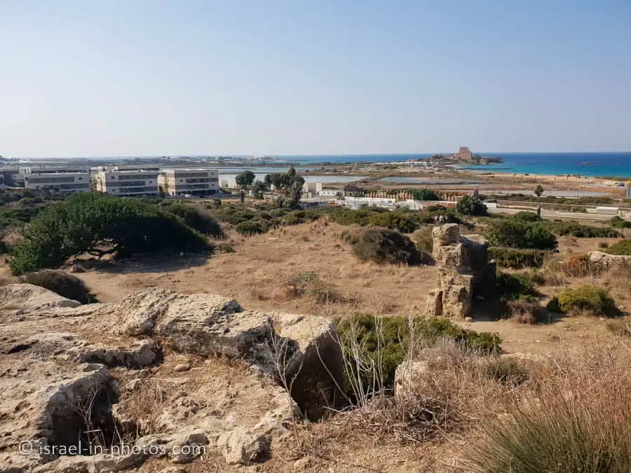
Here are several photos from the southern part of the track:
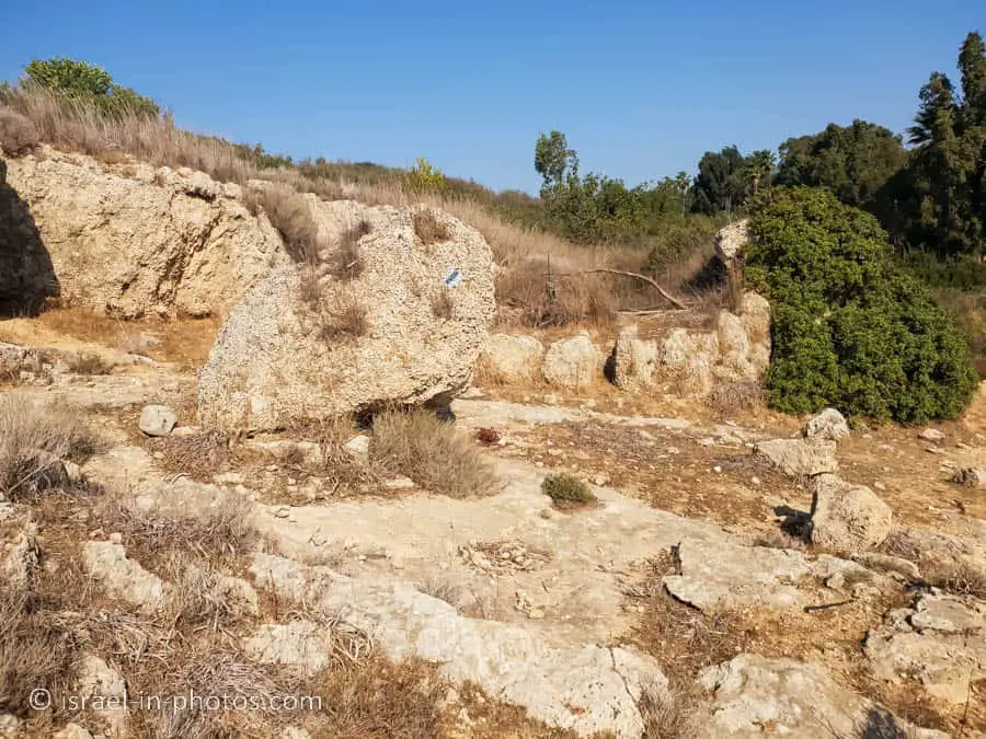


Le Destroit – Remains of a Crusader Fortress
Le Destroit is a ruined medieval fortified road station built by the Templars of the Crusader Kingdom of Jerusalem in the early 12th century CE. It is located on the Mediterranean shore near a site where they later built the Chateau Pelerin castle, today close to the modern town of Atlit, Israel.
The coastal road near Atlit ran through a narrow passage in the rock, making it an ideal location for robbers to ambush pilgrims and other travelers. In 1103, Baldwin I of Jerusalem was wounded by robbers in the area. The tower fortress, situated on a ridge above the pass on the east side of the peninsula at Atlit, was built to protect these travelers.
The army led by King Richard I of England camped at the fortress following the recapture of Acre in 1191. However, when the larger Castrum Perigrinorum was completed in 1218, Le Destroit was dismantled by the Crusaders so that the Muslim enemy couldn’t use it as a staging ground for an attack on the main castle. Denys Pringle indicates 1220 as the year Destroit was destroyed.
Source: Wikipedia
Today you can see the podium-shaped tower base with rock-cut cisterns.


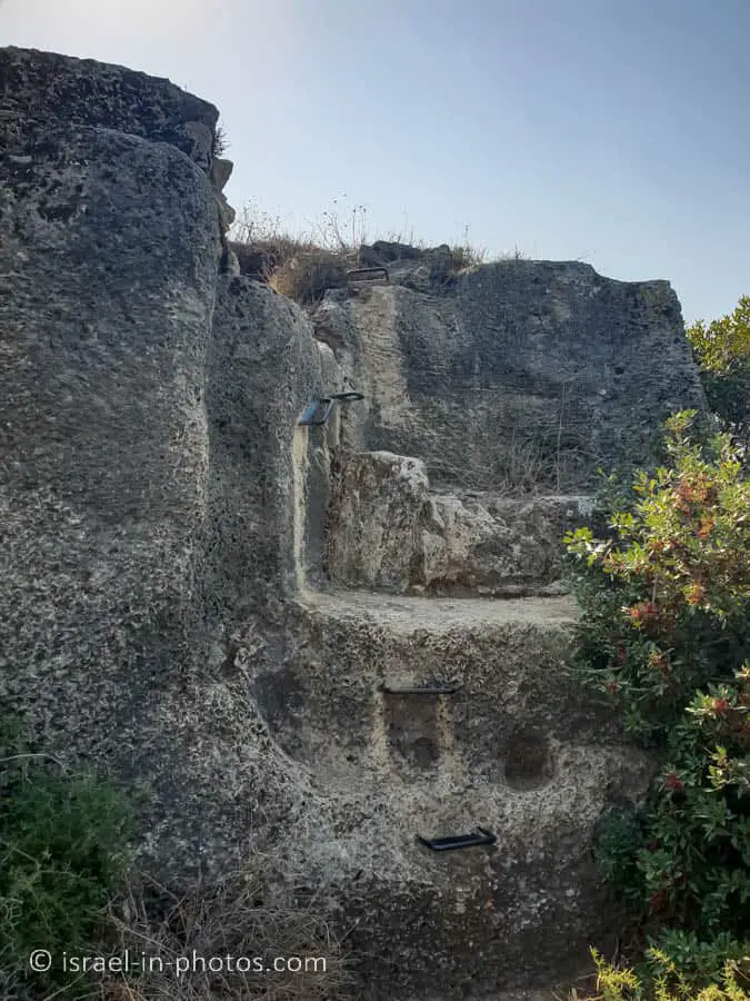
Stables
You can also see the stables and the moat. The remains are cut into the kurkar.


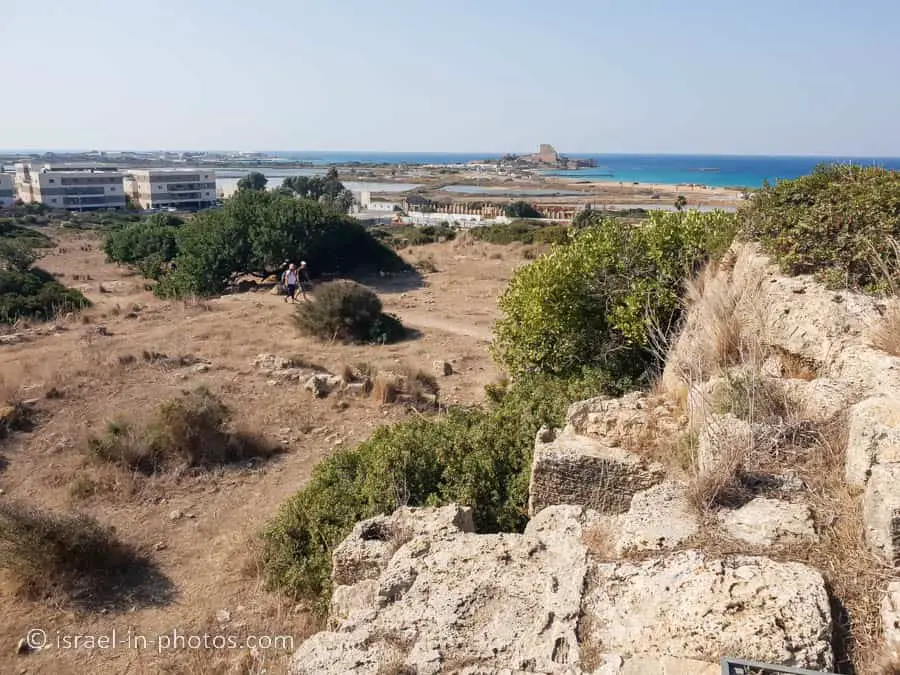
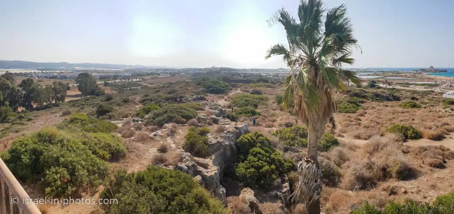
Water Tower
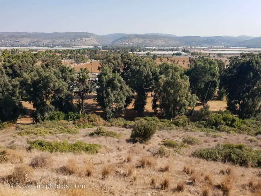
The last point of interest is the water tower. Using stairs, you can climb to the roof of the water tower, and it serves as a 360-degree viewpoint.
Here are photos from this viewpoint:


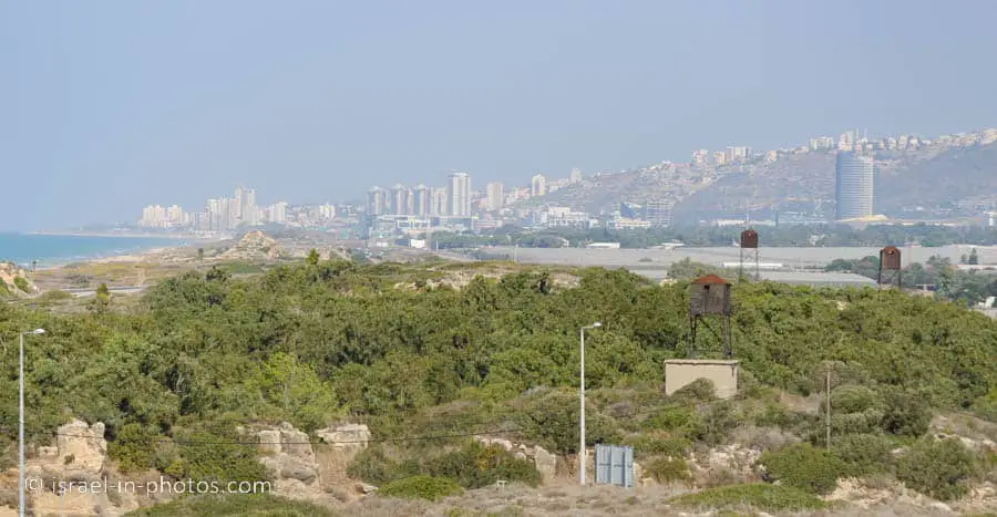


I took a long lens, hoping to see flamingoes (Flamingo Migration in Israel). Here is a photo using 500mm toward the salt pools, and you can barely see several dozen flamingoes there.

From the water tower, we descended to the Limor picnic area.

Summary
It took us about 1.5 hours to complete the track. And my 3-year-old daughter could finish it by herself (with some help). Hence this trail is suitable for families. Moreover, since it is short and there is a picnic area, it is ideal as a stop on the way to northern Israel.
Have you visited Karta Ruins? Tell us about your experience in the comments below.
That’s all for today, and I’ll see you in future travels!
Stay Tuned!
Additional Resources
Here are several resources that I created to help travelers:- Trip Planner with Attractions and Itineraries is the page that will help you create your perfect travel route.
- What is the Best Time to visit Israel? To answer this question, we will consider the weather, prices, holidays, festivals, and more.
- Information and Tips for Tourists to Israel will answer the most common questions tourists have about Israel (including safety, passports, weather, currency, tipping, electricity, and much more).
- Israel National Parks and Nature Reserves include a complete list, top ten, map, tickets (Israel Pass, Matmon, combo), and campsites.
- If you are looking for things to do, here are the pages for Jerusalem, Tel Aviv, Haifa, Sea Of Galilee, Akko (Acre), Eilat, Nazareth, Safed (Tzfat), and Makhtesh Ramon.


