
Ashdod Yam Fortress – Visitors Guide
Ashdod Yam Fortress is an ancient fort on the shore of the Mediterranean Sea located in the modern city of Ashdod.
Table of Contents
Map
Ashdod Yam Fortress is located inside Ashdod, near the intersection of Sderot Moshe Dayan and Sderot Yitshak Rabin. The easiest way to reach this spot is by entering “Ashdod Yam Fortress” into Waze.
Directions for drivers: Link to Waze and Link to Google Maps
Directions for public transport: Link to Moovit
Interactive map of the area:
And here is a map of the area:
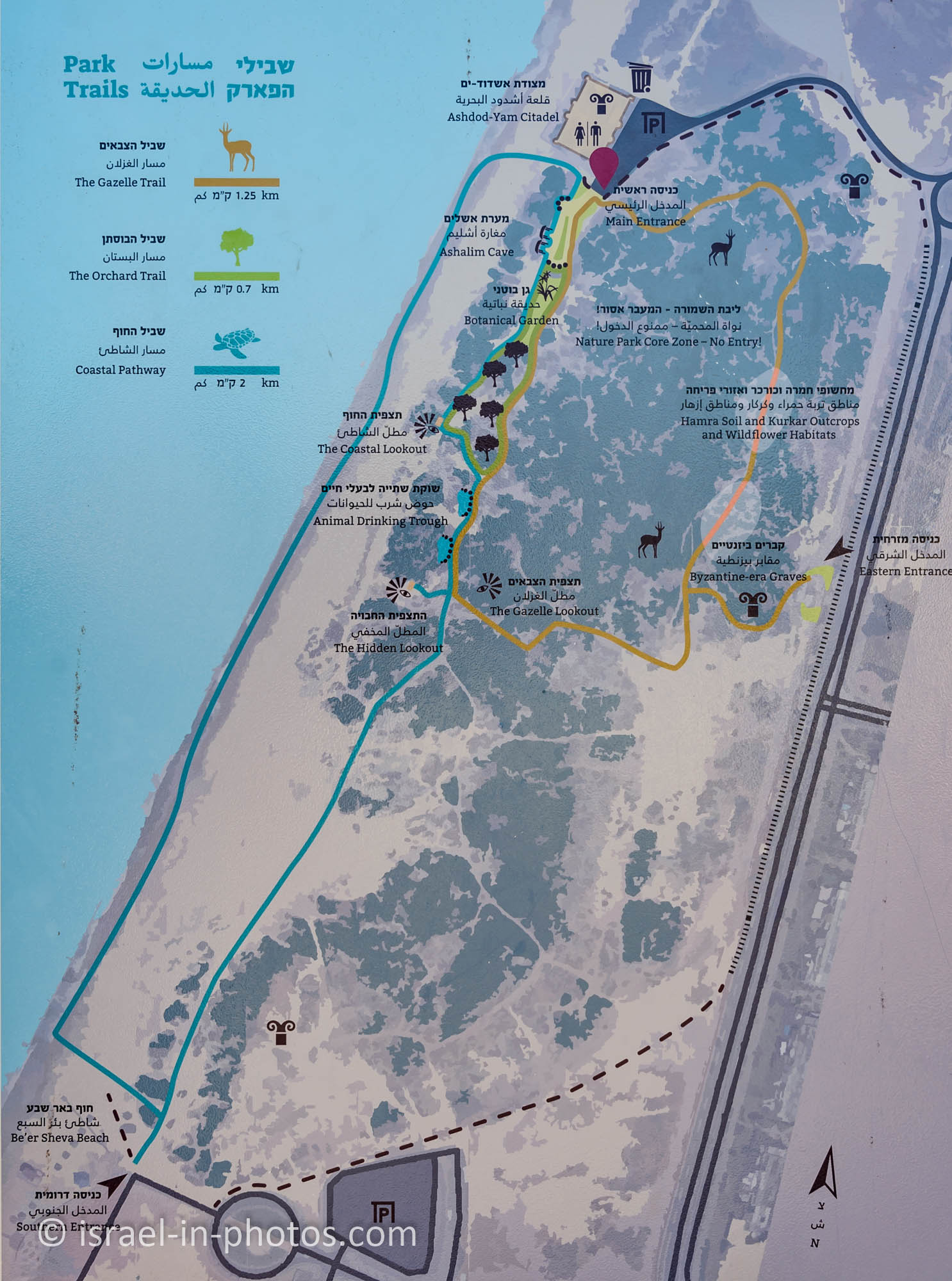
Note: you can click on the map to enlarge it.
On the map above, you can see Ashdod Yam Fortress in the top left corner. And it is located by the entrance to Metzudat-Yam Ashdod Ecological Park. And I recommend visiting both places together.
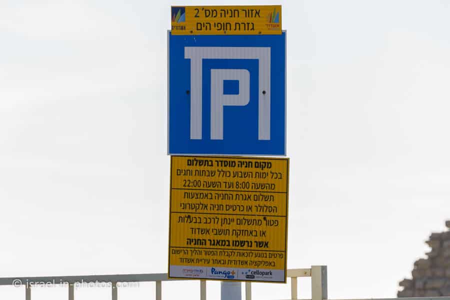
Parking
There is a parking lot by the fort. It is paid parking lot, and you can pay using your favorite parking app. Parking is free if you are an Ashdod resident registered in their database.
Entrance Fee
Free.
Opening Hours
Open daily: 9:30 – 22:00

Contact Information
Phone: 050-2211914
Events
You can register for marriage proposals at the fort on the official Ashdod website. But the citadel will remain open during the one-hour event. And there are occasionally light and sound shows (you can purchase tickets and the official website).
Restrooms
There are restrooms near the entrance (you can see them on the right side of the next photo). But the toilets were closed during our visit.
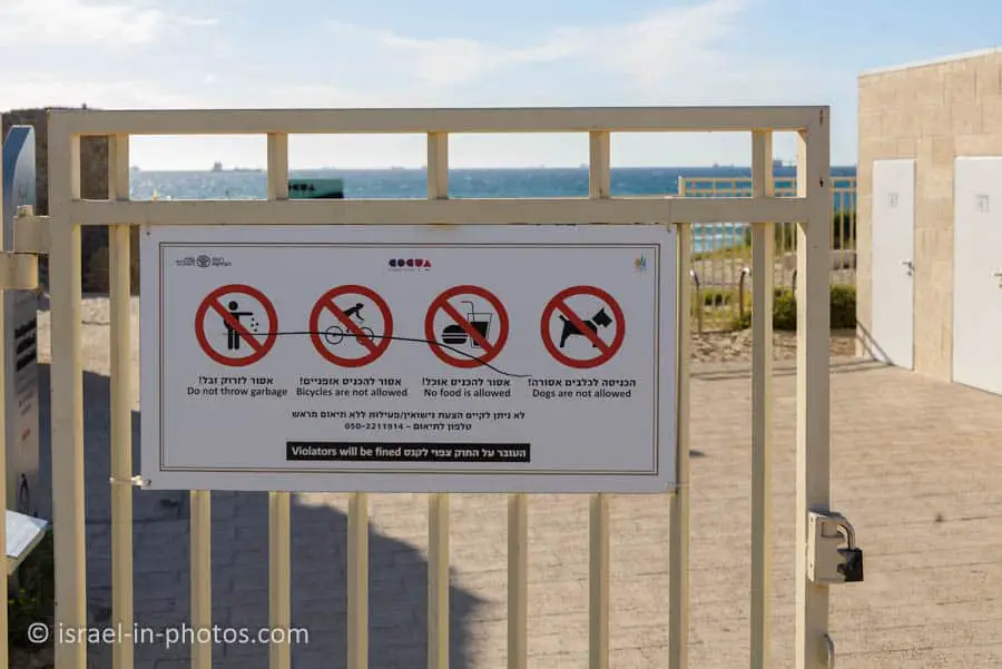
As you can see from the sign above: dogs, food, and bicycles are not allowed.
About Ashdod Yam Fort
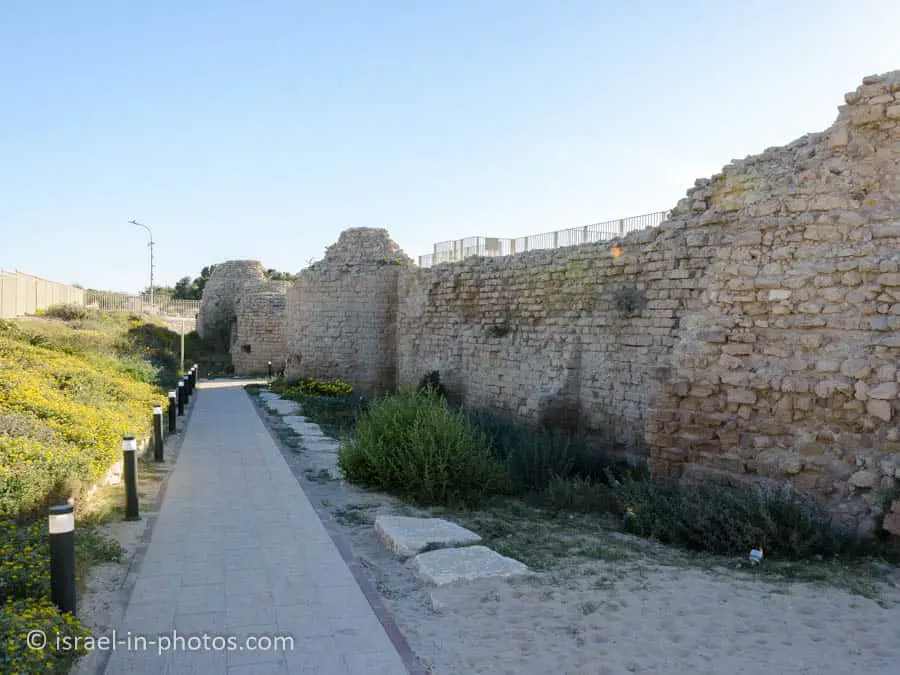
I will start by mentioning that the fort was upgraded in recent years. This place looked abandoned on my previous visit (about fifteen years ago). But now, there are pathways, explanatory signs, restrooms, and a surrounding fence. Thus, if you have not visited recently, I suggest revisiting this place. Moreover, Metzudat-Yam Ashdod Ecological Park was created nearby.
And here is basic info about this fort:
The Ashdod-Yam Fortress, or Qal’at el-Mina, was built by Caliph Abd al-Malik (685-705 CE) at the end of the seventh century CE over the ruins of a Byzantine settlement. The fortress was part of an Umayyad coastal defense system constructed to combat attacks of Christian forces from the west. The system comprised a chain of ribats (strongholds) built along the eastern Mediterranean coastline within sight of one another, enabling the conveying of messages at times of danger by means of fire beacons at night and smoke signals by day.
In the Crusader period (twelfth to thirteenth centuries CE), the fortress was rebuilt and resettled and named Castellum Beroart. It was finally abandoned when the Crusaders were expelled from the country in 1290. The fortress was excavated and conserved prior to opening the site to the public, thanks to a tourist initiative in Ashdod, and the Israel Antiquities Authority, with the assistance of youth and pupils from educational institutions in Ashdod.
Source: sign
“The Fortress Project” video by Ashdod Tourism:
Structure of the fortress
This is a rectangular structure (40m X 60m); the remains of a wall built with dressed kurkar stones can be seen. The fortress has two gates: the eastern land gate and the western sea gate. Towers were erected in the corners of the fortress and on both sides of the gates. The fortress’s two western towers and four gate towers are round, while the two eastern towers are rectangular in shape. The center of the fortress consists of a courtyard surrounded by domed rooms.
Source: sign

As you enter the fortress, you will see stairs to your right. If you take the stairs up, you can reach a balcony. Here is a panorama from the balcony:

Inside the fort, you can find a mosque. And, of course, they needed water.
Two wells were dug in the area of the fortress to provide water for soldiers and their horses. The southern well was surrounded by a raised platform accessed by four stairs. The northern well was built at courtyard level. The wells were replenished by means of gutters and drainpipes that collected rainwater from the fortress’s roofs.
Source: sign

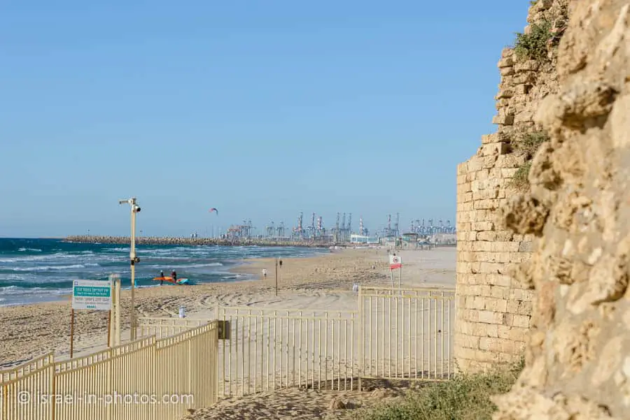
The fort is located close to the Mediterranean Sea.

As you can see from the following photo, it is situated to the south of Ashdod port.

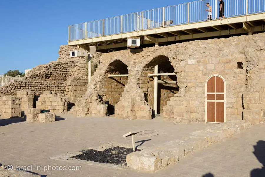
Inside the for you can also see the remains of a bathhouse.
The bathhouse was probably built during the era of the Crusaders. It consists of a stove and two bathtubs.
Source: sign
Summary
Ashdod Yam Fortress is a lovely place. And the visit took about 20 minutes. Thus I suggest combining it with one of the trails in Metzudat-Yam Ashdod Ecological Park.
This area has many attractions, and you can explore them using the interactive map above.
Have you visited Ashdod Yam Fortress? Tell us in the comment below about your experience.
That’s all for today, and I’ll see you in future travels!
Stay Tuned!
Additional Resources
Here are several resources that I created to help travelers:- Trip Planner with Attractions and Itineraries is the page that will help you create your perfect travel route.
- What is the Best Time to visit Israel? To answer this question, we will consider the weather, prices, holidays, festivals, and more.
- Information and Tips for Tourists to Israel will answer the most common questions tourists have about Israel (including safety, passports, weather, currency, tipping, electricity, and much more).
- Israel National Parks and Nature Reserves include a complete list, top ten, map, tickets (Israel Pass, Matmon, combo), and campsites.
- If you are looking for things to do, here are the pages for Jerusalem, Tel Aviv, Haifa, Sea Of Galilee, Akko (Acre), Eilat, Nazareth, Safed (Tzfat), and Makhtesh Ramon.


Hi, do you know at what time the light show start? And on which days?
Thanks
Hi Anna,
Till the end of October, the light show takes place every Thursday at 19:30. You can find additional information and purchase tickets (10 NIS per person) here: https://visit.ashdod.muni.il/events/%d7%9e%d7%95%d7%a4%d7%a2-%d7%90%d7%95%d7%a8-%d7%a7%d7%95%d7%9c%d7%99-%d7%91%d7%9e%d7%a6%d7%95%d7%93%d7%94/