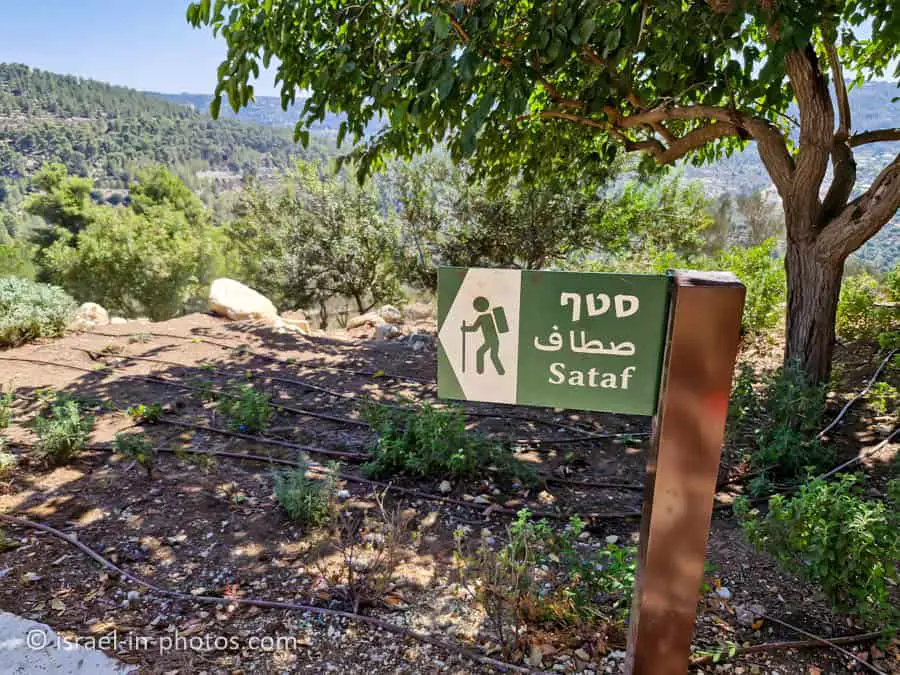
Sataf – Hiking Trails near Jerusalem – Visitors Guide
Sataf offers a variety of hiking trails near Jerusalem, presenting stunning views and showcasing ancient mountain agriculture.
Table of Contents
Map
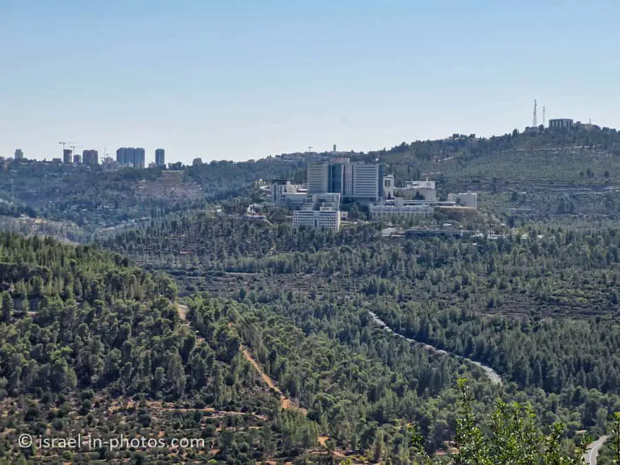
Sataf is located near Jerusalem, not far from Ein Kerem.
Directions for drivers: Link to Waze and Link to Google Maps
Directions for public transport: Link to Moovit
Interactive map of the area:
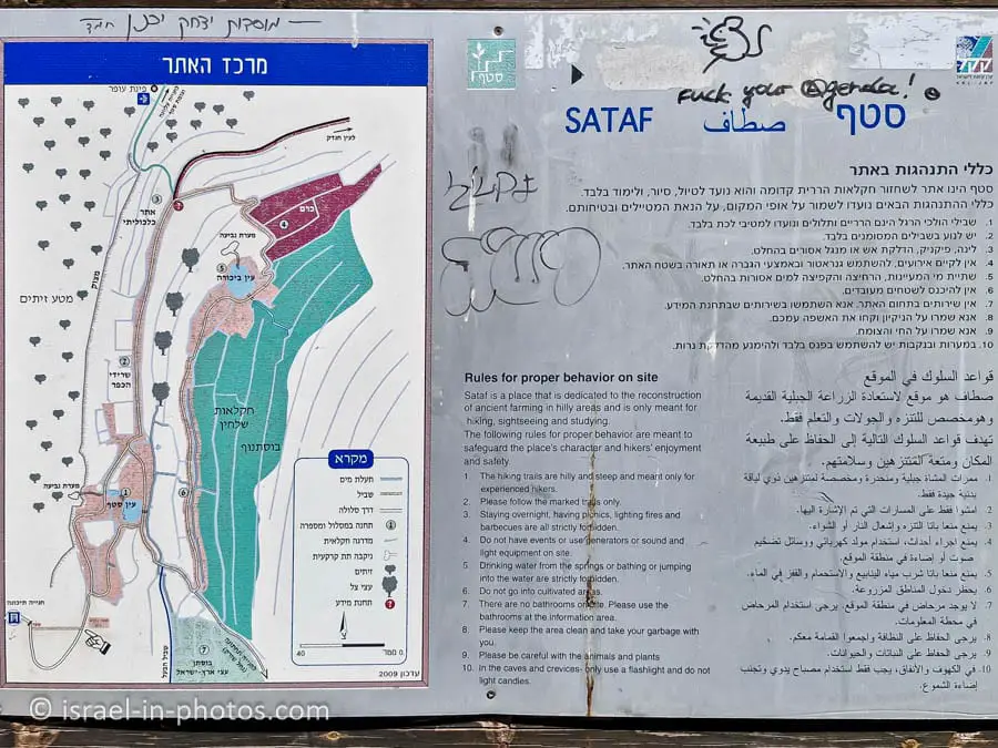
Note: you can click on the maps to enlarge them.
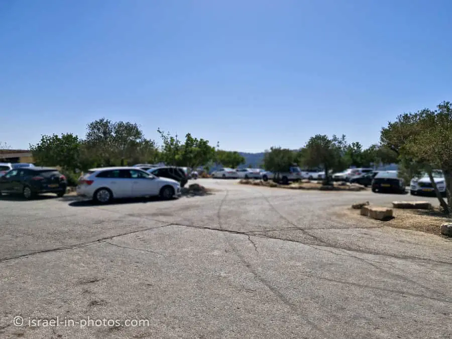
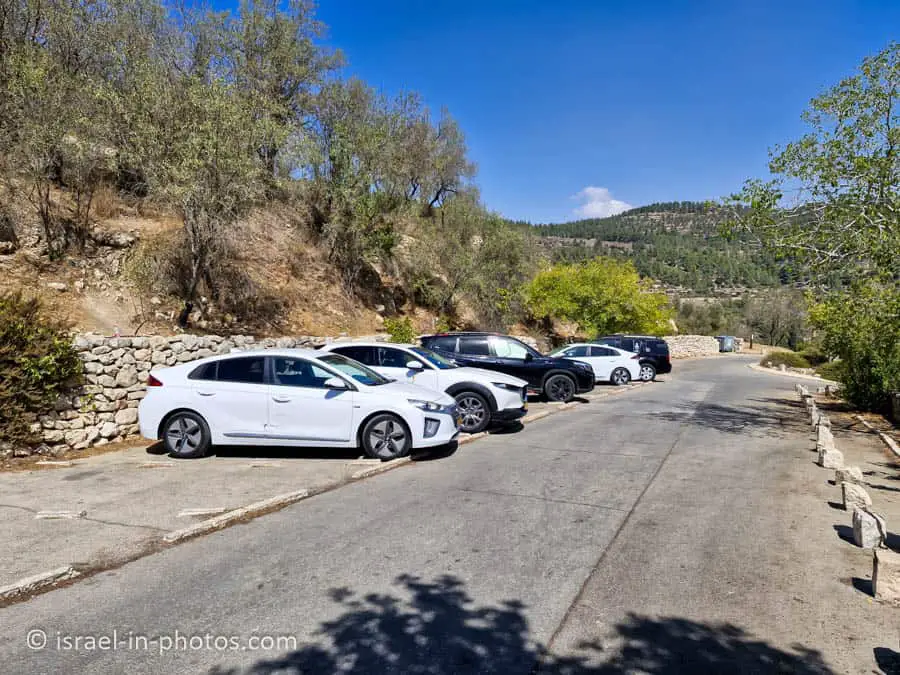
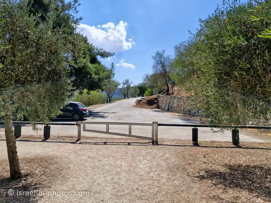
Parking
Sataf has three parking lots, with the upper lot being the largest and the starting point for all trails. Therefore, we usually park there.
I recently noticed that a new coffee shop has opened in Sataf. It is open every day, including Saturdays, from 7:00 AM to 19:00, and until 16:00 on Fridays. Since my last visit to Sataf was two decades ago, we decided it was time to revisit this place.
Although our main goal was not to visit the cafe, stopping there after our hike could have been enjoyable. However, since the coffee shop was packed and there was a long line, we decided to skip it. If you plan on visiting on a Saturday or a holiday, I recommend arriving early.
Here are the details about the parking lots:
Upper parking lot – large and accessible to buses. The parking lot contains picnic tables, a toilet, drinking water,a kiosk, and a sports compound built in memory of Hila Bezaleli. A short path for people with disabilities leads travelers to a stunning view of the Sorek stream and the Jerusalem Mountains.
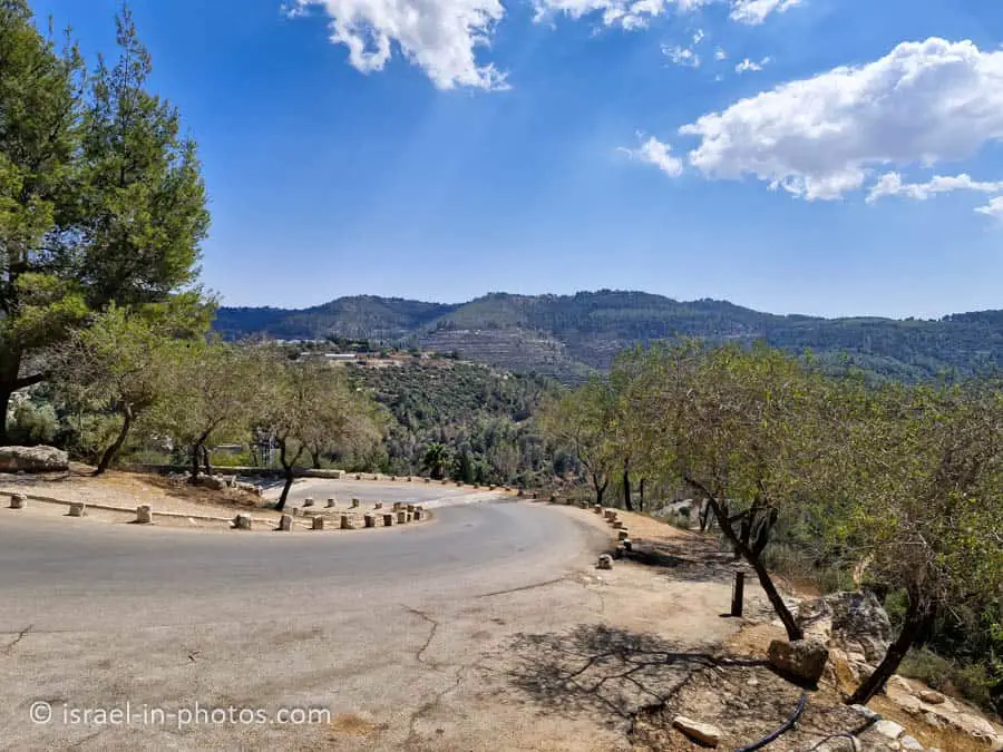
Middle parking lot – containing 90 spots for private vehicles only. A paved road leads here from the upper parking lot.
Lower parking lot – near the Sorek stream, accessible to buses. Access from Road 386, about 3 kilometers west from the roundabout near Ein Karem.
Source: KKL
Notes:
- The parking is free.
- The gate to the middle parking lot is closed overnight.
Opening Hours
There are no signs regarding opening hours. You can enter for free anytime. However, there is no artificial light, so visit only during the day.
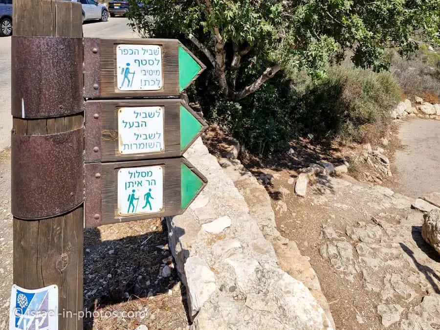
Trails
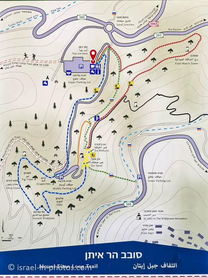
In the upper parking lot, you can find a trail map with suggested hikes.
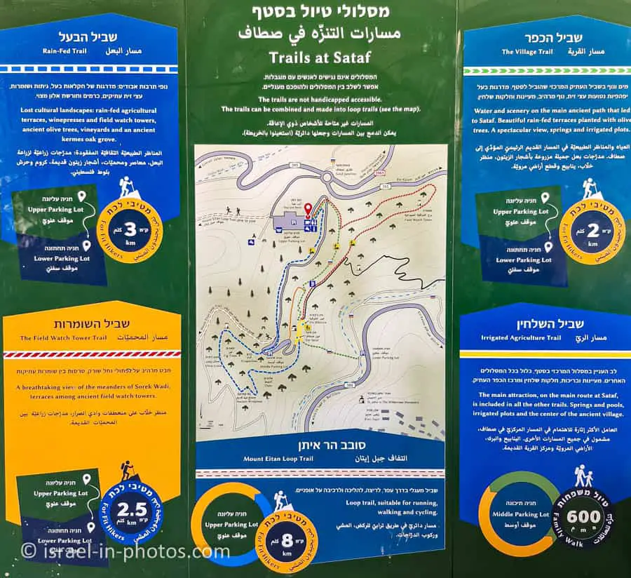
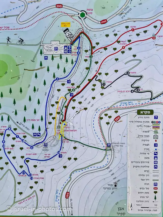
You can take one of the suggested hikes or combine several for a more extensive experience. Here are the details of the suggested trails and the hike that we did:
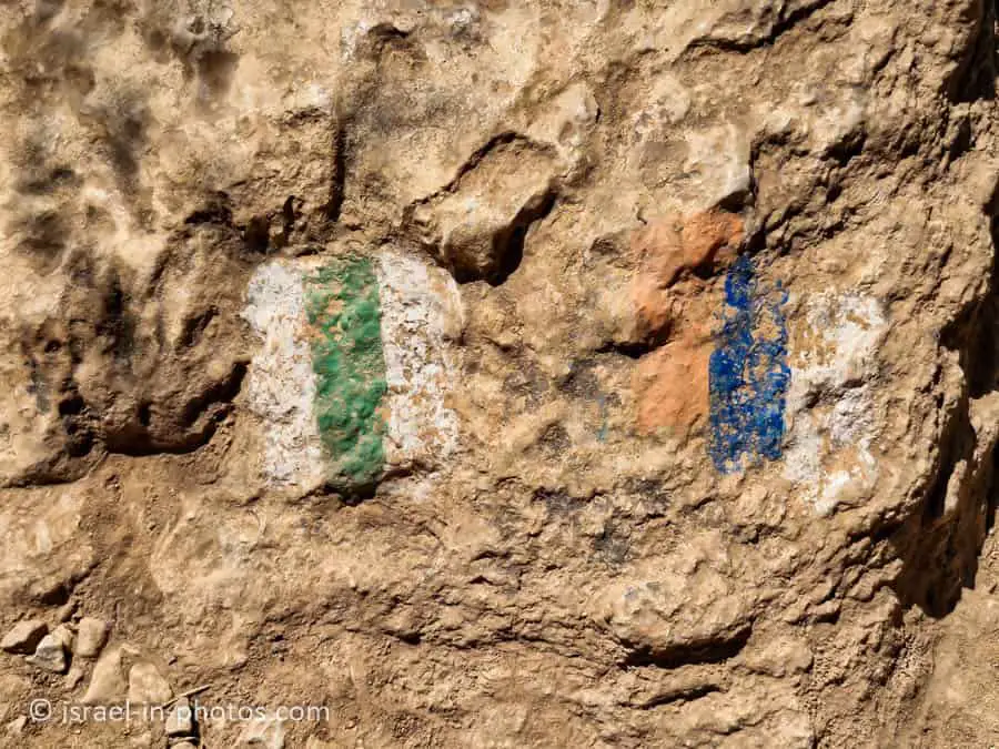
| Name | Color of the Trail | Description | Stratring Point | Ending Point | Distance (km) | Total climb and descent (meters) | Notes |
|---|---|---|---|---|---|---|---|
| The Village Trail | Green | The main ancient path that led to Sataf. | Upper Parking Lot | Lower Parking Lot | 1.6 | 209 | Two cars are needed to complete this trail. |
| Rain-Fed Trail | Blue | Rain-fed agricultural terraces, wine presses, field watchtowers, and more. | Upper Parking Lot | Lower Parking Lot | 3 | 243 | Two cars are needed to complete this trail. |
| The Field Watch Tower Trail | Red | A stunning view of the meandering Sorek Wadi with terraces and ancient field towers. | Upper Parking Lot | Lower Parking Lot | 2.6 | 223 | Two cars are needed to complete this trail. |
| Mount Eitan Loop Trail | Double Red Dotted Line | This trail is suitable for running, walking, and cycling. | Upper Parking Lot | Upper Parking Lot | 7.8 | 310 | |
| Irrigated Agriculture Trail | Yellow | Spring and pools, irrigated plots, and the center of the ancient village. | Middle parking lot | Middle parking lot | 0.7 | 45 | It is included in other trails. |
| Our Combo Trail | Green and Blue | We followed the green trail to reach Ein Sataf and then returned via the middle parking lot and the blue trail. | Upper Parking Lot | Upper Parking Lot | 2.6 | 218 |
What Ages is this trail Suitable for?
Although the sign indicates “for fit hikers” for most trails, the trails themselves were not particularly challenging. My six-year-old daughter had no trouble completing the combo trail, and while hiking, I saw many younger kids.
Entrance Fee
Free.
When to Visit?
We visited at the end of September, which is not the best time of year for nature hikes. Spring is typically the ideal season for this activity. If you’re planning to visit during the second half of February, you will have the opportunity to see the almond trees in bloom.
What to Bring?
In addition to the usual hiking gear, such as water, sunscreen, comfortable shoes, hats, and snacks, I recommend bringing a flashlight. You will understand why when we visit Ein Sataf.
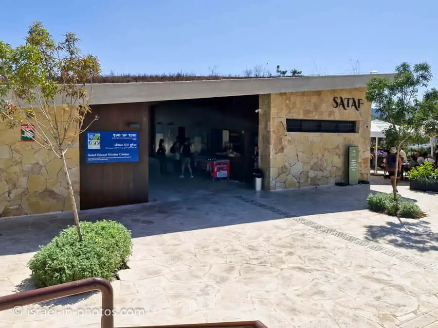
Sataf – Forest Visitor Center
As I mentioned above, we parked at the upper parking lot. At the south-west end of the parking lot, you can find the visitor center.
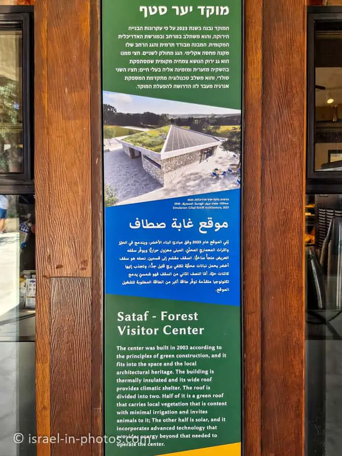
This center was built in 2003 according to the principles of green construction, and it fits into the space and local architectural heritage. The building is thermally insulated, and its wide roof provides climatic shelter. Half of it is a green roof that supports local vegetation, which is content with minimal irrigation, and invites animals to it. The other half is solar, incorporating advanced technology that provides energy beyond what is needed to operate the center.
Source: sign
At this visitor center, you can find a coffee shop, restrooms, informational signs, and a scenic viewpoint.
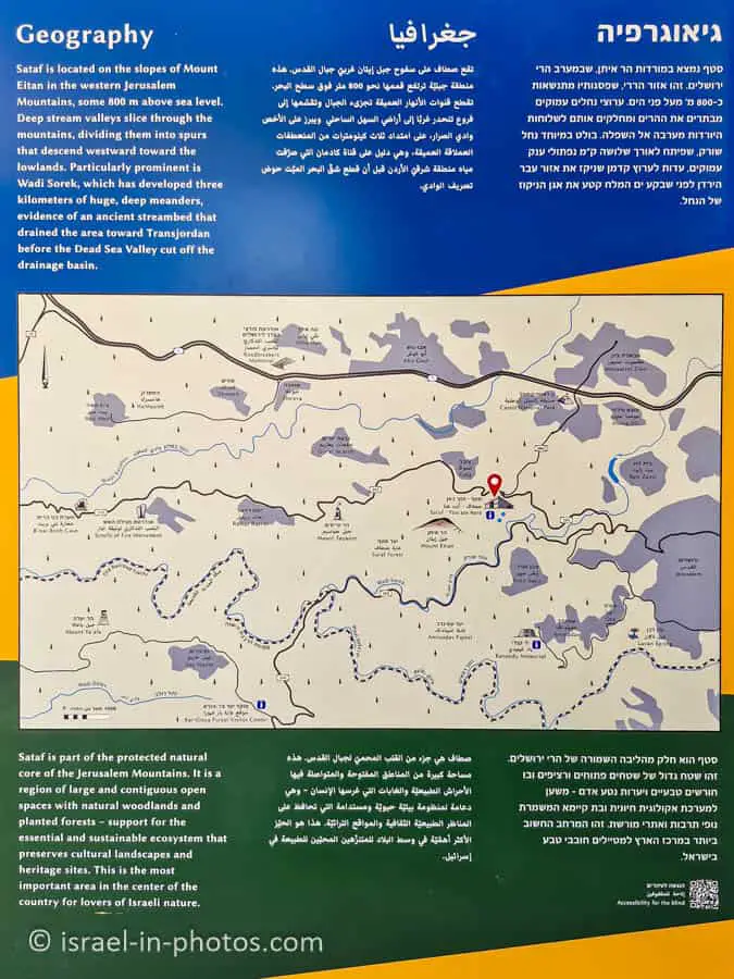
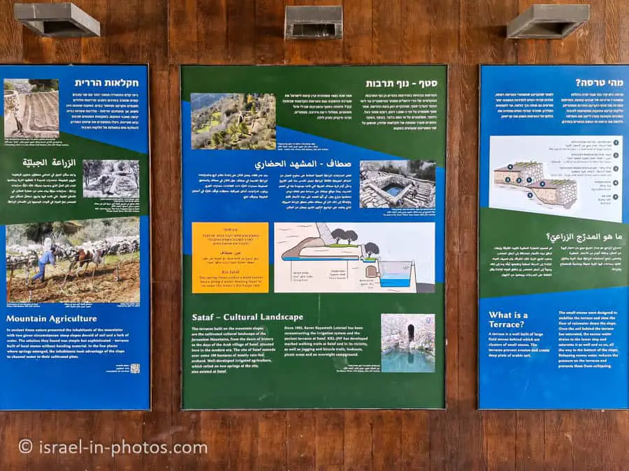
The informational signs include the trail map I showed above, geographical information, and details about mountain agriculture, including an explanation of terraces.
Here is some of the information from the signs:
Mountain Agriculture
In ancient times, nature presented the inhabitants of the mountains with two given circumstances: steep slopes devoid of soil and a lack of water. The solution they found was simple yet sophisticated – terraces constructed of local stones without the use of bonding material. In the few places where springs emerged, the inhabitants utilized the slope to channel water to their cultivated plots.
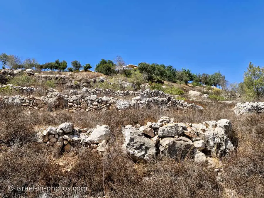
Sataf – Cultural Landscape
The terraces built on the mountain slopes are a cultivated cultural landscape of the Jerusalem Mountains, dating back to the dawn of history and continuing through the modern era, with the Arab village of Sataf situated here. The site of Sataf spans approximately 100 hectares of mostly rain-fed orchards. Well-developed irrigated agriculture, which relied on two springs at the site, also existed at Sataf.
Since 1985, Keren Kayemeth Lelsrael has been reconstructing the irrigation system and the ancient terraces at Sataf. KKL-JNF has developed marked walking trails at Sataf and in its vicinity, as well as jogging and bicycle trails, lookouts, picnic areas, and an overnight campground.
What is a Terrace?
A terrace is a wall built of large field stones behind which are clusters of small stones. The terraces prevent erosion and create deep plats of arable soil.
The small stones were designed to stabilize the terrace and slow the flow of rainwater down the slope. Once the soil behind the terrace has saturated, the excess water drains to the lower step and saturates it as well, and this process continues all the way to the bottom of the slope. Releasing excess water reduces the pressure on the terraces, preventing them from collapsing.
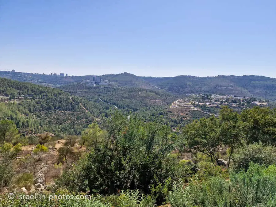
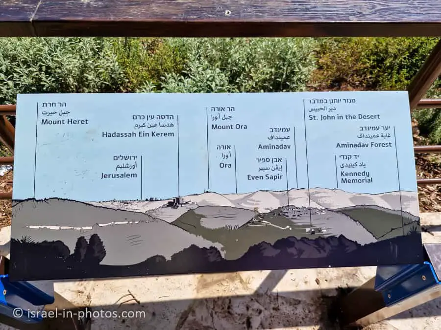
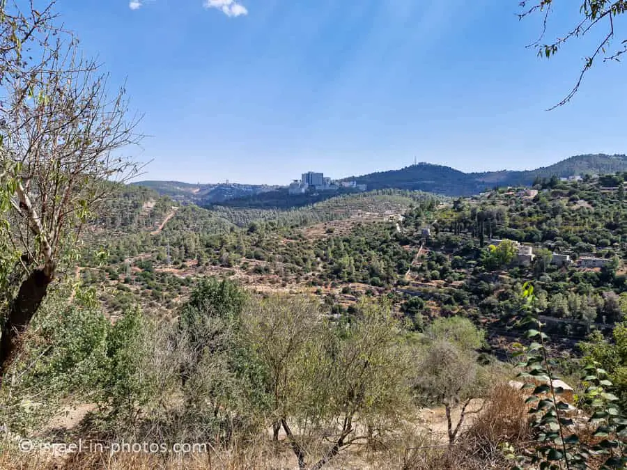
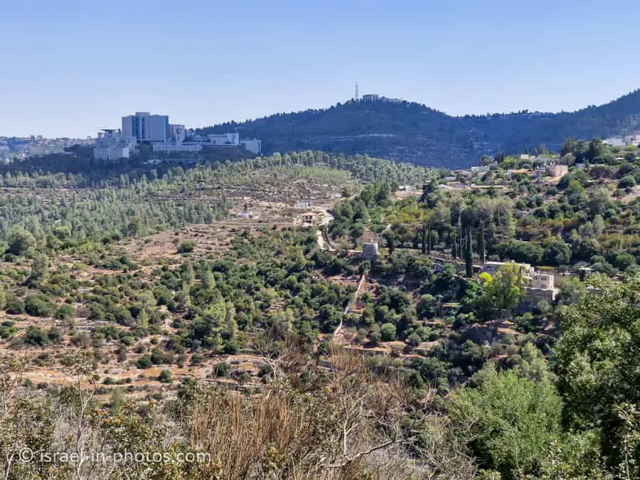
The Viewpoint
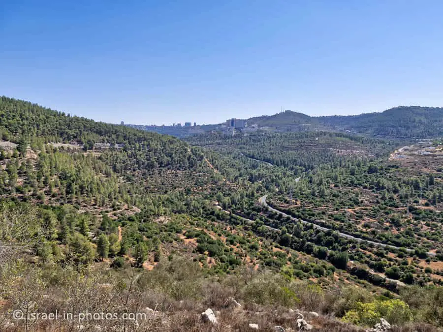
Behind the visitor center, you can find a viewpoint. You can see Ein Kerem and the surrounding mountains. Here are several photos:
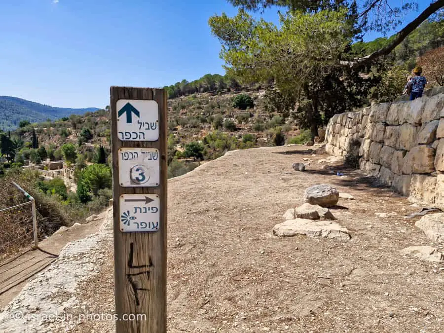
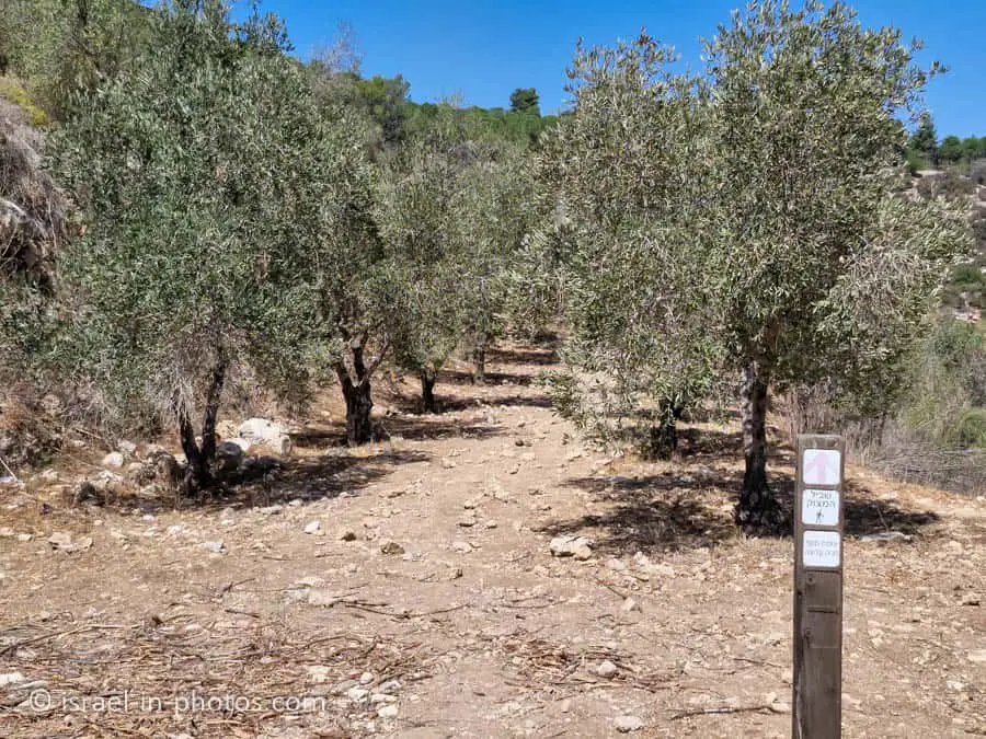
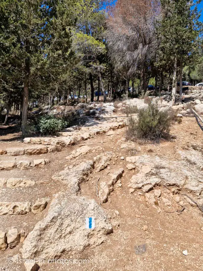
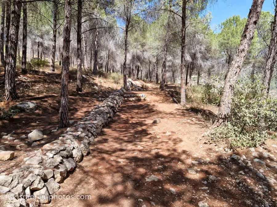
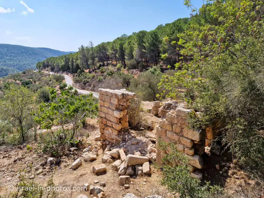
Hiking the Green Trail
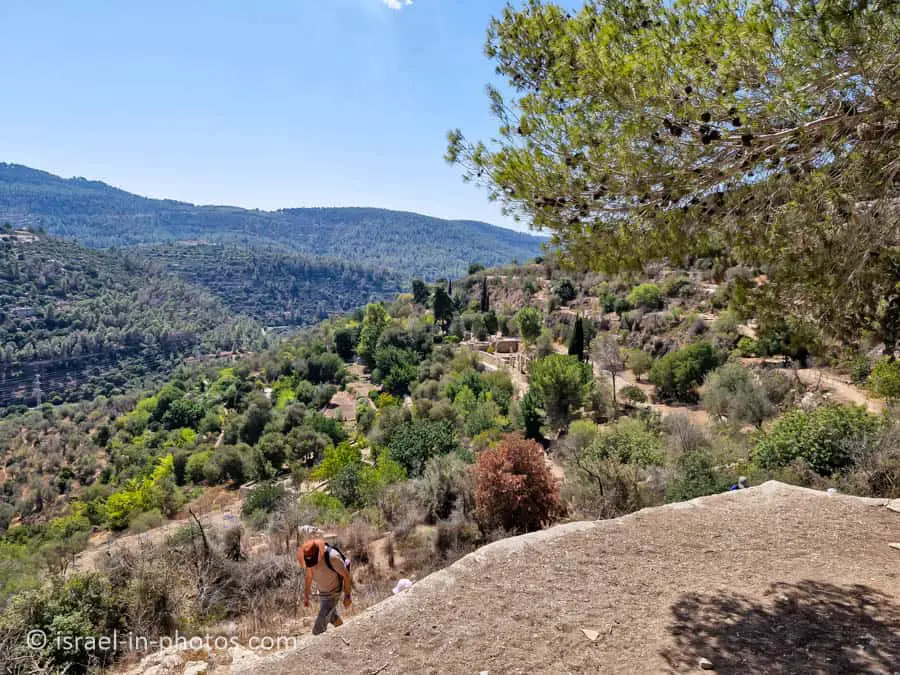
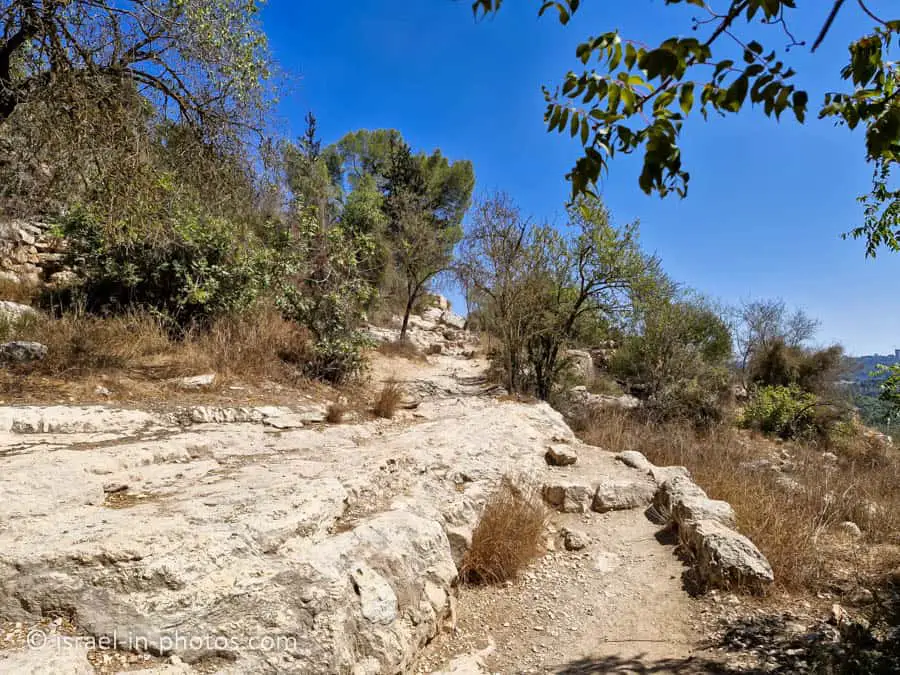
To the north of the viewpoint, you can see the beginning of the red, blue, and green trails. Our combo trail began with the green trail to Ein Sataf.
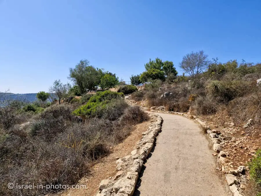
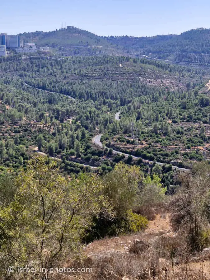
The green trail descends gradually. It starts with a small paved section, followed by hiking on stones and gravel.
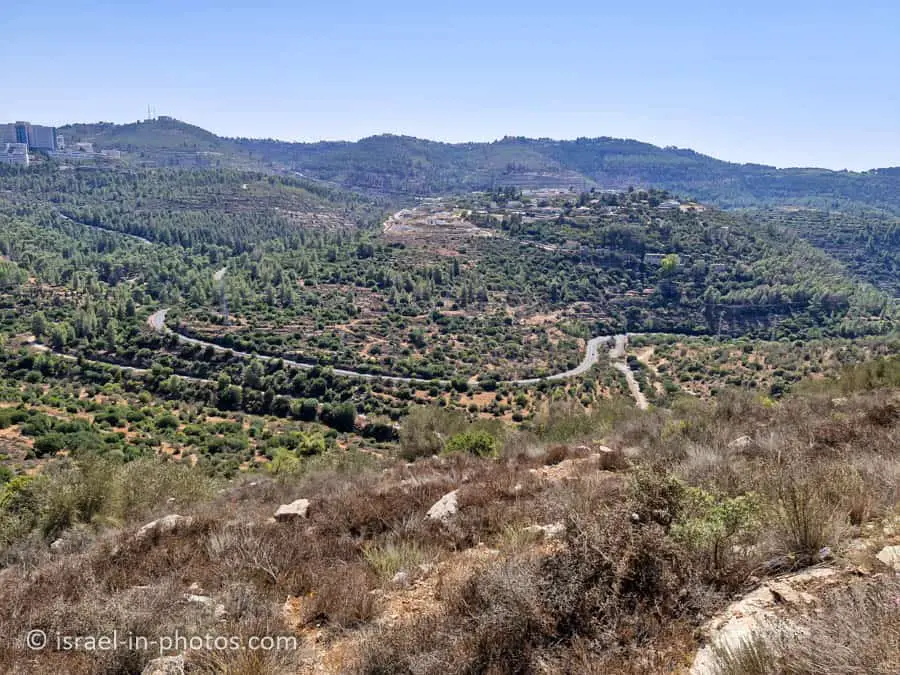
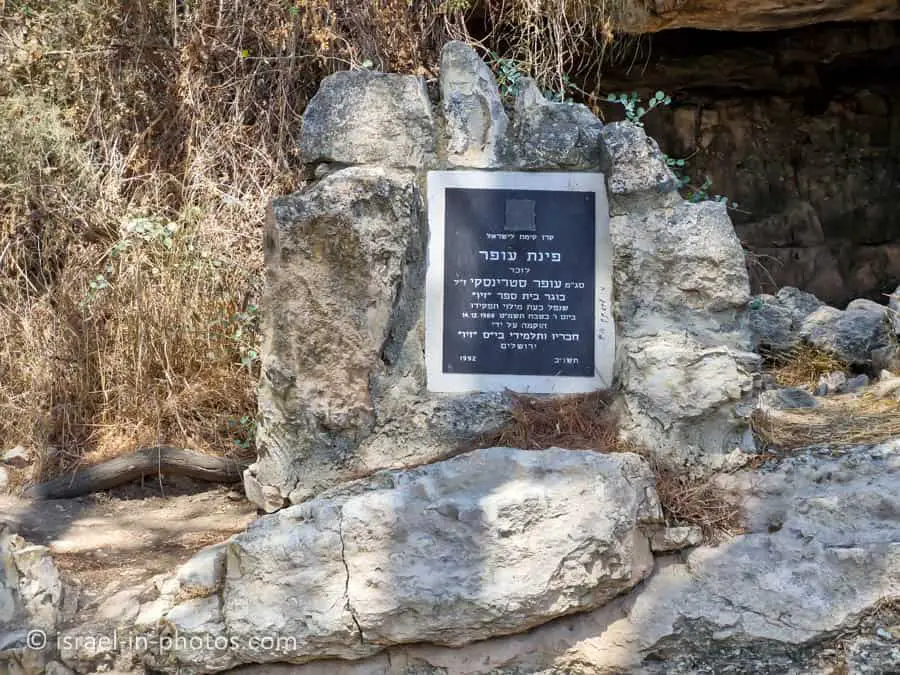
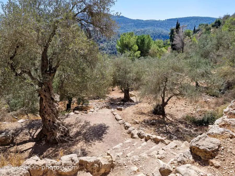
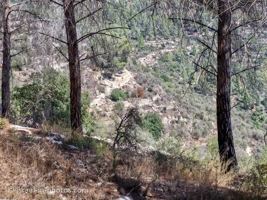
After almost half an hour, we reached Ofer’s corner. It was created in memory of Ofer Strinsky, who was killed in the line of duty. From there, you have a nice view of Sataf. Here are several photos:
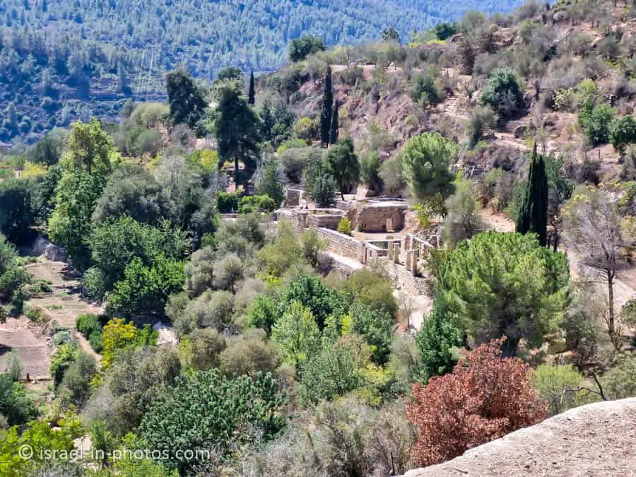
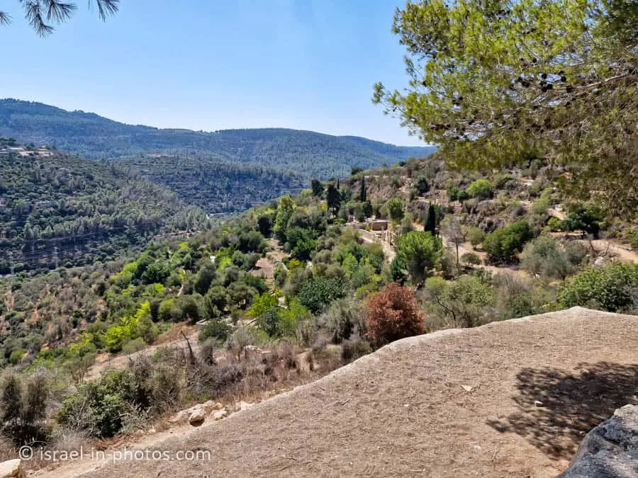
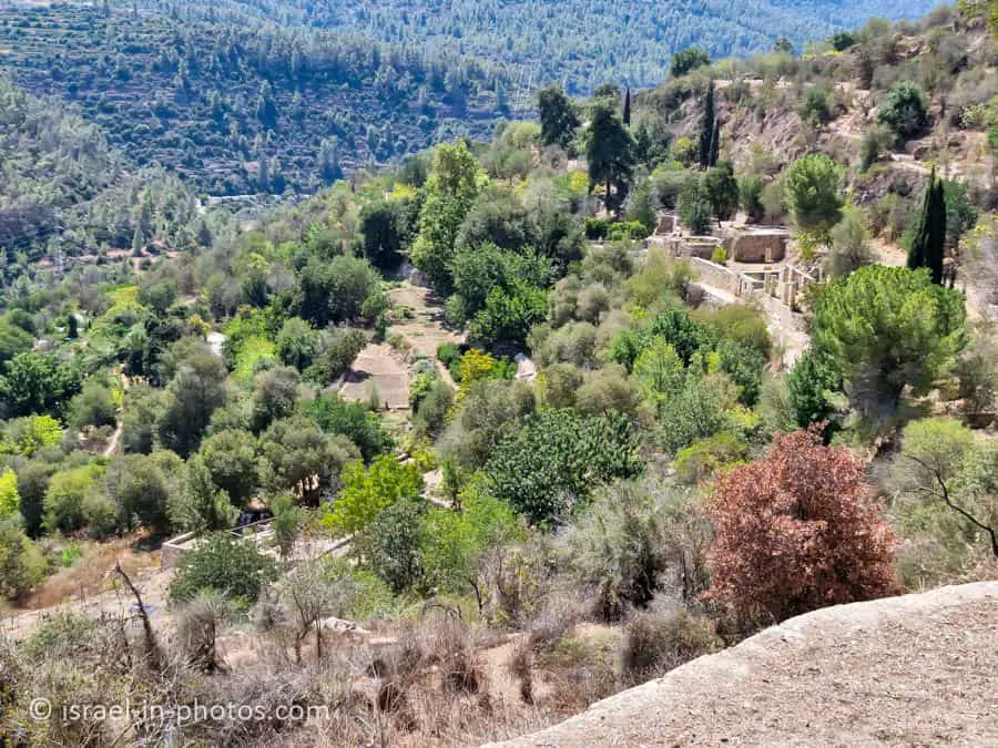
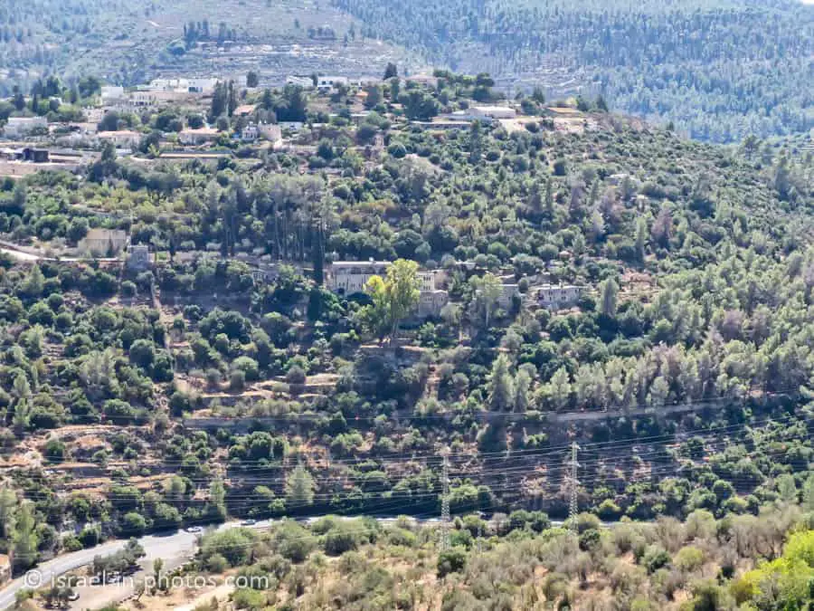
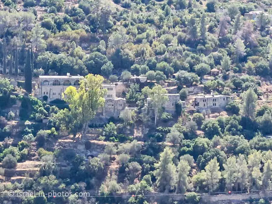
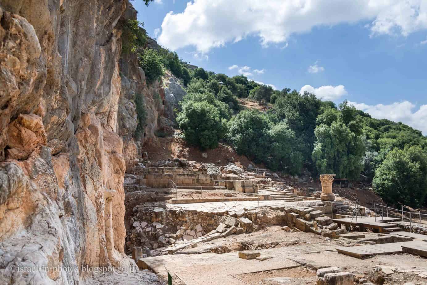
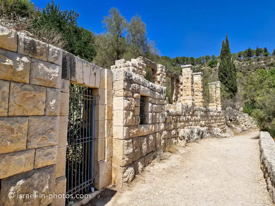
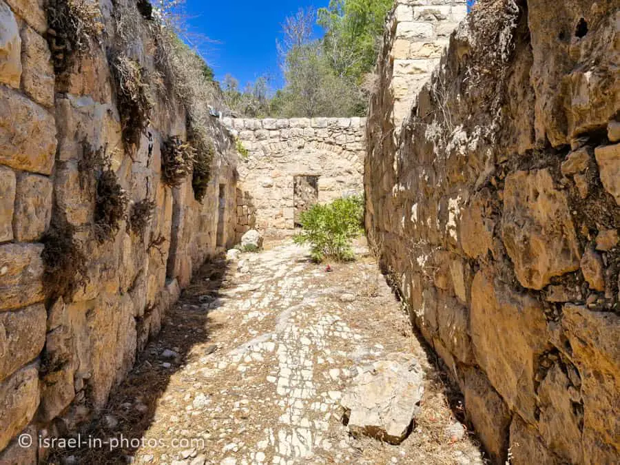
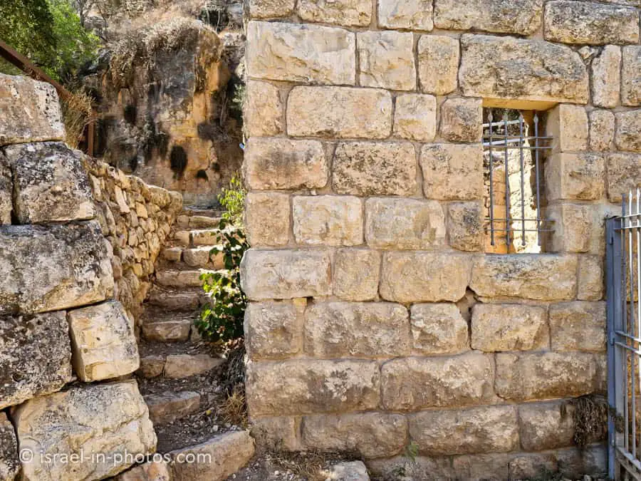
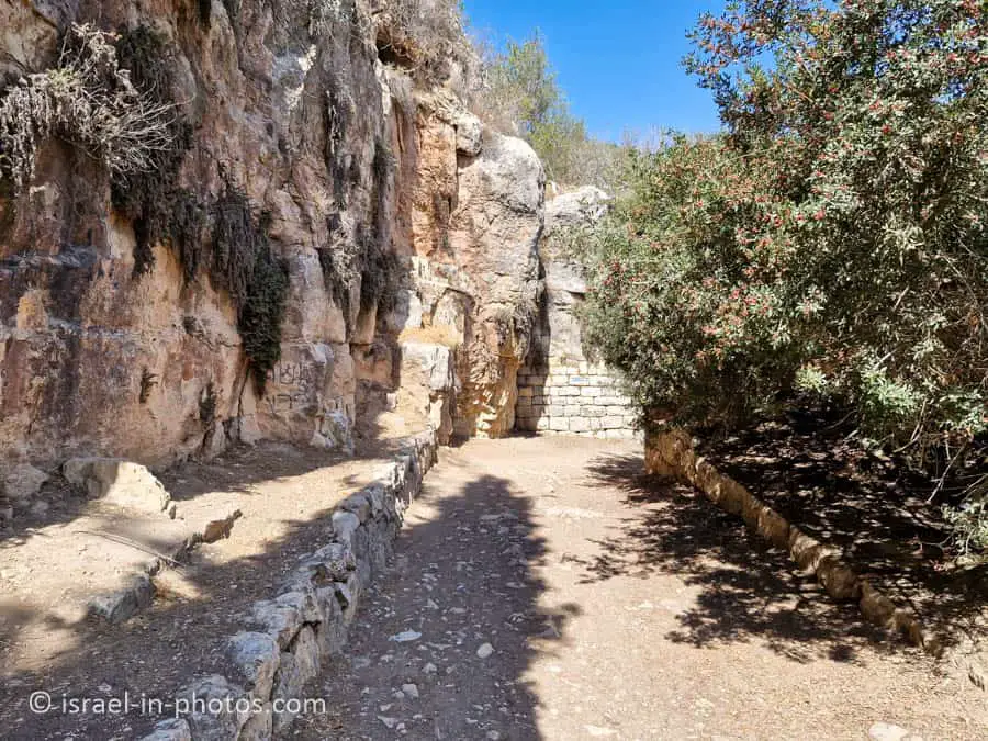
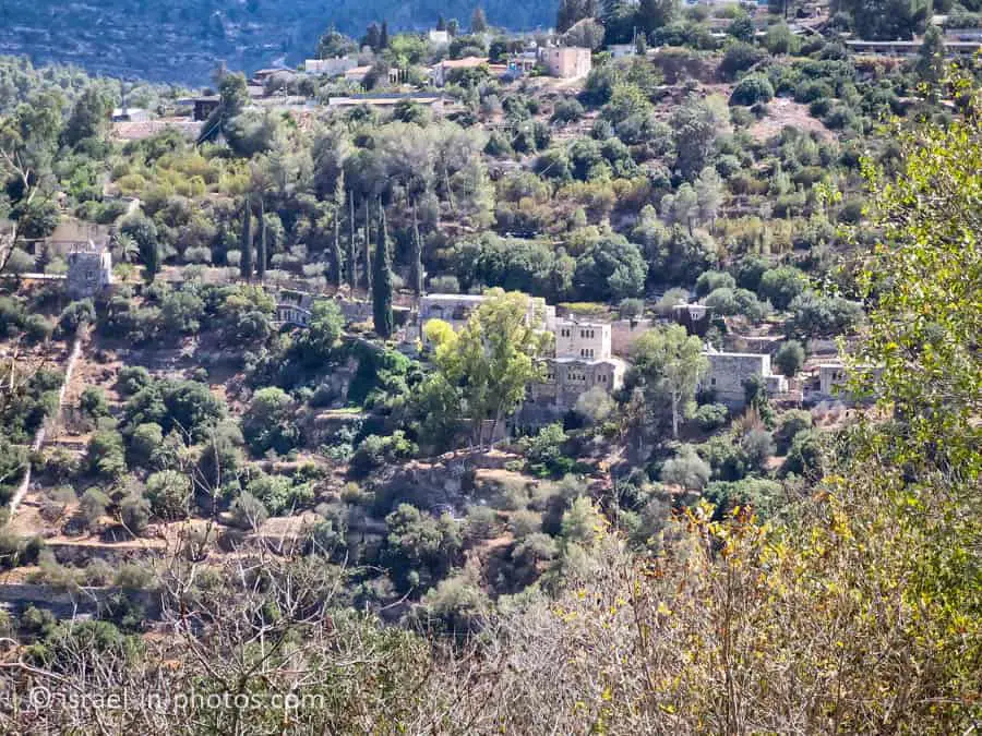
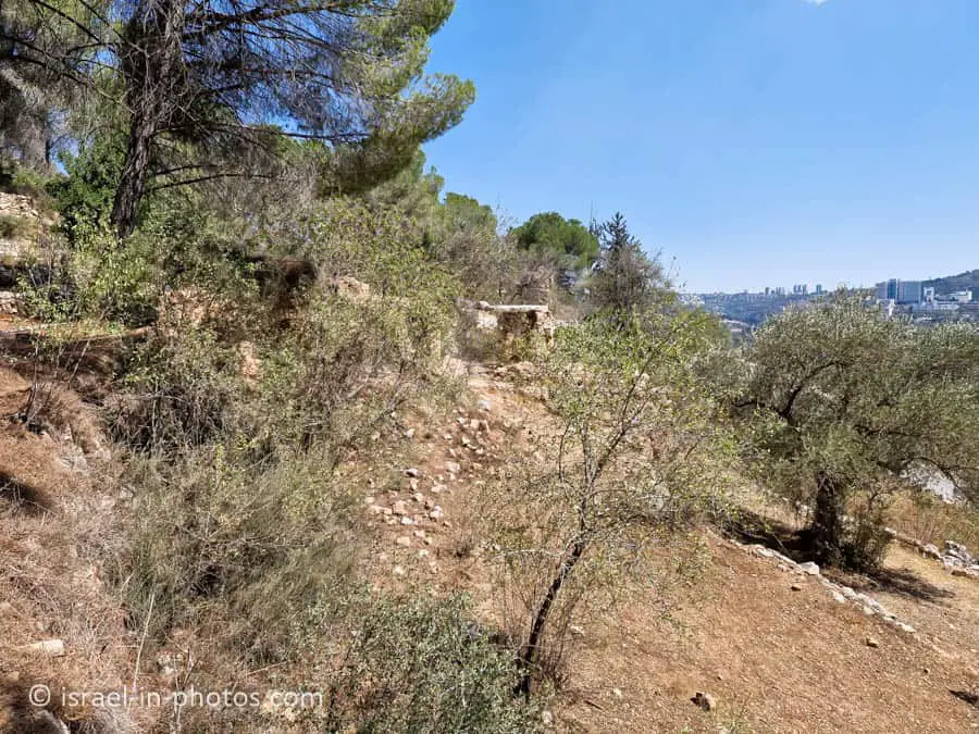
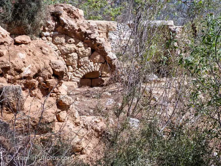
And from there, within several minutes, we reached Sataf.
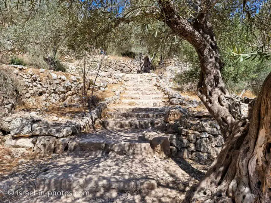
The entrances to the village buildings are closed, so here are several photos of the exterior.
Ein Sataf
This spring originates from within a mountain. To harness this natural resource, people constructed a rock-cut cave leading to the spring. From the cave, they created a channel to convey the water first to a small pool and then into a larger pool. See the diagram below for reference.
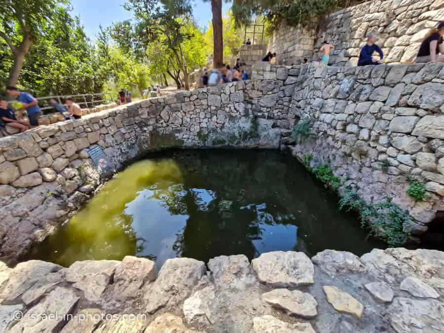
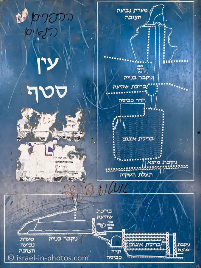
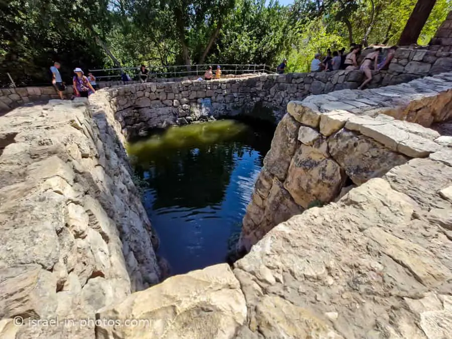
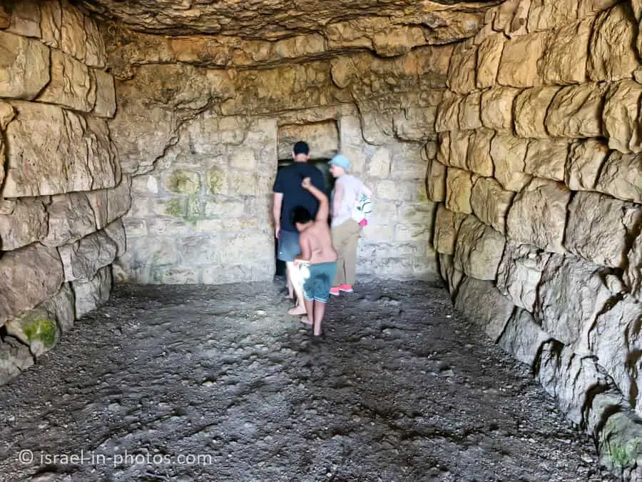
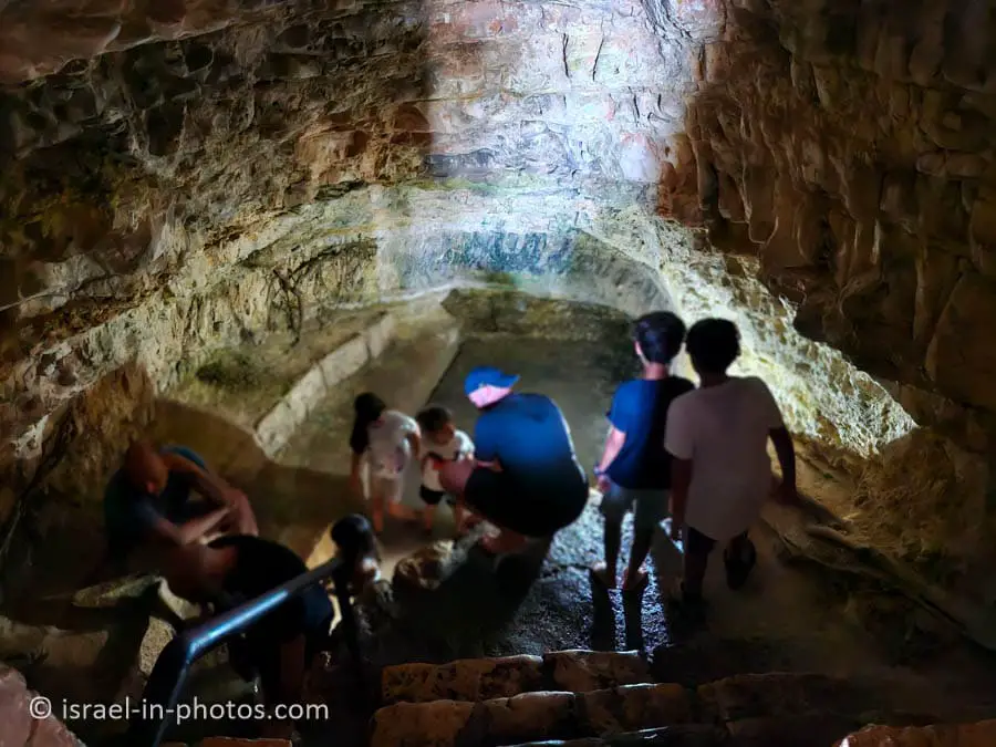
When hiking, you will come across a large pool. If you climb the stairs located near this pool, you will find a smaller pool that is about knee-deep and smaller than a typical bathtub. You can also see water flowing into the small pool from the mountain. If you head north and climb more stairs, you will reach the rock-cut spring cave. You can enter this cave, and if you crawl on your knees for about 10 meters, you will exit at the small pool. Kids enjoy exploring caves, but if you plan to do this, I recommend bringing flashlights.
Notes:
- Signs indicate that entering and jumping into the big pool is forbidden. However, you will likely see people doing just that.
- If you are interested, there is another pool nearby. Ein Bikkura was recently reopened to the public, and you can reach it using the yellow trail from Ein Sataf.
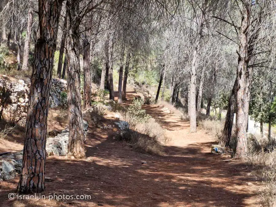
From Ein Sataf, we continued to the middle parking lot.
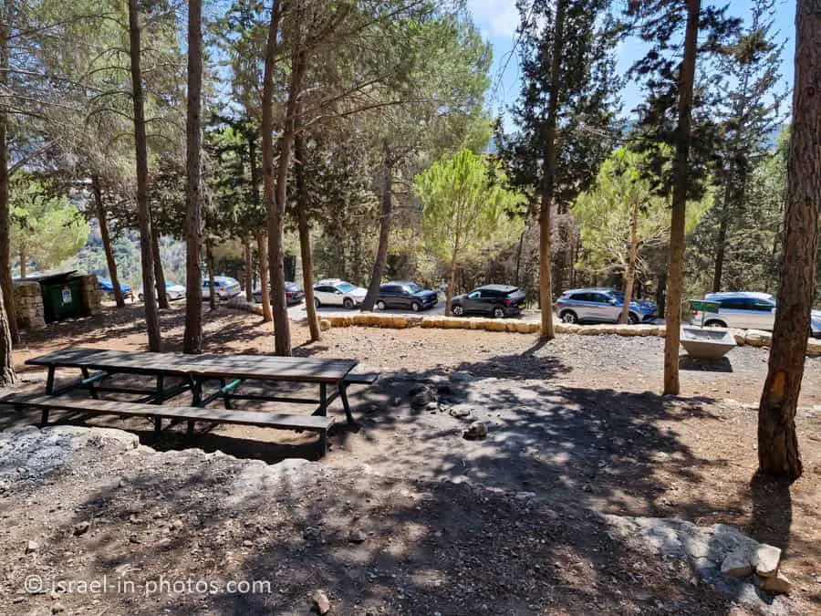
As you can see, there are all the standard facilities: picnic tables, ash collections, and running water at the middle parking lot. Hence, this can be a lovely place for a barbecue.
In the middle parking lot, we saw the blue trail and used it to return to the upper parking lot.
Summary
Completing the combo trail took us about two hours, including a stop at Ein Sataf. This lovely family trail is suitable for young children, and there are many other trails in the area. I definitely recommend it.
Since many other points of interest are nearby, you can always combine a visit with other places. Additional attractions can be found on the interactive map at the top of this page.
Have you ever been to Sataf? Tell us about your experience in the comments below.
That’s all for today, and I’ll see you on future travels!
Stay Tuned!
Additional Resources
Here are several resources that I created to help travelers:- Trip Planner with Attractions and Itineraries is the page that will help you create your perfect travel route.
- What is the Best Time to visit Israel? To answer this question, we will consider the weather, prices, holidays, festivals, and more.
- Information and Tips for Tourists to Israel will answer the most common questions tourists have about Israel (including safety, passports, weather, currency, tipping, electricity, and much more).
- Israel National Parks and Nature Reserves include a complete list, top ten, map, tickets (Israel Pass, Matmon, combo), and campsites.
- If you are looking for things to do, here are the pages for Jerusalem, Tel Aviv, Haifa, Sea Of Galilee, Akko (Acre), Eilat, Nazareth, Safed (Tzfat), and Makhtesh Ramon.