
Tzipori National Park – Visitors Guide – Capital of Galilee
Tzipori National Park presents remains of the ancient city of Sepphoris, including beautiful mosaics and an ancient water system.
Table of Contents
- 1 Map
- 2 Opening Hours
- 3 Entrance Fee
- 4 Contact Information
- 5 Ancient Water System
- 6 The City of Tzipori
- 7 The Ancient Synagogue
- 8 History
- 9 Zippori in the Bible
- 10 What Does Zippori Mean?
- 11 Common Questions
- 12 Summary
Map
Tzipori National Park is located in Lower Galilee, not far from Nazareth.
Directions for drivers: Link to Waze and Link to Google Maps
Directions for public transport: Link to Moovit
Interactive map of the area:
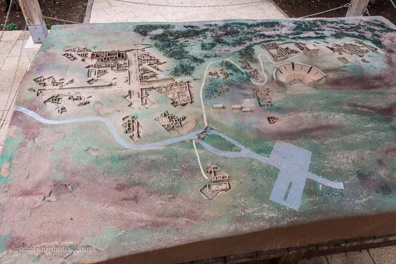
And here is a photo from the official brochure of the map of this national park:
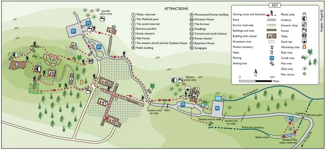
Note: you can click on the map to enlarge it.
As you can see from the map above, there are two parts to this national park.
- The ancient water system is closer to the entrance (on the right, it starts at #1).
- The remains of the ancient city of Zippori are on the left side of the map.
And we will visit them in the mentioned order. First, we will park near the entrance (#1). After completing the ancient water system route, we will not continue on foot towards the city and instead return to the parking near #1. Then drive to parking near #4 and walk to the town.
Note: on the map, two labels say “section not to scale.” Thus, we decided to return to the car at #1 and drive to #4.
Opening Hours
Sunday – Thursday and Saturday: 8:00 – 17:00 (16:00 in winter).
Friday: 8:00 – 16:00 (15:00 in winter).
On holiday eves, usually 8:00 – 13:00.
Note: Since the pandemic, the Israel Nature and Parks Authority has started limiting the number of people in each park. Thus, reservations are recommended through the official site (you can find the link below).
Entrance Fee
Adult – 28 NIS, child – 14 NIS, and student – 24 NIS. Free for National Parks annual subscribers.
If you visit several National Parks, consider purchasing a combo ticket. For additional information, see National Parks and Nature Reserves.
Note: opening hours and ticket prices were updated in October 2022. In any case, recheck the official site before visiting.
Contact Information
Phone: 04-6568272
Email: gl.zipori@npa.org.il
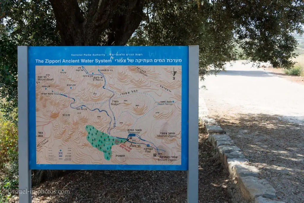
Ancient Water System
Tzipori Water System is next to the first parking, closer to the entrance.
We parked there and started walking along the trail. After several minutes, we saw this beautiful Sabres flower (also known as Opuntia ficus-Indica):

This cactus is the origin of the term sabra used to describe Israelis. A spiky skin on the outside but a soft, sweet interior, suggesting that while the Israeli sabras are rough on the outside, they are friendly and sensitive once you get to know them.
The map of the ancient Tzipori water system (#1) consists of several springs, aqueducts, tunnels, a reservoir, and a pool.
Aqueducts
Located at the entrance to the site on the left. 1.5 kilometers east of the city of Zippori. The reservoir is part of the city’s water supply system, which begins at the springs in the Nazareth Mountains near the villages of Mashhad and Reineh. The discharge rate of the springs is approximately 40 cubic meters per hour. The water was channeled to the city via two aqueducts; the one at Mashhad was dug into the rock, and the one at Reineh was constructed. The Reineh aqueduct led to the large reservoir east of the city.
Note: unless stated otherwise, all quotes were taken from the official site.
Reservoir
The reservoir was dug at this point because it is the only high place near Zippori with chalk rock, which is easy to hew. The reservoir is 260 meters long, ranges from two to four meters in width, and is some 10 meters high. Its total capacity is 4,300 cubic meters of water, which could supply 18,000 people for two weeks. The water flowed to the reservoir through a sedimentation basin five meters deep. Support arches were constructed across the width of the reservoir at certain points.
235 Meters Tunnel With A Valve
A valve at the reservoir’s outlet regulated the flow of water to the city. From this point, the water flowed through a tunnel 235 meters long and dug into the rock using six vertical shafts. The aqueduct entered the city at 270 meters above sea level (20 meters lower than the fortress) and supplied water to most of the city. The reservoir reveals two construction periods: the first is from the second century CE, and the second is from the fourth century CE. The reservoir continued in use until the seventh century. Numerous cisterns were discovered in dwellings in the higher part of the city, where residents who did not receive their water supply from the reservoir could store rainwater. The residents also utilized spring water which, although it flowed in the valley, had a stable discharge rate (about 110 cubic meters per hour).
Here you can see a part of a model that tells about this water system:
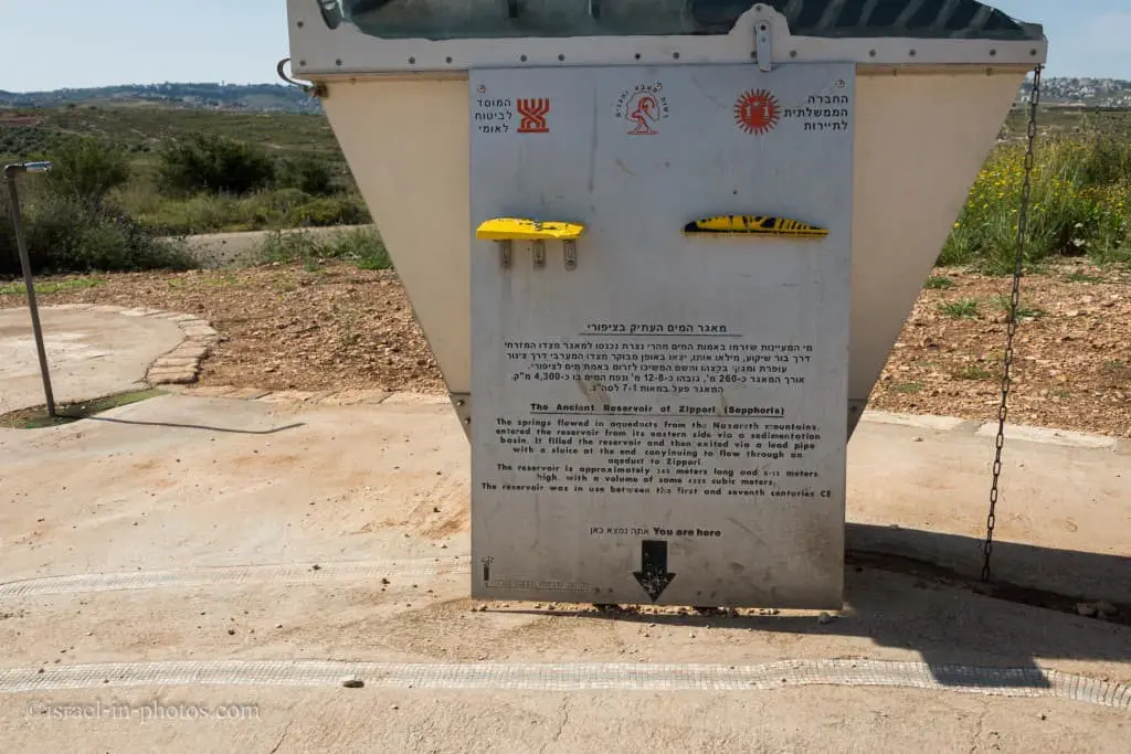
The reservoir is approximately 260 meters long and 8-12 meters high. It was in use during 1-7 CE.

Let’s enter inside:
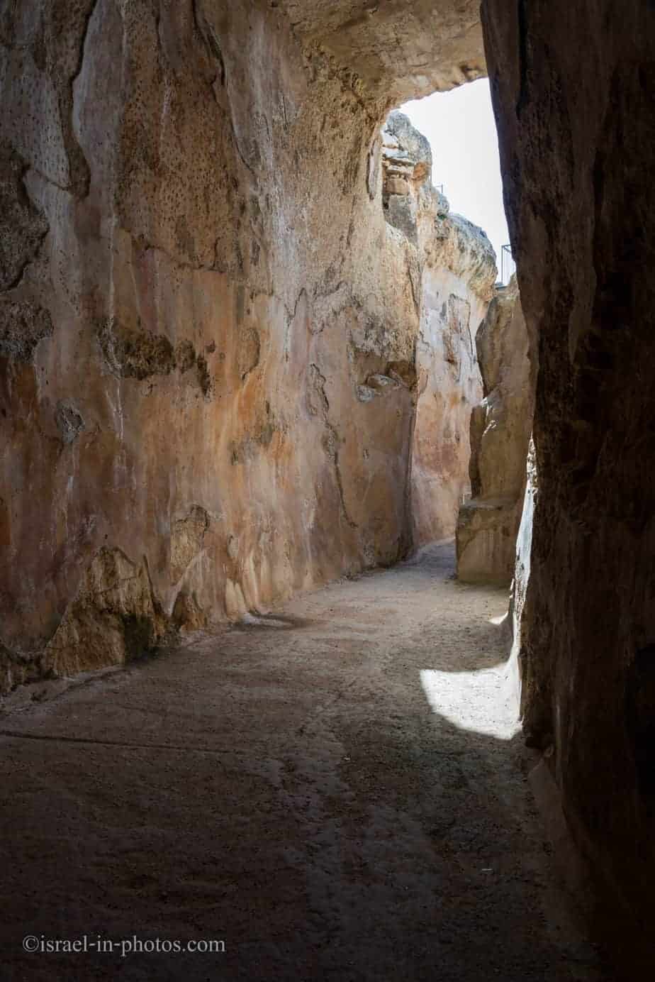
After about 10 minutes, we reached the end of the first part.
Here is the view of the exit:
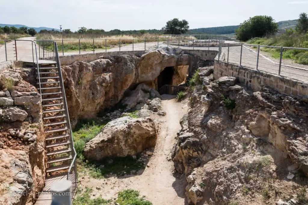
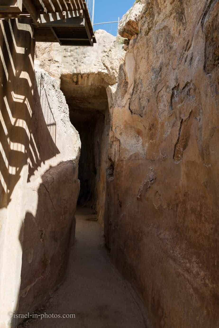
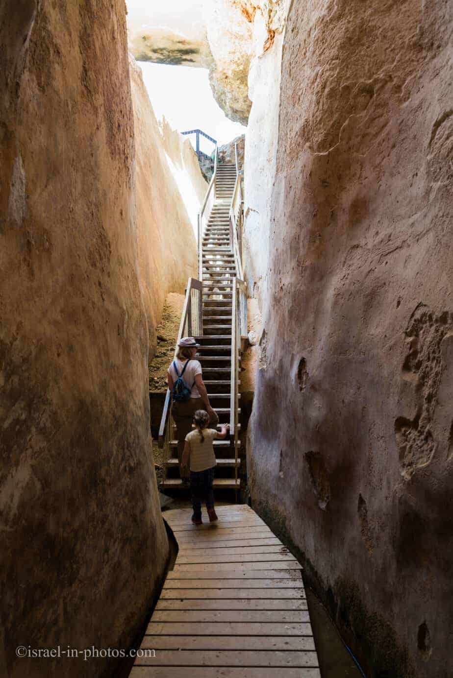
Six-Shaft Tunnel
We continued straight and reached the six-shaft tunnel.

They call it the six-shaft tunnel due to the construction method. People dug six shafts (about 15 meters deep each) and then dug horizontally in both directions till workers from different groups met.
At the beginning of this tunnel, there was a valve. Using this valve, the people regulated the quantity of water reaching the city.
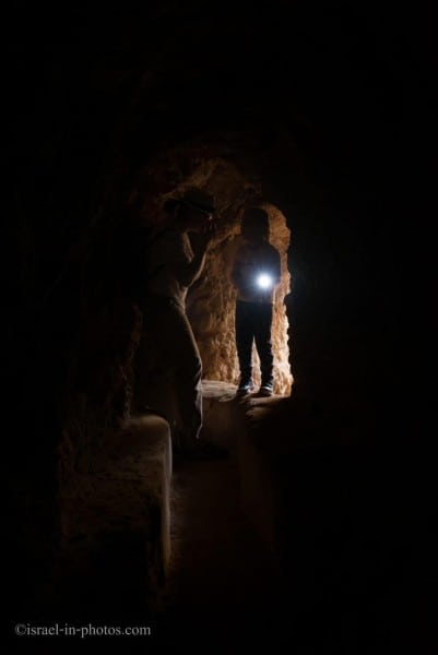
The tunnel inside is relatively small (0.8 meters and 1-3 meters high) and very dark. To visit this tunnel, you will need a flashlight.
After several bumps on the head ;), toward the end, I made this photo:
You can continue walking to the city or return to your car from the exit. Since our car was at the first parking, we returned there.
Exploring the Tzipori water system took about an hour. It is an excellent addition to the ancient city’s visit and is especially beloved by children, who can play with flashlights.
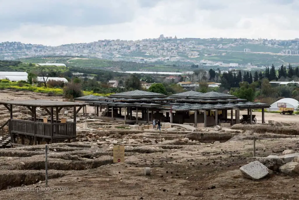
The City of Tzipori
The Entry Pavilion
To reach the city, you must drive several extra kilometers and see additional parking there (next to #4).
Visitors will find information, souvenirs, and an explanatory film here, as well as a model of the site, toilets, an instruction center, and the national park office. A path leads from the pavilion west to the Decumanus and the street system that is part of the touring route of the Zippori antiquities.

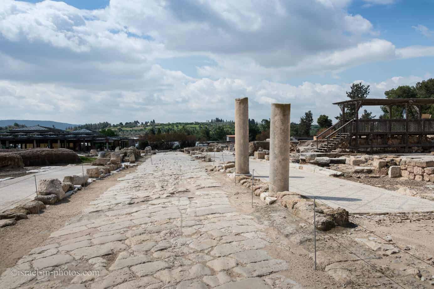
The Street System
After a five-minute walk, we reached the city (#5).
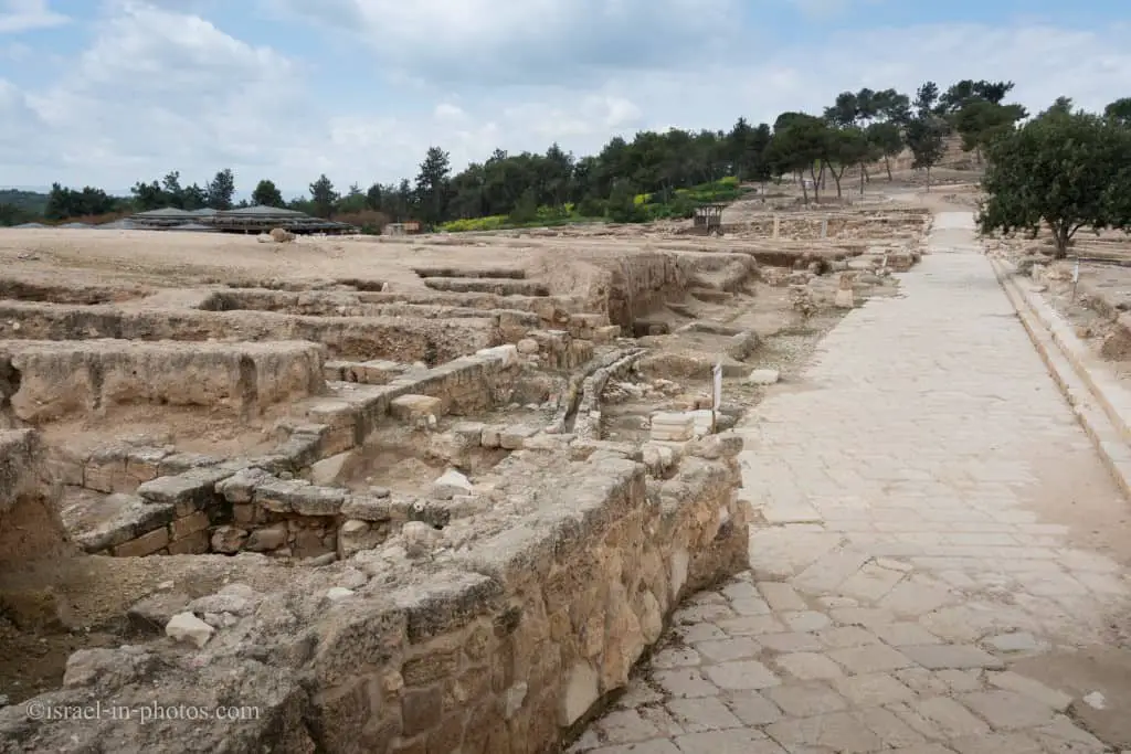
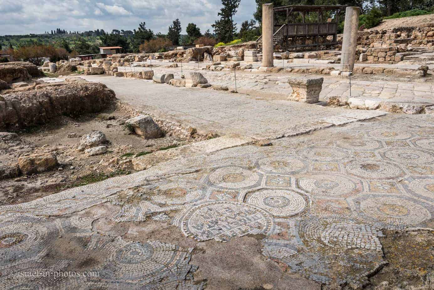
An impressive network of streets arranged in a grid, dating from the Roman period (apparently the early second century CE), was uncovered here. The street system indicates urban planning typical of important cities in the Roman Empire. Groups of buildings, or insulae, were found between the streets.
At the heart of the street, the system was two colonnaded streets, which intersected to create a kind of cross. The cardo ran north to south, and its cross-street, the Decumanus, ran east to west. The streets were paved with hard limestone, while the porticoes along both sides of the road were paved with mosaics.
The street was lined with small shops, which formed part of Zippori’s “lower market’ mentioned in the Talmud. Ruts can be seen in the paving stones created by wagon wheels that passed this way repeatedly over the years in antiquity. A seven-branched candelabrum was carved on one of the stones.
Most Israelis know Tzipori National Park for its famous Mona Lisa mosaic. But there are many mosaics in this National Park. Over sixty different mosaics dating from the third to the sixth century CE can be found across the city.
The Western Church And Orpheus House
The Western Church
The western church was built at the end of the fifth or the beginning of the sixth century CE atop the remains of the Orpheus House, dating to the Roman period. A rectangular plaza adorned with a mosaic served as a grand entryway between the Decumanus and the church along the long side of the building. The church’s foundations, made of fieldstones, were the main part of it to survive. The church was an elongated building about 18 meters wide, which faced east. The main hall was divided into a central space and two aisles. The apse (where mass was held) was at the eastern end, as usual in a church.
Note: The Western Church And Orpheus House are marked as #7 on the map.

Orpheus House
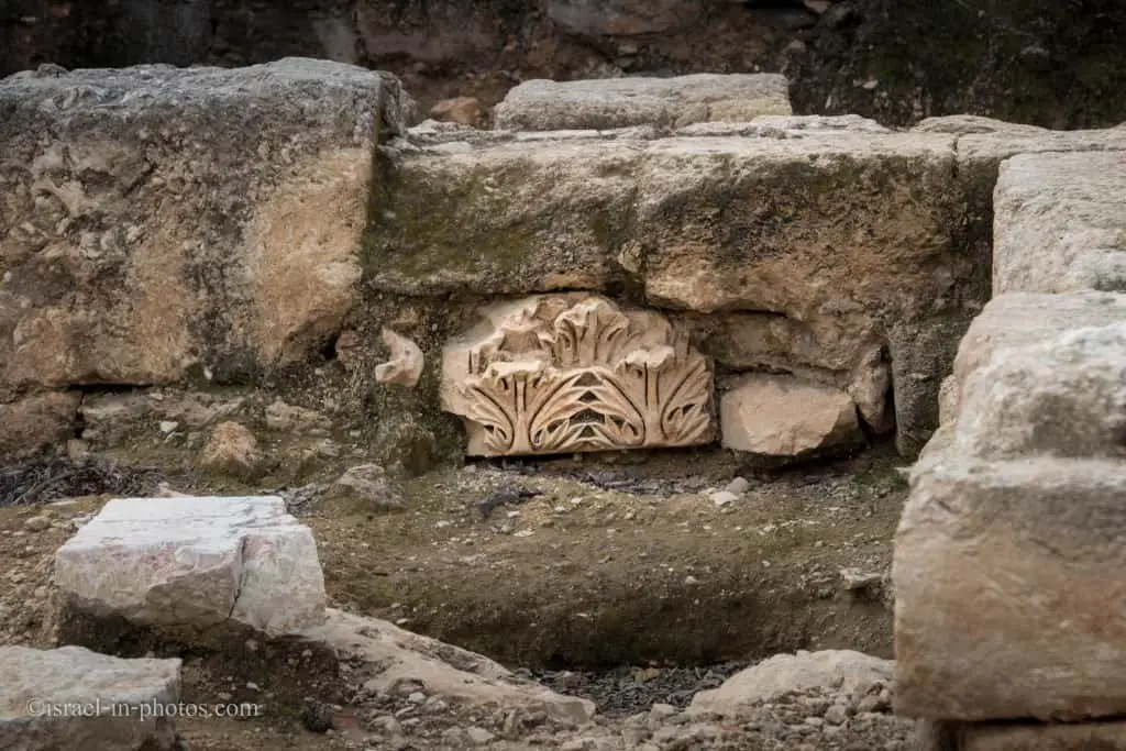
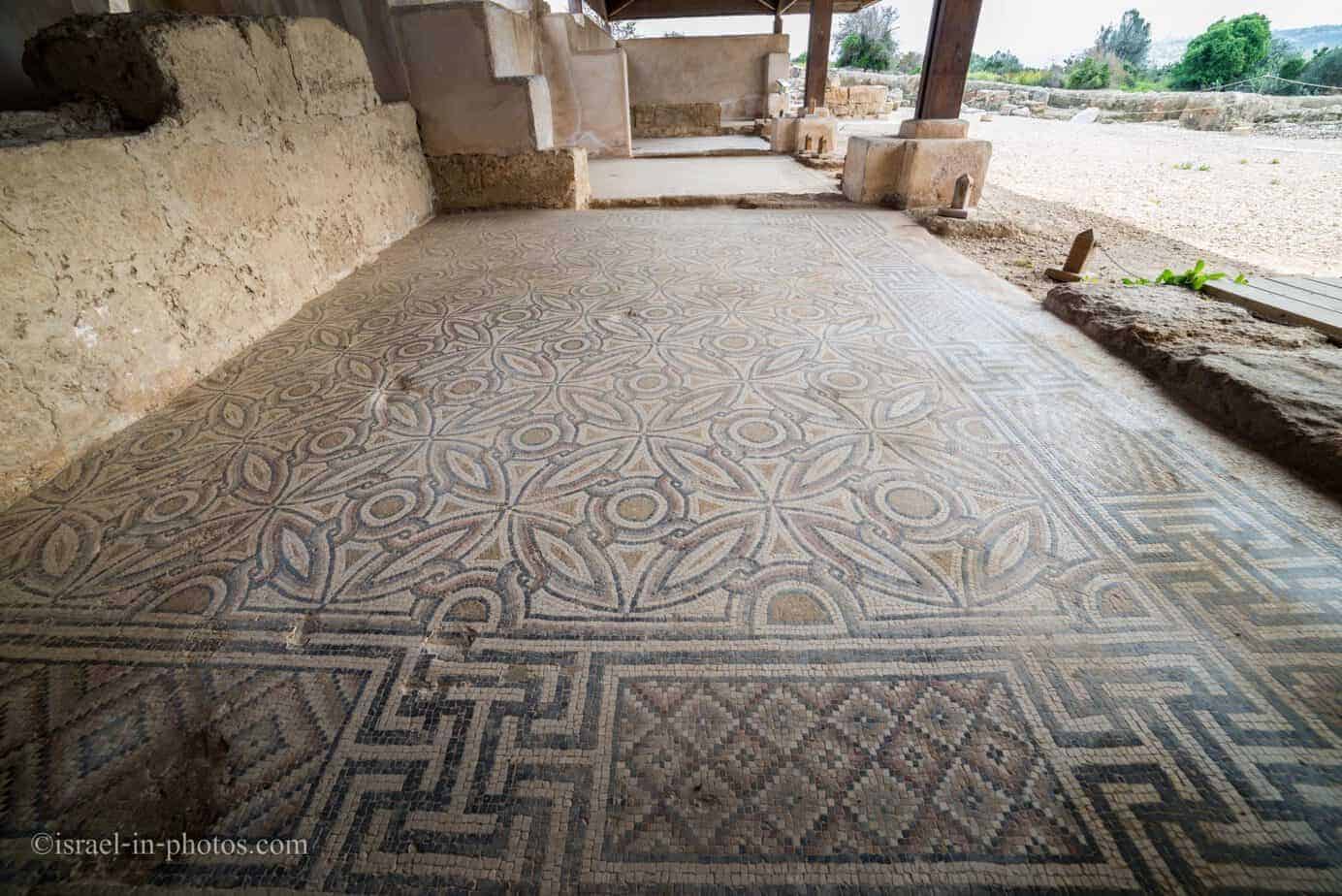
At the heart of the building. Measuring 17 x 28 meters, built in the second half of the third century CE, was a dining hall south of which was an open courtyard with two patios. Additional rooms of various sizes were grouped around the dining hall and the courtyard. The floors in these rooms were all decorated with mosaics with simple geometric patterns. In contrast, the mosaic in the dining hall features four colorful panels arranged in an inverted L. The central panel depicts Orpheus, the divine musician, and the others show scenes of daily life.
Orpheus House was damaged in the earthquake of 363 CE. Shortly after, the building was restored, and some structural changes could be discerned. New mosaics were installed also using geometric and figurative designs; however, these were only partially preserved.
Several floor mosaics:
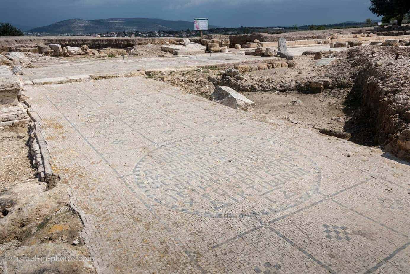

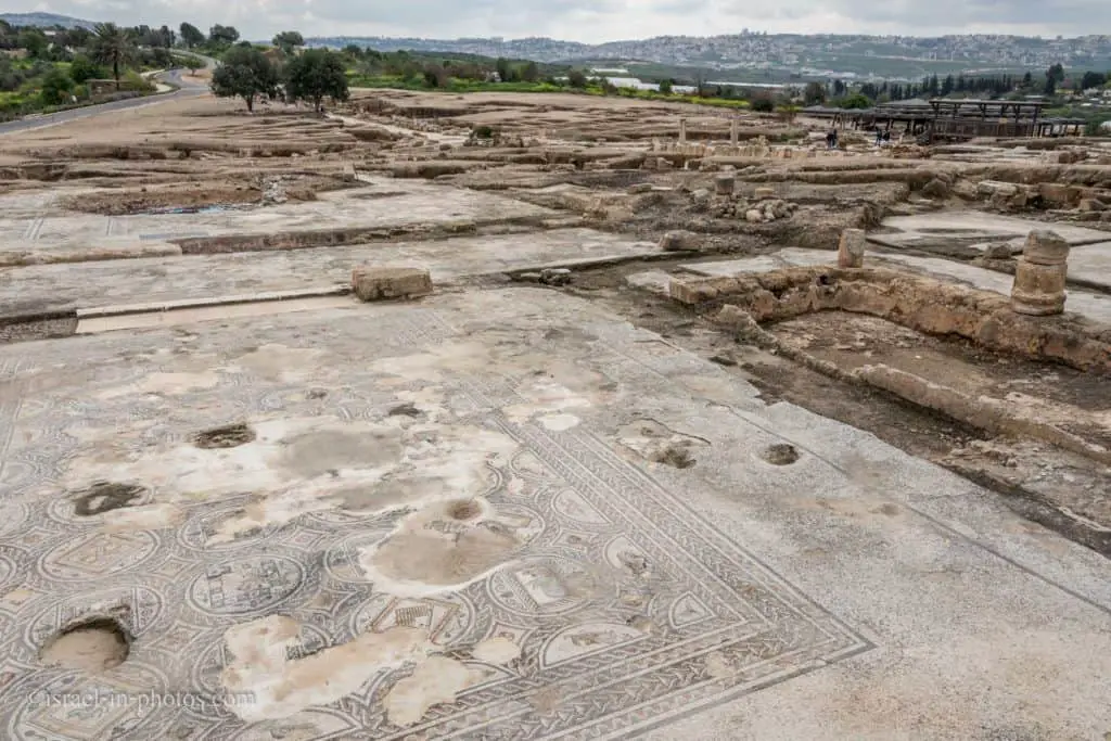
The Nile House
Here, you can see remains in the foreground, the Nile house (#6) in the middle ground, and Nazareth in the background:
Located east of the cardo, and covering a large part of the insula. At the western entrance, on a pavement next to the cardo, a mosaic floor was discovered, bearing an inscription mentioning the name of the mosaic artists. The building had three main wings connected by corridors. At the center of the western wing was a basilical hall bisected by two rows of columns. Additional rooms surrounded an open courtyard in the eastern wing of the building. A toilet was among the rooms of the southern wing, which was mostly destroyed.
The floors of the building were decorated with colorful mosaics, some with geometric patterns and some with human, animal, and plant imagery. Among the designs: a pair of hunters, a centaur is holding an object bearing a Greek inscription, Amazons and a male figure on a hunt, and Amazons participating in a celebration of an unknown type. The largest of all the floors was adorned with a spectacular mosaic depicting the celebrations held in Egypt when the Nile overflowed, alongside various hunting scenes – an unusual combination attesting to its creator’s great artistic skill and imagination.
Inside the Nile house, you can find several different mosaics. The biggest one is the Nile Mosaic from the fifth century CE.

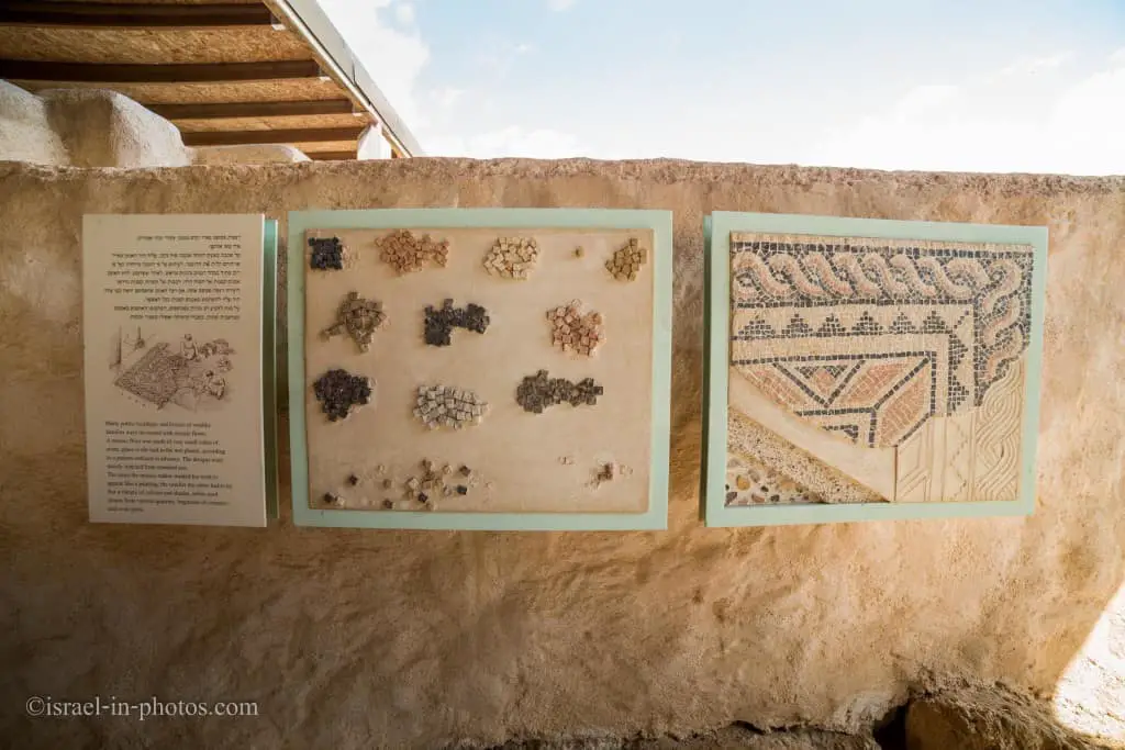
How mosaics were created:
Other mosaics in the Nile house:

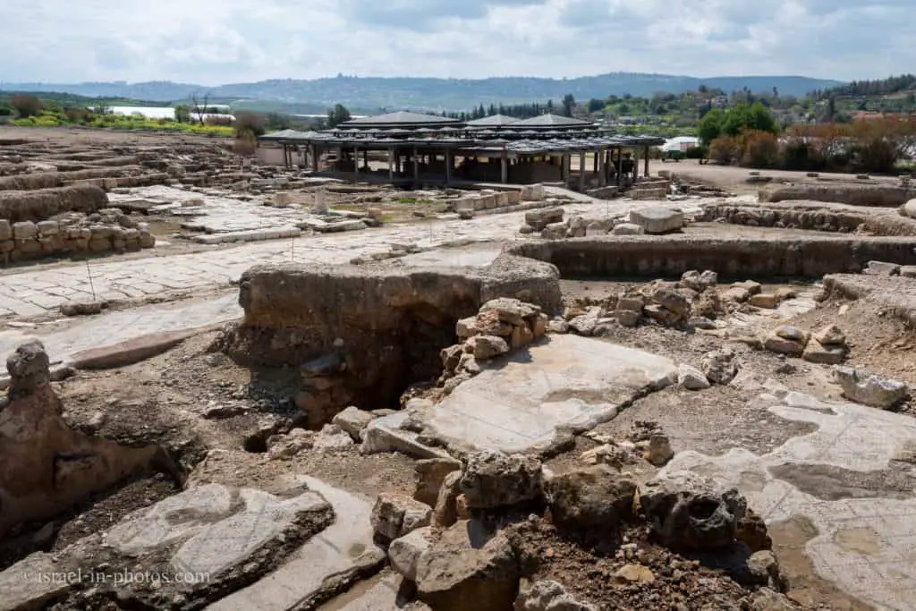
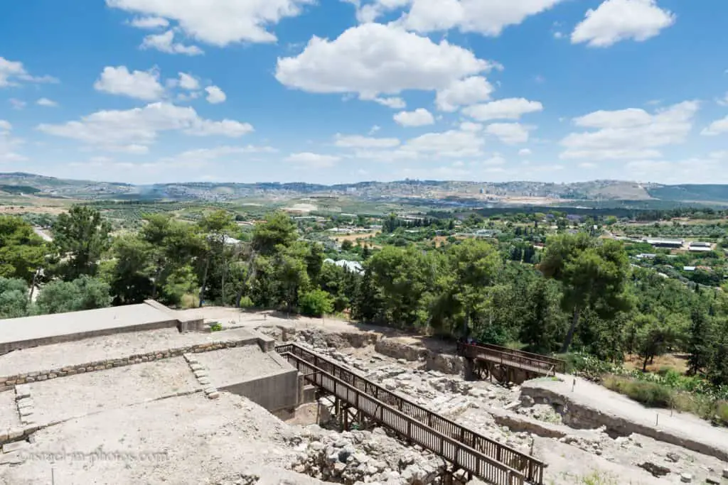
After visiting the Nile house, we continued toward the hill. You can get lovely views of Tzipori National Park in the foreground and Nazareth in the background on the mountain.
Public Building
In use from the first to the fourth centuries CE. and apparently containing Zippori’s market (agora). It measured 40 x 60 meters, and the entrance was from the east via the colonnaded street. At its center was a courtyard surrounded by columns and rooms with colorful mosaic floors depicting geometric patterns and animals.
Public Building (#8):
At this stage, we did not follow the suggested route and, instead of #9, headed to #14.
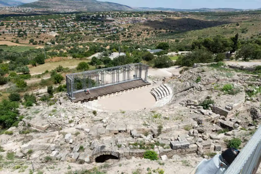
Roman Theater
As you pass the hill, you will find a 4,500-seat Roman theater (#14) at Zippori, partially restored, and the Crusader fortress on the top.
Built at the end of the first century or the beginning of the second century CE, it seems to have continued in use until the Byzantine period. It was built on the steep northern slope in a semi-circle facing the stage. The theater is about 70 meters across and contains some 4,500 stone seats. Some of them were robbed in antiquity; those that remained were not found in their original location.
In front of the orchestra (where the chorus stood in the Greek theater and where dignitaries sat in the Roman theater), a stone stage with a wooden floor was built. The front of the stage featured decorative niches along its entire length. The remains of the scoena frons (the wall behind the scene) were also discovered. This wall closed the structure and served as a backdrop for the actors. The theater had five entrances; three were among the seats (vomitoria), and two were on either side of the stage (pradoi). An arched corridor connected all the entries (the ambulatonum).
The plays performed in this theater expressed a clear-cut Roman way of life – hedonist and pagan – which was contrary to Jewish life and culture. The existence of a theater, a symbol of paganism, in a Jewish city raised concerns among the ancient sages. Rabbi Shimon Ben Pazi taught, “Happy is the man who walks not in the counsel of the wicked…nor sits in the seat of the scornful… (Psalm 1:1): Happy is the man who did not go to theaters, and to circuses of those who worship the stars” (Babylonian Talmud, Avoda Zara lab).

Many people confuse between a theater and an amphitheater. Do you know what the difference between the Roman Theater and Amphitheater is? For a full explanation, check out Is Caesarea Amphitheater really an amphitheater?
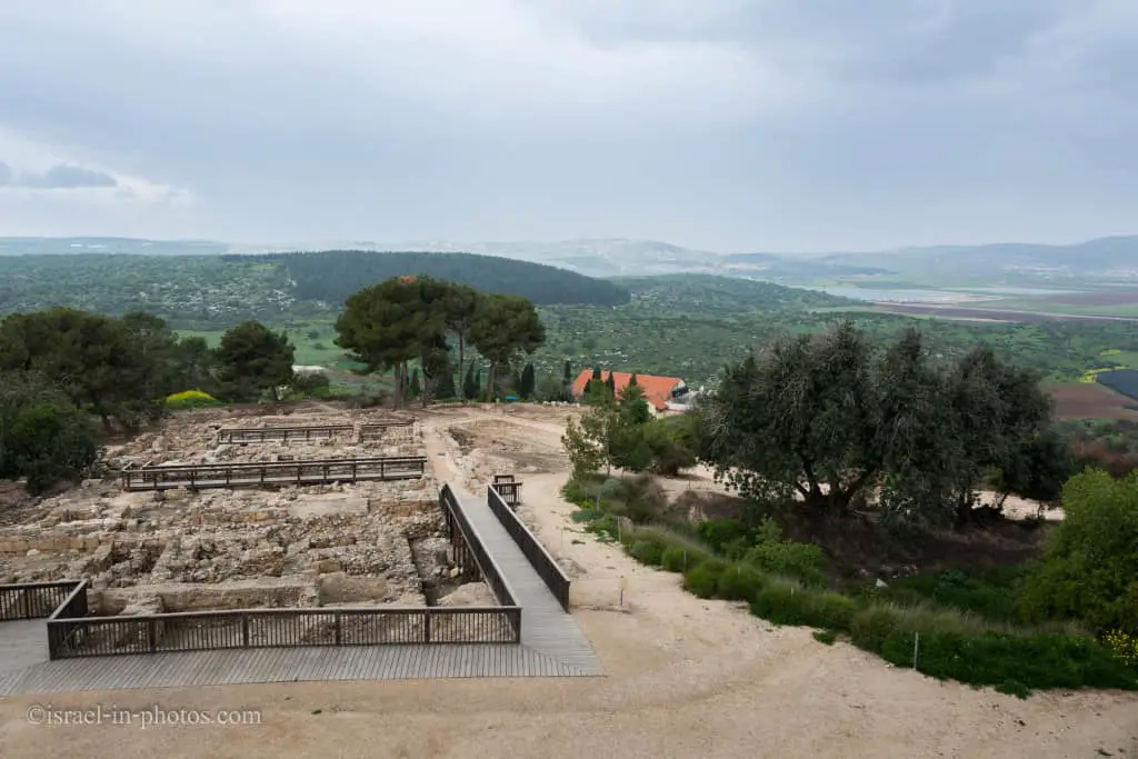
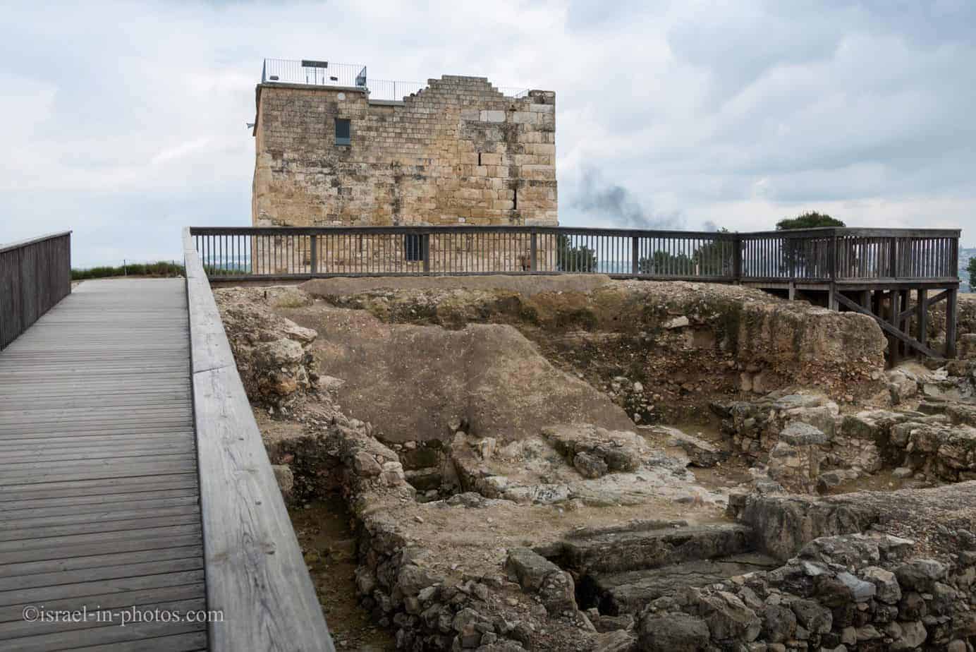
The Crusader Fortress
Today, the Crusader fortress (#11) contains two halls with movies. You can see 360-degree views of the whole area from the roof.
Built during the Crusader period on the remains of an earlier structure. The original two-story building was built out of large dressed stones taken from earlier structures. Roman sarcophagi, some decorated with reliefs, were inserted in the corners of the building. Daher el-Omar built the doorway with its decorative arch and the ground-floor wall to its right in the eighteenth century. At the end of the nineteenth century, the building was refurbished and served as a school for the children of Saffuriyyeh until the War of Independence. The fortress houses an exhibit of archaeological finds from Zippori.
The spectacular view from the fortress roof illustrates the words of the ancient sages about the city, which ‘perched on top of the mountain like a bird.’ From here, the Byzantine-era storehouse uncovered to the south can be seen. The storehouse contained a central hall flanked by additional storage rooms. Toward the end of the Byzantine period, the structure was destroyed in a major fire. Between the fortress and the storehouse. A large cistern was discovered, which was part of the water supply system to the top of the hilt.
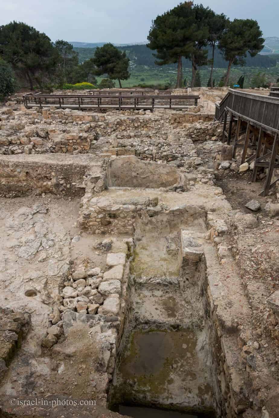
Dwellings from the Second Temple, the Mishnah, and the Talmud Periods
Near the Crusader Fortress, you can find dwellings From the Second Temple, the Mishnah, and the Talmud Periods (#12) (first century BCE to sixth century CE).
On the western part of the hill, a cluster of several structures was found near a paved street. During the Hasmonean period (second to first centuries BCE), stones were quarried in this area. A first-century CE building with massive walls and two ritual baths were unearthed on the easternmost edge of the area. Dwellings built later continued in use until the end of the Roman period and were rebuilt during the Byzantine period.
Cisterns and several other underground spaces were discovered in this area. Many ritual baths indicate an active Jewish life in this area.
“Mona Lisa of the Galilee”
From the Crusader Fortress’s roof, you can see a wooden path toward what many consider the main attraction, the Mona Lisa mosaic.
In the photo above, inside the Dionysus House (to the left), you can see a dwelling with a mosaic from the Roman period.
Note: This site, the Dionysus mosaic villa, is marked as #10 on the map.
At the top of the hill, near the theater, a mansion was discovered, built in the third century CE, and destroyed during the 363 CE earthquake. The house had an interior courtyard surrounded by columns on three sides. On the north side, rooms of a dwelling were discovered, among them a dining hall. Substructures were preserved to the south and under the courtyard, including a row of rooms that served as shops and faced the street.
The rooms of this house were paved with colorful mosaics preserved in the northern part of the structure. The most unusual of these adorned the dining hall. It depicts the life of Dionysus, the god of wine, and his worship. A woman of rare beauty, depicted in medallions surrounding the central panel, has been dubbed ‘the Mona Lisa of Zippori.” Interpretive signs have been installed that explain the scenes shown on the floor.
And finally, we reached the beautiful “Mona Lisa of the Galilee” mosaic, or as some call it, the Dionysus mosaic.
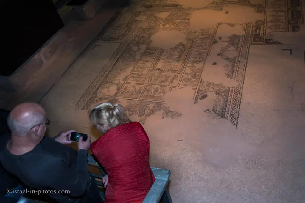
Here are two close-ups:


Also, you can find the following mosaic in the same building, only several meters from the Mona Lisa of Galilee.
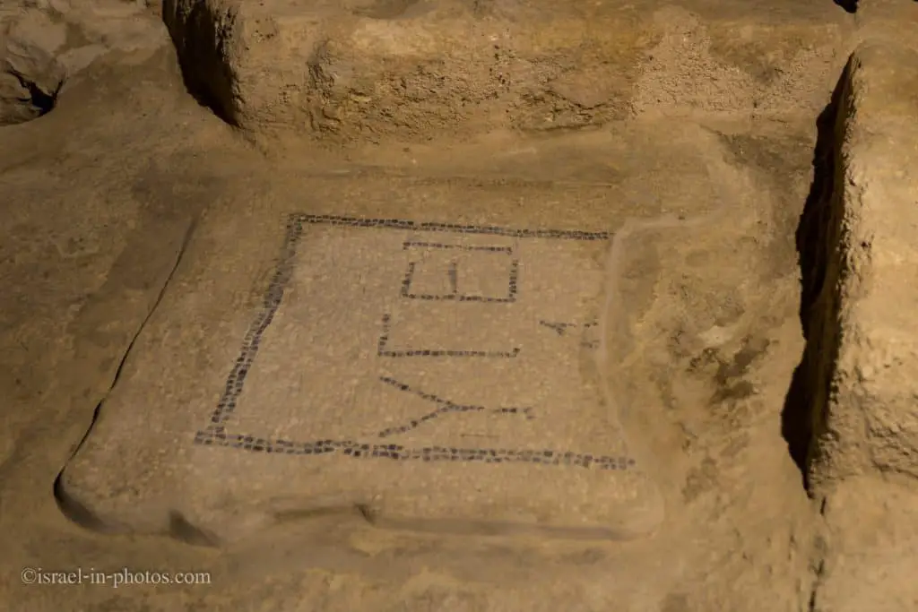
This mosaic reads, “To health.” That means it was a lavatory. If you had a private restroom inside the building, you were wealthy.
The Ancient Synagogue
Before we finish our visit, let’s make a slight detour to the Synagogue (#16 on the map).
As you enter the synagogue building, you will find yourself in a lobby. There, you can see signs with information about the Synagogue. Here is what it probably looked like.
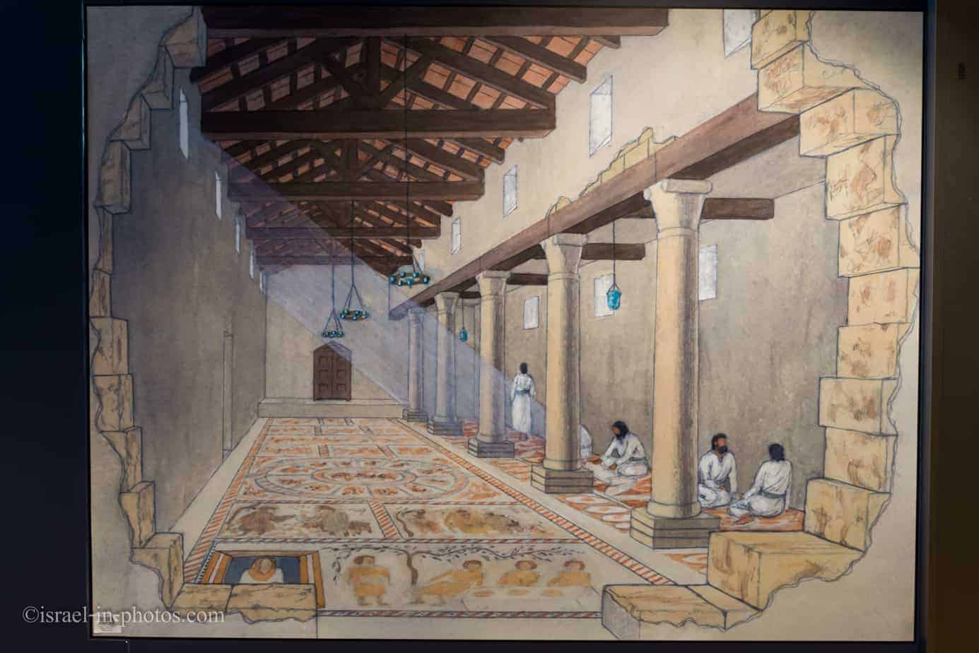
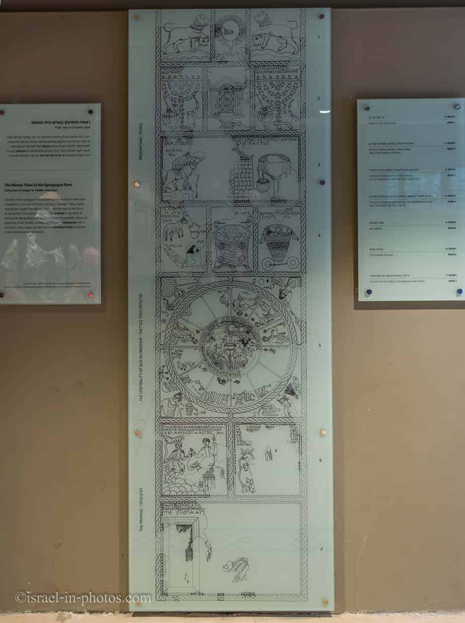
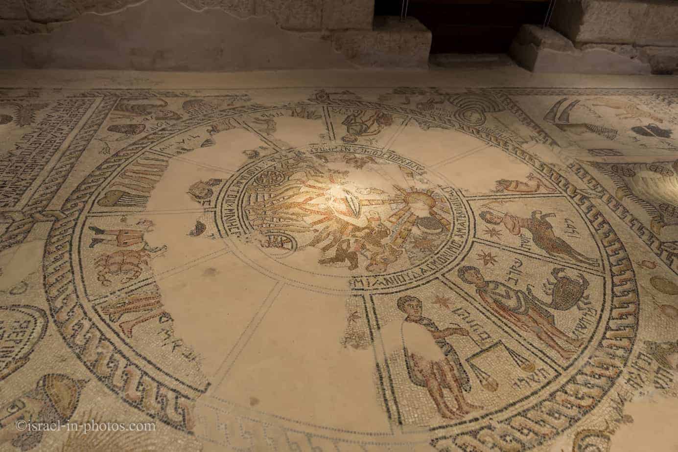
The Synagogue – a long narrow basilica-like structure, dated to the end of the Byzantine period, containing an impressive mosaic floor divided into four parts: the Sacrifice of Isaac, the signs of the Zodiac, a description of the Tabernacle in the desert, and the Arc of the Covenant in the Jerusalem Temple.
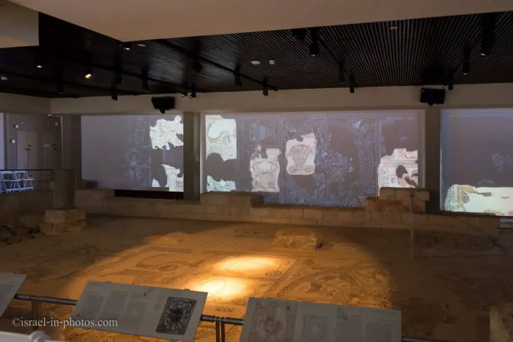
A fifteen-minute movie is screened continuously in the Synagogue. And in the lobby, you will see a timer telling when the movie ends. Once it ends, the door is automatically opened, and you can enter the main hall to see the mosaic and the movie.

Before the screening started, I took several photos of the mosaic. Here are they.

As you can see in the following photo, this is not a regular movie. It is an audiovisual presentation.
After the audiovisual presentation in the Synagogue, we will end our visit.
With a good guide, you can easily spend up to a half-day at Tzipori National Park, and the mosaics are beautiful.
History
The Sanhedrin was exiled…from Jerusalem to Yavneh, and from Yavneh to Usha, and from Usha to Shefarbm, and from Shefar’am to Beit Shearim, and from Beit Shearim to Zippori, and from Zippori to Tiberias” (Babylonian Talmud, Rosh Hashanah, 31a-b).
The Capital of the Galilee
Zippori is mentioned for the first time during the reign of Alexander Janaeus (103 BCE). However, some archaeological findings at the site date to the First Temple period, indicating the existence of an earlier settlement during this time. In 63 BCE, the country was conquered by the Roman army under Pompey, and in 55 BCE, Gabinius, governor of Syria, declared Zippori the capital of Galilee.
In 47 BCE, Herod the Great was appointed the governor of Galilee; however, he could not take up his post due to the murder of his father, Antipater, who had previously ruled the country. Herod had to take the city by force and attacked it at the head of his army in a snowstorm. In Herod’s time, Zippori continued to be the capital of Galilee. After he died in 4 BCE, the Jews revolted against the Romans and captured Zippori. But the Roman army, headed by Varus, quelled the rebellion and burned the city, selling its Jewish inhabitants into slavery. The Galilee subsequently came under the rule of Herod’s son Antipas, who rebuilt and fortified Zippori.
Diocaesarea
In 66 CE, the first revolt of the Jews against the Romans broke out. However, the people of Zippori made a treaty with the Roman army, thus protecting their city from destruction. In the Bar Kokhba Revolt (132-135 CE), the role played by Zippori is unclear. The city’s name was changed to Diocaesarea, and its Jewish leadership was unseated in favor of pagan rulers.
Mishnah And Talmud Period
At the beginning of the third century CE, after the leadership of the town was restored to the Jews, Rabbi Judah Hanasi moved to Zippori, and with him the Sanhedrin (the high court of Jewish law). Rabbi Judah lived in Zippori for 17 years until his death. It was here, around 200 CE, that he redacted the Mishnah.
Zippori is mentioned frequently in the Talmud as a Jewish city with 18 synagogues and some study houses, some of which are known by name. During the Mishnah and the Talmud period, many sages made their home in Zippori, among them Rabbi Halafta, Rabbi Elazar Ben-Azariya, and Rabbi Yosef Ben-Halafta. The Sanhedrin remained at Zippori until the second half of the third century CE when it moved to Tiberias under the leadership of Rabbi Yohanan, the greatest of the Amoraim (the Talmudic sages of the third to the fifth centuries).
Byzantine Period
In 324 CE, Emperor Constantine declared Christianity the religion of the Roman Empire, which marks the opening of the Byzantine period. Constantine supported a converted Jew by the name of Joseph, bestowing on him the title of “friend of the emperor” and allowing him to build a church in Zippori. In 351 CE, a revolt broke out against Gallus Caesar, governor of the province. Aursecinus, his general, was sent to the town to repress the revolt, but he did not destroy the city.
Zippori was completely demolished in an earthquake that struck the country in 363 CE but was quickly rebuilt. During the Byzantine period, the Christian community of Zippori grew, and the city became a bishopric. Some churches were built at this time. Still, the Jews remained the majority of the population. The city continued to flourish until the end of the Byzantine period, but it went into decline during the Arab period that followed.
Crusader Period
During the Crusader period, Le Saphourie was a city and fortress in the principality of Galilee. From here, the Crusader army set out to the Battle of Hattin, in which the Ayyubid warrior Saladin defeated it in 1187.
From the 18th Century Till Today
In the 18th century, the Arab village of Saffuriyyeh was fortified by Daher el-Omar, the Bedouin ruler of Galilee, who restored its fortress. During the Arab revolt (1936-1939) and the War of Independence in 1948, the village and its fortress housed Arab gangs that acted against the local Jewish population.
During Operation Dekel in the War of Independence, on the night of July 15, 1948, Saffuriyyeh was conquered, and its residents abandoned the place. Moshav Zippori was subsequently established adjacent to it.
Zippori National Park, covering an area of 16 square kilometers, was opened to the public in 1992. The development of the park was implemented jointly by the Tourism Ministry, the Israel Government Tourist Corporation, the Israel Nature and Parks Authority, the Jewish National Fund, the Hebrew University of Jerusalem, and the Galilee Foundation.
Zippori in the Bible
According to Richard R. Losch’s book “The Uttermost Part of the Earth: A Guide to Places in the Bible,” the Bible does not mention Zippori. Here is the relevant section from the book:
The city of Sepphoris’ is not mentioned in the Bible, and most people have never heard of it. Notwithstanding, it was a significant city in first-century Palestine and was probably quite important in the early life of Jesus. Ancient tradition identifies it as the hometown of the Virgin Mary’s parents and the mother of John the Baptist, although there is no authoritative evidence to support this. Sepphoris was in Lower Galilee, about five miles north of Nazareth. It had a commanding view of the fertile plains below it, making it an ideal location for military fortification. Although this region was a hotbed of paganism and Samaritanism, there is strong evidence that Sepphoris was a Jewish city and that it was walled and reasonably well-fortified.
But according to Jewish tradition (Babylonian Talmud, Megillah 6a), it is thought to be the city of Kitron. And Kitron mentioned in the Book of Judges (1:30):
Zebulun drove not out the inhabitants of Kitron, nor the inhabitants of Nahalol, but the Canaanites dwelt among them, and became tributary.
What Does Zippori Mean?
Zippor means a bird in Hebrew. And why is it called Zippori?
Because it is perched on top of the mountain like a bird (Babylonian Talmud, Megillah, 6a). The above Talmudic tradition notwithstanding, the city’s name’s source is unclear. The Romans called it Diocaesarea — the city of the god Zeus and Caesar. During the Crusader period, it was called Le Safourie, a name preserved in that of the Arab village established here, Saffuriyyeh. Moshav Zippori, founded in 1949, took the ancient Hebrew name.
Common Questions
Zippor means a bird in Hebrew. It is called Zippori because it rests on the mountain like a bird (Babylonian Talmud).
Zippori is in Lower Galilee, not far from Nazareth.
No. But according to Jewish tradition, it is thought to be the city Kitron mentioned in the Book of Judges.
With modern roads, the distance from the Old City in Nazareth to Sepphoris National Park is about 9.5 km. The aerial distance between those two points is about 6km.
Summary
Tzipori National Park is not a very big place. A typical visit to the city will take several hours. And if you want to incorporate the ancient water system, add another hour. Nonetheless, there are plenty of things to see and learn. That is why we return every several years.
Have you ever been to Tzipori National Park? Tell us about your experience in the comments below.
That’s all for today, and I’ll see you in future travels!
Stay Tuned!
Additional Resources
Here are several resources that I created to help travelers:- Trip Planner with Attractions and Itineraries is the page that will help you create your perfect travel route.
- What is the Best Time to visit Israel? To answer this question, we will consider the weather, prices, holidays, festivals, and more.
- Information and Tips for Tourists to Israel will answer the most common questions tourists have about Israel (including safety, passports, weather, currency, tipping, electricity, and much more).
- Israel National Parks and Nature Reserves include a complete list, top ten, map, tickets (Israel Pass, Matmon, combo), and campsites.
- If you are looking for things to do, here are the pages for Jerusalem, Tel Aviv, Haifa, Sea Of Galilee, Akko (Acre), Eilat, Nazareth, Safed (Tzfat), and Makhtesh Ramon.


Where are the archaeological remains of the church dedicated to St Crusaders. Joachim and St. Anna?
Since there is good to be localized, considered to P recurrence. Franciscans celebrate the liturgy!
Did you mean St Anne’s Church, Jerusalem (https://en.wikipedia.org/wiki/St_Anne%27s_Church,_Jerusalem)? It’s located in the Muslim quarter in the Old City of Jerusalem. Unfortunately I haven’t visited it.