
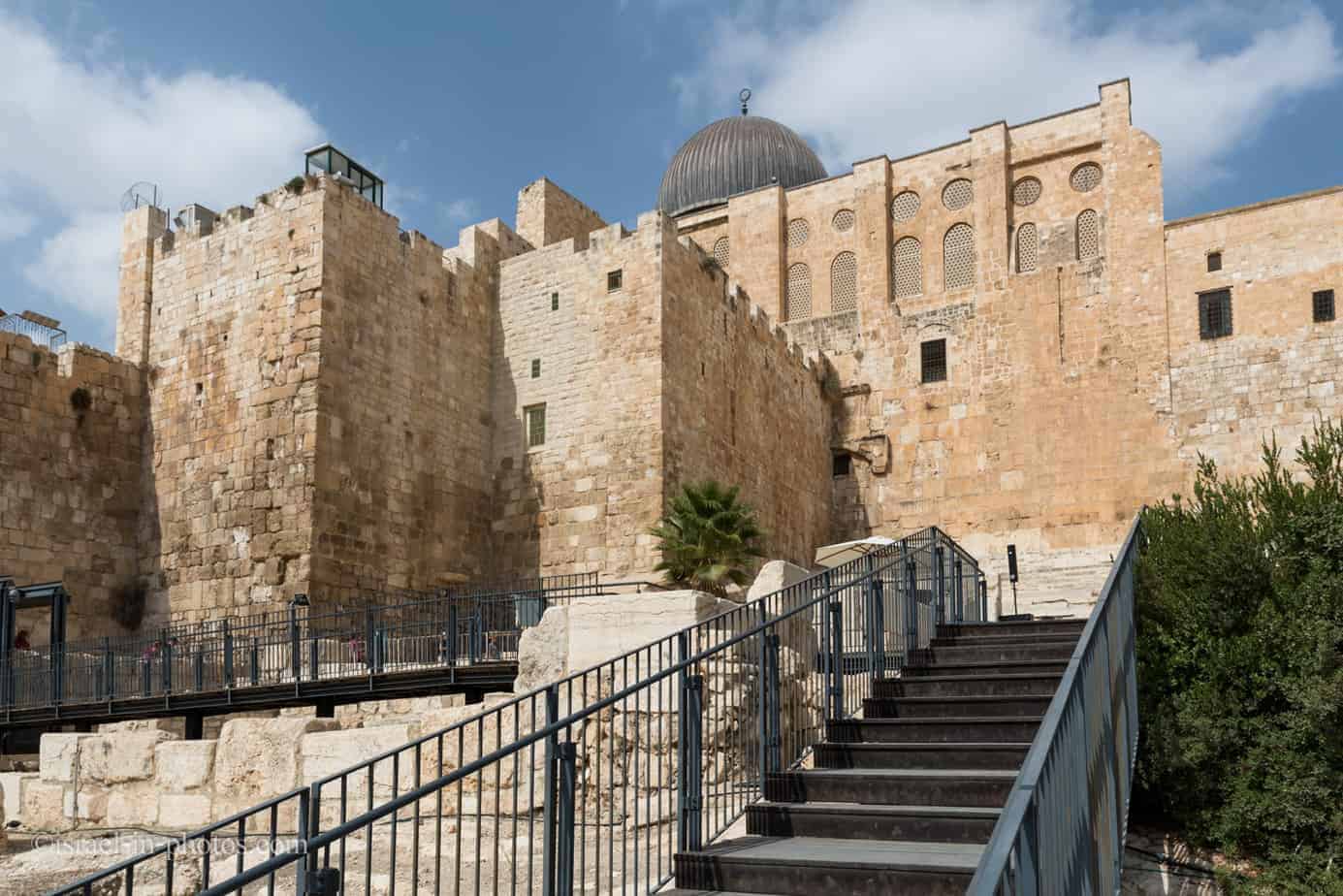
Davidson Center – Jerusalem Archaeological Park

Davidson Center is a magnificent archaeological park near the Western Wall in the Old City of Jerusalem, with findings from different periods.
Short Description
Adjacent to the Western Wall lies an impressive archaeological park. The park contains artifacts from different periods: the First and Second Temple periods, the Byzantine Muslim period, the ancient Crusades period, and others. The most exciting findings are the city walls from the First Temple period, the steps leading up to the Temple, the original street from the time of the Second Temple period, shops, ritual baths, and more. The Davidson Center is a museum within the archaeological park, with presentations and exhibitions related to findings from the site. You can watch a video about the pilgrims that will bring you back in time. Also, a virtual model with a local guide will take you on a journey in time to the Second Temple days.
Note: unless stated otherwise, all quotes were taken from the official site.
Naming
There are many names for this site. Some call it Davidson Center, and others name it Ophel Archaeological Garden, Jerusalem Archaeological Park, or simply Archaeological Park. All these names refer to the same place. More precisely, different parts of the same site. And further, in the post, we will explain the names.
Map
Jerusalem Archaeological Park is near the Western Wall in the Old City Of Jerusalem. Dung Gate is the closest one. You will see it to your right if you enter the Dung gate and walk along Batei Mahase Street. But the main entrance is beneath Batei Mahase street. You will have to walk in the opposite direction to Ma’alot Ha-Rav Shlomo Goren street and take the stairs down.
Directions for drivers: Link to Waze and Link to Google Maps
Directions for public transport: Link to Moovit
Interactive map of the area:
You can find the following map in several places in the Old City of Jerusalem.
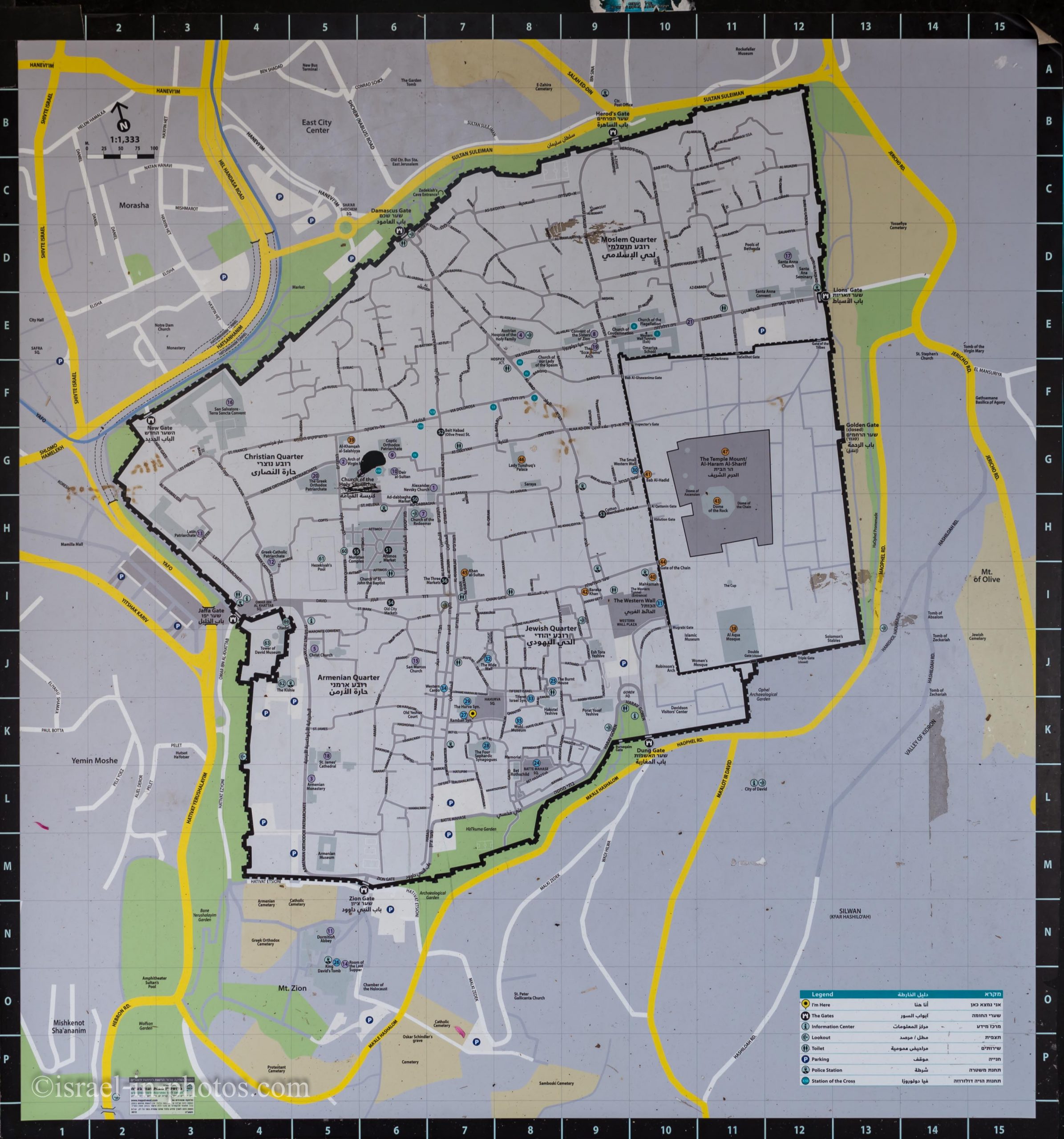
Note: You can click on the map to enlarge it.
On the photo of the map above, Davidson Center is located in square K10.
Directions and Parking
Though the Dung gate is the closest one, you can use any entrance since you will probably visit other sites in the Old City. For detailed directions, see the Old City Of Jerusalem.
Jerusalem Archaeological Park
While I was at the Davidson Center, I saw this old aerial photo of the compound:

This photo is a bit old, and things slightly changed over the years, but it can help us better understand the site. So I took a closeup and added notations, and here is the result:
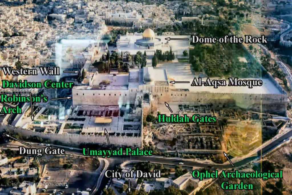
All places marked by green letters are part of the Davidson Center. Let’s go over the different areas of Jerusalem Archaeological Park.
Areas of Davidson Center
- The Davidson Center is a museum. It is built within the remains of a Muslim palace and grants a glimpse into the way of life.
Though Davidson Center refers to the museum, many people refer to Jerusalem Archaeological Park as Davidson Center. And over the years, these names became synonyms. - Robinson’s Arch and the market street beneath it are part of the Second Temple period.
- The Umayyad Palace belongs to the early Muslim period.
- Byzantine period remains – you can see a long stone wall between the Umayyad Palace and Ophel Archaeological Garden. In this area (including underneath), remains from the Byzantine period were found.
Entrance Fee
Entry prices in NIS:
Note: each ticket type has links to pages where you can purchase tickets.
Opening Hours
Sunday – Thursday: 10:00 – 18:00
Friday: 09:00 – 15:00
Note: opening hours and entrance prices were updated in June 2022. In any case, recheck the City Of David website and this website before visiting.
Contact Information
Phone: 02-6265906
Email: orders@jqc.org.il
Tours
You can both visit individually or join a tour. Though there are explanations on-site and inside the Davidson museum, it might be harder to understand the complete picture since there are findings from different periods. Moreover, since the City Of David organizes relatively inexpensive tours, consider joining one of them. You can find additional info here.
Note: our last visit to Davidson Center was part of the “From the City of David to the Western Wall” tour. Davidson Center is the ending point of that tour, and we almost did not tour the site. But since it ended inside, we explored the Davidson Center by ourselves.
Davidson Center
Before starting our visit to Davidson Center, let’s briefly review its history.
History
In 2001, an archaeological museum was established at the southwestern end of the archaeological garden, between the Umayyad Palace walls. The museum is named after a Jewish-American philanthropist, Bill Davidson, who funded its founding. The museum exhibits findings from various eras that have been discovered throughout and around the archaeological garden. The display of findings is in chronological order, from the Second Temple period to the first Muslim period. The museum also presents a short video (in Hebrew and English interchangeably) describing the history of archaeological excavations in the Ophel, from the 19th century to the present day. Another video (also in Hebrew and English interchangeably) illustrates a Jewish pilgrim’s emotional and religious experiences visiting Jerusalem and the Temple.
Source: Wikipedia
In Archaeological Museum
Davidson center is not a vast one. It will take around 0.5 – 1.5 hours to go through the museum (including watching the movie).
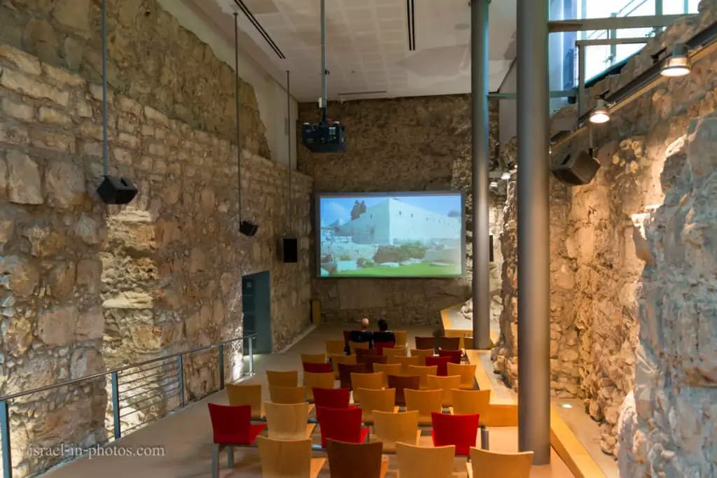
The Davidson Center has a museum showing artifacts found in the excavations and an impressive three-dimensional model that allows you to tour Jerusalem and go up to the Temple together with the pilgrim. To walk with him on the street, to buy a sacrifice with him, to immerse with him in the mikveh, and from there to accompany him on the ascent to Temple Mount. Viewing the unique 3D model completes the pilgrimage experience.

The Movie
The movie tells the story of Jewish pilgrims during the Second Temple period. It shows the market, Robinson’s Arch, and of course, the Second Temple.
Excavations conducted after the unification of Jerusalem adjacent to the Western Wall and the southern wall (yes, that’s right, there is a southern wall) yielded amazing and exciting findings. Adjacent to the Western Wall was a large and impressive street from the Second Temple period, which was the main street of Jerusalem at the time. Everyone strode there, pilgrims and tourists, and the greatest Jews of the time – Rabban Yohanan ben Zakkai and even Rabbi Akiva. If you come to the archeological park, you can also walk on the same tiles! Use your imagination, and you can feel the atmosphere felt when hundreds of thousands of Jews 2000 years ago walked in the street before their arrival pure and trembling before ascending Temple Mount.
The Earliest Document from Jerusalem
I will not go into all exhibits in the museum. But I wanted to tell you about the earliest document from Jerusalem.
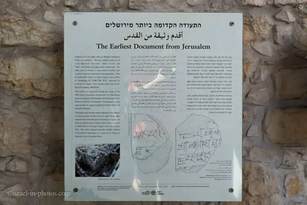
In 2009, during Ophel archeological excavations, a clay tablet with an Akkadian inscription was found. Examinations showed the material of the tablet derives from the area of Jerusalem, and it was sent by Abdi -Heba to the king of Egypt in the 14th century BCE.
As you exit the archaeological museum, you will see the following view:

Second Temple Period Complex
If you go to the left from the point the photo above was taken, you reach the Second Temple period complex.
Herodian Street Along the Western Wall
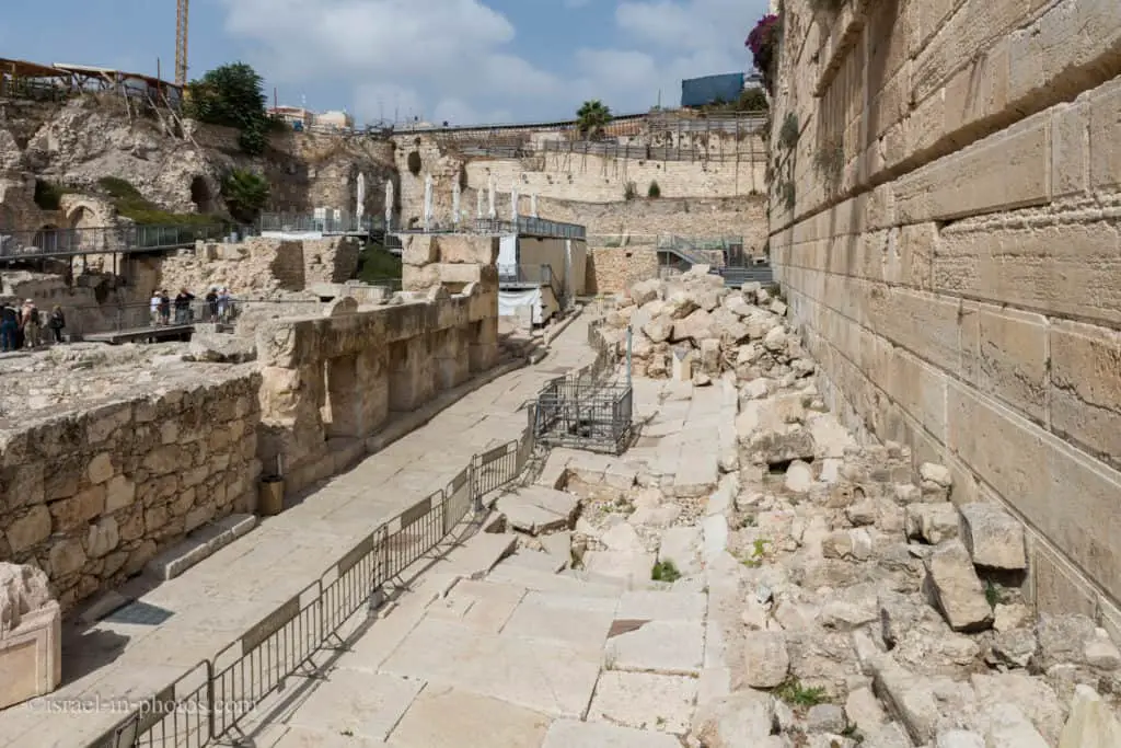
In the following photo, we stand beneath Robinson’s Arch, and you can see Herodian street from the Second Temple period. And on the left side of the avenue was an array of stores.
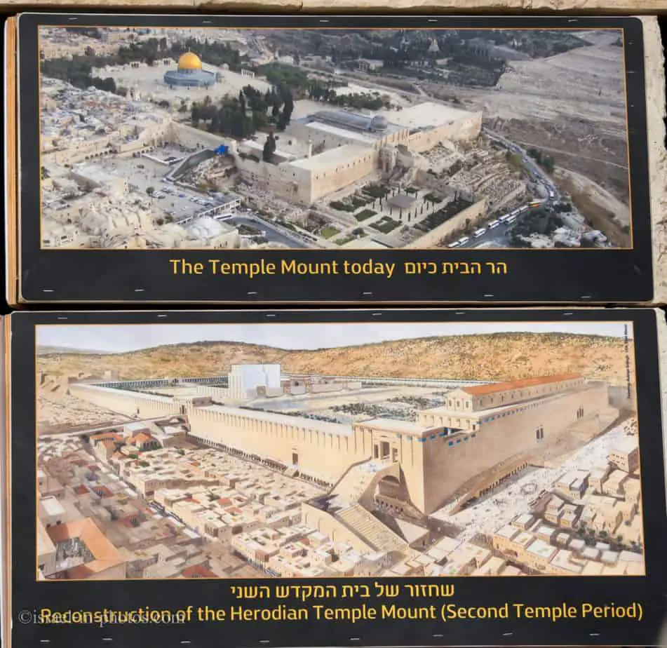
At the end of the 1st century BCE, King Herod rebuilt the Second Temple and made it into an edifice of great splendor. It was destroyed in the year 70 CE when the Roman legions under Titus, son of Emperor Vespasian, crushed the five-year-long revolt of the Jews against Rome and conquered Jerusalem. The foundations of the massive retaining walls built by Herod to create the podium on which the Temple stood are visible to this day. The best-known section is the Western Wall, the venerated remnant of the Temple where Jews pray to this day.
Excavations were begun during the 1970s along the southwestern corner of the Herodian Temple Mount enclosure. Remains of structures from many periods, covering 2,000 years of history, were uncovered above the destruction layer from the Second Temple period.
From 1993 to 1997, new excavations were conducted between the Western Wall and the southwestern corner of the Temple Mount. After removing the debris of later periods, the Herodian street running along the western wall of the Temple Mount was exposed in its full length. It followed the course of the Tyropoeon Valley between the Temple Mount and the western hill, where the Upper City, the quarter of the well-to-do in the Herodian period, was located (today’s Jewish and Armenian quarters within the Old City wall and Mt. Zion south of the wall).
The street was uncovered for a total length of 70 m. It is about 10 meters wide, paved with large (3 x 1.5 m), very thick stones, carefully trimmed, and joined together for comfortable walking. On both sides, the street is bounded with elevated curbstones, and beneath it is an impressive network of drains, the lowest of them covered with stone vaults, high enough to walk in. Between the street and the western wall of the Temple Mount, a row of small shops that opened onto the street was found. Evidence of the commerce that once took place here is provided by the many stone weights of different sizes that were found in this area.
The base of a massive arch protrudes from the western wall, some 12 meters north of the southwestern corner of the Temple Mount enclosure. It is known as Robinson’s Arch (after the American explorer who identified it in the mid-19th century as part of the Herodian construction). Opposite it, some 13 meters from the western wall, the remains of a pier that supported the other end of Robinsons Arch were exposed. The pier is constructed of large ashlars, similar to those of the Herodian walls of the Temple Mount. It contains four cells, like those in the row of shops on the opposite side of the street.
Source: Israel Ministry of Foreign Affairs
Trumpeting Place Cornerstone
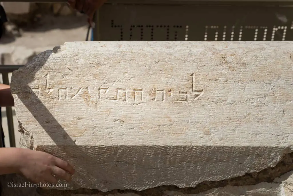
A large cornerstone with a typical Herodian profile had been found during the 1970s, lying in the street below the southwestern corner of the Temple Mount. A Hebrew inscription, partially preserved on this stone, is carved: To the trumpeting place to The most likely reconstruction of the missing ending of the inscription is “proclaim” or “separate.”
The stone had stood at the top of the southwestern corner of the Temple Mount, from where the Temple priests announced the onset of the Sabbath (on Friday evenings).
The great piles of fallen stones provide dramatic evidence of the destruction wrought by the Roman legions in Jerusalem in 70 CE., which Josephus Flavius described in great detail.
Some of the stones which covered the street were removed, and the site was opened to visitors, who can walk on the original pavement of this street from the Second Temple period and follow in the footsteps of the throngs of pilgrims who walked here 2000 years ago on their way to participate in the rituals on the Temple Mount.
Source: Israel Ministry of Foreign Affairs
Robinson’s Arch
Near the southwestern corner of the Western Wall, you can find Robinson’s Arch.

Robinson’s Arch is the name given to a monumental staircase carried by an unusually wide stone arch, which once stood at the Temple Mount’s southwestern corner. It was built as part of the Second Temple expansion initiated by Herod the Great at the end of the 1st century BCE. Recent findings suggest that it may not have been completed until at least 20 years after his death. The massive stone span was constructed along with the retaining walls of the Temple Mount. It carried traffic up from ancient Jerusalem’s Lower Market area and over the Tyropoeon street to the Royal Stoa complex on the esplanade of the Mount. The overpass was destroyed during the Great Jewish Revolt only a few decades after its completion.
The arch is named after Biblical scholar Edward Robinson who identified its remnants in 1838. Robinson published his findings in his landmark work Biblical Researches in Palestine, in which he draws the connection with a bridge described in Josephus’s Antiquities of the Jews and The Jewish War, concluding that its existence proves the antiquity of the Walls of Jerusalem.[1] Excavations during the second half of the 20th century revealed its purpose and the extent of its associated structures. Today the considerable surviving portions of the ancient overpass complex may be viewed by the public within the Jerusalem Archaeological Park. As it is adjacent to Jerusalem’s Western Wall worship area, a portion is used by some groups as a place of prayer.
Source: Wikipedia

And now, let’s return to the museum and head towards the early Muslim period complex.
Early Muslim Period Complex
The main POI in this complex is the Umayyad Palace, so let’s visit it.
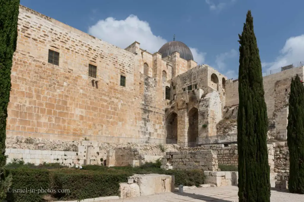
Umayyad Administration Center and Palaces
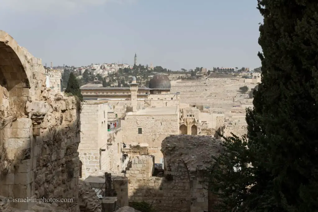
As you saw in the areal photo above, there is a wall between the Umayyad Palace and Ophel Archaeological Garden. If you climb up that wall towards the Crusader-period watchtower and look back at the Jewish quarter, then you will see this view:

In the bottom left corner, you can see the Umayyad Palace.
The conquest of Jerusalem by the Arab army in 638 was the beginning of an important era in the city’s long history. The new rulers of the Umayyad Dynasty (660-750) aimed at changing the character of the city from a Byzantine-Christian city of many churches, to a Muslim religious center and the administrative seat for a subdivision of their empire. They restored the breached walls of the Temple Mount (Haram al-Sharif) and built two impressive sanctuaries on it: the Dome of the Rock and the Al-Aksa mosque.
The two Hulda Gates of the Second Temple period in the southern wall of the Temple Mount was restored in order to provide the faithful with easy access to the Harams esplanade. The facade of the western of the two gates, the “Double Gate,” is preserved and the carved stone archway dating to this period is still visible.
In excavations carried out in the 1970s south and southwest of the Temple Mount, the remains of six massive buildings were uncovered. Not known previously, they were an administrative center of the Umayyad government.
The area south of the Temple Mount, which had sloped southwards, was leveled by earth fills and large building foundations, which entirely covered the Byzantine structures below. The result was a flat surface upon which the buildings were constructed, intersected by paved streets. Clay pipes were inserted into the stones of the Temple Mount wall, to provide running water from the main aqueduct along the restored Wilsons Arch on the Western Wall. Rainwater was channeled into large cisterns beneath the buildings, and an extensive drainage system was installed.
The Islamic administrative center included palaces and other buildings, which have been only partially uncovered. The palaces were similar in plan: a central courtyard surrounded by many rooms. Other structures, known as “pillared buildings,” had large stone-paved courtyards with rows of square pilasters supporting the roofs.
The largest and most impressive palace, near the southwestern corne