
Rosh HaNikra – Full Guide to Stunning Seaside Grottoes

Rosh HaNikra is a geologic formation near the border with Lebanon. Sea activity on white chalk rock formed the grottoes.
Map
Rosh HaNikra is located north of Nahariya, north of Achziv National Park, and next to Lebanon’s border. Rosh HaNikra Grottoes is a white chalk cliff face that opens into spectacular grottoes. The nearby Achziv National Park has one of the most beautiful beaches in Israel. And I am mentioning both nearby attractions since you can combine them into a half-day visit. Also, the Rosh HaNikra village is nearby.
Directions for drivers: Link to Waze and Link to Google Maps
Directions for public transport: Link to Moovit
Interactive map of the area:
Directions
If you are reaching by car, drive along road #4 to the north. You will drive along the sea till you get to the end. You should see signs directing you to the grottoes as you approach closer.
Reaching by public transport is less convenient but also doable. First, you need to get to Nahariya. You can do this using buses or trains, depending on your location. Then, from Nahariya, you can take a taxi or bus #31. Here are the directions from Tel Aviv to Rosh HaNikra Grottoes using Moovit. You can also update Moovit with your starting point and get the revised instructions.
Parking
There are free parking spaces next to Rosh HaNikra Grottoes. But if you arrive later in the day (for example, after 11 am on a Saturday), there might be no free spaces at the parking lot. You can still park along the leading road, which will add to extra walking.

Note: As seen in the photo above, restrooms are in the far left corner of the parking lot.
Opening Hours
Sunday – Thursday: 09:00-18:00 (till 16:00 in the winter)
Friday: 09:00-16:00
Saturday: 09:00-17:00
Entrance Fee
Adult (18+) – 49 NIS.
Child (3 – 18) and pensioner – 39 NIS.
Babies and toddlers (0 – 3) – free.
Audio guide rental – 14 NIS.
There are several types of combined tickets. The first type offers a visit to Rosh HaNikra Grottoes and a bicycle or a golf car drive along the beach. It costs 77 NIS per adult and 69 NIS per child. The second combo ticket offers a combined ticket to Rosh HaNikra Grottoes and various attractions in Old Acre. If you want to visit the Templars Tunnel, Hospitaller Fortress (Knights Halls), Hamam al-Basha, and Treasures In The Walls Museum, it will cost 80 NIS per person.
Note: the combo tickets and the prices change from time to time. Thus, check the official site before visiting.
Coupons
If you purchase tickets at the official site, there will be a small discount (43 NIS per adult and 35 NIS per child). Here are additional coupons I found online:
- 1+1 at MAX (in exchange for a treat)
- cpnclub.co.il – 44 NIS per adult and 36 NIS per child. It is higher than the prices on the official site.
- Members of teachers association – 30 NIS per adult and 33 NIS per child.
Notes:
- Rosh HaNikra is not part of the Israeli National Parks Authority. Thus, a Matmon card will not provide any discounts.
- Opening hours and ticket prices were updated in July 2022. In any case, recheck the official site before visiting.
Tours
I just wanted to mention that Rosh HaNikra is a popular tourist site, and many firms offer tours. Usually, these tours include several nearby attractions, and this site is one of them. For example, Old Acre and Rosh HaNikra. If you are short on time or love traveling with tours, consider joining.
What does Rosh HaNikra mean?
In Hebrew, Rosh HaNikra means “the head of the grottoes,” in other words, the best Grottoes.
Entrances
The site has two entrances – the main, the upper, and the lower, next to the beach.
We came to the upper entrance. At the top entry, you can find a large parking lot. But since Rosh HaNikra Grottoes is a popular site, the parking may be full if you come later in the day.
Here is the view to the south of the beach, Nehariya, and Haifa:
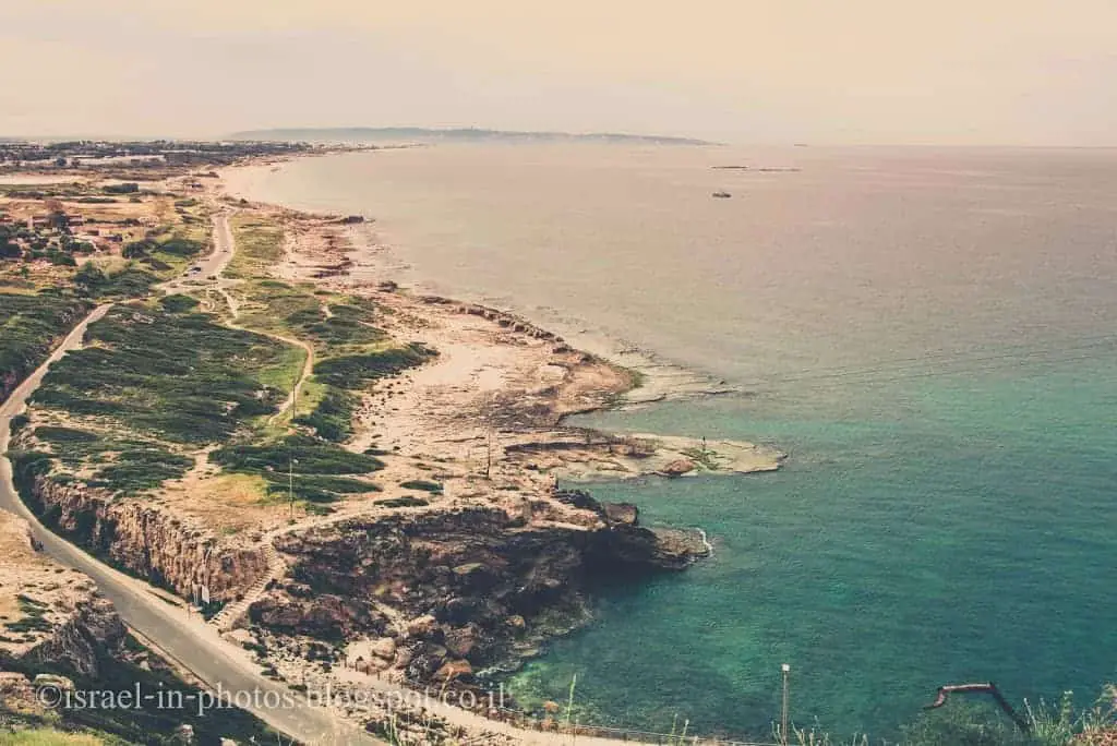


People usually associate crystal clear water with Greece, but some beaches in Israel look very similar to Greece. Achziv Beach and nearby ones are among Israel’s favorite and highest-ranking beaches.
Cable Car
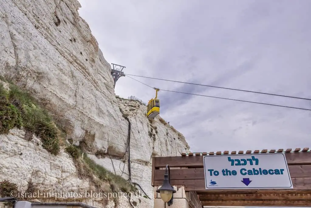
Reaching the caves from the top entry is done by cable car. They say it is the steepest cable car in the world (gradient of 60 degrees). But it is probably also one of the shortest ones. The ride takes about two minutes.
Also, since it is tiny (as far as I remember, the maximum capacity is eight people), I recommend getting to Rosh HaNikrah either early or late. Otherwise, you may get stuck in the queue for the cable car.
As you get off the cable car, you will see the following sign:

I suggest starting with the audiovisual presentation. To reach it, you turn left and go till the end.
Audiovisual Presentation at Rosh HaNikra Grottoes
After getting off the cable car, I recommend starting with the movie about this place. There is a screening every 15 minutes. And there are displays in different languages.
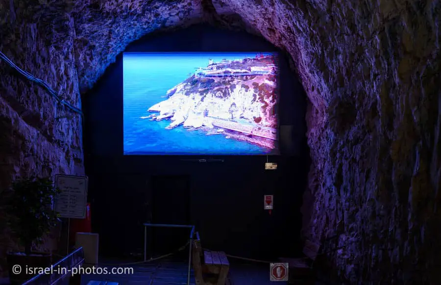
The film tells the history of this place and the geological history of the Grottoes. Plus, the story of the British Cairo – Istanbul railway.
History
The Book of Joshua mentions “Misraphot Mayim” as a place south of Rosh HaNikra that was the border of the Israelite tribes of the time. In the First Book of the Maccabees, it is referred to as the place that Shimon HaHashmonai was responsible for in 144BCE (1 Maccabees 11:59). Josephus Flavius also describes Rosh Hanikra as the northern border of the city of Acre, Israel. (The Jewish War 2, 10, 2). The archaeological tell is today situated within the kibbutz.
In the Jewish apocryphal First Book of Maccabees (1 Macc 11:59), a cape in this region is referred to as “The Ladder of Tyre.” The author could have meant either the cliffs at Rosh HaNikra or one of two other capes jutting out into the sea slightly north or south of them. The site was later named an-Nawakir (“The Grottoes”) by the Arabs.
Cairo-Istanbul Train

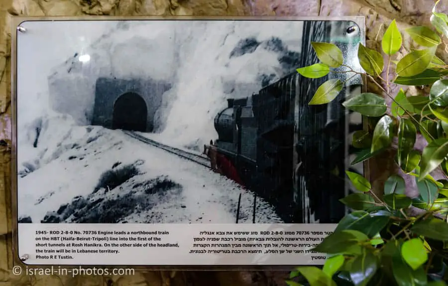
Rosh HaNikra has served as a passage point for trade caravans and armies between Lebanon, Syria, Israel, Egypt, and Africa. During the Second World War, South African forces blasted railway tunnels through the nearby rocks for trains running along the Cairo-Istanbul line. The Haganah spared the railway bridge at Rosh HaNikra during the 1946 Night of the Bridges operation. But following a late-1947 British announcement that it would withdraw from Palestine months ahead of schedule, the bridge was destroyed by the 21st Battalion under the Palmach in late February 1948 to hinder Lebanese arms shipments to Arab forces opposing the UN Partition Plan. As repairs were prohibitively expensive, the tunnels were later wholly sealed. The Lebanese railways have been dismantled mainly while the Coastal Railway in Israel currently ends near Nahariya, several kilometers to the south.
Rosh Hanikra was the location where Israeli and Lebanese officials negotiated and concluded an armistice agreement in 1949, which ended the Lebanese-Israeli component of the 1948 War of Israeli Independence. A border passage across the Blue Line into Lebanon at the site is sometimes used by UNIFIL personnel.
Source: Wikipedia
The Grottoes
Our next stop will be the grottoes.
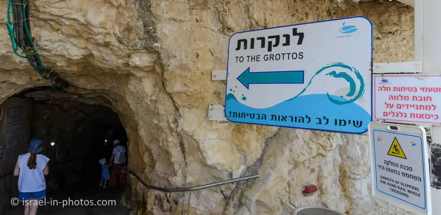

Keep in mind that the stones might be wet and slippery. Thus, walk cautiously and use rails when needed.
The Big Grotto
When stormy, huge waves enter the grotto, pounding and powerful. They close off the opening, compressing the air within and causing momentary darkness… until the powerful breaking wave rocks the cliff foundation and partly floods the path before you. Grotto height – 16 meters. At its top live fruit bats, feeding off fragrant ripe fruit growing here. The bats live in colonies, enjoying a life expectancy of about twenty years. The fruit bat has good intact vision, and unlike widely believed, it doesn’t become entangled in people’s hair. On quiet days you can hear the bats screaming and chirping.
Source: sign
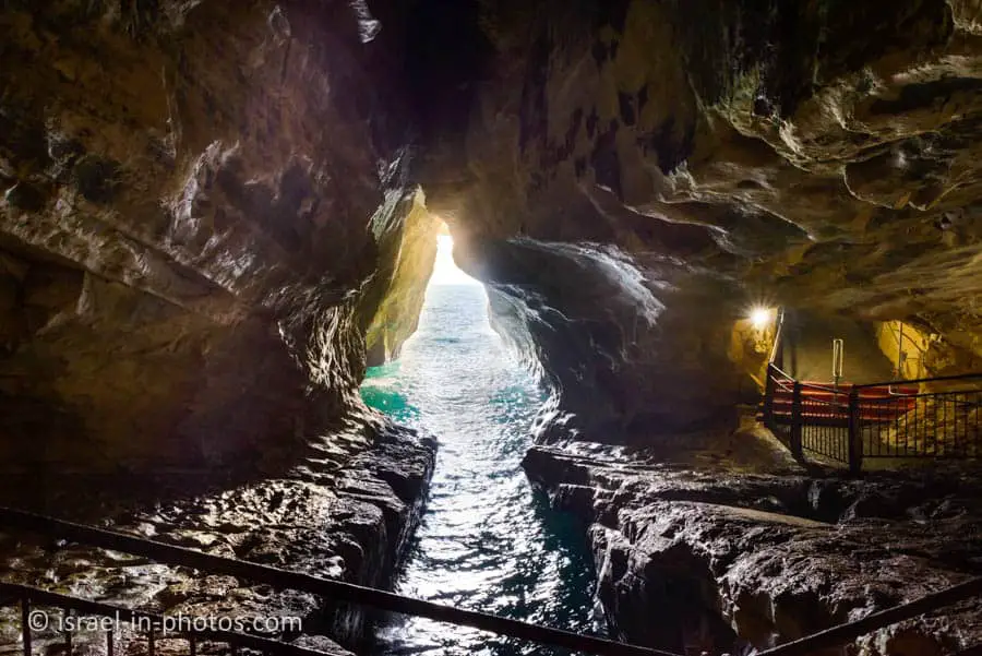


The path in the caves is not very long. It took us about fifteen minutes (including taking photos) to reach the pigeon bridge (the end of the underground route).
Pigeon Bridge – Lucky Bridge?
In the giant rock cleft above us, the rock pigeon makes its nest. The place provides a refuge from the weather, allowing it to nest in peace. Watch out for the pigeon’s droppings, but know this… It brings good luck!! From the observatory overlooking the sea, you can see the flat coarse sand rocks – the work of the sea waves and winds constantly polishing the rock surface smooth.
Source: sign
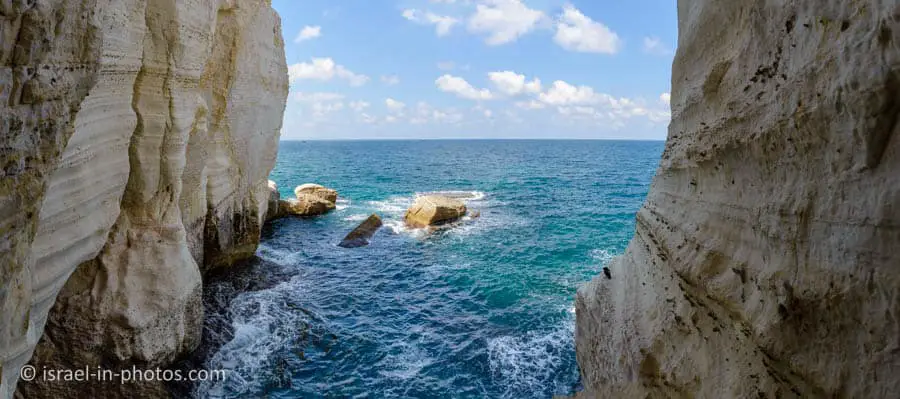
The Elephant’s Leg
Here is another scene of the white cliffs and the beach. If you look closer at the other ridge, you might think it resembles an elephant because the right part resembles a trunk or a leg. Thus, some people refer to this stone under the name elephant’s leg.

The never-ending encounter of sea and mountain created a natural stone sculpture shaped like an elephant leg. This is the edge of the cliff at the only point in Israel where the mountain descends into the sea without a sandy seashore. Glancing south, you can see the three islands. “Pale Blue” – mostly covered by water, “Seagull,” and “Wagtail.”