Ariel Sharon Park stands on top of a former waste dump named Hiriya. And once completed, it will be the biggest park in the middle east.
Table of Contents
Map
Ariel Sharon Park is located near highways #1 and #4. Here is an interactive map with links to the mountain compound.
Directions for drivers: Link to Waze and Link to Google Maps
Directions for public transport: Link to Moovit
Interactive map of the area:
Offers:
- Hotels, hostels, and apartments in this area:
- Buy photos of Israel and support this blog.
- Get 10% off for your next tour at Bein Harim with coupon code LEV10#12306.
And here is the map of Ariel Sharon Park:
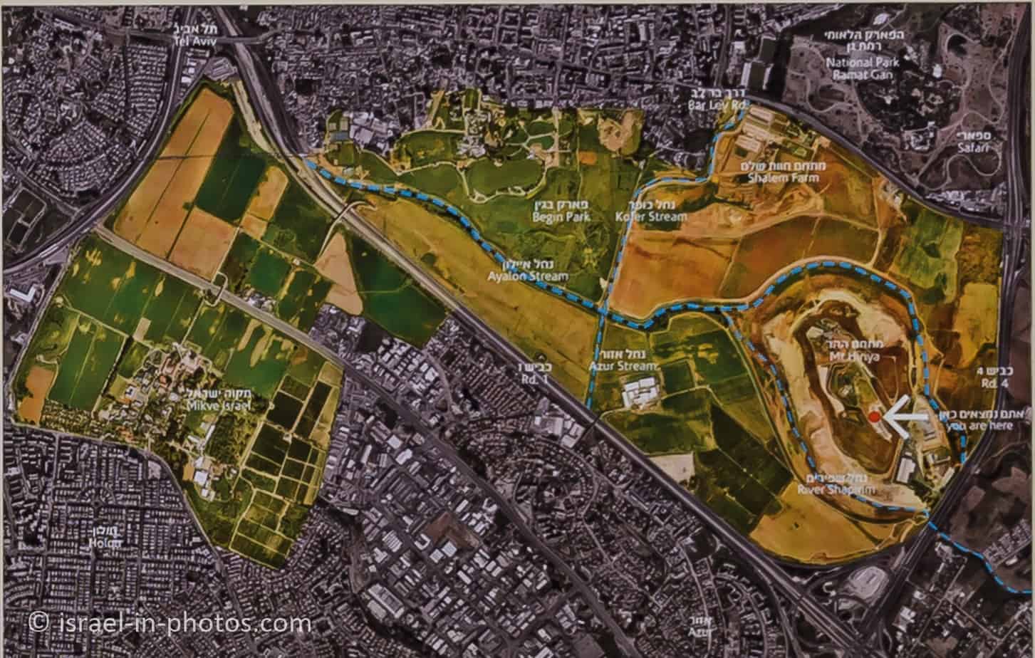
Note: you can click on the map to enlarge it.
Currently, the park has two complexes and two different entrances.
| Name of the compound | Directions | What to enter into Waze | Description | Marking on the map above |
|---|---|---|---|---|
| The mountain compound (Mount Hiriya) | The entrance is from highway #4 south. And as you get off highway #4 south, turn right and drive around the industrial complex. After completing a semi-circle, you will see a right turn leading uphill to the mountain parking. Also, you can get there only by car, since no public transport reaches this site. | “Park Ariel Sharon, mountain compound.” | It is the restored waste mountain and the first area to open. | It is marked with the white arrow on the map above. |
| The northern compound (Shalem Farm) | You have to get off highway #4 and drive on road #461 in Tel Aviv’s direction to get there. After several minutes you will see a sign pointing to the left. | “Offices of Ariel Sharon Park” or “Havat Shalem” | It is the second area to open. You can find Shalem Farm and a playground for children. | You can see it in the top right part of the map above. |
And here is a closeup map of the mountain compound at Ariel Sharon park:

Trails
The complete trail at the top of the mountain is about 2 km long. But you can easily make it shorter. It is only a hiking path since cycling on the hill is forbidden.
Here is an interactive map from israelhiking.osm.org.il:
Cycling
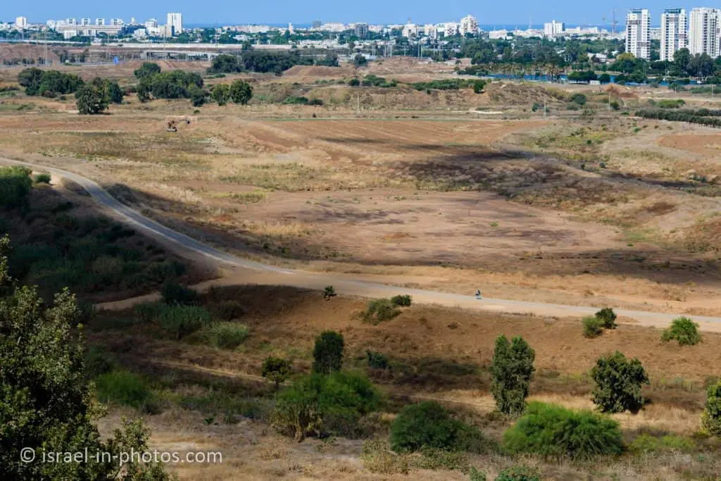
Cycling on top of the hill is forbidden. But there are asphalt trails to the north of the mountain. And many use them for cycling. There is a cyclic three km trail, and you can continue towards Menachem Begin park. You can see part of this trail in the following photo.
Opening Hours
The mountain compound is open according to the following schedule unless there is a special event (check at the official site):
Sunday – Thursday, and Saturday: 8:00 – 17:00
Friday: 08:00 – 16:00
The opening hours of Shalem farm are:
Sunday – Saturday: 06:00 – 22:00
Entrance Fee
Free.
Parking
You can park at the mountain compound for free, but parking at Shalem farm costs 20 NIS per day.

Tours
Today (June 2022), there are only tours for organized groups (no more free tours for the general public). You can find additional information on the official site.
Dogs
You can bring dogs to Ariel Sharon Park, but they should be on a leash.
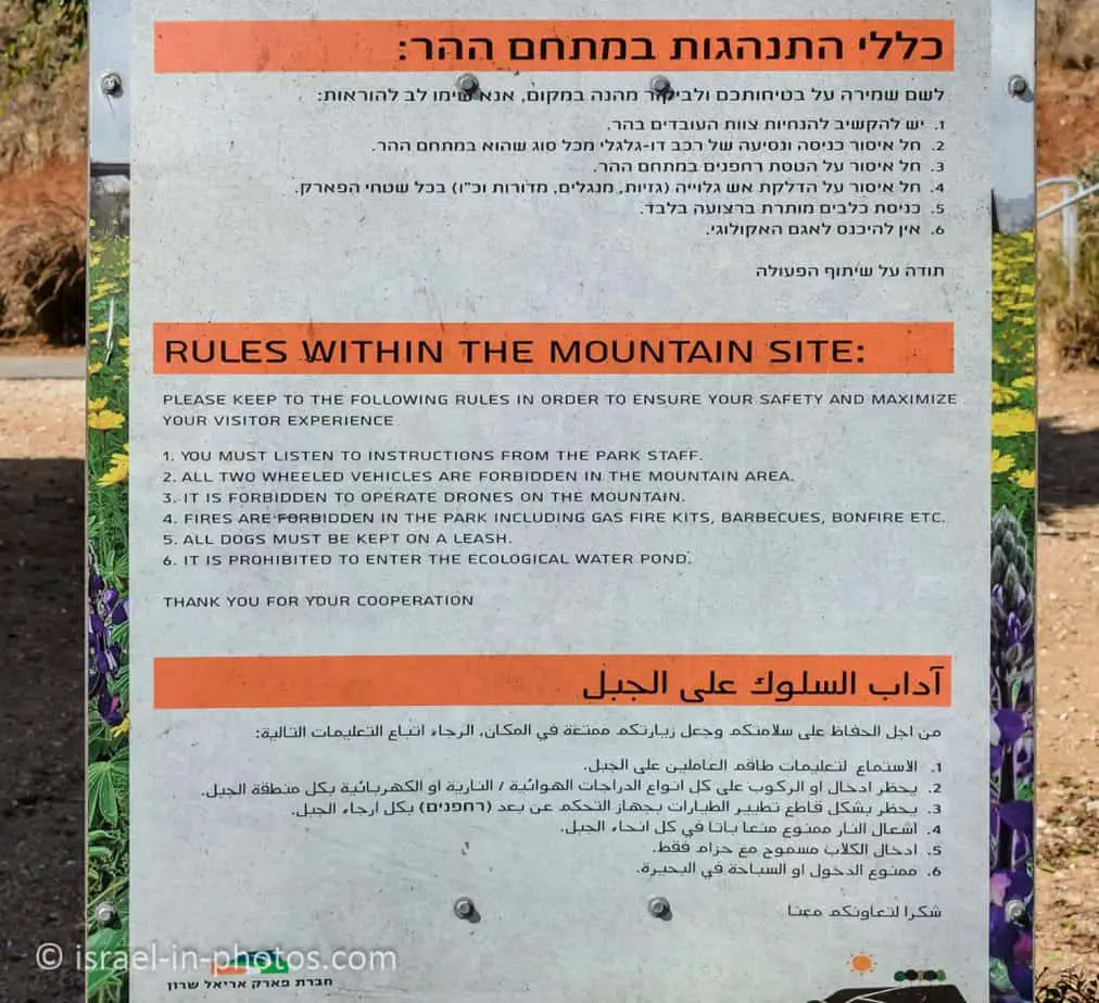
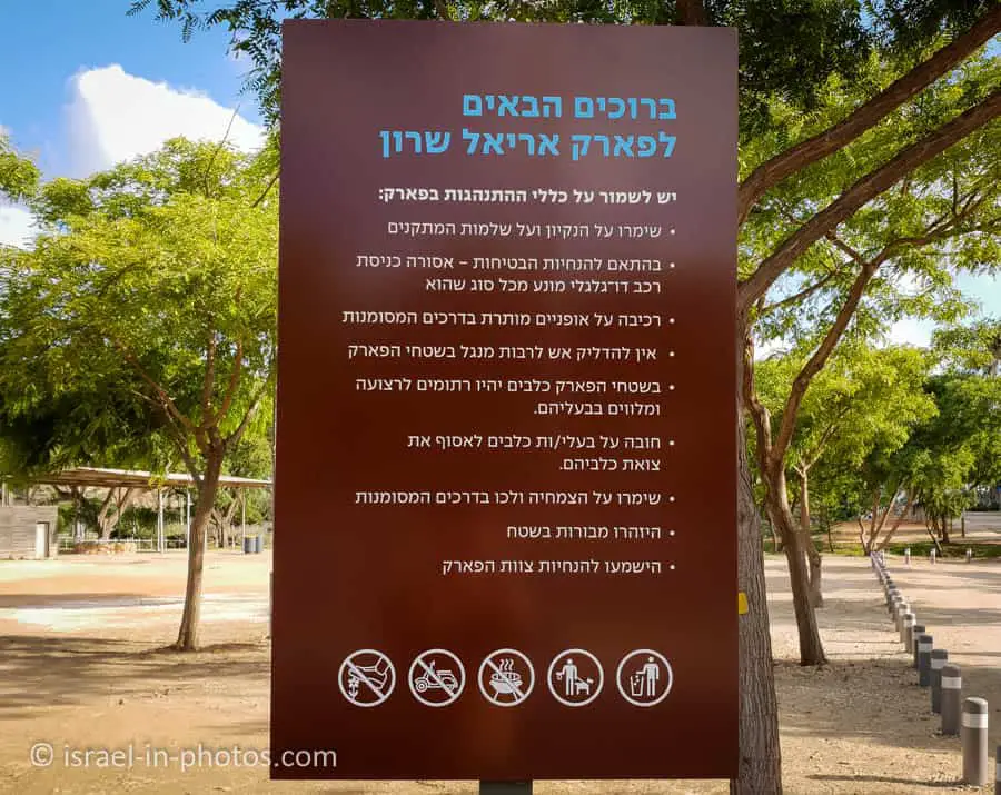
Also, starting a fire, including barbeque, is prohibited in both compounds. But you can have a picnic.
Contact Information
Phone: 03-7398999
Shows and Concerts
If you are interested in purchasing tickets for a concert at the mountain compound, you can do it here or here.
About Ariel Sharon Park
Ariel Sharon Park stands on a waste dump. Wait. What? Park on a waste dump? Yes, let’s start chronologically.
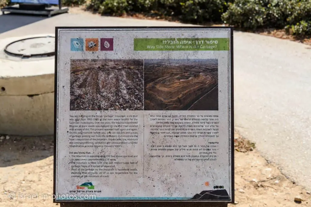
Hiriya is a former waste dump located southeast of Tel Aviv. It received waste and worked as a landfill during 1952 – 1999. Over time, the size of the mountain reached 450,000 square meters and a height of 70 meters. It is visible as a flat-topped mountain at the intersection of highways #1 and #4.
From the establishment of the State of Israel up until 1998, this site was used as the main waste landfill for the Dan District municipality. For years, Israel’s “Mountain of Waste” was a symbol of an environmental, sanitary, and safety hazard, until the onset of its rehabilitation project in 2000.
The mountain spans approximately 110 acres and stands 230 feet above ground level. The mountain holds approximately 16 million cubes of all sorts of waste!
The mountain’s rehabilitation and transformation into a park was an architectural-engineering initiative based upon the principles of sustainable development with the following objectives:
• Pumping out the methane gas that is emitted by the decomposition of organic waste buried deep inside the mountain. The gas is used to produce green energy.
• Recycling and use of construction waste in the mountain’s rehabilitation process.
• Building underground detention ponds to store rainwater in the winter months for irrigation of plant life in the summer.
On the mountain site, you can enjoy:
• Spectacular observation points overlooking the Dan District region.
• Visitor’s Center with a multimedia presentation that tells the story of the mountain (entrance fee required).
• Self-guided walking tour – “The Way Side Story” – An easily accessible and well-marked walking trail that includes observation points, information, and interesting facts about the rehabilitation process of the landfill mountain.
• Shaded areas and green lawns.
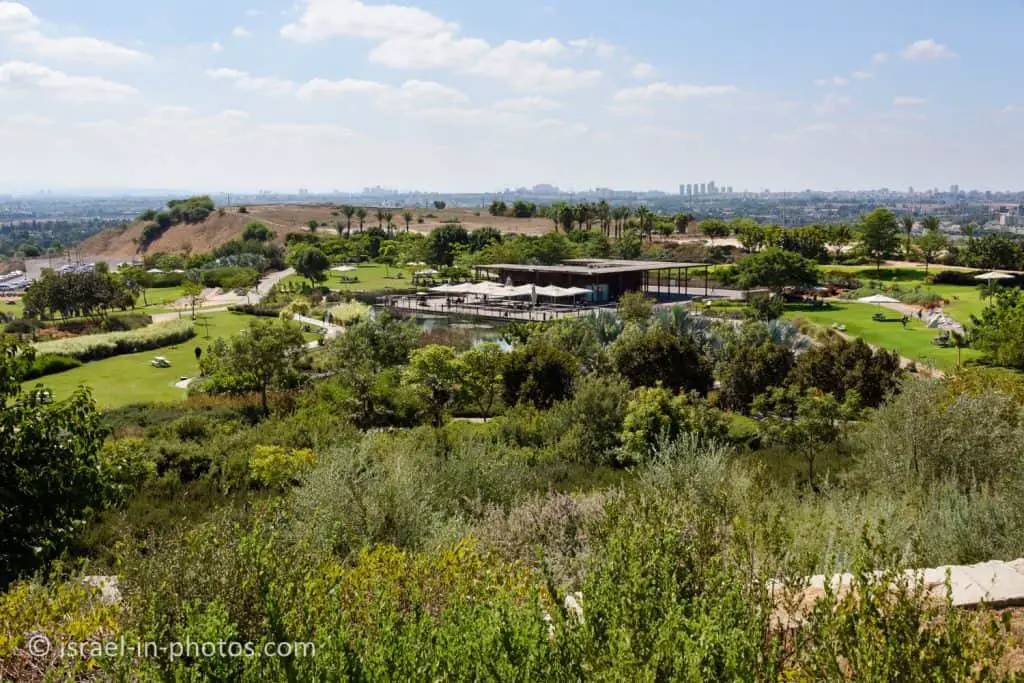
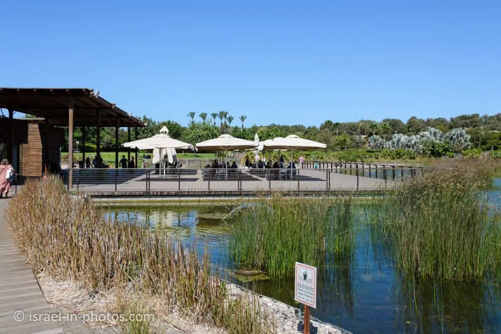
• An ecological lake and a coffee shop.
Source: sign
Mountain Compound – Mount Hiriya
And now, let’s visit the mountain compound.
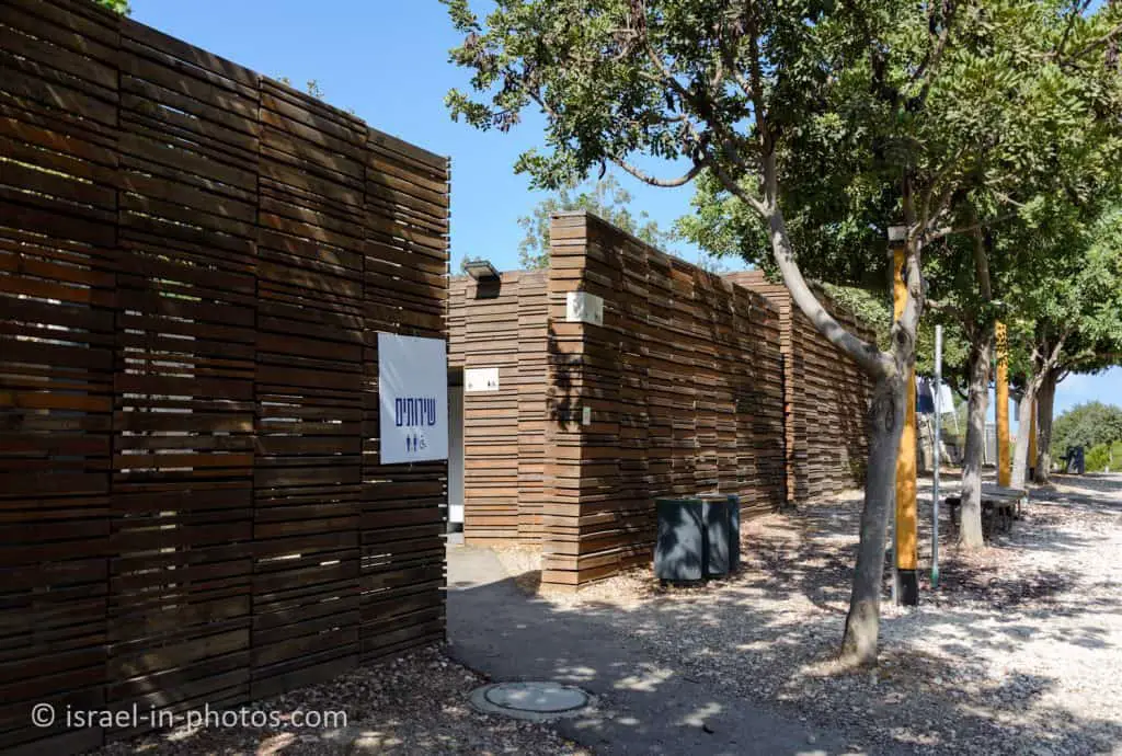
Near the parking, you can find restrooms and explanation signs.
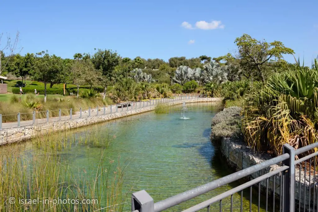
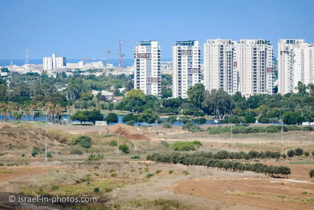
Ecological Lake
From viewpoint #8 (on the map of the mountain compound), you can see the ecological lake (#11 on the map), visitors center, cafe, and parking.
Here are several additional photos of the ecological lake:
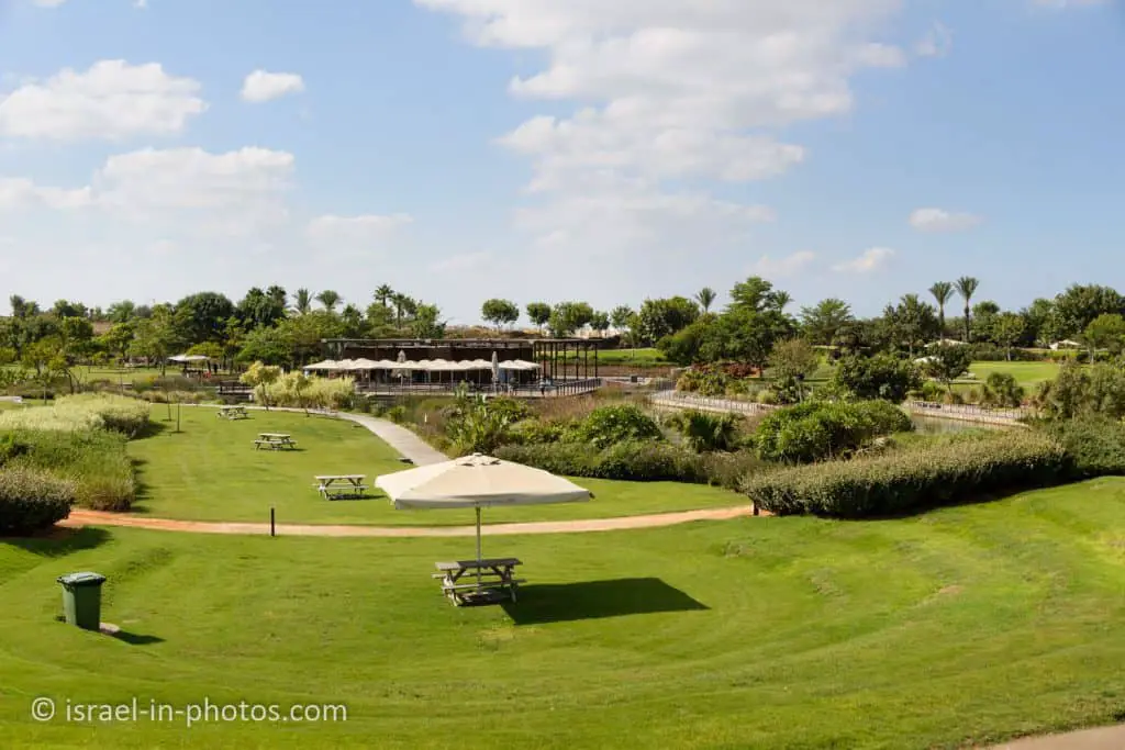
There are picnic tables, and some of them have shade. But as you can see in the rules above, starting a fire, including a gas fire kit, barbeque, and bonfire, is prohibited in Ariel Sharon Park.

I was afraid there would be some smell, but I did not feel any smell throughout my visits to the park.
One downside of this park is that all trees are very young and small. Moreover, there are not many of them. Thus, there is hardly any shade. As a result, I would not recommend visiting on hot days.
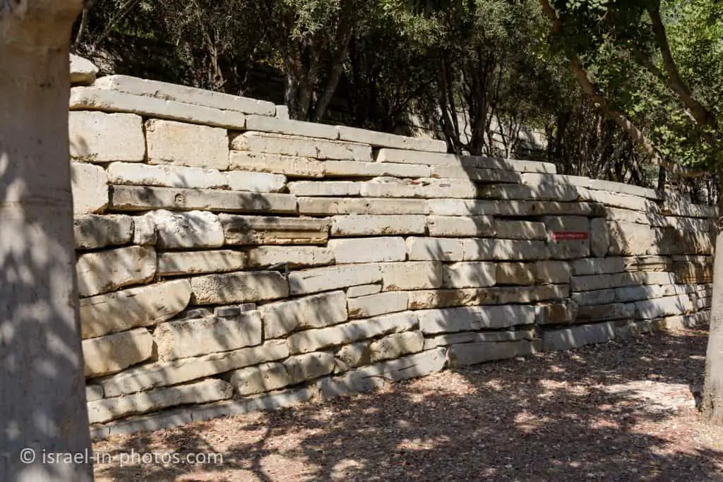
Recycled Concrete
From the ecological lake, we will continue to the viewpoints. And near point #2 (on the mountain map), you can see the story of the stones by the road.
To moderated the angles of the mountain’s inner slopes, the planning team chose to use broken fragments of concrete recycled from construction waster. This use of construction waste mirrors the ecological principles for sustainable development implemented in the mountain plans.
Source: sign
Near point #3, you will find additional restrooms and a concert complex.
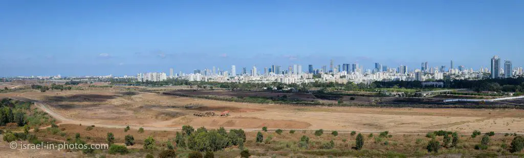
Viewpoints
We will continue our walk in the anti-clockwise direction and head towards viewpoint #4.
And here are several photos from the northern observation point (#4 on the map):
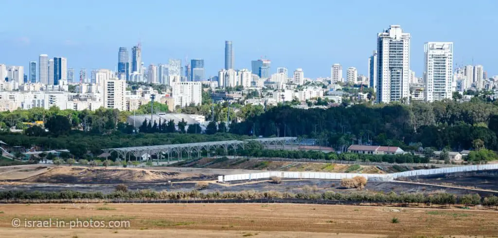
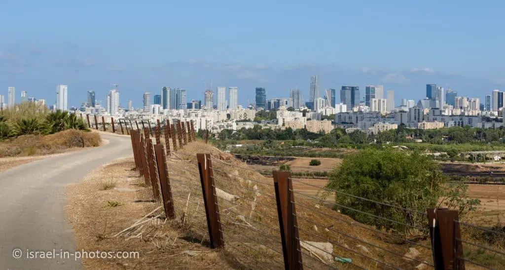
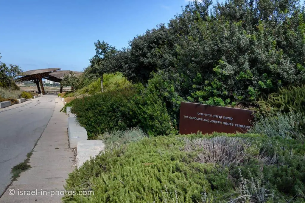
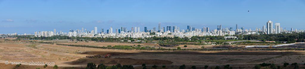
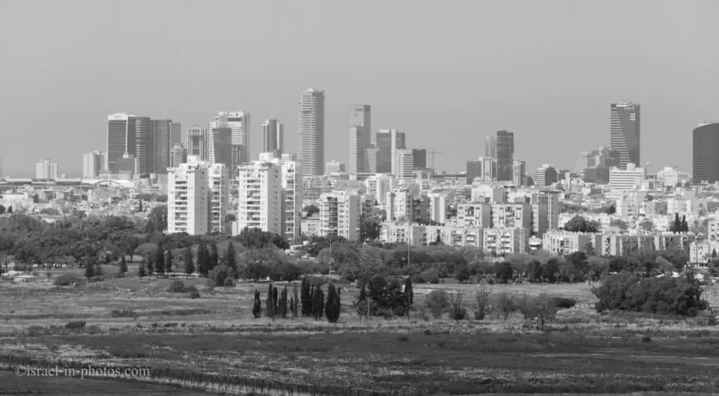
And now, let’s head to the Caroline and Joseph Gruss Terrace (#6 on the map).
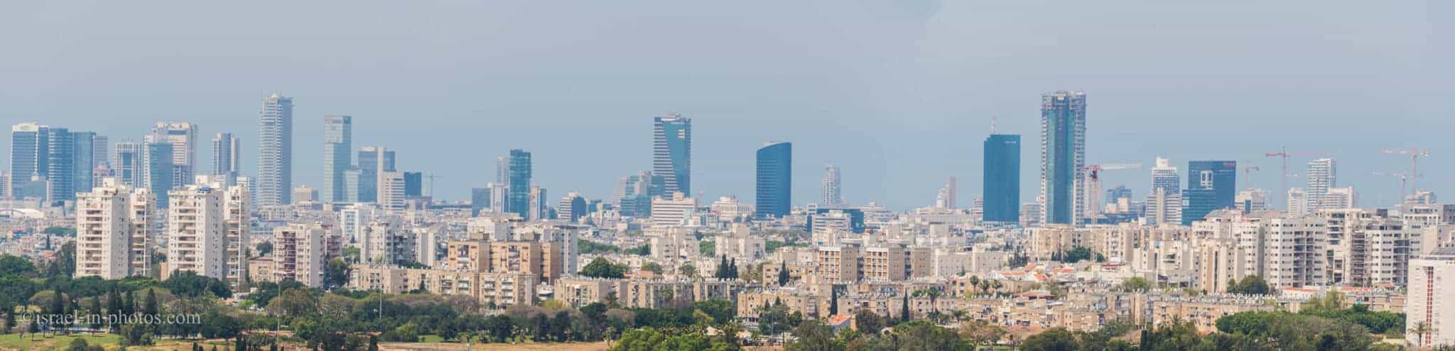
You can see Tel Aviv and its surroundings from there. Here are several photos that I shot from this terrace.
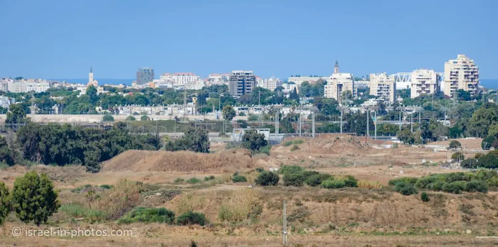
In the following photo, you can see two churches. These are the Russian Orthodox Church In Abu Kabir and Saint Anthony’s Church in Old Jaffa.
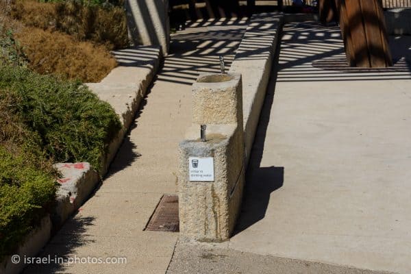
I wanted to mention that you can find water taps in various places in the park.
“Trash People”
While visiting, we saw this guy:

It is one of the “Trash People.” In 2014 Ariel Sharon park hosted the international exhibition “Trash People” by the German artist HA Schult. The show presented 500 life-sized statues on the mountaintop. All the figures were made from crushed cans, electronic waste, and other types of garbage. This exhibition was created in 1996 as a criticism of consumer culture.
Like the rehabilitated mountain of waste, human-like statues remind him of humankind’s power to ruin and destroy the environment and his ability to restore and repair it.
This specific statue was a gift to the Minister of Environment Protection.
Why was the Hiriya waste dump closed?
When you visit this park, you will see many planes.

Ben Gurion airport is not far away, and aircraft fly over the park after they have already started to decrease their altitude.
Though the official site does not mention why Hiriya was closed, some say it is because of the planes and birds combination. Each waste dump attracts many birds. And as the waste dump became higher and higher, the birds above it flew closer to the landing planes. And this could lead to a disaster.
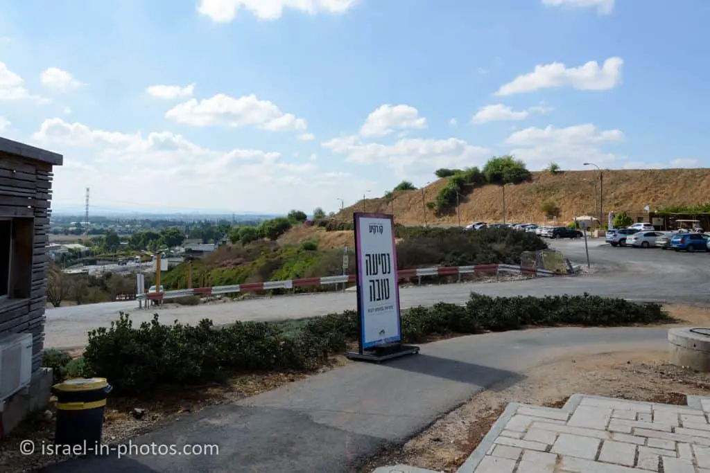
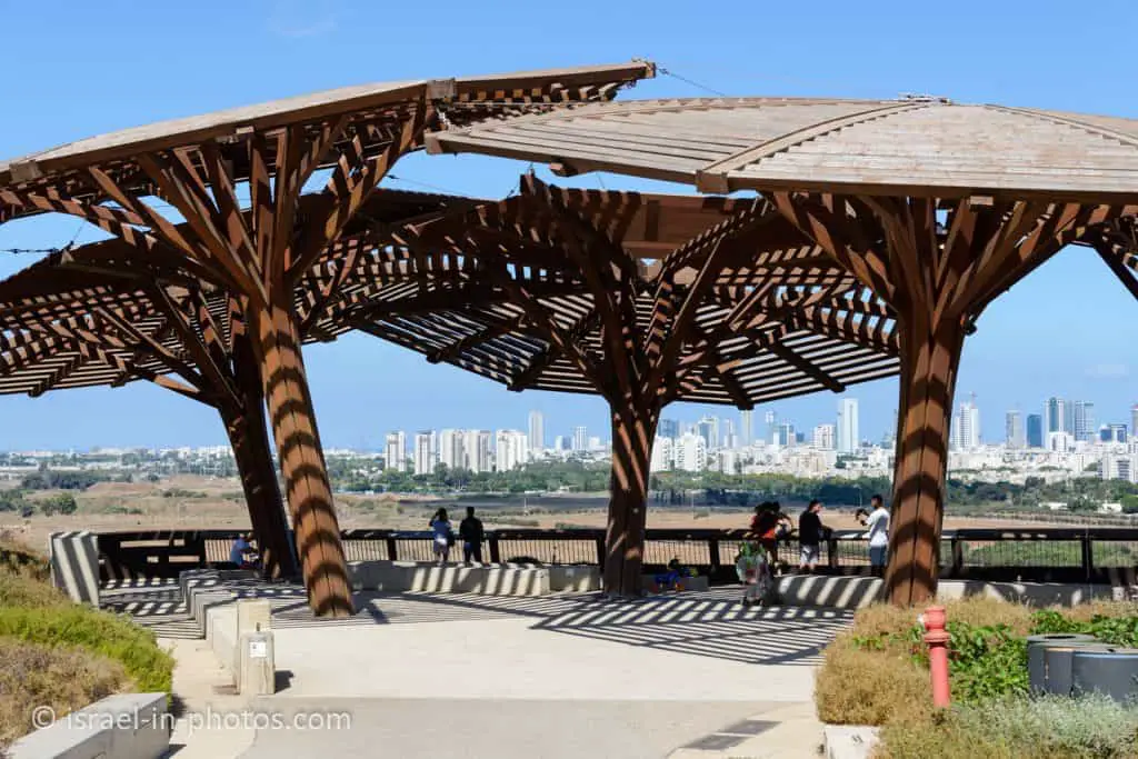
Shalem Farm – The Northern Compound
And now, let’s visit the northern compound.

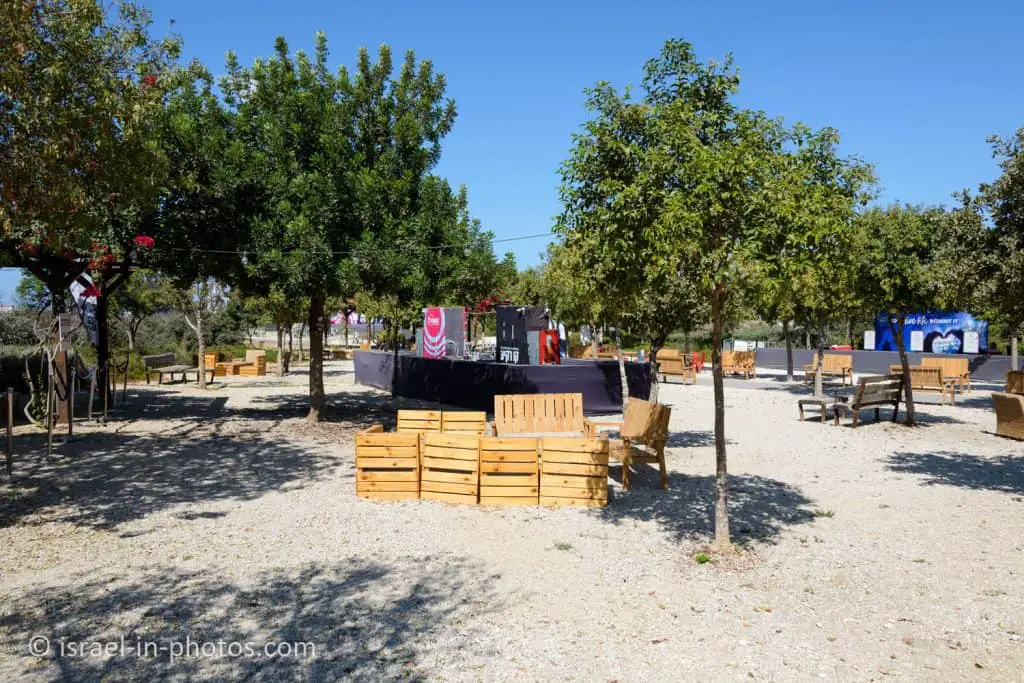
As you enter the park, you will see a big pergola. Its length is 250 meters, and its height is 12 meters. And the intention is to hold events and exhibitions in this area.
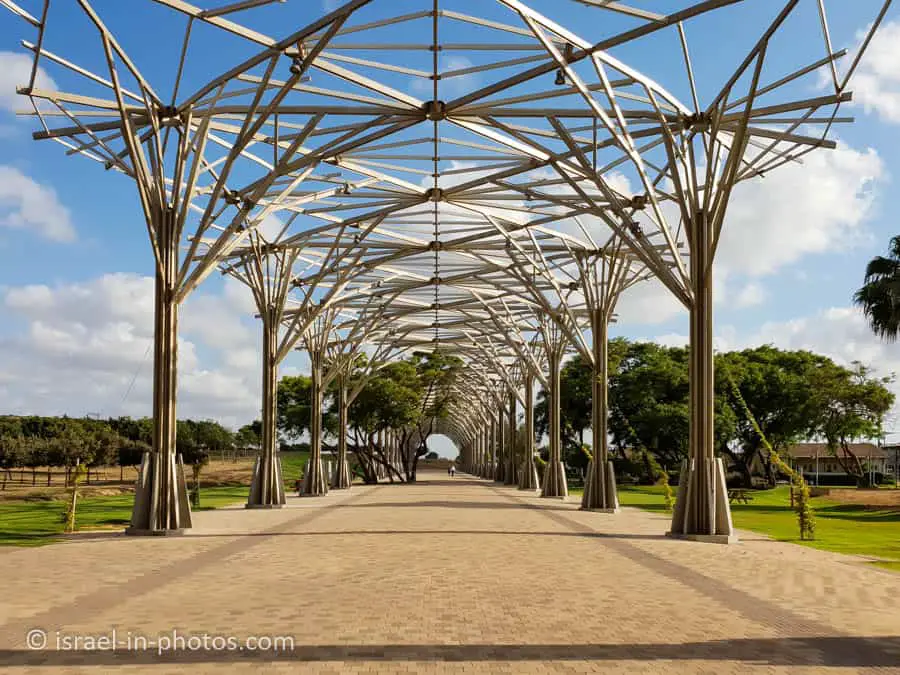
Near the pergola, you can find restrooms, and a little further, you can see Shalem Farm.
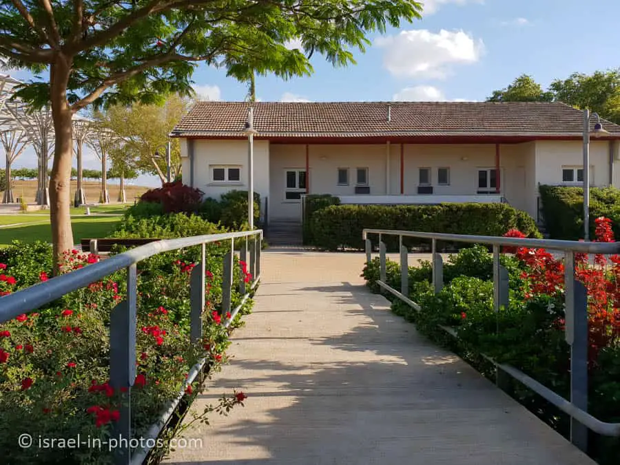
Shalem Farm
The Shalem Farm complex is an important milestone in the timeline of the early days of the State of Israel. Shalem Farm was established in 1953 by the “Hazerah” Communal Agricultural Association, which was involved in growing and cultivating seeds for farming. The background to the farm’s establishment was the economic boycott declared on the country’s Jewish economy and the increasing need for the supply of agricultural products for the growing population of the village.
The activities of the Association in the field of agricultural research and development contributed to the shaping of the State of Israel as a leader and trailblazer in the world in terms of modem agriculture and the cultivation of unique varieties. The location of the farm, in the open plains surrounding the Ayalon River, gives the place a unique character. The flat agricultural landscape was planted with decorative and fruit trees, and the connection of the farm to its surroundings created a natural continuation between the farm buildings and the fields surrounding them. The farm is split into two main areas: the economic area, where agricultural activities took place; and the residential area, where the farm workers and their families lived.
Source: sign

This historical area underwent preservation and restoration. And as I understood, in the future these houses will hold exhibitions.
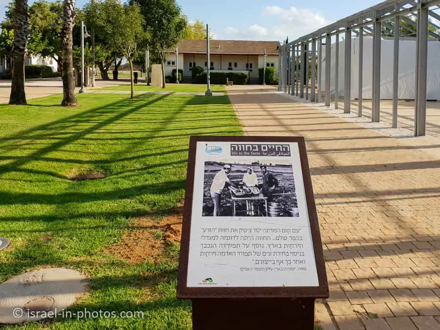
Meanwhile, you can see the buildings, greenery, and explanatory signs.

Ecological Pool
Near the end of the pergola, you can see the entrance to the ecological pool.

Ariel Sharon Park covers an area of approximately 8,000 Dunams forming a continuum of open spaces in the heart of Israel’s most densely populated metropolitan area. The Park areas form a habitat for rich biodiversity – both flora and fauna, serving as a vital resource for preserving nature within an urban setting.
The Park lies on an international avian migration route. So far over 200 species of birds have been observed in the Park, including endangered species. You are about to enter a center that has been set up ‘in the spirit of the Park’s values to serve a center for education, sustainability, and nature conservation. In its middle is an ecological pond with unique wetland flora planted- around it. Along the trail are disabled-accessible observation shelters containing information plaques and a bird ringing and research center.
Source: sign

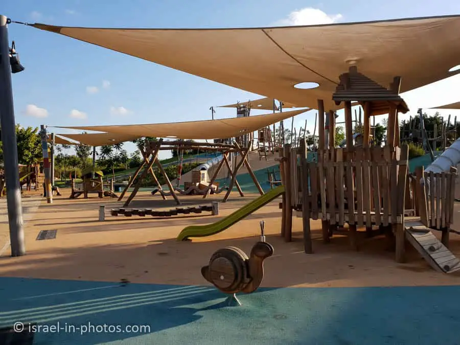
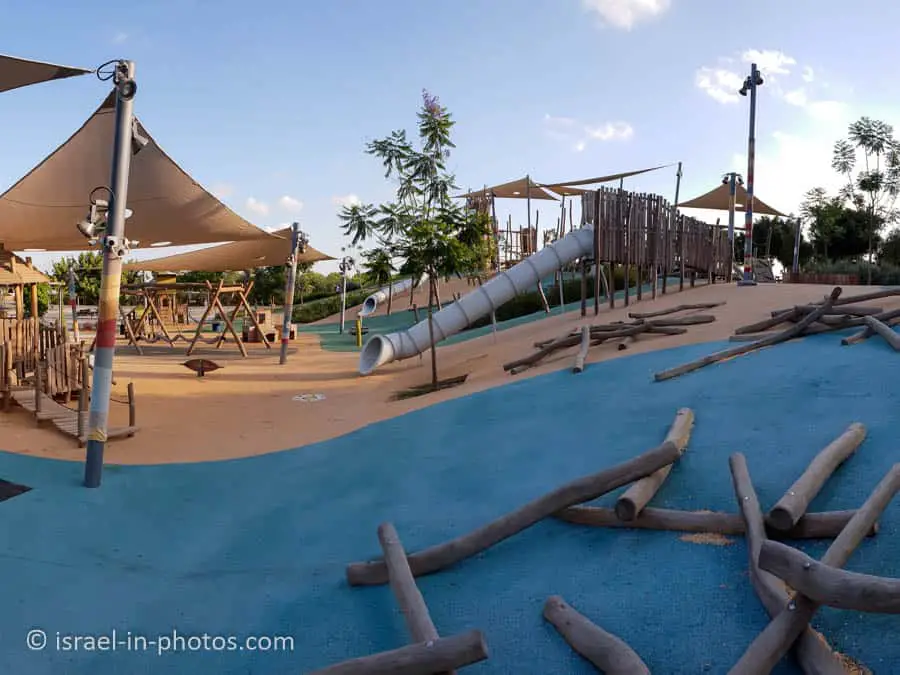
Playground
And our last point of interest at the northern compound was the playground.
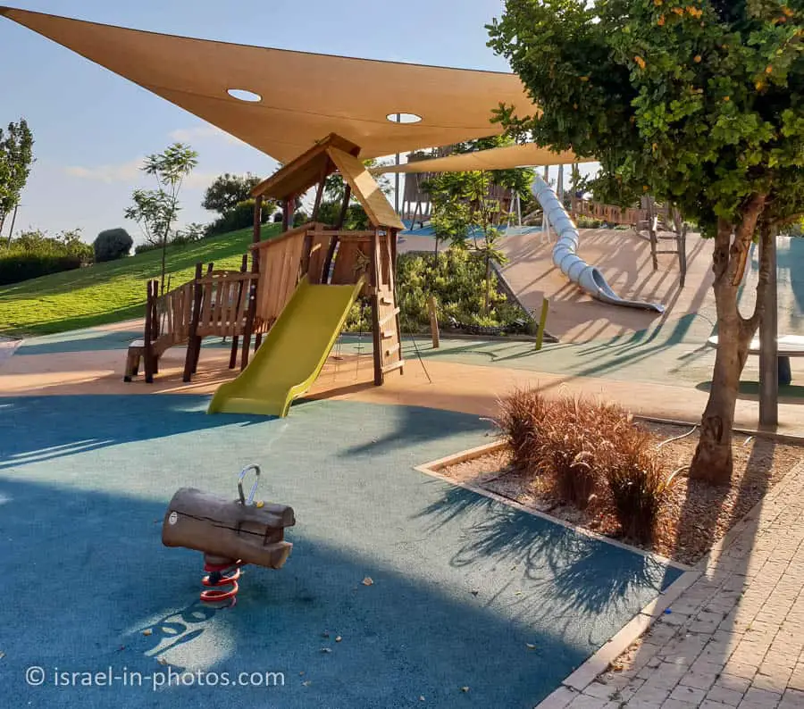
Near the playground and by the pergola, you can find picnic areas.

View of the ecological pool from the playground:

The playground is not very big, but there are fewer standard attractions.
We visited the northern compound in June 2022. And since the visit was in the middle of the week, there were few people.
Overall, it looks enjoyable and suits a short visit with kids. But it seems that it is not finished yet. There were signs for exhibitions and restaurants, but we did not see them.
Summary
Ariel Sharon Park (Hiriya) is a lovely place. And it is inspiring what people can do when they put their minds to it. Also, keep in mind they have not finished building this park. And over the years, it will be extended. The plan is that it will become the biggest park in the middle east.
The downsides of this park are the lack of shade and slow development. I have visited this park many times between 2015 and 2022, and the pace of change is very slow.
Have you ever been to Ariel Sharon Park? Let us know in the comments below.
That’s all for today, and I’ll see you in future travels!
Stay Tuned!
For additional points of interest nearby, see Tel Aviv-Yafo.
Additional Resources
Here are several resources that I created to help travelers:- Israel Trip Planner is the page that will help you to create your perfect travel route.
- National Parks And Nature Reserves page lists and put all national parks on the map. There is also a top list, information about ticket types and campsites.
- If you are looking for things to do, here are the pages for Jerusalem, Tel Aviv, Haifa, Sea Of Galilee, and Makhtesh Ramon.
- Wondering what events are there in Israel? Here is the Events And Festivals By Season guide.
Active cafe restaurant
תודה על העדכון